Huckleberry Park?
Mississippi River
Hannibal, Missouri
Mark Twain


Huckleberry Park?
Mississippi River
Hannibal, Missouri
Mark Twain

Not Huckleberry Park. The pictures were taken up by the Mark Twain Memorial Lighthouse (at the top of those 244 steps). As for everything else, yes, yes, and yes! As you obviously know, Hannibal was the boyhood home of Samuel Clemens (aka Mark Twain), and as such, it was the setting for both Tom Sawyer and Huckleberry Finn. It's an interesting place to visit, just a couple of hours north of St. Louis.Originally Posted by Mark Sedenquist

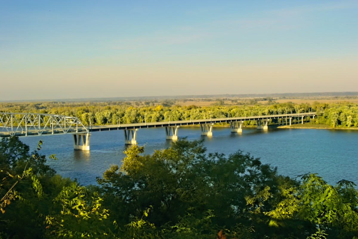
Interstate 72 actually starts in Hannibal, and crosses the Mississippi on this bridge:
...before rolling across central Illinois as far as Champagne. One of those strictly regional freeways; I bet if I looked hard enough, I could find a scenic alternative!
Rick

 RoadTrip Guru & Enthusiast
There really isn't anything more scenic than I-72 from Hannibal to Champaign. All the roads in that area are pretty much the same - flat farmland.
Eventually, I-72 will extend west to Cameron MO at I-35. They are slowly but surely upgrading US-36 to Interstate standards. It's already close to it, all 4 lane expressway with some freeway stretches all the way to St. Joe. It's part of the Chicago-Kansas City Expressway (MO-110/IL-110).
Thanks for the clarification, and I'm sure you're correct about the scenery, though when it comes to places like the Midwestern farm belt, beauty is in the eye of the beholder. I know people who grew up in big cities who were blown away by their first view of the Midwest, but even at that, "scenic" may have been the wrong word to use when there's so much sameness in the landscape. In those areas, getting off the Interstate (the "Super Slab" in AZBuck's parlance) doesn't necessarily provide a better view, but it does allow a closer view, which is pretty much always a lot more interesting!
Rick
This time, I'd like to see if anyone out there can identify a ROAD. It's not a road that's commonly used, so while some of you more adventurous Road Trippers may have driven it before, identifying the precise location might be a challenge for everyone else.
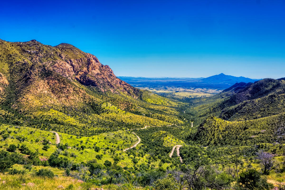
Here's the road, squiggling its way up the side of a mountain. Most of what you see in the distance is in another country.
This is where the road begins:
And this is where the road ends:
This is the road out of the area:
Random scenery:
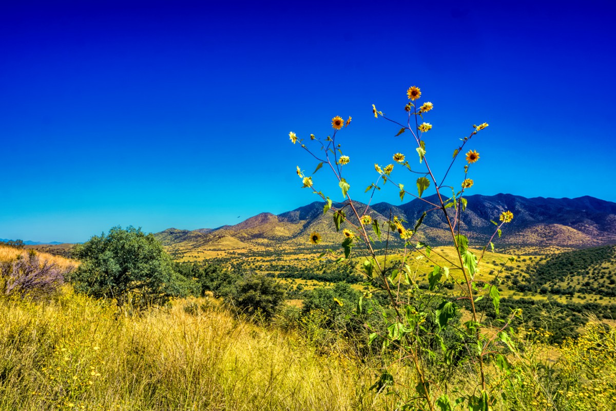
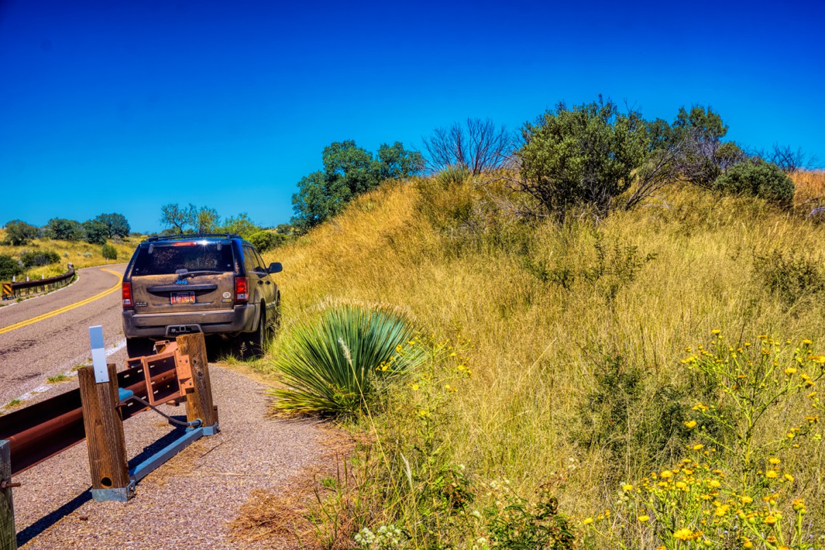
Stopping to smell the flowers on the drive back out. Note: My Jeep was clean when the day started!
Warning to anyone who actually makes this drive: if you have any carbonated adult beverages in your ice chest, and you decide you want to crack one when you get to the lake? Do NOT (I repeat: do NOT) open it while sitting inside your vehicle! (Yikes!)
Okay, everybody: Where am I?
Name the Road!
For a bonus:
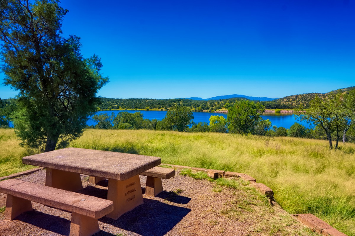
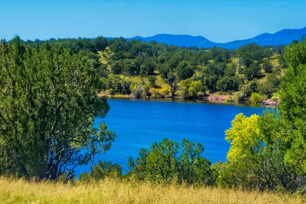
Name the Lake!
Rick

So the hint about seeing another country was key and Google is my friend!
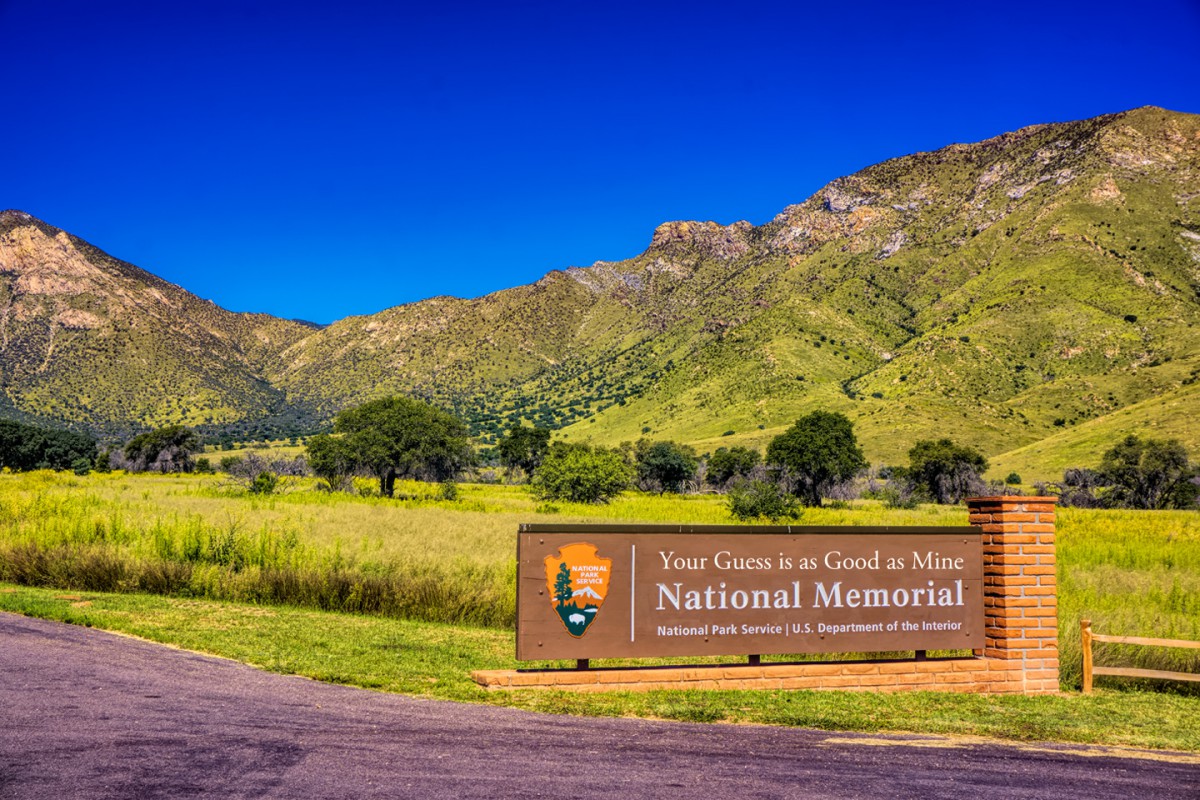
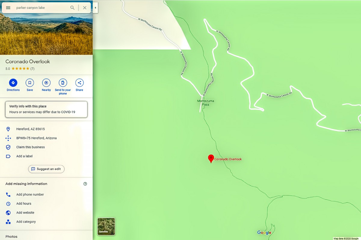
You are in Arizona on the Coronado National Memorial and that is Parker Canyon Lake. I have not been. The closest I've been is Benson, AZ
Utahtea
RoadTrip Guru & Enthusiast
You are in the Coronado National Memorial, that's Montezuma Canyon Road, and I think that might be Parker Canyon Lake?
If WE are correct...you missed it by two minutes ;)
Utahtea
You're both correct--and you were both pretty darned quick on the draw! Utahtea, you were first with the name of the Memorial and the Lake, but glc got the name of the road! Nobody got the precise location, which was the Coronado Overlook at the top of Montezuma Pass:
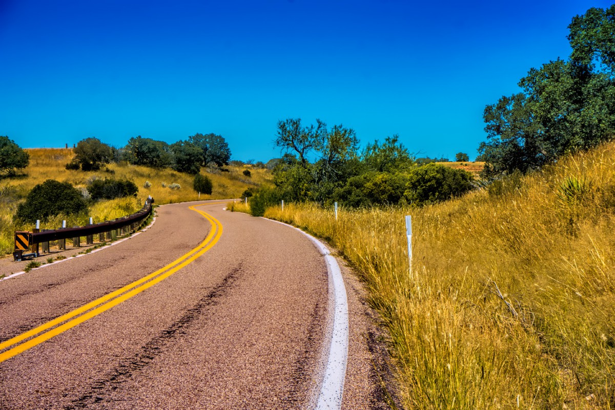
Montezuma Canyon Road is the road into the Coronado Memorial, which is a bit like a park for the folks in nearby Sierra Vista, with shady picnic areas, hiking trails, and places for the kids to run around. If you keep going on Montezuma Canyon Road, past the Visitor's Center, the pavement ends rather abruptly, and the road takes off up the mountain, climbing like a mountain goat via hairpin turns that might best be described as "dizzying." There are potholes and washboard ruts that will rattle your teeth, and everything else, but when you reach the top, you're rewarded with quite the view at that overlook, which has a nice big parking area (frequently occupied by a small fleet of Border Patrol vehicles, who use the overlook as an observation post). Most people turn around and go back down the same way they came up, but if you keep driving on the rough dirt road, you end up at Parker Canyon Lake, and from there you can drive on to Sonoita (and southern Arizona's wine country) by way of a gorgeous paved road (see photos, above).
I found this area the same way you did: on Google maps. I was doing the preliminary route planning for Scenic Side Trip #6, which runs from Benson to Tucson by way of Sierra Vista and Nogales. I was looking for a way to get from Sierra Vista to Sonoita without backtracking north on AZ 90, and I found a squiggly line on the map running west from the Coronado Memorial. This was a few years ago, and the Satellite View of that sensitive border area was not particularly clear. I couldn't tell for sure if the road actually went through to the lake, so off I went to "field test" my proposed route. I'm happy to say that it worked out perfectly--though I would not recommend that first part of the road for low-slung sports cars or big RV's. In the book, I add that caveat, and I offer an alternative route to Parker Canyon Lake via paved roads.
On the topic of out of the way place roads, I have one too!
This is the view looking one direction.
This is the view looking in the other direction.
The pictures shows the road
A close up view of the landmark, which I don't know if they have a name..LOL!
HINT: While we have traveled this paved part of the road many times we've only done the unpaved part in sections twice. These pictures are of views taken only on the paved part.
Where am I?
What is the name of the Road?
What is the name of the mountains in the first picture?
What are we looking at in the second picture?
Extra credit if you can name the left most feature in the second picture!
Utahtea
Last edited by Utahtea; 06-13-2020 at 02:32 PM.
 Posting Permissions

 Reply With Quote