The first two shots are of the road:
And the next two are at the end of the road:
Where am I?
Name the River, name the general location, and for bonus points, name the road!
Need a clue? Here you go:
Rick


The first two shots are of the road:
And the next two are at the end of the road:
Where am I?
Name the River, name the general location, and for bonus points, name the road!
Need a clue? Here you go:
Rick
Can't win 'em all! That was a terrific little photo quiz, and in the course of ciphering those out, I really had my eyes opened. So much of the best of Yellowstone is "off the beaten path," you really do need two weeks to do it justice; (I knew that, but I didn't really KNOW that--if you know what I mean ;-).Originally Posted by Utahtea

Some of your commentary brought home a really good point: when you go to see Old Faithful, you'll share your experience with thousands of other park visitors, so many that you'll be hard-pressed to find a space for your car in the humongous parking lot. When you go to a place like Fairy Falls or Imperial Geyser, both accessible on the same relatively short hike, you might just have them all to yourself. "Off the Beaten Path," "Scenic Side Trips," whatever you call them, there are many ways to enjoy our National Parks and the surrounding countryside without battling the traffic and the worrisome crowds. In light of the pandemic, that's more than just a personal preference, and it's more important than ever. When they open the entrance gate at a National Park, the very first thing in the morning, 80% of the cars that have been waiting in line will head straight for the Visitors Center and the concession area. My recommendation? Go the other way (both literally and figuratively).
Rick
Last edited by Rick Quinn; 06-01-2020 at 09:48 AM.
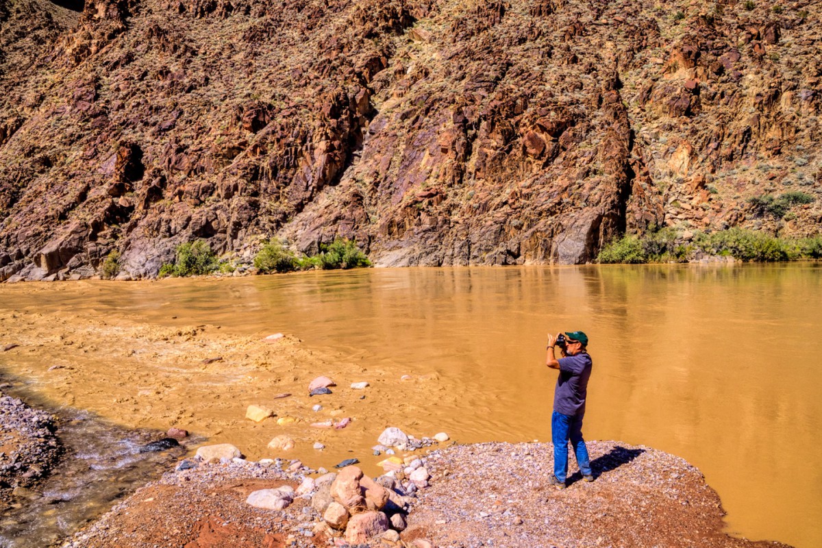
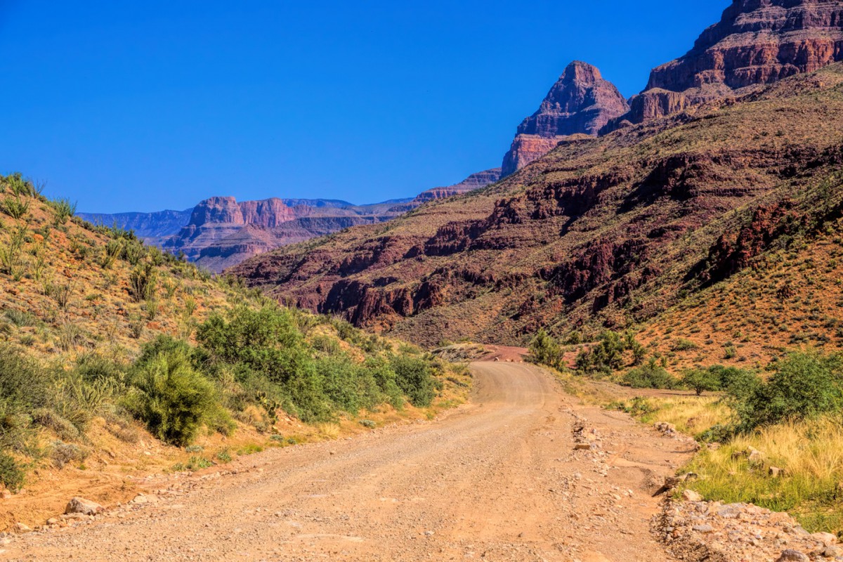
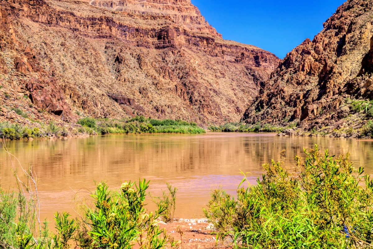
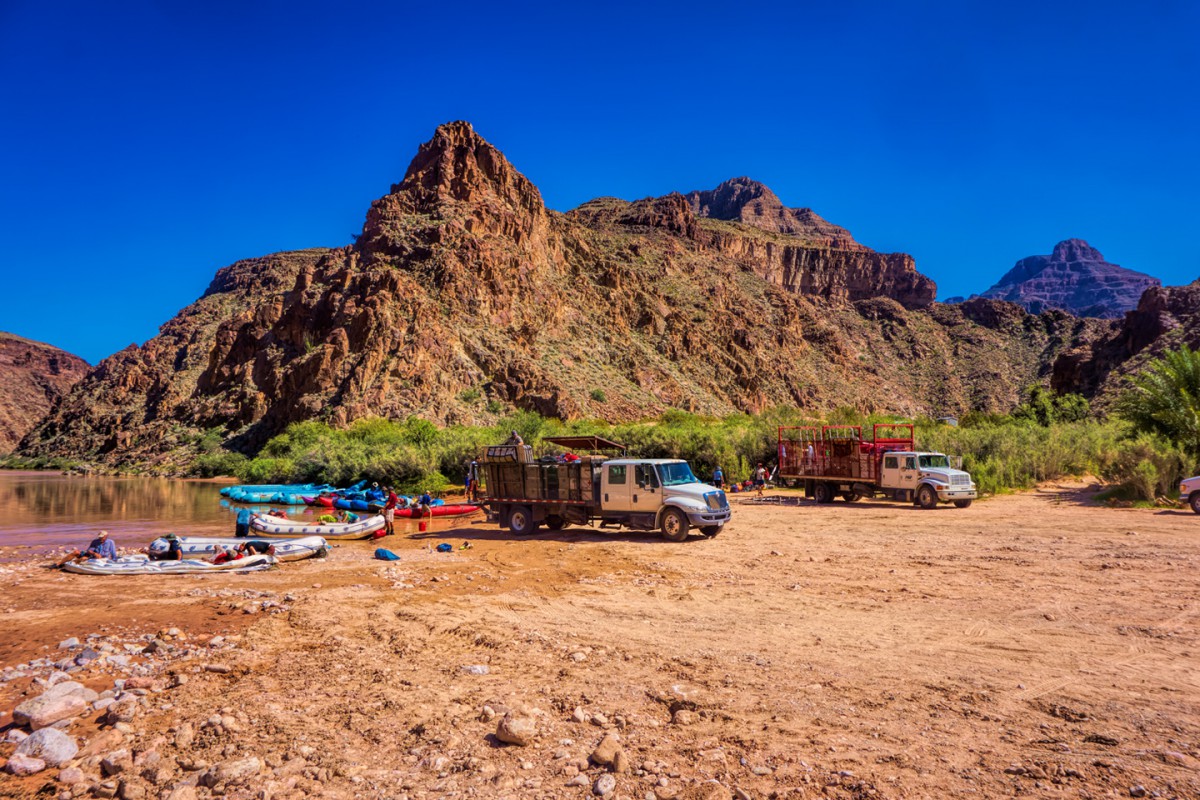
Okay, so let's sum up what we know about this place. It's not a hike. It's a place you can drive to, even in fairly large trucks. There's a parking area with sheltered picnic tables at the end of the road, and a body of water that appears to be relatively tranquil.
Hint: If that's your impression, you're gonna need these additional clues!
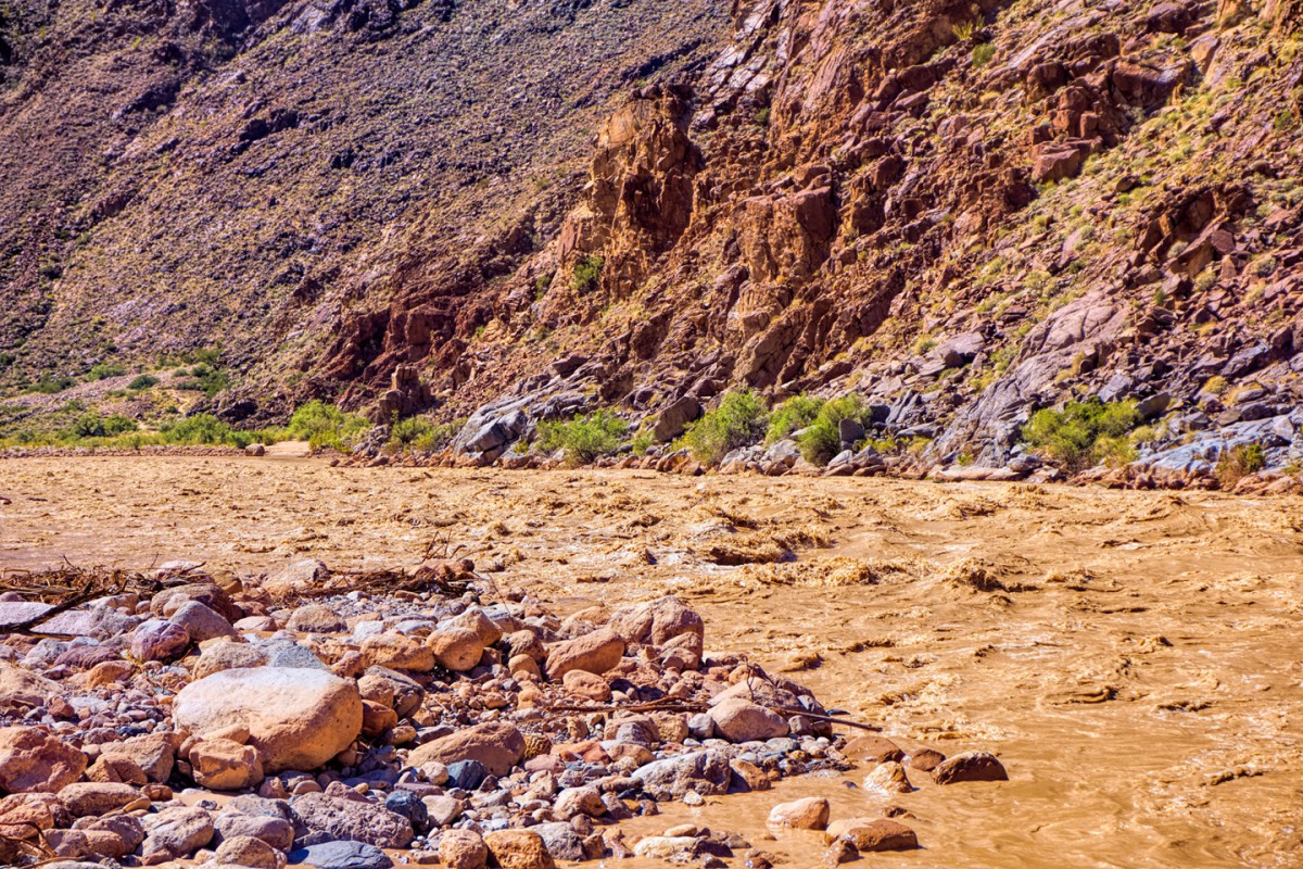
Look to your left, you'll see that the relatively tranquil body of water changes...
...into a body of water that's a good bit less tranquil.
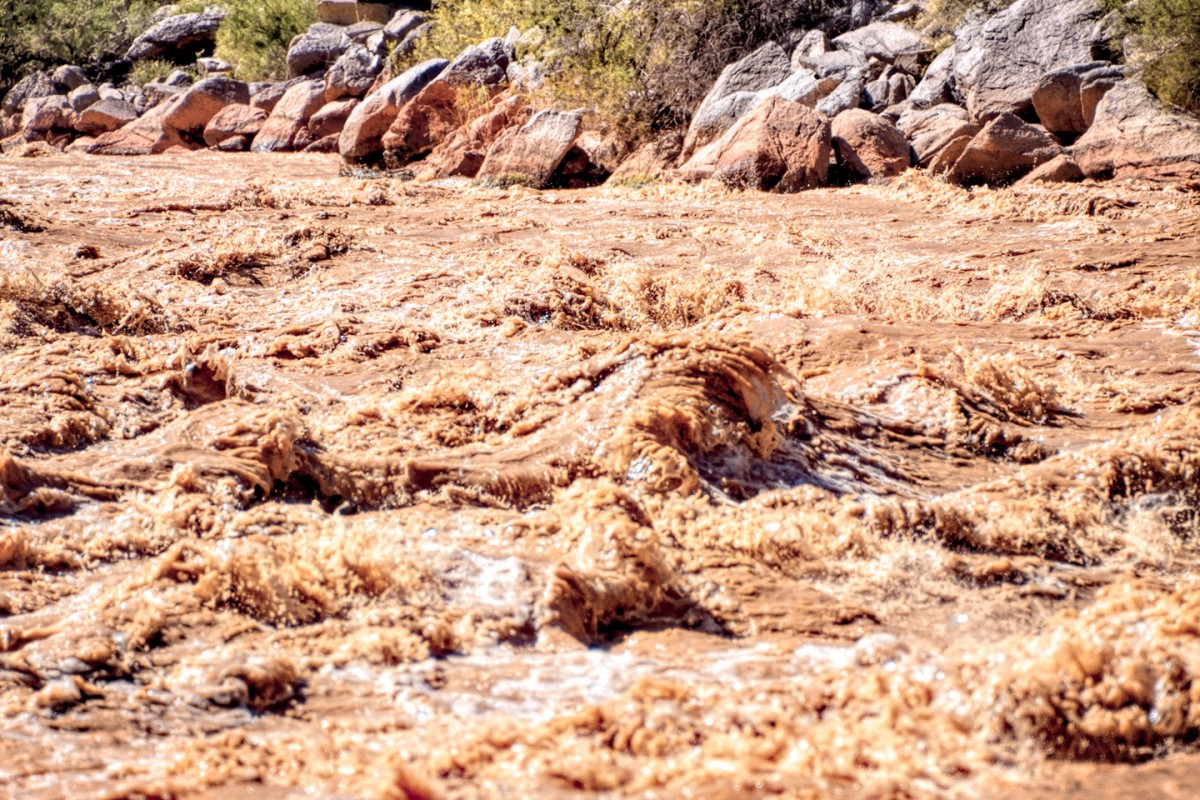
In fairly short order, it gets downright rowdy! Something tells me this isn't a swimming hole.
Where am I?
And how did I get there?

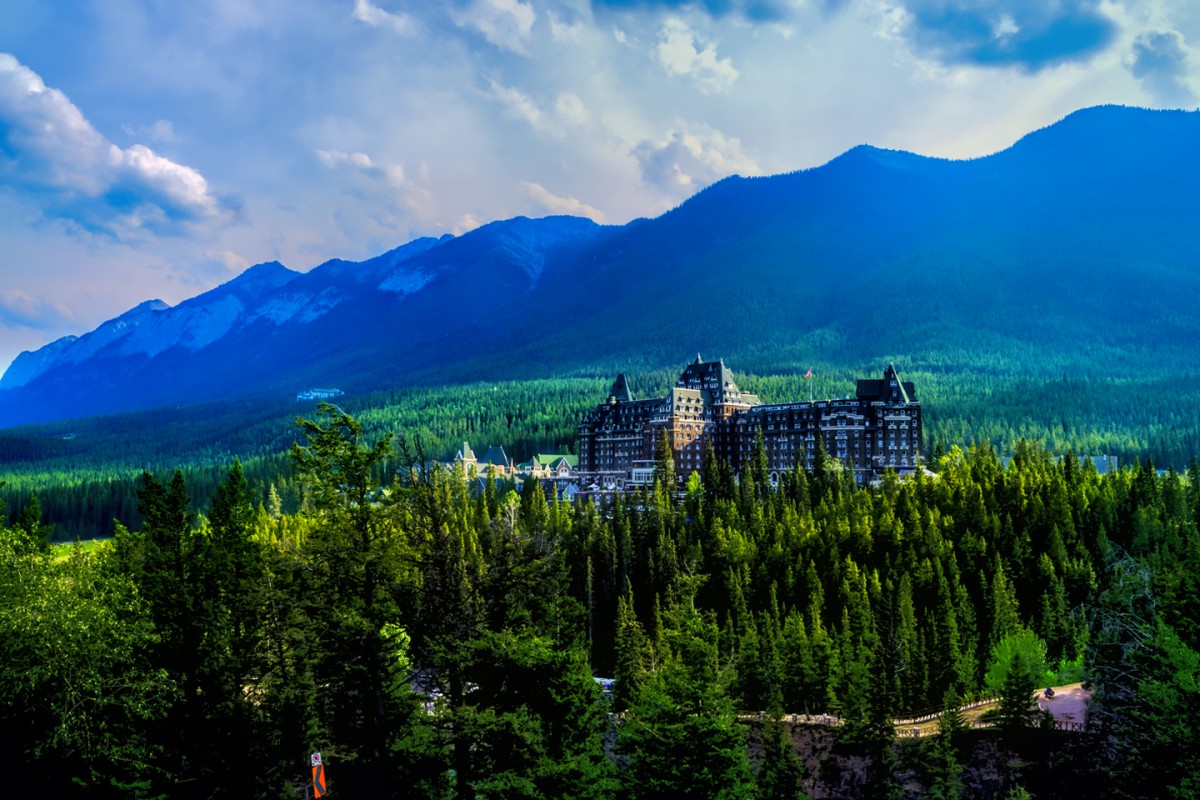
Officially this is known as the Fairmont Creek Waterfall. What makes this "stream" a bit unusual is that it the discharge from the hot spring pools at the Fairmont Hot Springs resort!
Mark
It looks seriously awesome. I slept in a tent in a campground the last time I was in Banff, but we most definitely admired the Fairmount Banff Springs Hotel when we drove past it. Now that I'm aware of the hot springs waterfall, I know where I'll be spending my next visit!

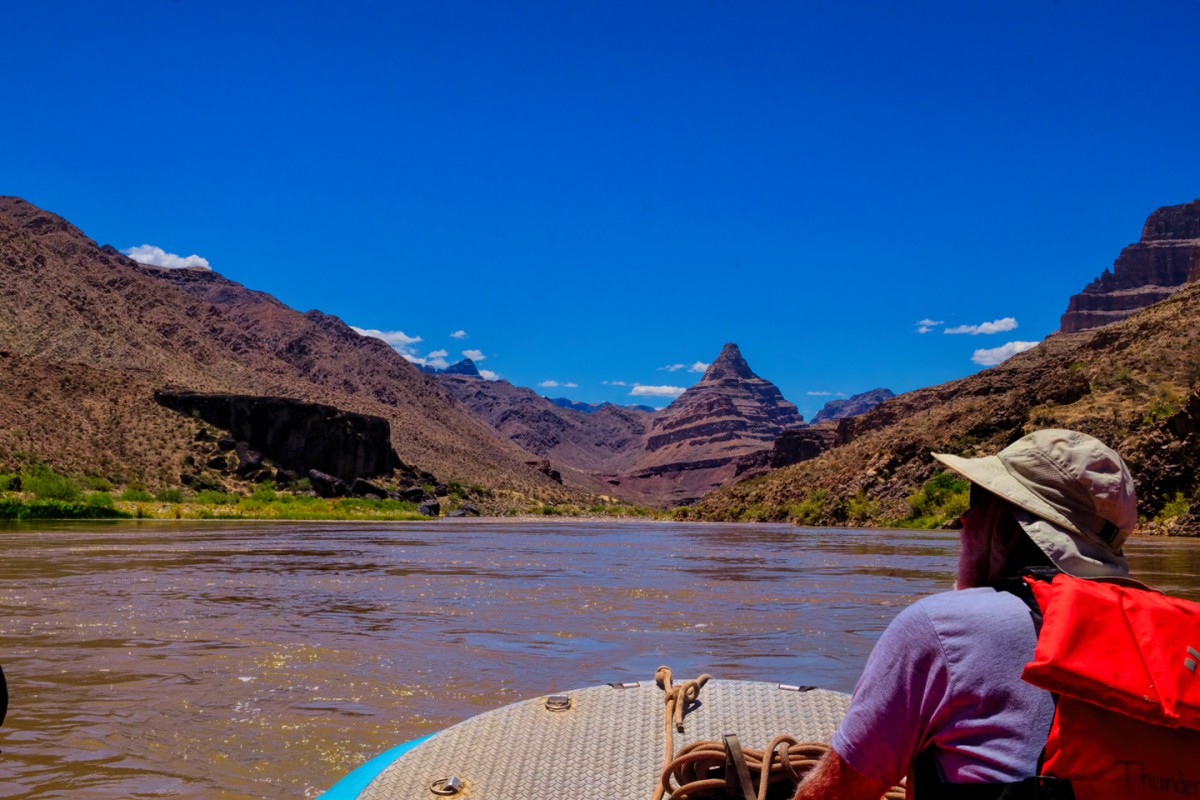
I figured it was a river rafting trip but I just don't recognize where it's at! I thought Arizona or Utah for the scenery but I could be way off. The murky water makes me think Utah. Sorry, I haven't been so have no clue.
Utahtea
I'm surprised how many people on travel forums will only give Yellowstone a day or two thinking it's just about Old Faithful! When we first started coming to Yellowstone back in 1974 we always made sure we stayed 7 days. It takes that long to see just the major attractions. It wasn't until DH retired we could spend longer. We need to get back...I miss that park!
Utahtea
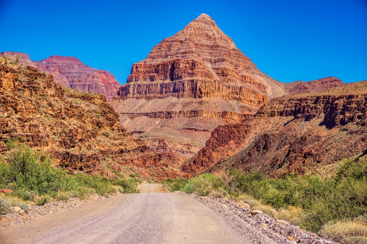
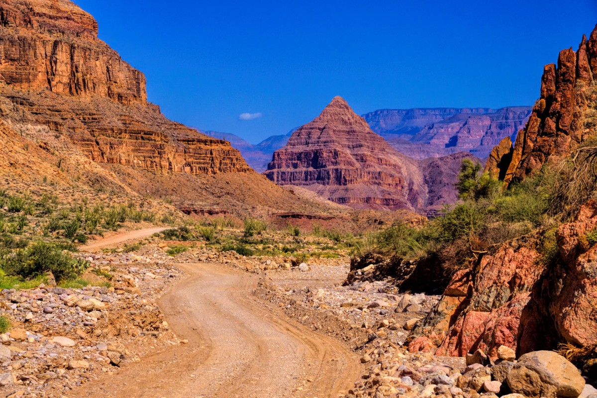
Driving down the road (which is obviously descending), there's a predominate peak that grows larger and larger util it completely fills your field of vision. The peak has a name reminiscent of it's shape (hint: think jewelry), which is also the name of the creek that the road follows on its way down to the river, as well as the name of the rapid that whips up the water downstream from the beach in the preceding pictures. Oh--and it's also the name of the road!
Here's that same peak from the opposite side, picture taken on a different occasion
Still not sure of which river this is?
Diamond Creek Road, Diamond Creek picnic/campground, Diamond is the name of the peak. You were rafting the Colorado River! So I wasn't to far off...you were in Arizona!
From what I'm finding is there are many starting and stopping points. Was this was your final destination or launch site? NOW, if you had started from Lee's Ferry I would have known that. We did the float trip from Page, AZ to Lee's Ferry many years ago.
Utahtea
Last edited by Utahtea; 06-01-2020 at 02:46 PM. Reason: Correction
The Grand Canyon rafting trip happened a few years before I figured out how to get down to Diamond Creek. The rafting trip was fabulous; eight days on the river with a group of 25 people, using a pair of those big 37 foot pontoon rafts. I wrote it up as a Field Report and posted it here on RTA last year, as a thread titled, Into the Heart of the Grand Canyon. Anyway, on the morning of the 7th day of that rafting trip, we came around a bend in the river and saw vehicles on the riverbank, which was a total surprise.
I checked into it after the trip was over, and that's how I found out about Diamond Creek Road, which is the only road of any kind that allows you to drive your vehicle down to the Colorado River, INSIDE the Grand Canyon! (Lee's Ferry doesn't count--because that isn't--yet--the Grand Canyon). Some rafting trips end at Diamond Creek, and there are others, short excursions run by the Hualapai Tribe, that actually begin at Diamond Creek. Diamond Creek Road is rugged, but most vehicles with decent ground clearance make it without issues. (I wouldn't try it in a big RV). This isn't quite the same Grand Canyon that you see in the National Park. It's actually a part of Grand Canyon West, of Grand Canyon Skywalk fame, so the canyon here is less deep, less wide, and less colorful, but it's still a very cool drive, all the way down to the mighty Colorado River and that rumbling rapid. You don't need to be involved with a rafting trip to use the road, but you do need a permit, which you pick up in Peach Springs (on old Route 66). Since not EVERY vehicle can handle the trip, I included Diamond Creek Road as an "optional extra" with Scenic Side Trip #12. It's one of my "hidden gems," a really amazing place that most folks, even the veterans, have never heard of!

 Posting Permissions


 Reply With Quote