Page 4 of 8 FirstFirst 12345678 LastLast
Results 31 to 40 of 79
  1. #31
    Join Date
    Mar 2016
    Location
    Phoenix, Arizona
    Posts
    808

    Default Kenai: Seward and Kenai Fjords National Park

    Day 32: Friday, July 24th

    I slept really poorly after staying up too late. For one thing, I was convinced that someone was going to try to break into the Jeep. Worse, the walls of the room were paper thin. My neighbor on the one side was snoring like a buzz saw, and on the other side, the TV was blaring until 2AM. I tried some foam earplugs, but they didn’t help a bit, so I got up very early, and I couldn’t get out of that place fast enough. Snagged a junk food breakfast, then hit the road: the Seward Highway headed south. When I was in Alaska on a week-long work trip 15 years earlier, I skipped one of my meetings and played hooky for a few hours. There was a car rental agency in the lobby of my hotel, so I picked up a late model something-or-other and did a little sight-seeing. The Seward Highway south into the Kenai was the road I’d taken that day, and I didn't have to go more than a few miles to find spectacular scenery. It was late September, and the Chugach Mountains just south of Anchorage were ablaze with golden autumn leaves.


    Chugach Mountains in the fall: photo taken from the Seward Highway in September, 2000

    The fall colors and the snowy mountains made an unforgettable impression. That was probably the biggest reason I’d wanted to take this trip to Alaska in the first place: after having had that little taste of it back in 2000, I was looking forward to tucking in to the whole meal (complete with appetizers and dessert)!

    This time, making that same drive, there was no dramatic autumn color. The light, still behind the mountains, wasn’t all that good for photos, and the landscape, Cook Inlet, Turnagain Arm, just wasn’t all that impressive, relative to what I’d been seeing elsewhere. At one point I noticed several cars pulled to the side of the highway and three guys with telephoto lenses pointed up a hill. I stopped the Jeep and ran back to see what they were shooting: seems there was a small herd of Dall Sheep, at least five adults and a young one with its mother, circling a tree, eating branches or berries, or leaves, I wasn’t sure which.


    A family of Dall Sheep, along the side of the road in the Kenai Peninsula

    I snapped a few pics of my own, then drove pretty much directly to Seward, making just two or three quick stops for photos.


    Kenai in the summer—complete with fireweed!

    In Seward, I quickly found the waterfront park I’d read about, and reserved a tent site for $10; a very good deal! Next, I used the Alaska App on my phone to locate the tour operators with boats into Kenai Fjords National Park. I grabbed a parking space right in front of the ticket office, went straight in, and booked the last spot on the last six hour tour of the day, leaving in just 15 minutes. For not knowing anything about the schedule, I timed that pretty well!

    It was a nice big boat, and we had a Ranger from the National Park giving a running commentary on the loudspeakers, really great information, especially about the wildlife. Almost all of the passengers had come straight off a huge cruise ship that was docked in Seward; this tour was one of their “optional excursions”.


    Looking back toward Seward from a tour boat, headed for Kenai Fjords National Park. Seward is a popular stop for cruise ships such as this one

    I felt quite apart from those folks—it was almost as if I’d crawled out of the bush and straight into a fancy cocktail party; the contrast was sufficiently surreal, it would have made a good gimmick for an episode of the Twilight Zone. The tour was wonderful, six action-packed hours. I saw humpback whales, puffins, seals, sea lions, sea otters, leaping silver salmon, and a booming, calving glacier, half mile wide and 500 feet thick, from ¼ mile away. All that was too awesome for words, so I took 800 photos, many of which weren't half bad!


    An alpha sea lion telling his mate to move it!


    Seabirds by the tens of thousands make their summer home in Kenai Fjords, their nests occupying every ledge and cranny of the rugged cliffs that line the shore


    Puffins roosting among the rocks. They’re adorable birds, but looks can be deceiving; they have a vicious bite, even the babies (known as pufflings)!


    In the brief summer season, the brightest green imaginable bursts forth from hills that are covered with snow and ice most of the year


    A glacier is like a river of ice, flowing ever so slowly down to the sea


    A chunk of ice the size of a two-story house splits off the massive face of the glacier. First you see it starting to fall, and then you hear a booming crack that’s louder than cannon fire, followed by a resounding splash as the newborn iceberg hits the water

    After the tour I returned to the campground, and set up the tent fairly easily, despite a bit of breeze. (Practice makes perfect). Skipped dinner and ate snacks, then slept quite well in the tent. It was cold out, but warm in my sleeping bag. No rain that night, thank goodness.

    Next up: Homer and the Kenai Peninsula

  2. #32
    Join Date
    Mar 2016
    Location
    Phoenix, Arizona
    Posts
    808

    Default Homing in on Homer

    Day 33: Saturday, July 25th

    Woke up early, put the wet tent away very carefully, trying to keep as much as possible of the great outdoors, well, outdoors (and not inside my Jeep ;-). I planned to drive to Homer, but I wasn’t sure if I’d be staying there, because hotels and campgrounds on the Kenai Peninsula tend to book up far in advance on summer weekends, not just with tourists from elsewhere, but with people from Anchorage. I still wanted to go, regardless.

    Due to seasonal road closures (snow, mud, road construction, etc.) some of the maps displayed in this thread are not displaying properly or you might see pop-up windows reporting errors found with the route. Unfortunately, the map data used to create these maps enforces these "Time-outs" if a particular road segment is closed. In the case of the pop-up windows (alerts), please click the "OK" or "Close" button and the rest of the page will display properly. In the case on some of the maps where the route seems all jammed up -- reloading the page where the map is displaying seems to solve the issue. All of these problems go away once the winter closures of the roads end. So, everything will look fine in the North American summer months.


    Click here for this RTA Library Map
    (This map shows Rick's route between Anchorage and Homer, Alaska. Exit Glacier Road is closed in winter, so the map doesn't include this.)

    The day started out cloudy and gray, and I anticipated a rainy drive, with limited vistas. Leaving town, I passed a side road, and out of the corner of my eye I saw a sign that read Kenai Fjords National Park?! I’d been under the impression that the only access to the park was by boat, so I was instantly intrigued, and turned around to follow that road, just to see where it would take me. About halfway along, the sun came out, highlighting a beautiful scene: steep, snowy peaks with verdant green slopes and a great view of a glacier in the near distance.


    Exit Glacier, Kenai Fjords National Park

    It was about ten miles back to a visitor’s center, and the beginning of a trail system that allowed hiking to two glaciers and the big ice field that fed them. I wasn’t up for the long hike, which would have taken all day, but I did a short hike, less than three miles, and got right up next to Exit Glacier, which was quite beautiful, and the closest I’ve ever been to a thing like that. That was an unplanned, unexpected interlude that was absolutely delightful, my favorite kind of surprise!


    The continuously melting “toe” of Exit Glacier; from such simple beginnings, mighty rivers are born

    By the time I got back on the road, the Seward Highway, the sun came out in a major way. Instead of continuing all the way back on the road I'd taken from Anchorage, I turned west at the junction, toward Homer. It was quite a long drive—close to 200 miles from Seward, but incredibly scenic, and I took some fabulous pictures along the route.


    By the side of the road on the Kenai Peninsula (complete with fireweed)

    Finally arrived in Homer, and was determined to camp (as if I had a choice, with all the hotels booked to capacity months in advance). First, I drove out along “the spit,” a long, rocky breakwater that leads out to the deep water docks and the ferry terminal.


    Car ferry approaching the dock in Homer

    In summer, hundreds of RV’s line up on either side of the road and make a small transient city, with a spring-break style party atmosphere. That’s where most of the camping was to be found, but it wasn’t for me—not with all the noise and hoopla and the lack of shelter from the cold wind off the water. I used my Alaska App to search for other campgrounds in and around the town, and found the perfect spot, where there was just one space still open. Unfortunately for my purposes, it was an RV space with hookups that I couldn’t even use. I wasn’t planning to set up the tent—the forecast called for lots of rain, so I just wanted to park the Jeep and sleep in it. Even still, I had to pay the full prime season RV hookup rate of $55, and all I got for that was a parking space with a picnic table, and access to a bathroom and shower. A poor value, but the location was great, right across the street from what’s considered “old town” Homer, an area with shops and a couple of restaurants.

    I ate dinner at the Steak House Tavern (or something like that). The special was fresh caught salmon, so that’s what I ordered—probably the best, definitely the freshest salmon I’ve ever eaten. Delicious! Rigged up the Jeep for sleeping, with the plastic tubs set outside on a picnic table, covered by my tarp, and the inside of the vehicle arranged just so, filling the gap behind the driver’s seat so that I could fully extend the air mattress and stretch out full length, not with my knees tucked. I sat up front in the passenger seat making notes on my laptop until late. It was raining steadily at that point, so I crawled into the back, careful not to drag wet, muddy shoes into my bedding. I used my dorky sleeping mask, as it was still light outside despite the storm. This time, I fell right to sleep. I had an amazing déjà vu experience, lying in my old sleeping bag in that confined space, listening to the rain drumming on the metal roof of the vehicle. In my mind, I was transported back in time more than 40 years, back to when I used to sleep in my camper on rainy nights in the mountains of southern Colombia, burrowed into that very same sleeping bag. The sounds of the rain, the slightly musty smell of the bag, the sense of confined space in the back of the vehicle, all those things combined to create a visceral experience that was very powerful, and left me feeling more than a bit wistful at the thought of all those years that have passed since my time in South America, a whole lifetime ago.

    Day 34: Sunday, July 26th

    Packing up after a rainy night in the Jeep is much quicker and easier than putting away the tent when it’s wet! I had a nice shower, in no hurry to go anywhere. I went to breakfast at the other restaurant across the street from the RV Park, a little delicatessen/bistro. Mournful old French pop songs were playing on their sound system, and I had a delicious crepe with fresh farmer’s cheese and local blueberries. Great way to start the day! Then I drove around Homer a bit. While taking pictures of fireweed near the beach, a large, raucous bird landed in a nearby tree. I focused in with my zoom lens, and staring back at me was a Bald Eagle!


    Alaskan songbird

    The regal bird posed like an artist’s model, and I got some great shots, including a couple of stop motion action sequence shots of him taking off into the air.


    I took more photos of boats and mountains and clouds and, needless to say, fireweed, and then made my way, in no hurry, to Soldotna, gateway to the Kenai River, and the world’s best salmon fishing. With close to 5,000 residents, it’s the big city, Alaska style.


    In most areas fireweed merely lines the roads. In the Kenai, it blankets the meadows and hillsides like a pink carpet


    Salmon fishing in the Kenai; world record beauties weighing close to 100 pounds have been caught in this river

    When driving through that area the day before I’d taken note of all the options for lodging that were there, and I figured I’d find a room and take care of the stuff I’d planned to do in Anchorage: laundry, banking, getting the Jeep serviced and so forth. I ended up paying $200 for a fairly ordinary room at the Quality Inn—the most I’d paid up to that point, but it was the peak of their peak tourist season, and the best price I was likely to find. At least it was clean--and extremely convenient! I got my laundry done, had lots of time to fool with photos. After camping two days in a row, it was nice, treating myself to a comfortable spot indoors.

    Next up: Palmer, Glennallen, and the largest National Park in the U.S.
    Last edited by Tom_H007; 01-18-2022 at 02:09 AM. Reason: updated closure alert explanation

  3. #33
    Join Date
    Mar 2016
    Location
    Phoenix, Arizona
    Posts
    808

    Default From Kenai to Palmer to Glennallen

    Day 35: Monday, July 27th

    I caught a break when I started loading the car and noticed that there was an auto service center directly adjacent to the motel. They got me right in and gave the Jeep an oil change, tire rotation, and a thorough inspection. They told me the tie rod ends had a little play, and that they would need to be replaced soon. They offered to do it for $500, but since my tires weren’t wearing unevenly, I knew it wasn’t critical. In fact, I wasn't sure it was even necessary, so I elected to hold off until I got back home, where I have a trusted mechanic. I figured I’d probably have to put a few grand into my vehicle after this trip—she was going to need tires and front end work, at minimum. (As an aside, when I did get the Jeep checked over, after the trip? The tie rods were just fine.) My Jeep is a great vehicle, with a lot more miles left to go, but it’s on me to keep up with the maintenance. (The same can be said of everything in our lives that’s worth hanging on to--from our vehicles to our health to our relationships.) At any rate I got all my stuff done, and then drove the four hours or so to Anchorage, with numerous photo stops along the way.


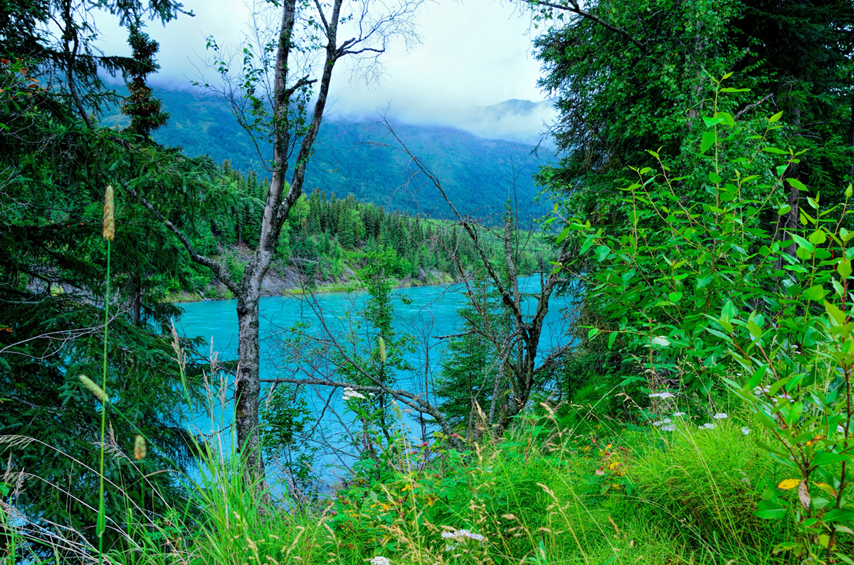
    Random roadside view, Kenai Peninsula

    I didn’t hang around Anchorage at all—stopped for gas, and drove straight out of town, north to Palmer. The day was on-again off-again rainy, with some beautiful sunshine and clouds in between. Another spectacular day in Alaska!


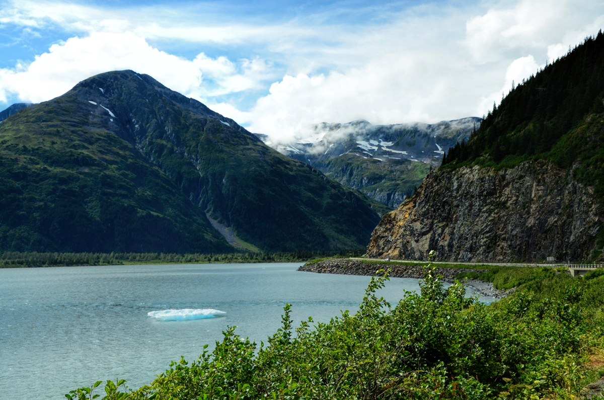
    The floating chunk of ice in this lake makes it a uniquely Alaskan vista


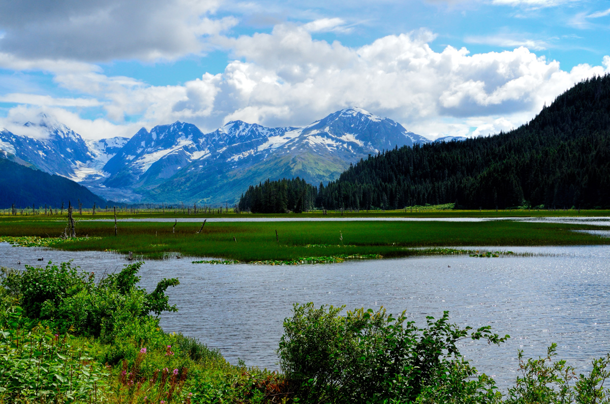
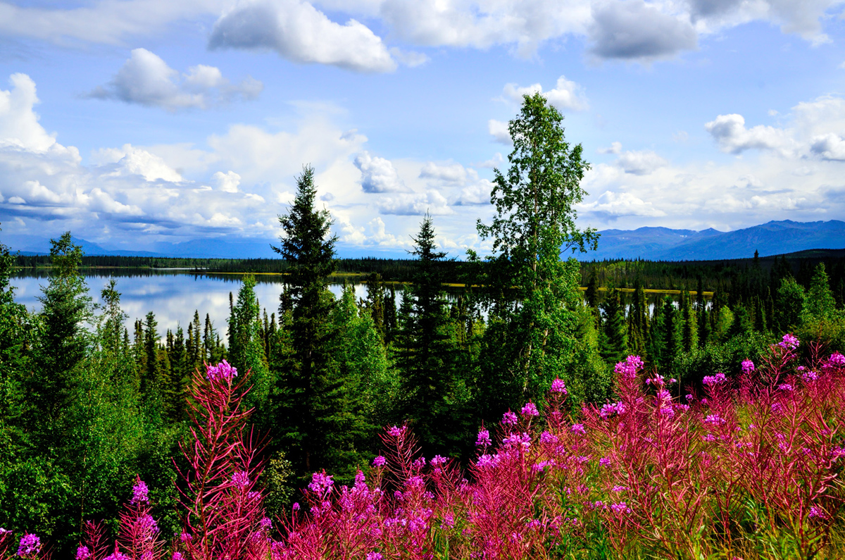
    Lakes, greenery, clouds, and snowy mountains: a timeless recipe that never fails to produce a perfect landscape

    Due to seasonal road closures (snow, mud, road construction, etc.) some of the maps displayed in this thread are not displaying properly or you might see pop-up windows reporting errors found with the route. Unfortunately, the map data used to create these maps enforces these "Time-outs" if a particular road segment is closed. In the case of the pop-up windows (alerts), please click the "OK" or "Close" button and the rest of the page will display properly. In the case on some of the maps where the route seems all jammed up -- reloading the page where the map is displaying seems to solve the issue. All of these problems go away once the winter closures of the roads end. So, everything will look fine in the North American summer months.


    Click here for this RTA Library Map
    (This map shows Rick's route between Homer and Tok, Alaska.)

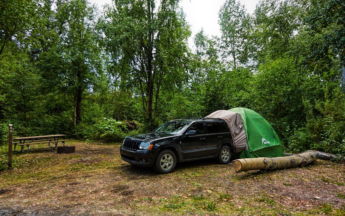
    Late nights and early mornings make a bad combination, so I was a little bit droopy at the wheel, and elected not to push myself too hard. Stopped at Palmer, start of the Glenn Highway, and found a campground using my new best friend, the Alaska App. They had tent sites for fifteen bucks; not half bad. Setting up the tent by myself was a pain, but I did it anyway, even though it was threatening rain. I wasn’t going anywhere for the rest of the day, and the tent gave me a whole lot more mosquito-free space to hang out in.


    Tent Camping in Palmer

    I used the stop watch on my phone to time the task: setting up that tent with the rain fly: 45 minutes, start to finish. Taking it down, probably a little less, but still, not what you could call quick. If I had the whole thing to do over again, a small RV, a travel trailer, or even a van with a proper bed in the back would no doubt be a better way to make this trip. Doing it the way I was doing it had the singular virtue of being a little bit cheaper. I find that the proper balance between cost and convenience is something that tends to shift around quite a lot as I make my way through life.

    Day 36: Tuesday, July 28th

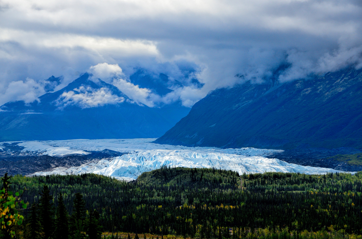
    It rained pretty much the whole night, and while the tent stayed dry, my sleeping bag felt pretty damp, and I was cold! I felt vague stirrings of the crud that knocked me flat in Anchorage a few days before; hopefully, I wasn’t exacerbating a chest thing, camping out in this cold, damp weather. A bout with bronchitis was the last thing I needed, so I made this another easy day for myself. I drove a mere 150 miles to Glennallen, a road junction that truly wasn’t much of a town, but was nevertheless the biggest community between Palmer and Tok. The road that took me there, the Glenn Highway, was very pretty, with rivers and glaciers and snowy peaks, but the weather, once again, was on-again off-again rain interspersed with cloudy skies and occasional sunshine.


    Matanuska Glacier as seen from the Glenn Highway east of Palmer


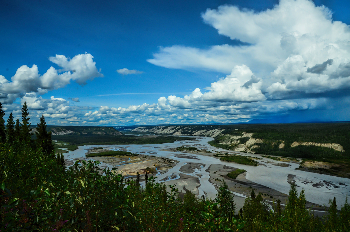
    Matanuska River from the Glenn Highway

    In Glennallen, I spied a place called the Caribou Hotel that looked as if it might be reasonable, so I inquired: $149 a night, and with AAA discount, $139? At this point, that sounded a bargain, so I took it, and they even let me check in early, right on the spot. I was tempted to just hunker down and flake for the day, take it maximum easy, but I decided to at least drive toward the nearby Wrangell-St. Elias National Park, to get a sense of what it looked like. Established in 1980, Wrangell-St. Elias is the largest National Park in the U.S. system. You could combine Yellowstone with Yosemite, throw in the entire country of Switzerland, and you still wouldn’t match the 13.2 million acres of trackless wilderness that’s protected here. I drove south from Glennallen toward Valdez, and after about 8 miles I came across signs for a Visitor’s Center, so I stopped in. The friendly Park Rangers gave me a map and some other information, and I ended up driving about 70 miles on a paved road (with many roller coaster frost heaves) to a tiny town called Chitina, the gateway to the McCarthy Road, one of the two access points to the massive preserve, a land of soaring peaks and rushing rivers that comprises most of southeast Alaska, and straddles the border with Canada.


    Kuskulana River near Chitina


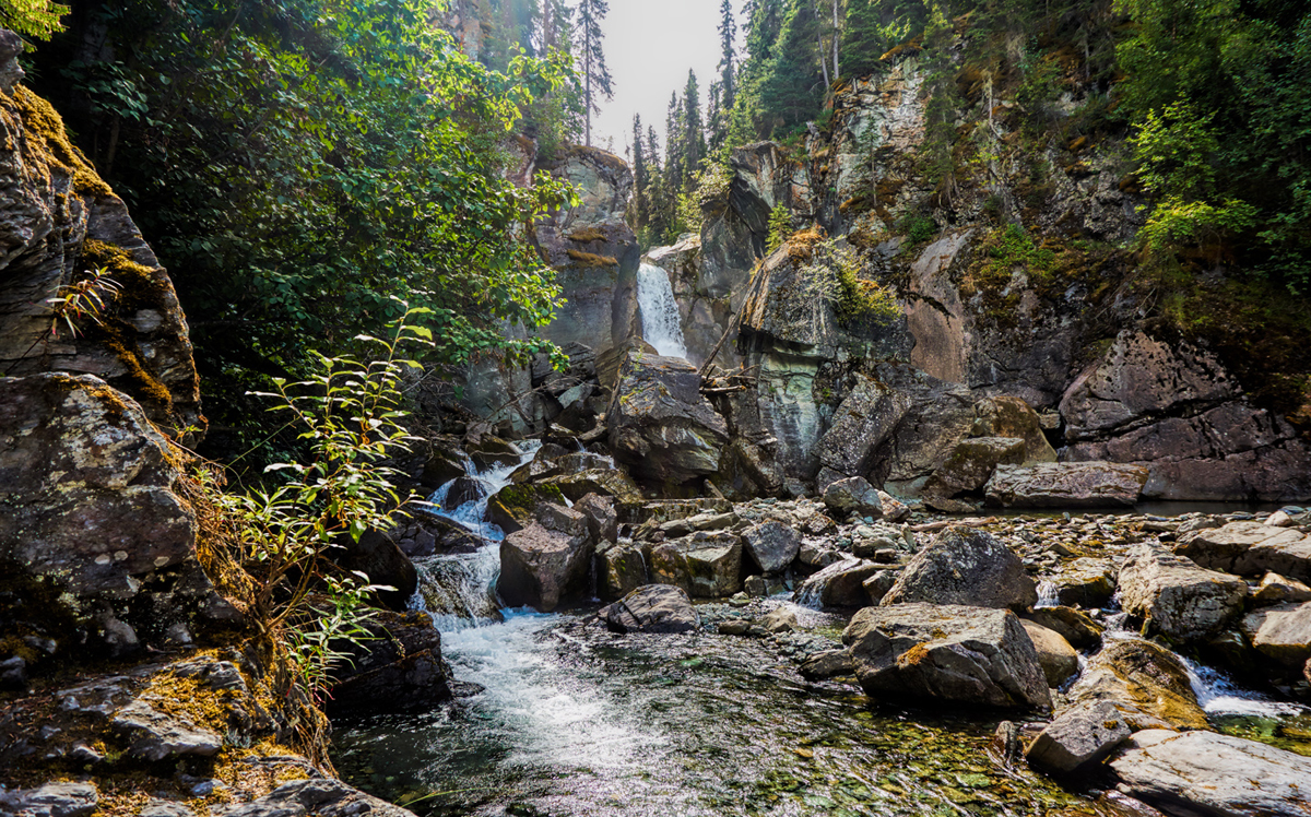
    Liberty Falls, near Chitina, an Alaska State Recreation Site that’s popular for picnics, especially among the local folk


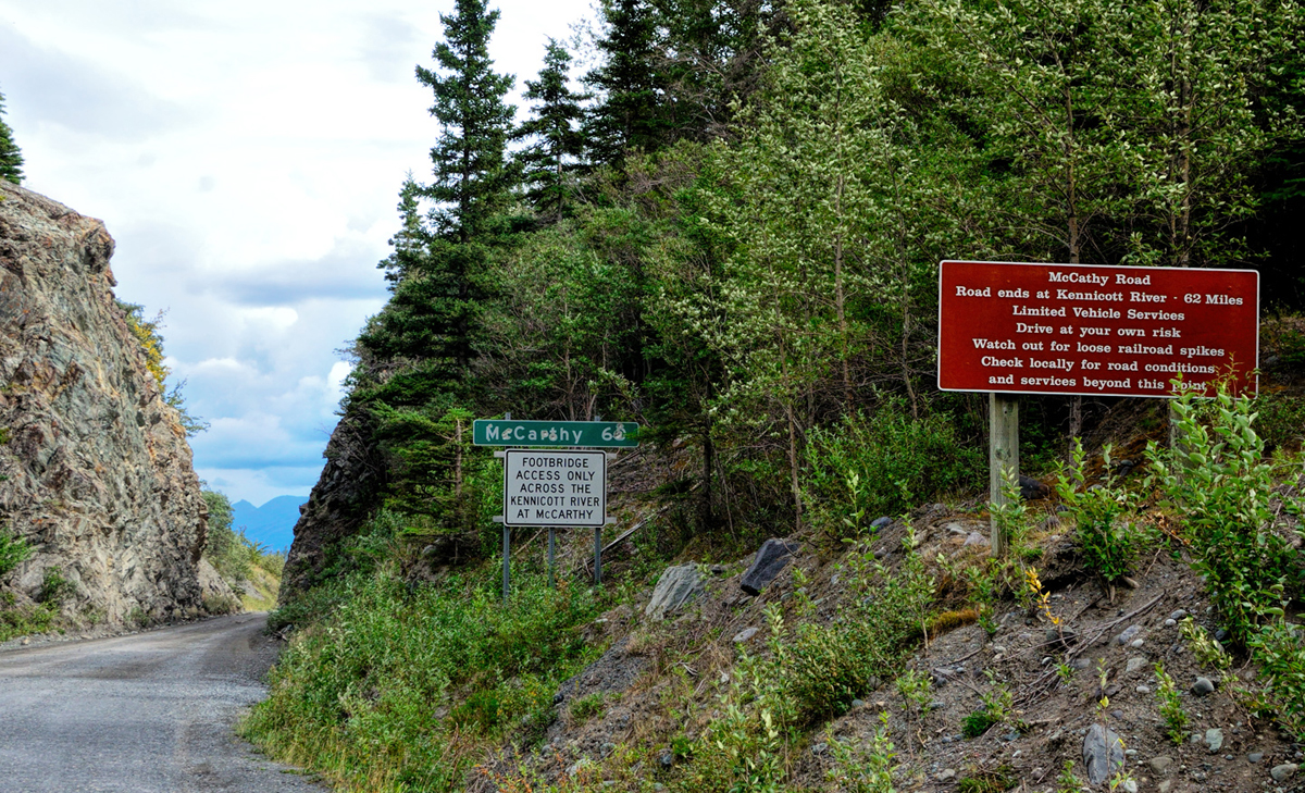
    End of the pavement and the beginning of the McCarthy Road, one of two roads that lead into the vast wilderness of the Wrangell-St. Elias National Park.


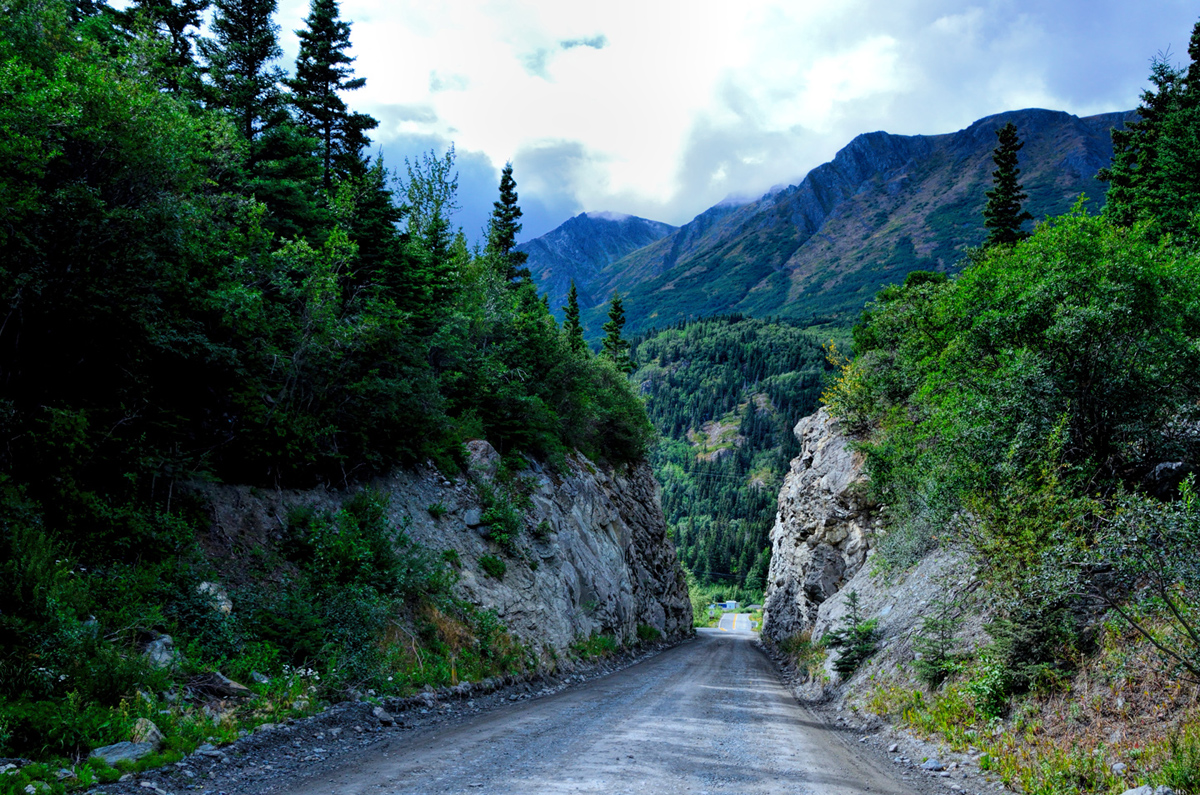
    Looking back toward Chitina after starting down the McCarthy Road


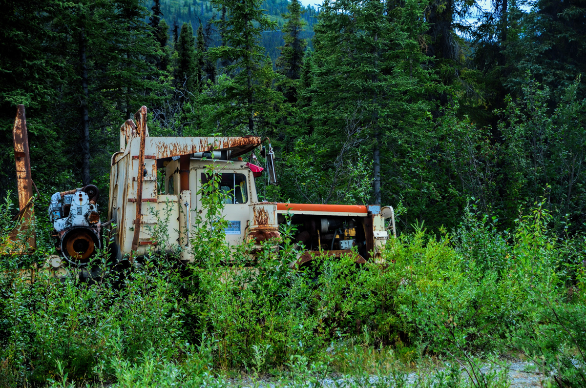
    When a piece of equipment fails in a remote part of Alaska, it will usually remain in the spot where it died until it rusts into dust

    The pavement ends in Chitina, and a gravel road continues into the wilderness for another 62 miles of slow going to a tiny town called McCarthy, which pre-dates the Wilderness area, and has less than 100 permanent residents. Five miles from McCarthy is Kennecott, a mining camp with an ore mill that was completely abandoned in the 1930’s when copper prices dropped. It would have been interesting to go; a well-preserved depression-era ghost town in the middle of the Alaskan wilderness sounded pretty unique, but it was also pretty far, and like an idiot I hadn’t topped off my gas tank before leaving Glennallen. I’d assumed I’d be able to get fuel in Chitina, but as it turned out, there were no services there, so I had to turn around, and I barely made it back to town, coasting on fumes, lowest I’d been on fuel in I don’t know how long. There’s a lesson in there, somewhere.

    After returning to my hotel, I just kicked back. Ate an overpriced burger at the hotel restaurant, and crashed early. It was interesting to note that my old routines that had sustained me through my working life had been shattered in the course of this trip. A bit more than a month into it, I had no routine of any kind. Every day was different, and I didn’t even know, from one day to the next, where I’d be sleeping! After 35 years with my shoulder to the wheel, I found that incredibly liberating.

    Next up: The Nabesna Road, and a tick for Tok
    Last edited by Tom_H007; 01-18-2022 at 02:09 AM. Reason: updated closure alert explanation

  4. #34
    Join Date
    Mar 2016
    Location
    Phoenix, Arizona
    Posts
    808

    Default Wrangell St. Elias, the largest National Park in the United States

    Day 37: Wednesday, July 29th

    Since I’d blown my opportunity to follow the McCarthy Road into Wrangell-St. Elias, I didn’t want to leave the area until I’d at least driven the Nabesna Road, the northern access point to the massive National Park. The sky was totally overcast and threatening rain, but the weather report indicated a possibility of partial sun in the afternoon. Checkout time at the Caribou was 11 AM, so I stalled until close to that point, then loaded the Jeep and drove north toward Tok on Alaska Route 1, keeping a sharp eye out for the turn at Slana, well over an hour beyond Glennallen.


    The Ranger Station in Slana, where you can get information, especially about road conditions.

    I stopped at the ranger station for information, and they loaned me an audio CD to play in my car. The sound track gave interesting descriptions of the various segments of the road as I drove along, information about the geology, plantlife, wildlife, and the fascinating history of the area. At the time this National Park was created, there were numerous private land holdings within its boundaries, some of which started out as homesteads. Because the private parcels predate the formation of the park, they were simply incorporated into the park, and the private landowners are protected in much the same way that the ecosystems and the wild animals are protected. The Homestead Act of 1862, which gave free federal land to anyone who was willing to settle on it and eke out a living for themselves, was one of the primary driving factors in the westward expansion of the United States, and in Alaska, the provisions of that act were still official policy all the way up until 1986. Legally, culturally, and in every other way, homesteaders are as much a part of the ambience of the Alaskan wilderness as the caribou and the grizzlies, so there was never any question about eminent domain, about kicking any of the old codgers out of the arbitrary confines of the new National Park. The two roads, McCarthy and Nabesna, also predate the park, and their primary purpose is not to provide access for park visitors; rather, the two roads are there to provide access to the scant handful of hardy souls who actually live in that extraordinary place. As you drive along the Nabesna road, you enter and leave the wilderness numerous times, as you cross in and out of the private land that’s interspersed along the route.


    The last 27 miles of the Nabesna Road is mud and gravel with LOTS of potholes! The 13.2 million acre preserve is the largest in the U.S National Park system, but it has little formal infrastructure and very few facilities for visitors


    Traveling the Nabesna Road, you enter and leave the National Park numerous times as you cross private land that predates the huge preserve


    The ultimate end of the Nabesna Road. The dirt track goes on just a bit further, providing access to an active gold claim, but the last bit of road is private land, closed to the public.


    A homestead at the end of the Nabesna Road, complete with a small airstrip.

    The road was paved the first 15 miles, but the next 25 miles were rough, and great fun to drive in the Jeep. Several unbridged streams crossed the road, which also negotiated several seriously rocky stream beds, and there were zillions of potholes filled with muddy rainwater that made wonderful BEGOOSH geysers when I hit them just right. Crossing a couple of those shallow streams, I was spraying water off to the side, higher than the roof of the Jeep! One thing that caught my attention: all of those private parcels had rural mailboxes, even those that were all the way at the end of the road—which was originally built to access a gold mine that is no longer commercially viable, but still being worked by its owner. When I inquired about the mail service, I was told that a rural carrier out of Slana delivers to those boxes three days a week, even in winter (depending on conditions). The Postal Service has long been a lifeline for rural Americans, even here, in one of the most remote parts of Alaska. There were actually two B&B’s at the end of the road—it would have been an interesting place to stay! There was also a small fairly primitive airstrip, where flightseeing excursions over the surrounding wilderness can be arranged.

    I took very few pictures on the way in—too cloudy—but the sun came partway out as I was driving back and I made numerous stops to take in the views. My visit to Wrangell-St. Elias was great fun, but, compared to the other places I’d been, not the greatest in terms of photo ops. (Sometimes you have to just absorb the experience, and not worry about capturing a place with photos.) I stopped at the Ranger Station to return the Audio CD, chatted a bit with the staff, then drove on toward Tok. It rained on and off along the way, but it was a very pretty drive.


    Fireweed, mountains, and clouds reflected in beautiful lakes. Ho, hum. Just another day in Alaska


    Rain, rain, go away! Lousy weather between Glennallen and Tok

    I pulled into Tok at about 5:00 PM, and since I’d actually been there before, it felt like a familiar spot. I got a room at a motel/campground for a mere $110 (cheap!). Later, I took in a presentation on dogsled racing that was being given to a tour group from Wisconsin; that was actually very interesting! I had a Halibut Burger at Fast Eddie’s (another familiar place), then back to my room, to sleep, per chance to dream.

    Next up: Back to Canada via Chicken, the Top of the Word Highway, and Dawson City, Yukon

  5. #35
    Join Date
    Mar 2016
    Location
    Phoenix, Arizona
    Posts
    808

    Default Over the Border on the Top of the World

    Day 38: Thursday, July 30th

    My first morning in Fairbanks, I met a couple from Tok who gave me two “must-see” recommendations. The first was the Eskimo Olympics, a totally unique event that I thoroughly enjoyed. The second was a drive on the Top of the World Highway, an alternative border crossing route between Tok and Dawson City, Yukon. They claimed that the road offered incredible views, “even better than Denali,” but just like Denali, you had to catch it on a clear day. I’d been checking the weather forecast twice a day for the last week, and this day, Thursday the 30th, was supposed to be clear in the morning, with probable rain in the afternoon. That was all the incentive I needed to get an early start on what I was pretty sure would be my last day in Alaska. I had a quick breakfast at Fast Eddie’s, and then I took off, headed north on the Taylor Highway, AK Route 5, which intersects the Top of the World near a tiny town called Chicken. The first 60 miles of the route was paved, if you could call it that. I’d never seen so many frost heaves—sections of road where the pavement has been buckled by expansion and contraction of the water-soaked soil beneath the road bed, which alternately freezes and thaws with the changing seasons. Once that rippled pavement ended, the road pretty well went to the dogs.

    Due to seasonal road closures (snow, mud, road construction, etc.) some of the maps displayed in this thread are not displaying properly or you might see pop-up windows reporting errors found with the route. Unfortunately, the map data used to create these maps enforces these "Time-outs" if a particular road segment is closed. In the case of the pop-up windows (alerts), please click the "OK" or "Close" button and the rest of the page will display properly. In the case on some of the maps where the route seems all jammed up -- reloading the page where the map is displaying seems to solve the issue. All of these problems go away once the winter closures of the roads end. So, everything will look fine in the North American summer months.


    Click here for this RTA Library Map
    (This map shows Rick's route between Tok, Alaska and Dawson City, Yukon.)

    The area around Chicken was so foggy I could scarcely see the place. It started as a mining camp during the Yukon gold rush, and it’s one of the very few such places that is still producing gold more than a century later.


    Abandoned gold dredge, Chicken, Alaska

    The mining operations have scaled back pretty dramatically, such that the primary industry in Chicken, with a permanent population of 7 souls, is tourism. When the mining camp grew large enough to need a Post Office, back in 1902, residents had to come up with a name for the place. They wanted to call it Ptarmigan, which is the Alaska State bird. Unfortunately, nobody knew how to spell Ptarmigan, so they settled on Chicken, and that’s what it’s been called ever since.


    Chicken Monument, the centerpiece of Chicken, Alaska

    There was a campground in the town with a significant number of large RV’s towing cars (“toads”); a whole herd of Class A rigs, lots more than I would have expected on such a rough back-country route. Apparently, the Top of the World was more popular than I realized. I topped up my gas tank in Chicken, even though the price per gallon was pretty outrageous. There’s a rule of thumb in the far north: even the most expensive gas in Alaska is cheaper than the cheapest gas in Canada. I bought a souvenir post card in the gift shop, and then I drove on. The weather stayed foggy for the first ten miles, and then it lifted. The view WOULD have been tremendous—the road followed a high ridge well above the tree line—but it was so hazy you couldn’t see more than a mile, at most—so the mountains were more like vague shapes.


    Hazy views from the Top of the World Highway, one of the most northerly highways on the entire planet

    Based on my interpretation of the road map, I expected a road junction not far past Chicken. The Taylor Highway went north to the tiny town of Eagle, and the Top of the World Highway turned east to Canada. But after driving and driving on the rough dirt road, there was no junction, and I was afraid I might have missed it. I didn’t want to go all the way to Eagle and back accidentally, so when I noticed a camp down in a gulley alongside the road, I stopped and walked down. The people there were apparently working a gold claim. I kept my distance, and rather cautiously announced myself. When I got their attention, I asked about the road. As it turned out, the junction was still ahead of me—the map was simply misleading about the distance, so all was well.


    Top of the World Highway near the Canadian border


    Welcome to Alaska sign greets travelers arriving from Canada on the Top of the World Highway; for me, it was a sad goodbye

    The last section of road, just before the border, was newly and beautifully paved, which was quite an anachronism in such a remote area. Canadian Customs, the Little Gold Creek Border Crossing, was a small building in the middle of nowhere, an unusual place, because that same single building is shared by U.S. Customs. The inspection consisted of a glance at my passport, questions about firearms, liquor, and tobacco, and how long did I plan to stay in Canada? That was it; have a nice day, and they didn’t even glance at my vehicle. I was sad to be leaving Alaska so soon, but I was also pretty satisfied, because I felt I’d done it up right!


    Little Gold Creek border crossing

    I drove on over a very good dirt road, traveling it too fast, probably, down to the Yukon River, with a stop at an overlook for a great view of Dawson City, the metropolis of the far north, and quite a place in its heyday during the Yukon gold rush.


    Dawson City, founded in the late 19th century on a bend in the Yukon River

    There’s no bridge, just a small car ferry, but my timing was perfect. I didn’t know anything about this ferry, which can be a major delay for travelers—but once again, my luck was very good and I was across in minutes.


    George Black Ferry, the only way to cross the Yukon River, and only in the summer months.

    Dawson City was pretty cool. A turn of the century gold rush town—partially restored, partially dilapidated original. Tons of young people—sort of a hippy type community here, mostly young Canadians. There was even a small music scene. I got a room at a seriously dilapidated hotel downtown for about fifty bucks. Zero amenities, shared bathroom, two flights of creaky stairs to carry my stuff up, and the building’s floors were literally tilted in various directions, as if it’s on the brink of collapse. This was another case of “should have checked the room before paying for it,” but this time, it really wasn’t as bad as all that.


    Westminster Hotel in Dawson City, Yukon. The building façade is newly painted and kind of cute. The interior of the building behind the façade was slowly caving in on itself


    Klondike Kate’s, one of the more nicely restored places in this hodge-podge of old and new, where they’ve retained, a 19th Century ambience.


    The Flora Dora, where, back in the day, the rooms came either with, or without (the girl in the window)

    I wandered about the town taking pictures, and then holed up in the room to do some serious route planning. It was 1800 miles to Edmonton, and I wanted to break it into logical, relatively even segments. I spent most of my time in this interesting little town hanging out in my funky room. I checked out the bar downstairs, but the evening crowd was a little rough to my taste, so I didn’t stay to hear the band.

    Day 39: Friday, July 31st

    I woke up fairly early and took a shower in the shared bathroom. There were very few guests in the hotel, judging by the lack of noise. I couldn’t leave before 9:00, because I had to wait until the bar opened in order to get a refund on the $100 deposit they’d made me put down on my $50 room (as if it would even be possible to do that much damage to so Spartan an accommodation, with peeling floor tiles, cracked and peeling paint, and worn old furniture). I spent some time editing photos, had a good breakfast at the much nicer hotel across the street, and then went back to the bar to reclaim my deposit. There was a guy in there already drinking at 9:00 AM, bragging to the pretty female bartender that he’d just turned down a producer who wanted to feature him on a reality show about the Yukon. The producer had offered him $1,000 to appear in the show, but that was an insult, he claimed, because he was currently making a wage of “$24,000 an hour!”

    That got my attention. “What kind of work pays that kind of money?” I asked.

    “Gold mining,” he replied. He claimed he was on to a very hot spot, part of a crew that was killing it at that very moment. If that was true, I couldn’t help thinking, why was he drinking cheap beer in a Dawson City bar at 9 AM? Good question, that, but I left it unasked. Instead, I retrieved my deposit, gassed up my Jeep, and drove south down the Klondike Highway. This was, for the most part, a very good road, though it did have a few patches of dirt and gravel, part of the ongoing road repair and construction that’s endemic to that part of the world during the short summers; the winters up there in the far north are absolute hell on the road surfaces.


    Yukon River from the all but deserted Klondike Highway

    The highway followed the Yukon River south, crossing it a few times on bridges, but for the most part you couldn’t even see the water for the solid hedge of trees lining the road. I stopped a few times for photos, but not many. There was almost no traffic on the first half of the drive. I passed two cars, but not a single car passed me, and I saw no more than 2 or 3 vehicles going the other direction, plus a couple more here and there at rest stops.


    The all-but-empty Klondike Highway, which follows the route once taken by the thousands of desperate men who answered the call of the Yukon gold rush in the late 19th century

    This was, without a doubt, the most deserted highway I had ever encountered. There were very few towns and almost no homesteads along the route, at least none that were visible, so it would have been a terrible place to break down. To get assistance, you’d have to flag someone down, and pray that they stopped! Pretty iffy, but I suspect there’s an unwritten code among the folks that travel these lonely roads, to help any fellow traveler in distress. On the way in to Whitehorse, 350 miles and at least five hours later, I followed the signs to the Lake Leberge Campground, and drove a winding road through the woods to a camping area on the lake shore.


    The “marge of Lake Labarge,” (sic), near Whitehorse, Yukon

    I got out, and took a picture, just so that I could say that I’ve stood “on the marge of Lake Labarge.” (A classic line from the famous poem, “The Cremation of Sam McGee,” by Robert Service. Service, known as the bard of the Yukon, spent a good bit of his time on earth in and around Whitehorse). I found the Days Inn hotel that I stayed in when I passed through this place in an earlier lifetime. (Was it even possible that it had only been three weeks?) The hotel was quite comfortable before, so I booked it again, and was pleased to note that the rate had actually dropped by $25. It was already getting colder in the Yukon—so I guessed they were already past their peak season. I spent a quiet evening in the room, frustrated because my phone wouldn’t connect to my email account, even with good Wi-Fi. Crashed early, still feeling lousy, but pleased to be in a clean, comfortable bed.

    Next up: The Alaska Highway (in reverse)
    Last edited by Tom_H007; 01-18-2022 at 02:11 AM. Reason: updated closure alert explanation

  6. #36
    Join Date
    Mar 2016
    Location
    Phoenix, Arizona
    Posts
    808

    Default The Alaska Highway in reverse

    Day 40: Saturday, August 1st

    Before leaving Whitehorse, I studied my maps and my copy of the most recent edition of The Milepost, a comprehensive mile-by-mile guide to the Alaska Highway and all the other roads that connect to it. I was strongly considering taking a different route back into British Columbia, rather than retracing the Alaska Highway back to Dawson Creek. There was an intriguing possibility—the Cassiare Highway, which led south from the Al-Can, just a bit west of Watson Lake. The Cassiare was more remote, less travelled, and, quite possibly, more scenic than the Al-Can, so it seemed like a no-brainer: a loop trip, where you travel different roads on the return leg, is nearly always better than simply reversing course, because you get to see new stuff. The only thing stopping me in this case was the weather: the forecast called for heavy rain throughout the region for the next several days, and if that was true, I wouldn’t be seeing much of anything in the way of scenery, and under those circumstances, an unfamiliar route through remote territory had significantly less appeal. I took my time getting up and leaving, because I still hadn’t quite made up my mind.

    Due to seasonal road closures (snow, mud, road construction, etc.) some of the maps displayed in this thread are not displaying properly or you might see pop-up windows reporting errors found with the route. Unfortunately, the map data used to create these maps enforces these "Time-outs" if a particular road segment is closed. In the case of the pop-up windows (alerts), please click the "OK" or "Close" button and the rest of the page will display properly. In the case on some of the maps where the route seems all jammed up -- reloading the page where the map is displaying seems to solve the issue. All of these problems go away once the winter closures of the roads end. So, everything will look fine in the North American summer months.


    Click here for this RTA Library Map
    (This map shows Rick's route between Dawson City, Yukon and Jasper, Alberta.)

    The rain predicted in the weather forecast was already happening; it was pouring buckets when I checked out of my hotel. I stopped by my favorite Tim Horton’s for a breakfast sandwich and coffee, finally got on the road about 10 AM. Whitehorse was a familiar place at this point—it almost felt like I knew my way around! While gassing up the Jeep at my favorite gas station, my phone went off, and all the email that had so stubbornly resisted downloading while I was hooked to the hotel Wi-Fi suddenly came in through the local cell data network. I drove east on the now familiar Alaska Highway, and continued to get email, as well as a text or two, as much as 30 miles outside the town. It’s like everything started working the way it was supposed to work all along, but I still didn’t quite understand it.


    Sign marking the junction of the Alaska Highway with the Cassiare. I had a tough time deciding which way to go!

    When I got to the junction with the Cassiare, I stopped and reviewed my maps one more time. The rain had let up a little, but one look at the sky told me there was a lot more coming, so I elected to stick with the familiar, as opposed to the strange, and kept driving toward Watson Lake. The stretch of the road I was on, between Whitehorse and Watson Lake, had been my favorite part of the drive on my way to Alaska. Amazing green mountains, billowing clouds, ice blue and green rivers. On this day, I was traversing the exact same territory, traveling in the other direction, but on this day it was raining so hard, with such a low ceiling of clouds, that I could barely see past the edge of the road. I was extremely glad that I’d had beautiful weather when I drove it the first time; otherwise, I would never have known what I’d missed!

    I pulled into Watson Lake at about 3:00. Just like the first time, it was raining, but this time I knew in advance that there were numerous motel choices, just off the main drag, and I’d already decided that I’d stay in one of them. I chose the Bighorn, which was overpriced, but comfortable enough. The sun came out in the afternoon, so I took a lengthy stroll through the signpost forest. On my previous visit, I stood at the edge and snapped a couple of quick pictures. This time I really looked around, looked at the small details, and took much better pictures!


    The Signpost Forest in Watson Lake, revisited. This roadside attraction is interesting when viewed in its totality, but it’s fascinating when you look more closely, because every one of those tens of thousands of signs has a story to tell.

    For dinner, I had the meatloaf at a restaurant called “A Taste of Home.” It was edible, but nowhere close to the meatloaf at MY home!

    Day 41: Sunday, August 2nd

    Didn’t sleep all that well, and felt the need to get moving, so I had a quick breakfast, gassed up, and hit the road. There was light rain as I drove south toward BC, and when the clouds broke I noticed beautiful light over the distant hills, so I stopped the car and ran to the top of the rise. In the other direction was a perfect rainbow.


    I took that as a good omen. The rain cut back to a light sprinkle, and the road stretched out before me, a ribbon of asphalt across a verdant landscape.


    Alaska Highway east of Watson Lake, headed back toward Fort Nelson

    The drive was like a relay race. I got ahead of the line of traffic and stayed out front until Liard Hot Springs. Remembering how pleasant it was the first time, I stopped for a soak. When I paid my fee on the way in, the woman in the booth warned me that there were bears in the area, so bold that they had been nosing around all the way up to the hot springs pool. “Be careful!” she warned. “If you see one of those bad boys on your way in, back away slowly, and whatever you do, don’t run from them!” That was pretty sobering! I walked in anyway, paying very close attention. The hot spring was as awesome as ever, a little more crowded this time, and no bears showed up to spoil the pool party.


    Liard Hot Springs, British Columbia. Keep an eye peeled for bothersome bears!

    Back on the road, I wound up stuck behind a long chain of RV’s and a couple of semis, so I passed them all, one by one. When I got to Muncho Lake, it was gorgeous, despite the cloudy skies, so of course I had to stop for more photos.


    Return to Muncho Lake

    When I got back on the road, the RV’s and the semis had all gotten ahead of me again. There were several lengthy construction delays, the “pilot car tango,” and after one of those delays I got stuck right behind one of the big trucks. That son of a gun simply would NOT let me pass him. There were multiple patches of dirt and gravel road, and every time the semi hit one of those, he sprayed gravel at my windshield, and stirred up billowing clouds of dust so thick I couldn’t even see the road. I’d back off, and then I’d pull close again in hopes of sneaking around him, but he kept deliberately speeding up on the open or downhill stretches, pedal to the metal, so I never got a chance. Overall, I drove that section of road much too fast! I did get some good photos of a buffalo browsing through fireweed, and another of a family of mountain sheep.


    Fireweed Bison


    Mountain sheep, posing for a family portrait

    I arrived in Fort Nelson at about 3:00, elected to NOT push on to Dawson’s Creek, which would have meant another 5 hours of driving, give or take. Checked in to the Blue Bell, which cost $30 more than the place I’d stayed the last time, but it was a little nicer, and it had Wi-Fi! I spent a quiet evening watching a couple of dumb movies on a cable channel.

    Day 42: Monday, August 3rd

    Last leg of the Al-Can, from Fort Nelson to Dawson’s Creek! I took my time packing up and getting ready to go, knowing that I’d only be driving five or six hours this day. The rain was pretty steady starting out, and got infinitely worse, pouring hard in some sections, and never really letting up. This is the most populated section of the road, so traffic was correspondingly heavy, the most commercial traffic I’d seen in a single day, and that was not a good thing. Numerous stretches of the road were undergoing repair, and the pavement had been removed, leaving a dirt and gravel surface. That, plus the heavy rain, plus the heavy truck traffic was a recipe for disaster. Every northbound truck that passed me going the other way drenched me with the muddy rain water that was standing on the road in deep puddles, to the extent that I could scarcely see. The Jeep got dirtier than it’s ever been, and the constant spray of muddy water obscuring my windshield caused a fair bit of white-knuckle anxiety, enough that I was getting bad cramps in my hands. I didn’t stop even once for photographs. Didn’t even think about it!

    When I arrived in Dawson Creek, I was struck by how big it seemed, especially when compared to my perception of it my first time through, less than a month earlier. Back then, it looked so small, a Podunk town in the middle of nowhere, but after driving to Alaska and back, my perceptions had changed quite a lot! The Comfort Inn was probably the best motel in town. When I stopped and asked how much, the gal at the desk knocked $30 of the published rate, which made it quite competitive. I had a few days to kill before meeting my friend in Edmonton, so I booked for two nights, glad at the chance to just stay put in one place long enough to catch things up and relax a little. In the early evening there was a whopper of a thunderstorm—an inch and a half of rain in less than an hour. I was quite glad to be indoors watching the storm, not driving, and not camping!


    No amount of rain will wash off this kind of road grime!

    After the rain stopped, something really strange happened: it started getting dark, and somewhere between 9 and 10, the sun went down! I was finally far enough south, and it was long enough since the solstice, that I was finally away from that whole “midnight sun” phenomenon. I’m not sure I could ever get entirely used to that—I definitely didn’t like it much! That night in Dawson Creek was the first time I’d seen actual darkness in almost a month, and it was very reassuring!

    Next up: On to Edmonton (to pick up my co-pilot)!
    Last edited by Tom_H007; 01-18-2022 at 02:12 AM. Reason: updated closure alert explanation

  7. #37
    Join Date
    Mar 2016
    Location
    Phoenix, Arizona
    Posts
    808

    Default Dawson City to Edmonton

    Day 43: Tuesday, August 4th

    The next morning, I had the free breakfast offered by the hotel—the all-too familiar business travelers special: mass produced scrambled eggs from a carton, weird bacon, day old pastries, make-it-yourself waffles, cereal in plastic dispensers, and tasteless fruit. I practically lived in business class hotels when I was working, and lord, I did NOT miss that routine! I think that may have been the moment that it actually struck me: all of that stuff was in the past tense. I wasn’t simply on an extended vacation. THIS was my life now, and I was never going back to the office again! I poured myself another cup of coffee and sat back, with what must have been a silly grin on my face, while I watched the Canadian morning news. It was very similar to what I was accustomed to seeing back home, but with a different slant, much milder in manner. There was an election coming up, and all the politicians were so polite! I could definitely learn to like living in Canada—if it wasn’t so darned cold in the winter!

    I did laundry at the hotel, then went out and about, changed money, bought supplies, and then stopped by an automated car wash, only to find it out of order. I located the “Milepost 0” monument that I somehow missed on my first trip through Dawson Creek, right in the middle of a busy intersection in the downtown area. Found a parking place, got out, and took a picture.


    A couple of blocks away, I watched tourists taking selfies by the “Word Famous Alaska Highway” sign. I was a seasoned veteran now, so I went over and chatted with some of them, telling of my experience, and answering a few questions. I went back to the carwash, and the guys working on the equipment still weren’t sure if they had it fixed. They offered me a free wash if I’d be willing run my Jeep through the machine to test it for them. Sold! The machinery worked fine, and, just that quick, the Jeep was nice and shiny again. I bought a bumper sticker at the visitor’s center: “I drove the Historic Alaska Highway”. A badge of honor my Grand Cherokee can wear quite proudly!


    I also bought myself an Alaska Highway Survivor T-shirt, which I can wear quite proudly!


    Back at the room I balanced my checkbook, paid some bills, caught up my field notes, all sorts of things I’d been putting off. All in all it had been a pretty good day, and a nice pause for reflection. I’d actually driven all the way to Alaska and back! And speaking of backs, mine was actually holding up, so much better than I expected! I was proud, relieved, very satisfied, and more than a little exhausted. The home stretch was coming right up: the next day, I had to drive 585 miles to Edmonton, where I’d be hooking up with my friend Carl. The two of us would be driving south through the Rockies, and a whole string of National Parks, most of which I’d never seen. Traveling with a friend, someone to talk to, someone to share the experience with (not to mention the driving); that was going to dramatically alter the whole dynamic of this journey, and I was really looking forward to that change of pace!

    Day 44: Wednesday, August 5th

    Got up fairly early, but took my time getting ready, figuring there was no real reason to hurry to Edmonton, even though it was quite a long drive. Got on the road at probably 9:00 or thereabouts, and headed east out of Dawson Creek. I drove through a whole different section of the town that was actually larger than the area I’d come to know, with more hotels, more food choices. Dawson Creek is actually quite a good-sized community by BC standards, and it was obviously growing! The road was a basic two lane starting out, but before long it expanded into a divided highway with two lanes in each direction. Not a freeway, exactly, because it wasn’t limited access—but definitely an expressway, a high speed road the likes of which I hadn’t seen (in Canada) since turning off the main Trans-Canada Highway just east of Vancouver. I’d seen a couple of short freeway-like stretches in Fairbanks and in Anchorage, but other than that, since leaving Washington State, the whole trip had been on the venerable old two-lane routes—or worse! My drive east was completely uneventful, through mostly flat farmland, reminiscent of the prairie heartland of Nebraska and Kansas—and indeed, these prairies in Alberta, Saskatchewan, and Manitoba are an extension of exactly that same geography—little to distinguish it from the upper Midwest. They have freezing cold winters throughout that whole broad swath of the world. There are no mountains to divert the frigid air rolling south out of the arctic, so it just flows through, turning the whole place into an icebox. I’d have to say, after all the amazing things I’d seen, that stretch of road was not much of an inspiration! I could have taken a few pictures of bucolic farms, the fields with the rolled up bundles of harvested hay scattered about in interesting patterns—but that type of expressway just isn’t conducive to pulling over for photos. Net result, I didn’t take a single picture, all day long.

    As I approached Edmonton it started raining pretty hard, and that continued as I negotiated heavy traffic through the town. I’d written down some cryptic road junctions that would lead me toward the area near the Edmonton airport, where I hoped to find a reasonable room; much to my delight that actually worked! The distances between exits were longer than expected, so I continually doubted whether my hand-written turn-by-turn instructions were accurate, fearing the signs wouldn’t match my notes, but I ended up in downtown Leduc, the Edmonton suburb nearest the airport, which was right where I wanted to be. I drove around a bit in the pouring rain and heavy traffic but couldn’t find any of the hotels I’d jotted down. Desperate, I switched my phone to Data Roaming so that I could hook to a cell network and ask for a little navigation assistance. I’d already used up my allotment of roaming megabytes, so using the GPS was going to cost me—but it worked like a charm, and I ended up at the Super 8, where I booked a room for the night for a mere $120 Canadian. I was exchanging texts with Carl throughout the day, making sure he got on his plane, making sure it would be on-time, but suddenly, there was a big problem! It seems Carl had packed his Passport Card instead of his Passport, because he wanted to travel light. He assumed the Passport Card would be all he’d need for Canada, and that would have been true if he was traveling by land. Unfortunately, he was traveling by air, and the Passport Cards are invalid for International Air travel. Net result, he was at the airport in San Francisco with his luggage, but they wouldn’t allow him on the flight. He had to re-book for the next day, a mistake that no doubt cost him big bucks. I was disappointed by the delay, but honestly, I was pretty whipped from the long drive, still not feeling all that well, so I just went to bed early, glad that I wasn’t going to have to make a midnight run to the airport!

    Next up: Jasper National Park in the Canadian Rockies

  8. #38
    Join Date
    Nov 2009
    Location
    Brisbane, Queensland, Australia, Australia
    Posts
    232

    Default Breakfast

    Hi Rick.

    Loving your adventures. Question for you. Do you get Breakfast thrown in when you stay at Choice brand motels and Super 8 Motels in Canada and Alaska like you do in mainland USA? Here in Australia you dont. Or i havnt seen one yet. I know where you can get a fantastic steak in Las Vegas on the way home. hehe.

    Keithg

  9. #39
    Join Date
    Mar 2016
    Location
    Phoenix, Arizona
    Posts
    808

    Default

    Keith:

    The Choice Hotels and the Super 8's in Alaska offer essentially the same amenities as their counterparts in the lower 48. The only real difference is the price of the rooms, particularly in the high season (which is the all-too-short summer, from June to about mid-September). So yes, you do get the breakfast. Not exactly gourmet fare, but you can fill up on it, and it's a nice perk, because the cost of just about everything in Alaska is on the high side.

    I've been to that place in Las Vegas that you mentioned. Didn't have the steak, but the hospitality was first rate!

    Rick

  10. #40
    Join Date
    Mar 2016
    Location
    Phoenix, Arizona
    Posts
    808

    Default Jazzed about Jasper!

    Day 45: Thursday, August 6th

    I talked the folks at the Super 8 into letting me stay in my room well past their 11 AM checkout, since Carl’s plane wasn’t due until 3:00 (or later). They were quite nice about it—even let me go back into the room after it was cleaned, which gave me a chance to catch up a bit on photos and notes. Carl’s plane was delayed at least an hour before it even left the ground in San Francisco, so I made my way to the airport at about 2:30 or 3:00, just killing time. After the plane landed it was another hour before the passengers cleared customs, but you know what? Despite the wasted day hanging around Edmonton, and despite the lengthy delays, it was an awesome relief, seeing my friend come through that door. Our rendezvous at that airport was a remarkable accomplishment, when you considered the distance we both had to travel, and the coordination that it took to arrive at the same date and time in a city that neither of us had ever been to before. I will say that with cell phones and text messages and all the other modern-day options for communication, that sort of thing is a WHOLE lot easier than it used to be! I traveled the world extensively when I was a young man, long before the age of mobile phones, long before the Internet, before GPS systems, before hotel booking sites, before any of that stuff we now take for granted. Communication was mostly by letter or by postcard, or on very rare occasions, by telegram. Even a simple exchange of basic information could take weeks, as opposed to seconds, and yet, we still managed. I even pulled off the occasional miraculous rendezvous with friends in places that were far more remote and dramatically more unpredictable than the Edmonton airport. I often stayed off the grid and out of touch for months at a stretch, and that didn’t bother me a bit. Today, I get cranky if my hotel doesn’t have Wi-Fi, or when I drive through a dead spot where there isn’t any cell service! Would I ever want to go back in time to that simpler era? In a heartbeat! (But I would really, really miss my smart phone ;-)

    Carl and I had a spirited reunion with a lot of back-slapping and high fives, and the minute we retrieved his suitcase, we hit the road. It was already 4:30, going on 5:00 in the afternoon, but we didn’t have all that far to drive. The first stop on our Rocky Mountain Odyssey was Jasper, which, along with Banff, ranks among the crown jewels of Canada’s National Park system. These are very popular places, not just with international travelers, but with Canadians on summer holiday. The eastern gateway to Jasper was the town of Hinton, just under 200 miles west of Edmonton on the Yellowhead Highway, (Alberta Route 16). This was the peak of their peak season, and that created a serious shortage of hotel rooms. Knowing that to be the case, I’d done some checking in advance, and reserved us a double at the Hinton Holiday Inn. (As an aside: that was the first, and, as it turned out, the only advance hotel reservation that was made on this entire two-month trip!) We drove straight to it, arriving at our hotel in Hinton at about 7:30. I was certainly glad I had the reservation, because at that point, the hotel was booked to capacity, and people ahead of me in the line at the front desk were being turned away. Once we’d secured our room, we shopped for supplies, had some dinner, and crashed. (Boom! Out like a light.) This was another rare day when my cameras stayed in their cases, and I took no photos at all.

    Due to seasonal road closures (snow, mud, road construction, etc.) some of the maps displayed in this thread are not displaying properly or you might see pop-up windows reporting errors found with the route. Unfortunately, the map data used to create these maps enforces these "Time-outs" if a particular road segment is closed. In the case of the pop-up windows (alerts), please click the "OK" or "Close" button and the rest of the page will display properly. In the case on some of the maps where the route seems all jammed up -- reloading the page where the map is displaying seems to solve the issue. All of these problems go away once the winter closures of the roads end. So, everything will look fine in the North American summer months.


    Click here for this RTA Library Map
    (This map shows Rick's route between Jasper, Alberta and Mount Revelstoke, British Columbia.)

    Day 46: Friday, August 7th

    From Hinton, it was another two hours to the middle of the huge national park, but the drive west was gorgeous.


    The Yellowhead Highway, AB-16, headed into Jasper National Park


    The Athabasca River, as seen from the Yellowhead Highway on the long, beautiful drive into Jasper

    The whole area was quite crowded, and most of the campgrounds were already full up. Here’s what we were told: the Canadian Dollar was relatively weak that summer, which was great for us, because it gave us more “loonies” for each of our U.S. dollars when we changed money, but it was obviously bad for Canadians, because it meant that their money didn’t stretch nearly as far when they traveled outside of Canada. Net result, most Canadian families were vacationing “in-country” that year, which put a LOT of extra pressure on their national parks! Most of the tourists we saw were, in fact, Canadian, mostly from Eastern Canada, as we heard a preponderance of French being spoken. Of the others, a significant percentage were from China--no doubt taking advantage of the favorable currency exchange. Tourists from the U.S. were conspicuous by their absence, though I honestly can’t say why that would be.

    My opinion: the Canadian Rockies are world-class extraordinary, and completely accessible, so any of you RoadTrippers traversing the northern tier of the United States, especially anyone passing through Montana, should STRONGLY consider taking a few extra days for a detour north into Canada. There are no less than seven Canadian National Parks within a few hundred miles of the border. If you’ve never been there? You have no idea what you’re missing!

    We drove around a bit, enjoying the scenery. Snowy mountains and ice blue lakes never fail to stir my soul. Perhaps I have an ancestral memory of such a place lurking deep within my lizard brain. More likely, it’s the photographer in me, always on the lookout for a stunning composition. Either way, places like Jasper National Park make me very, very happy!


    We managed to locate a decent camp site at Kerkeslin, 30 km south of the town of Jasper. We set up the tent and paid the fee, then headed back toward town. From Jasper, we took a drive out to Maligne Lake, which was quite lovely.


    Maligne Lake, Jasper National Park


    Canoes and kayaks on Maligne Lake, with a stunning backdrop of ice-clad peaks

    Spent some time in the town of Jasper, and had dinner at a place with an outdoor upper deck, where we watched the sun drop low in the sky, creating beautiful light on the mountains.


    Sun going down over Jasper

    From there, we drove back to our campground for a pleasant evening camping in the tent. We built a small fire, did a lot of reminiscing, and slept reasonably well. There was no rain that night, and that of itself was a joy, considering my recent experience with heavy weather. I’d have to say that this day was some of the best fun I’d had on this whole trip. Carl and I have been friends for half a century, and when we travel together, we do a whole lot of laughing. That not only feels good, it's good for the soul!

    Next up: The Icefields Parkway, Yoho, Glacier, Kootenay, and Mount Revelstoke!
    Last edited by Tom_H007; 01-18-2022 at 02:13 AM. Reason: updated closure alert explanation

Similar Threads

  1. Visit ALL of the National Parks?
    By Rodentranger in forum Planning Summer RoadTrips
    Replies: 8
    Last Post: 08-17-2014, 12:13 PM
  2. 14 days planned from SD to the National parks and back to SF and confused
    By driving miss daisy in forum Spring RoadTrips
    Replies: 10
    Last Post: 03-02-2013, 04:24 PM
  3. national parks tour pt.1 - colorado, arizona and utah
    By adamharwood84 in forum Spring RoadTrips
    Replies: 5
    Last Post: 04-04-2011, 04:28 PM
  4. The Mother of All American Roadtrips
    By bmy78 in forum Planning Summer RoadTrips
    Replies: 11
    Last Post: 07-01-2009, 12:47 PM
  5. The mother of all road trips
    By moisf in forum Off the Beaten Path
    Replies: 1
    Last Post: 08-17-2008, 05:07 PM

Tags for this Thread

Posting Permissions

  • You may not post new threads
  • You may not post replies
  • You may not post attachments
  • You may not edit your posts
  •