This is a historically significant place -- Where is it and what was the historical significance?
(Photo by Mark Sedenquist)


This is a historically significant place -- Where is it and what was the historical significance?
(Photo by Mark Sedenquist)

Whitney Trail. Shot taken about a mile or two short of the summit, where the trail is actually on the west side of the Sierra crest.
A lovely hike if:
1) You manage to get a permit through the annual lottery
2) You prepare yourself physically (4 months of hiking up and down Mt Diablo at least once a week until we got tired of it and started abusing Tamalpais, Hamilton, Saint Helena, Mt. Rose. Add to that carrying the full pack across SF during Bay-to-Breakers to get used to hiking with the gear.
3) You have the right gear (this assumes you're not insane enough to do the 11 miles out 11 miles back 6000' elevation gain in one day.
4) You acclimate for the elevation (we spent a night in Reno and two nights in Mammoth).
As for #3, while we were setting up at Trail Camp (12,000') we had one group come ask to borrow matches because when packing they grabbed a box of toothpicks instead of matches, and another couple walk by arguing about who didn't read what instruction telling them they needed HOT water to reconstitute their freeze-dried meal packets (neglected to bring a stove). The last group was really sad; they reached Trail Camp alright, but with "car camping" sleeping bags instead of 3 season models; after a night of freezing to death they headed straight back down the trail in the morning, never did the final 4 miles/2500' feet to the top.
Then there was the group that came up the trail carrying plastic kayaks so they could cross over and drift down the river on the other side into the valley. Oy my aching back!
Other than a relentless uphill slog, the trail is in great condition and if you are in decent condition you don't need to be a mountaineer. Decent condition: able to jog at least a 5K and willing to put in some practice time on uphill hiking to get the right muscle groups in shape for back-to-back 3000' gain hikes. We ran into a guy who must have been in his 70s coming back down. Added incentive to summit.
Don't step back, it's a long drop to Iceberg Lake: Don Casey
I've not been up to Whitney yet, but I've hiked some of the alpine country south and west of there, -- what river were these yahoos thinking of?Originally Posted by CalOldBlue

I've done some uphill slogging in the Khumbu range in Nepal -- the thin air does tend to put most of life's challenges in the proper and immediate perspective.Other than a relentless uphill slog, the trail is in great condition and if you are in decent condition you don't need to be a mountaineer.
Loved that photo!
Mark
Last edited by Mark Sedenquist; 06-08-2009 at 04:02 PM.
... the Kern. Unless they were planning on paddling around Guitar lake for awhile then hauling them back over the crest.
Yeah, amazing what your body tries to tell you when the oxygen load drops to less than 2/3rds what it is used to. Also can't get the morning coffee hot enough. Science says about a 190 degree boiling point at Trail Camp.
Here's a shot taken from almost the same spot but a wider view, you can see the south side of Whitney and how the west face isn't all that steep... trail continues around the base of the summit through a small snow field (this is early July) before it makes a right turn and does the final uphill. Summit is a little past the highest point in this photo.
Final bit of Whitney Trail: Don Casey
Lastly, here's the Sierra crest at dawn from Trail Camp. The trail is on the far side of the sawtooth ridge (you ascend the infamous "97 switchbacks" to the left of this photo, cross over the crest, and traverse the far side (prior pictures). Whitney itself is just out of this photo, to the extreme right.
Sunrise on the Sierra crest from Trail Camp, Mount Whitney Trail: Don Casey
Back to my last puzzle....
 RoadTrip Guru & Enthusiast
Thanks Mark,
I know not whether it's a blessing or a curse, given the periodic inability to remember important things, as opposed to remembering only pleasant things. That CRS (Can't Remember Stuff) is tough sledding as I navigate through my mid-50s.
One of my geology professors 35 years ago asked his colleague to characterize the students in my class, as he would have most of us in the next course in our major's normal sequence. About me, Professor Callahan said "He never forgets anything he sees in the field". True enough, I suppose, but as noted, not always the most desirable of attributes.
Foy
Foy,
I imagine we arrived on this earth about the same time -- and I too have advancing CRS. And like you, I have a highly developed sense of visual memory -- for places. I seem unable to remember faces and/names very long, but if I've seen a bend in the road, I can usually remember it years later.... Not a very useful skill, except when playing this game on RTA!
Mark
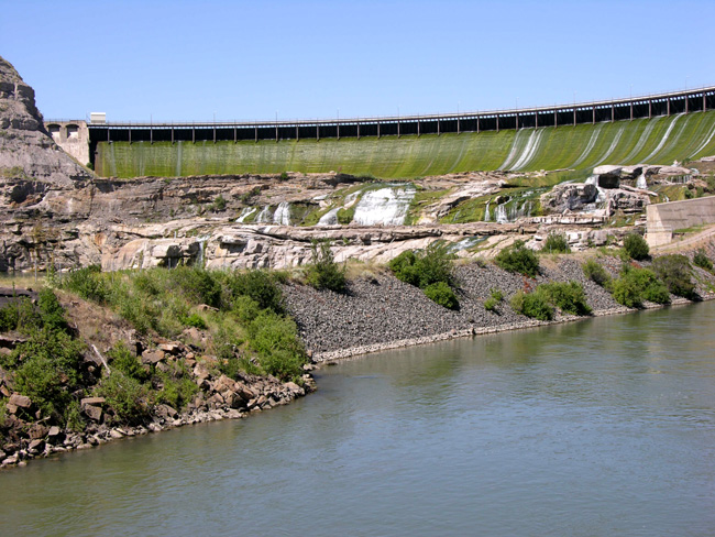
Does the phrase "Lewis and Clark" ring any bells for you WRT this location?

Well with that clue, is it an unusual angle and fairly dry looking shot of Black eagle dam, Great falls Montana?
Ryan dam? Further downstream?
 Posting Permissions