Nope. No Gila River anywhere near Bandelier!Originally Posted by landmariner


Nope. No Gila River anywhere near Bandelier!

I think it may be the Gila Cliff dwellings which is on NM15. Heading north on Pinos Alto towards the Burro Trail.
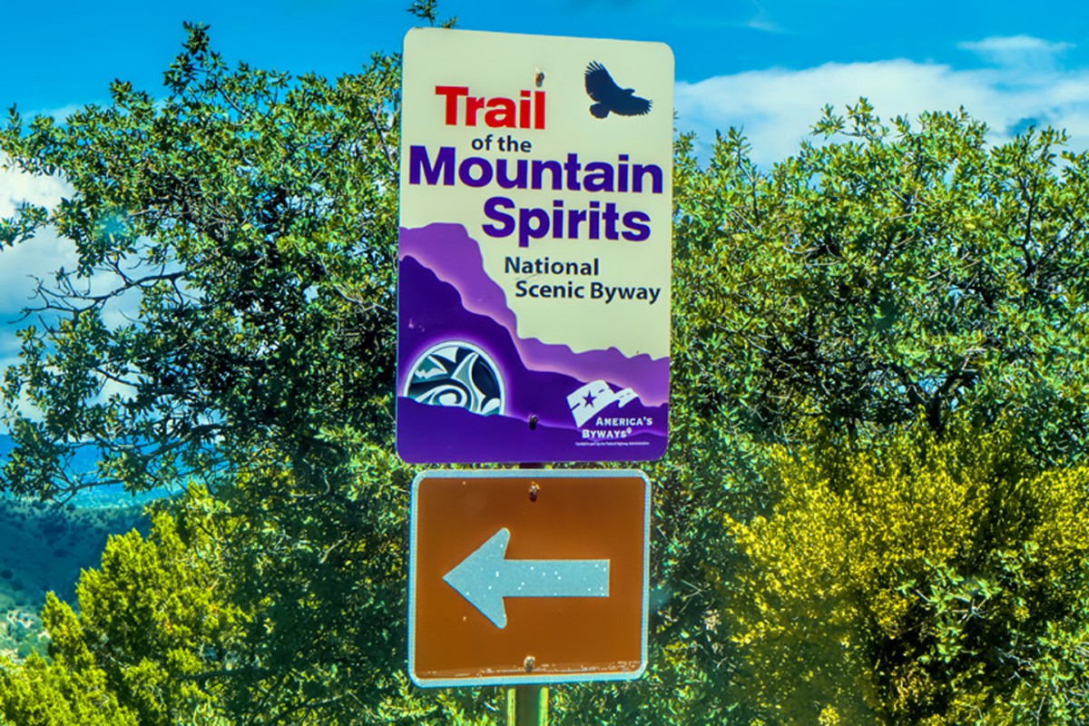
(Perhaps part of the Trail of the mountain spirits scenic byway ? )
Dave.
Dave:
Good answer! I wanted to drive this road from the moment I first saw it printed on a map, if only because the name is so totally cool.
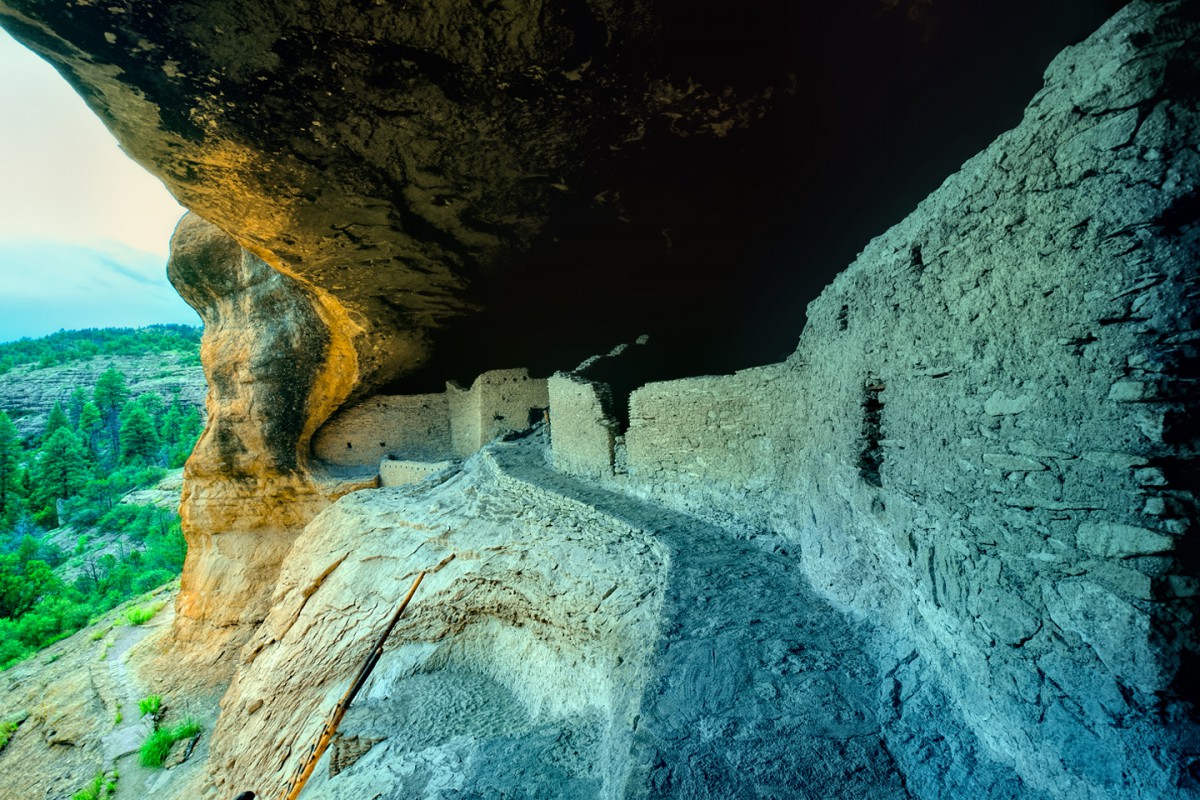
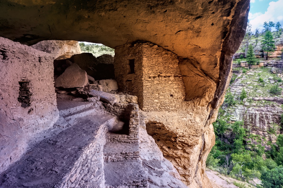
The fact that the road takes you to my favorite cliff dwelling is very much a bonus. Gila Cliff Dwellings National Monument is so isolated that it gets very few visitors, and those who do make the trip are afforded the rare privilege of being allowed to climb up into the ruin for a closer view, the kind of access that hasn't been possible for quite some time, due to the sheer size of the crowds at the more popular National Monuments.
Anyone with a serious interest in this type of ruin owes it to themselves to visit this one. The Trail of the Mountain Spirits National Scenic Byway is a part of Scenic Side Trip #2, which is a very nice alternative to Interstate 10, between Las Cruces and Lordsburg, NM.
Rick
Last edited by Rick Quinn; 05-15-2020 at 06:36 PM.

Looks very inviting for a future stopover. Thanks!

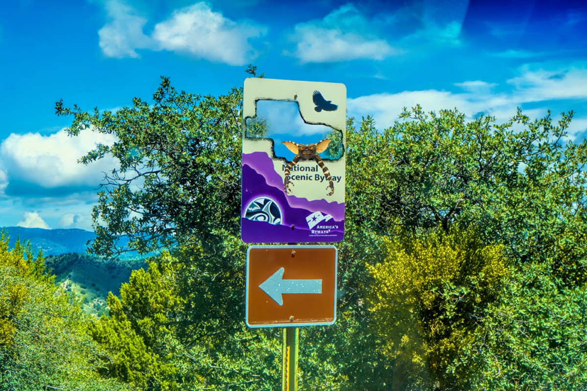
I really liked the Photoshop treatment by the flying alien! Very nice work!
That alone was worth some kudos on this. I didn't mention earlier, I was waiting to see if generated any other comments!
Mark
Hey, Donna! Happy Saturday!
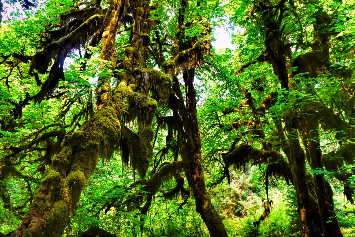
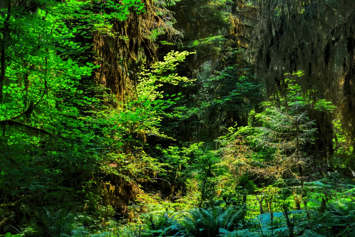
There's nothing wrong with obvious clues. It was refreshing to see one of these that didn't strain my aging memory! Those first two pictures could have been most anywhere that has both forest and beach, but the third one? There are moss-covered trees in the Louisiana bayous, but there's only one place on the west coast that looks like that:
Hall of mosses; Hoh Rain Forest
Olympic National Park!
I've only been there once, when I was on my way to Alaska a few years ago, but I was blown away. I've had plenty of experience with rain forests in Central and South America, but Olympic National Park was the first time I'd seen a jungle outside of the tropics. There are more shades of green per square yard than just about anywhere else I've ever been!
Rick
Donna.
Is the second photo down Ruby Beach ?
Dave.
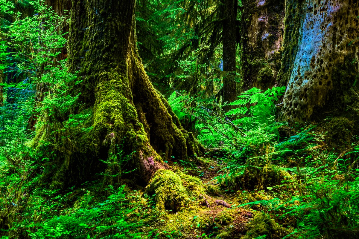
Kudos to Rick on picking out the Hall of Mosses in Hoh Rain Forest (my brother called it the Hall of Moses when he was a kid, and it's stuck), and to Chief Dave for the Ruby Beach photo. (At least, I think it was Ruby Beach. Or at least close enough by it!) The river and forest was also part of Olympic National Park, in the Staircase area on the southeast corner of the park. We were on the Staircase Rapids Trail, along the south side of the Skohomish River. All of these were taken 3 years ago.
Donna
Thanks, Mark! I must admit, got a little carried away with that one. All I really wanted to do was redact the name of the Scenic Byway, like I did with the Apache Trail sign further back in this thread. Then I got the notion to make a hole in the sign, as if somebody with a cutting torch had removed a souvenir. The flying alien just sort of appeared. I think he was attracted by the smell of hot metal...
But hey, before we get too far removed from the Gila Cliff Dwellings and the Trail of the Mountain Spirits, I wanted to take the opportunity to present you folks with a relevant excerpt from Arizona and New Mexico: 25 Scenic Side Trips. Some of you already have a copy of the book. Me, I've got a couple of 'em ;-), but it had been quite a long time since I'd even looked at Scenic Side Trip #2 (per se). When I reread it this morning, I realized that it's a very good example of something I tried to do throughout the book, for the benefit of road trippers like yourselves. Scenic Side Trips aren't just about the big attractions (in this case, the Gila Cliff Dwellings). Scenic Side Trips emphasize the roads that you take to get there, because on a road trip, the journey overall is (or should be) more important than the destinations. Allow me to show you what I mean by that:
SST #2 begins in Las Cruces, NM, where you leave Interstate 10 and travel north along the Rio Grande through Hatch, of chile pepper fame. This excerpt picks up at the point where you leave the river behind, and head for the hills:
(note that the following is copyrighted material, used by permission of the author ;-):
GILA CLIFF DWELLINGS NATIONAL MONUMENT
Leaving Caballo Lake, head west on NM 152 up into an impressive wall of mountains known as the Black Range, or Sierra Diablo. If you like to drive, you’ll love this road. This segment, known as the Geronimo Trail Scenic Byway, is widely considered one of the finest driving roads in the United States. You’ll negotiate one S curve after another on a climb to almost 9,000 feet at Emory Pass, which marks the Continental Divide. Pull off the road at the scenic viewpoint for awesome vistas and some great photographs.
Seventeen gloriously curvy miles beyond the pass will drop you 3,000 feet to the Mimbres River, which runs along the base of the Black Range. When you reach the intersection with NM 35, in the small town of San Lorenzo, check your time. If you plan to visit the Gila Cliff Dwellings, be aware that the gate to the ruins closes promptly at 4 p.m.—no exceptions. The distance from San Lorenzo to the site is only 45 miles, but you should allow at least 90 minutes for the drive. Late afternoon is a wonderful time of day to photograph the ruins—just don’t cut it too close.
The route to the cliff dwellings begins with NM 35, known as the Trail of the Mountain Spirits Scenic Byway. The highway follows the Mimbres River upstream, through the town of Mimbres. Twenty miles further along is Lake Roberts, a small but quite beautiful lake popular with trout fishermen and bird-watchers. There are cabins and motel rooms for rent here, and a lovely campground. Four miles beyond the lake is the intersection with NM 15; turn right (north) and follow it all the way to the end, about 18 miles, to the Gila Cliff Dwellings National Monument. The road to the ruins is narrow and winding, very slow going, with some sheer drop-offs and many hairpin turns posted as low as 10 mph—and for good reason! At one point, the highway skirts the edge of a collapsed volcanic caldera. Timeworn, overgrown, but still plainly visible, the caldera is a graphic reminder of the region’s violent geological past. Stop at Anderson Scenic Overlook for a breathtaking view of the Mogollon Range, the tallest mountains in southwestern New Mexico, and Gila River Canyon, 2,000 feet below.
Continuing north on NM 15 you’ll pass Gila Hot Springs a few miles before the end of the road. Much of this area is geothermally active and there are several natural hot springs nearby, some on public land, some private. There are a few campsites here, with access to the hot springs included.
At the National Monument visitors center, you can pick up maps and information about the ruins and the trails in the park. Even if you’ve seen your share of cliff dwellings, you’ll find this one is special. The setting is a narrow, wooded canyon with a perennial stream. On the west side of the ravine there’s a sheer cliff, and hollowed out from the face of it, high above the canyon floor, you can see a series of natural alcoves: interconnected caves that are open to the morning sun. In the late 13th century, a small group of perhaps 15 farming families from the Native American culture we now call the Mogollon moved into the caves and built an elaborate communal home there.
It was a perfect spot: protected from the elements, easily defended, close to water. A lot of craftsmanship went into the construction, and the wonderful organic structure that they created is still standing and largely intact. There are graceful, curving walls built of flat stones stacked like bricks, cemented with adobe mortar, and then plastered. The walls enclose more than 40 interconnected rooms that fill the alcoves: large common areas, smaller private living quarters, a granary. Many of the outward-facing walls had windows, and some sections were left open. Clearly, the builders appreciated their view!
There’s a tour every day at 11 a.m., but you can hike to the ruins and explore them on your own any time between 9 a.m. and 5 p.m., when the park closes. It takes about an hour to see the ruins, including the 1-mile hike up and back.
Leaving the ruins, head back the way you came in, on NM 15. When you reach the junction with NM 35, bear right, staying with NM 15, which continues south from here to Pinos Altos, at an altitude of more than 7,000 feet. The distance isn’t great, just 30 miles from the national monument, but it will seem much further. This is a wonderful corkscrew of a road, but it’s very, very narrow, with poor shoulders, no center stripe, and very few signs, so you have to take it slow. Be extremely careful on blind curves, as there is little room to pass vehicles coming from the other direction. I would not recommend driving this stretch in the dark, so if you’re not staying the night at Lake Roberts or camping near the monument, be sure to be on your way south well before dusk.
So there it is. Rick's notion of useful, practical information for someone who might be interested in making the drive to the Gila Cliff Dwellings!
 Posting Permissions

 Reply With Quote