Hehe...I had to pinch my self with the Gila clue. I'm not shaken any longer, I know what season it is!Originally Posted by Rick Quinn

BTW....I've never been to this location but I'm getting really good at figuring out the clues!
Utahtea :P


Hehe...I had to pinch my self with the Gila clue. I'm not shaken any longer, I know what season it is!
BTW....I've never been to this location but I'm getting really good at figuring out the clues!
Utahtea :P

Best be careful--too much of that stuff will raise your blood pressure!
Good morning, everyone! All this talk of condiments is making me hungry, and honestly, it's best to have a proper breakfast before setting out on a drive through the Salt River Canyon. (Those who are inclined toward motion sickness are excused from that recommendation.) The road in my little quiz is US 60, the river is, of course, the Salt River, and the water ends up in Roosevelt Lake (see photo in previous post) before stair-stepping its way down through Apache Lake, Canyon Lake, and Saguaro Lake, all of which are massive reservoirs, ultimately entering the municipal water systems that sustain the gargantuan population center known as the Phoenix Metropolitan Area. (Home sweet home).
When I was a kid growing up, back in the '50's, there weren't any Interstate Highways, so when my family made the long drive from Phoenix back to the mid-west to visit grandparents, we drove the US Highways, and at the beginning of the trip, that meant driving to Globe, and then north through the Salt River Canyon on US 60 (which was, at that time, a major cross country route that went from coast to coast). My father loved driving through the Salt River Canyon for the same reasons my mother hated it: steep grades, hairpin curves, precipitous drops. I'd be bouncing around in the big back seat of the Desoto with my sister (this was long before cars came with seat belts, much less child seats), and I loved every minute of it. Later in life, when I was old enough to drive that road myself, I loved it even more!
The run through Salt River Canyon is actually the continuation of Scenic Side Trip #11, which takes you from Phoenix to Holbrook (on I-40) by way of the Apache Trail (or it will, once its open again!) and the Salt River Canyon. The old mining town of Globe is the mid-point:
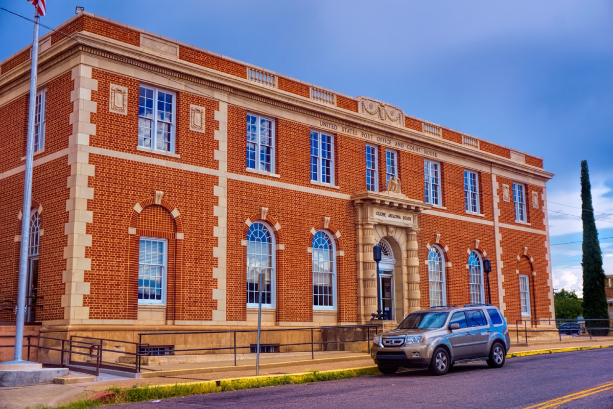
Once upon a time, in an earlier life, I had a work assignment that took me traveling all over the state of Arizona, upgrading and auditing financial systems in small town post offices like this one. Sometimes the Postmasters were happy to see me coming, and sometimes they weren't :-(, but either way, I really loved that job. In small towns, the Post Office is a vital institution, with roots that go deep into each community, and it was an inspiration to me, coming from the big city, to experience that side of the organization.
In the course of the COVID-19 Pandemic, Letter Carriers join the ranks of the new American heroes. My hat is off to them and all the other essential workers who are literally putting their lives on the line to keep us fed, informed, and connected!
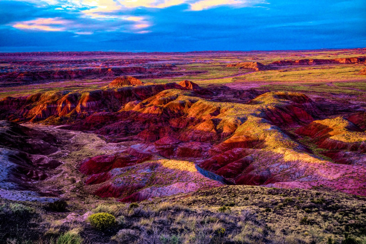
Once we all get back on the road, you'll find that Scenic Side Trip #11 is nicely paced. You can take your time, stop as often as you like, and you'll reach I-40 right around the end of the day. Just in time to whip into the northern section of Petrified Forest National Park, and catch the sunset over the painted desert:
Where to next? That's for me to know, and for you guys to "take your best guess!"
Rick
I'd totally forgotten about the Salt River! So often it is dry.
One summer, back in my college years, I took a job working at the gift shop at Petrified Forest NP. It was then run by Fred Harvey and the non-locals lived in air conditioned trailers, two to a room dorm style, behind the Fred Harvey conglomeration. I used to travel between my home near Casa Grande, and Petrified Forest, whenever I had 2 days off, leaving when I was done with an early shift one day and getting back to PFNP right before another shift started, taking an afternoon shift. I would drive up to Coolidge and Florence to catch US-60 at Superior, then northeast through the Salt River Canyon. Meal stop in either direction was almost always in Snowflake. I loved the mountain area! I could see why my dad loved the SRC and why my mom was always glad to let him take the wheel through there -- he was usually towing a travel trailer!
A favorite story about one of those trips between home and PFNP: while coming up from the bottom of the Salt River Canyon, a bird suddenly darted in front of my car and I hit it. I had no other choice - I was a relatively inexperienced driver, but I remembered being taught: DO NOT SWERVE to avoid an animal unless you can see where you're going! And on that road, there was no place to go. When I got to the place where I usually ran in to grab some food, there was a guy with a water hose and a broom. I could see the dead bird clinging to my radiator grill. I asked the young man if he'd mind getting rid of that bird for me. He took a look at it, and it was obvious that he was as squeamish as I, and said, "I don't want to aim a hose there, it might crack your radiator." (Glad he knew that, as I'd never have thought of that as a very new driver.) He took his broom and whacked at it, then used the hose to move the bird over to some dirt. After I said "thank you!", he and I looked at each other and laughed. Why?? I don't know.
Donna
Thanks for sharing that, Donna; I'd bet you're not the only one with a story to tell about US 60 through the Salt River Canyon!
I have one: I can remember driving that road on a Monday morning in my government Ford, headed to Show Low, I think it was, to audit their Post Office. There had been heavy storms over the weekend, and while the rain hadn't caused any rock slides bad enough to warrant closing the Highway, it had nevertheless knocked loose a whole heck of a lot of stones, ranging from baseballs to basketballs in size, scattered here and there across the roadway for miles. That road is hairy enough without adding rocks big enough to blow your tire (or worse), but it gets better: there was a ton of other traffic on the road, in both directions, and those crazy idiots were swerving all over the place, oblivious to oncoming traffic! Throw in a hundred or more 10 mph hairpin curves, and let's just say I had a lot to look out for that morning! When I got to the top of the grade on the north side of the canyon, I literally had to pry my fingers off the steering wheel of that government Ford.
Since we're on the subject of rocks, I'll segue right straight into our next mystery destination. No series of questions this time. Just the one:
Where am I?
You have to park and walk just a little
Until you get to the Flintstone village.
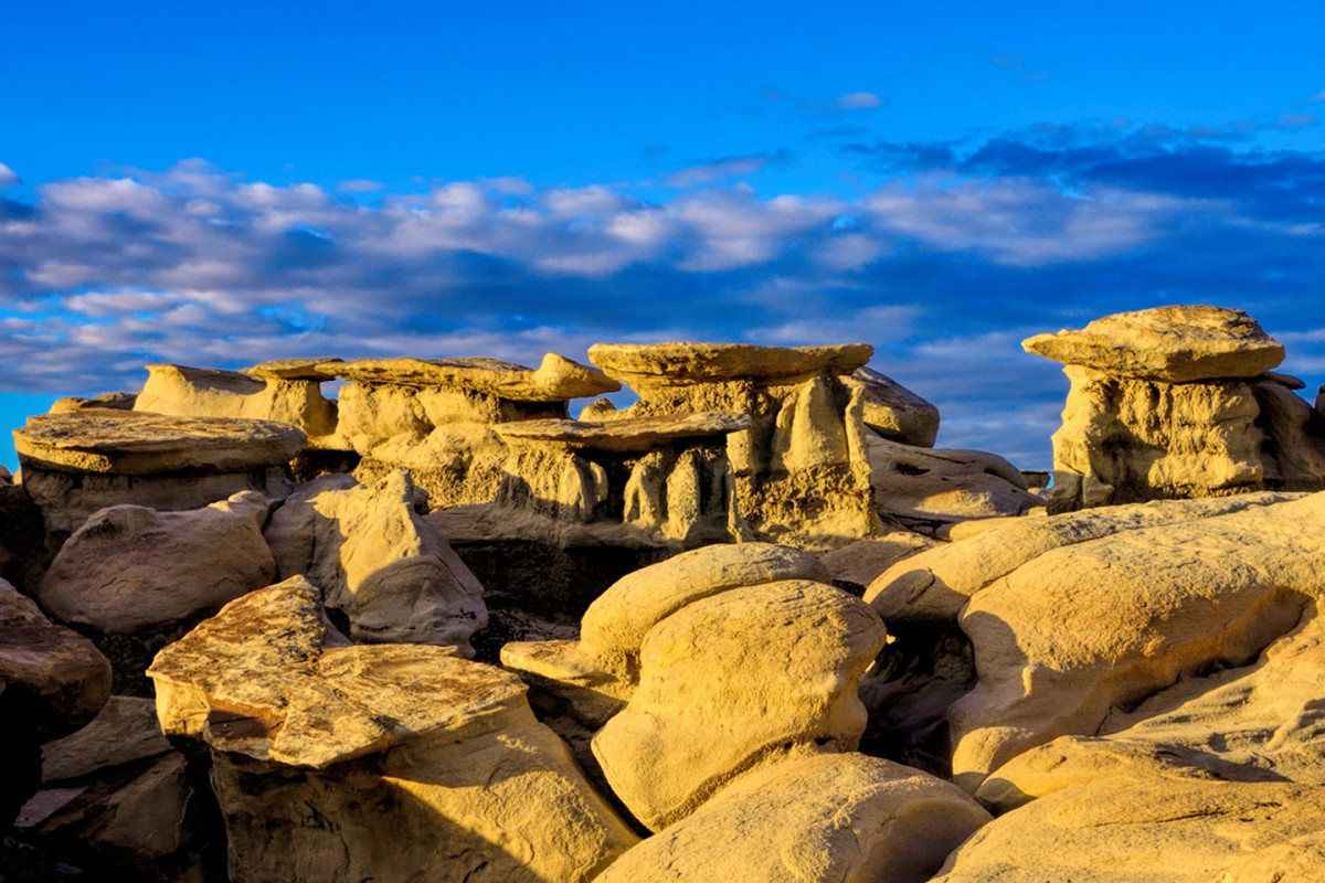
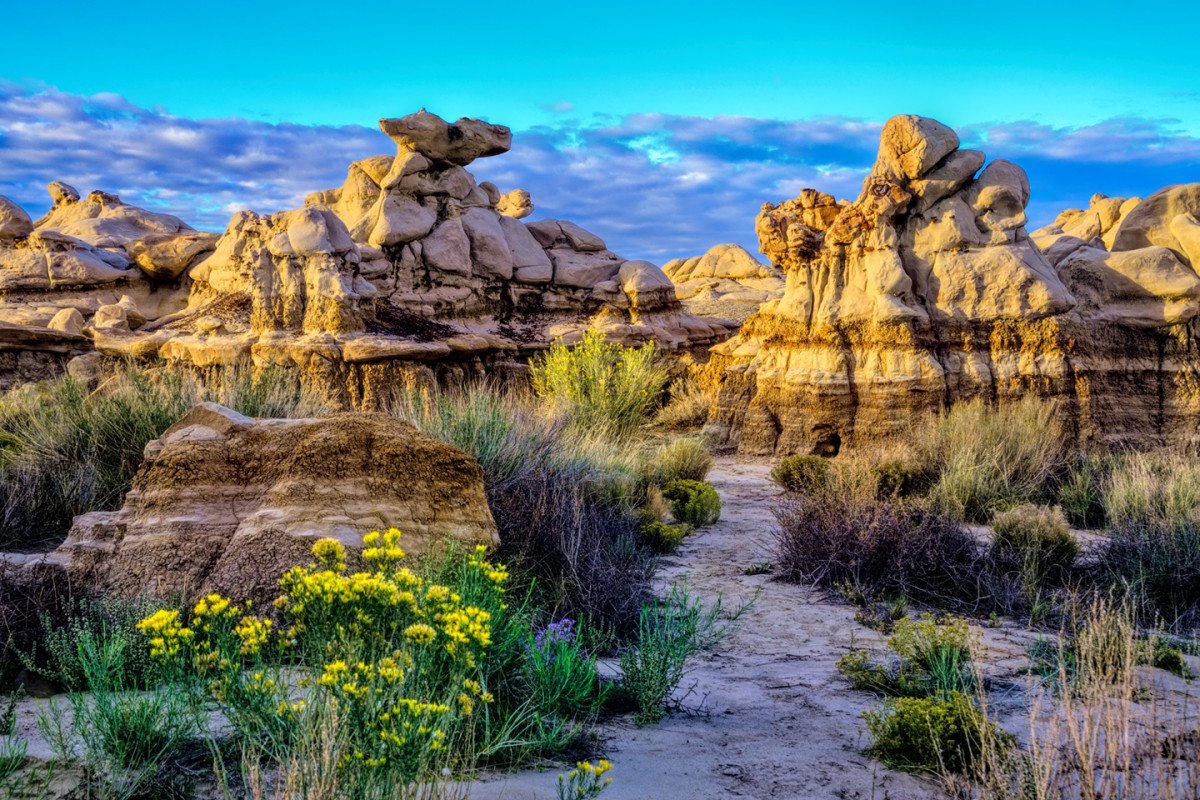
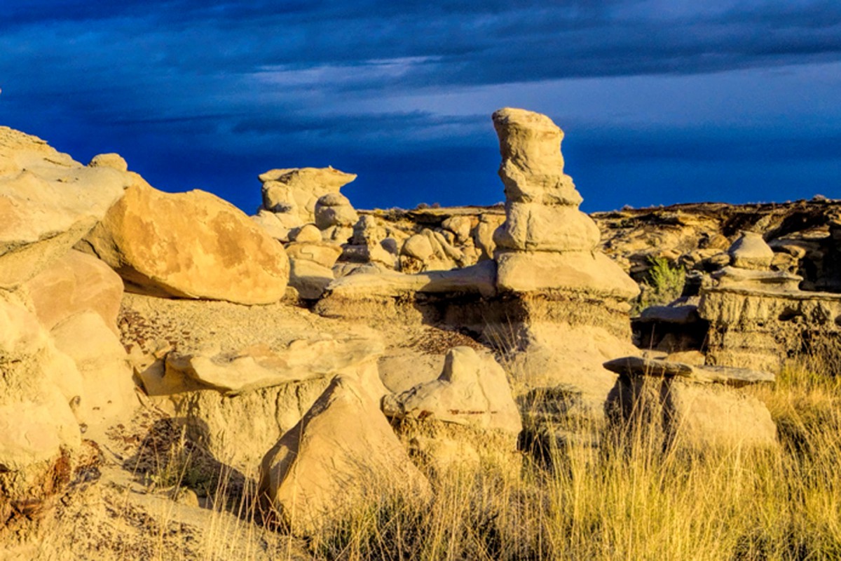
Still not sure? Here are some Hoo Doos. These are nice, don't you think? Unusual, even, but they could be in any of several different places.
This petrified chicken, on the other hand? It's one of a kind!
Additional clues available on request!
Rick
Last edited by Rick Quinn; 05-08-2020 at 05:18 PM.
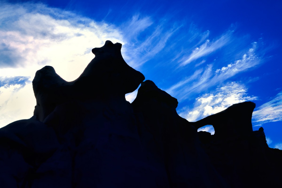
Here are two more photos from this place, where even a short hike in any direction will take you through the Looking Glass into the world of the Mad Hatter. The labyrinth of sandy pathways winds among striped pillars and platforms crowned with fantastic shapes: rats and bats and cats with hats, and many others that are just plain...strange!
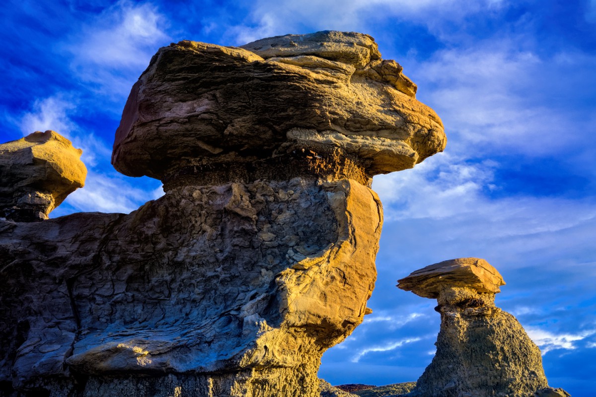
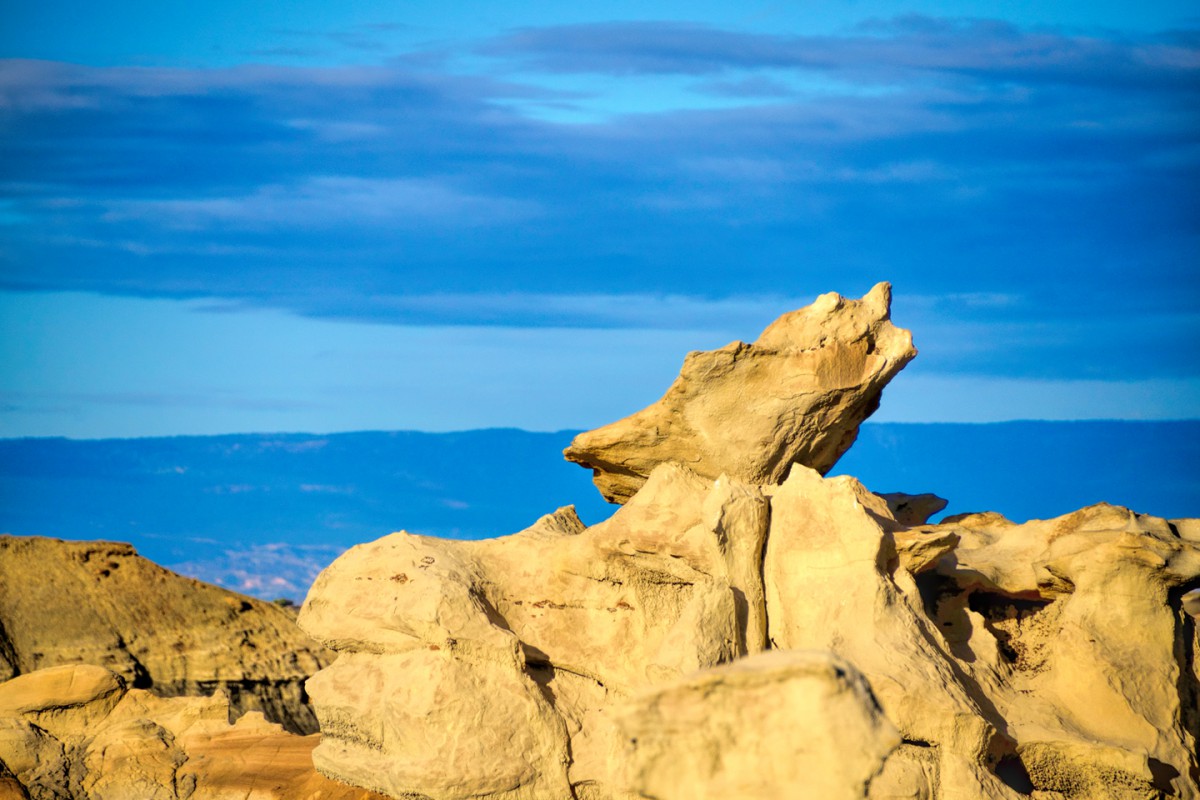
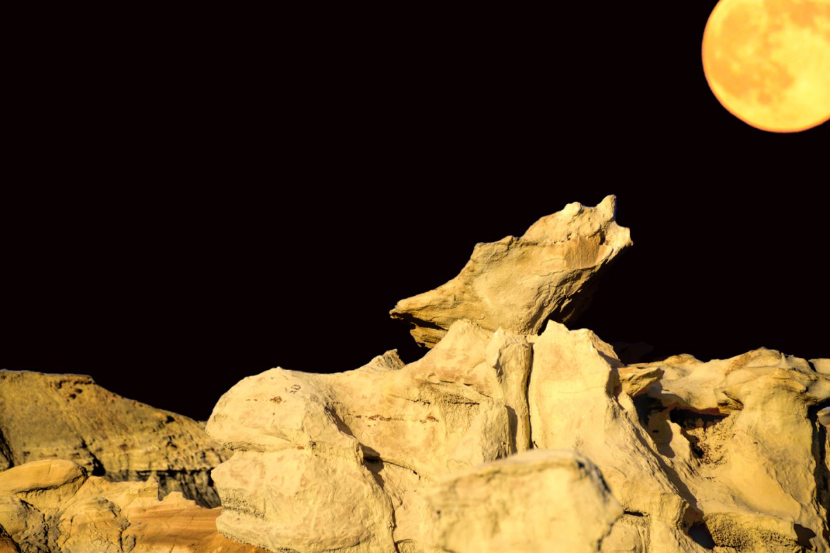
Over millions of years, wind and water have sculpted some of the world's most extravagant rock formations: hoodoos, arches, balanced rocks, and boulders shaped like everything from birds to beehives, including giant mushrooms, a barking seal, and the head of a wolf, tilted skyward, howling at the moon!
Here's a third picture that's just as unreal as the place it was taken, a.k.a.: merely me, having a little phun with Photoshop:
Where the heck am I? Anybody want to hazard a guess??
It reminds me of Bisti/De-Na-Zin Wilderness area in New Mexico south of Farmington. We've only been once in 2010 and only saw a small part of the area. We had planned to go again last year but we had RAIN, RAIN, RAIN!
Utahtea
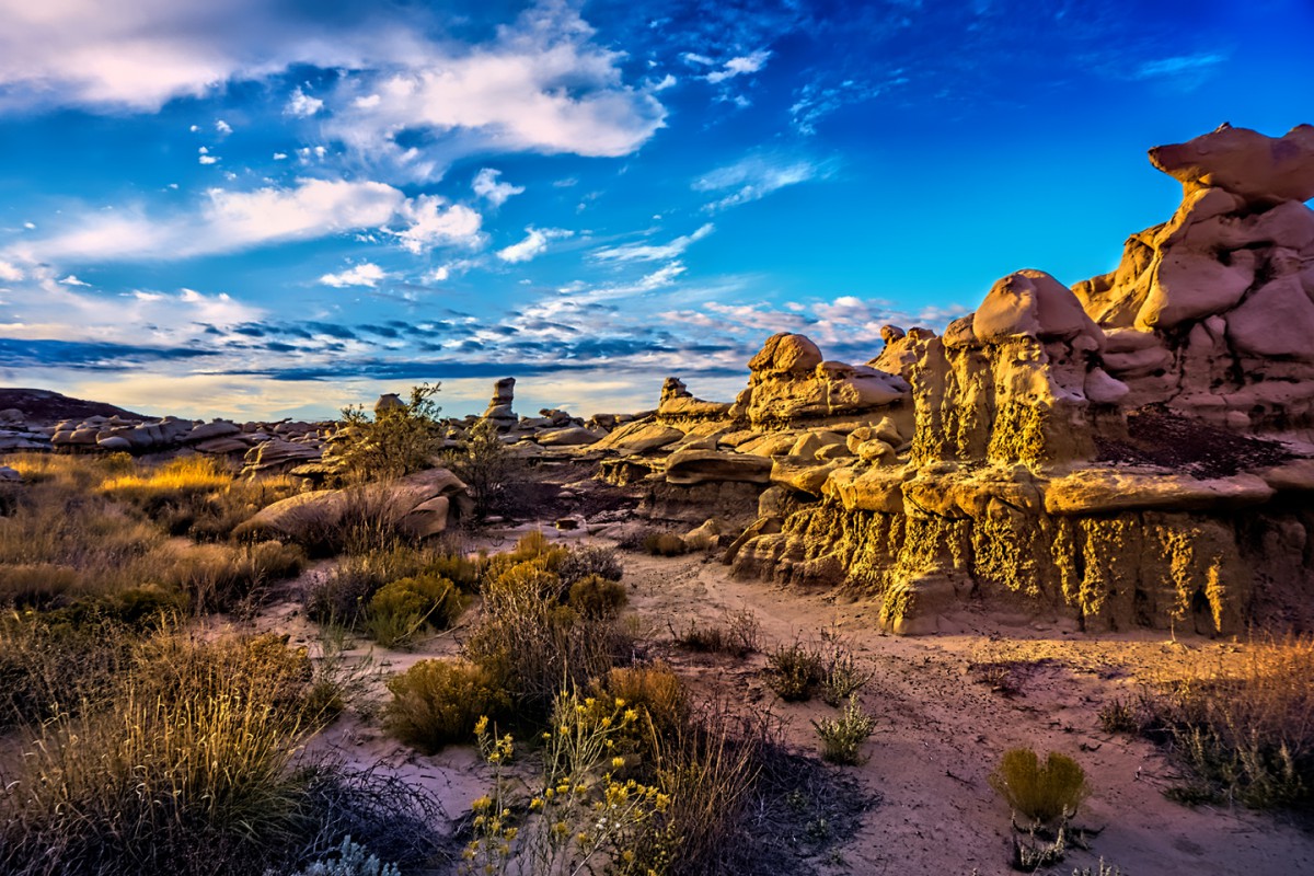
The Bisti/De-Na-Zin Wilderness, often referred to as the Bisti Badlands, is not a place you'd want to be in heavy rain! There's an area that's easily accessible, right off the road, and that's where most of these photos were taken. There's a much more interesting section that requires a bit of a hike up the wash. There are no trails to speak of, just the footprints of other hikers, and in the rain, those wash away (and the ground where you're walking turns into glorp).
It's a great place to be for the sunrise. Only problem with that, in order to pull it off, you have to leave Farmington at about four in the AM...
I wasn't kidding about the rats and the cats with the hats:
It's one of several extremely cool stops on Scenic Side Trip #17
Rick
Last edited by Rick Quinn; 05-09-2020 at 01:37 PM. Reason: Added link
Rick,
We didn't have a good GPS the first time we explored here in 2010 and couldn't find the Cracked Eggs so that Christmas we bought a really nice GPS and last fall was our first time back and we were bummed not to be able to explore.
We don't get up at the crack of dawn so we were here in the middle of the day. Our pictures aren't as good as early morning or late evening photos. These pictures were from 2010.
The petrified wood in the rock layers was pretty cool!
Utahtea
Let's go on a very popular hike....
....we're almost there!
Where am I and what's around the corner!
Utahtea
P.S. Sorry for the smug on the pictures it was the camera lens. GRRRRR!
 Posting Permissions

 Reply With Quote