Page 3 of 5 FirstFirst 12345 LastLast
Results 21 to 30 of 44
  1. #21

    Default Day 11 (Saturday August 17)McCarthy and the Kennecott Mine

    The day begins badly – a storm blew through town in the early hours, rattling shutters and sending stuff crashing so we’ve had little sleep – and it’s about to get worse. Not only has wind damage cut off the town’s electricity, but it seems that the water supply needs power too.

    So no shower, no second flush of the toilet (too much detail?), and no coffee. Well, to their credit the hotel staff do find a gas cooker and a pot of water to boil up but they’re unable to make more than a few cups at a time and we’re not the only ones crying our for our morning fix, so it’s a 20 minute wait for a disappointingly weak and luke warm drink.

    Anywhere else and we’d drive up the road to find a café with power but the closest community to Chitina is Kenny Lake, 25 miles in the wrong direction. Instead we embark on what promises to be the slowest and bumpiest leg of not just this trip but any we’ve ever made in the US.


    Click here for this RTA Library Map

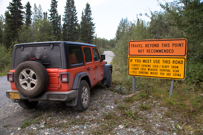
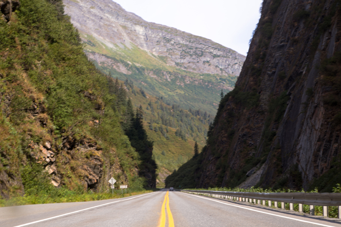
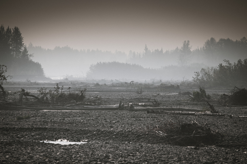
    The McCarthy Road is a 60-mile gravel-surfaced, washboard road that runs from Chitina to the town of McCarthy. It is rough and slow going, with rock falls, deep pot holes, sharp turns, narrow one-way bridges, and local traffic to watch out for. As a driver I have to say it’s actually tremendous fun – this road is why we rented a Jeep – but I can understand why someone riding shotgun - especially one who's gone without coffee - might find the sudden but constant bumps and lurches a less than pleasant experience, particularly after having missed out on coffee, and I can sense that the sooner we reach our destination, the better.

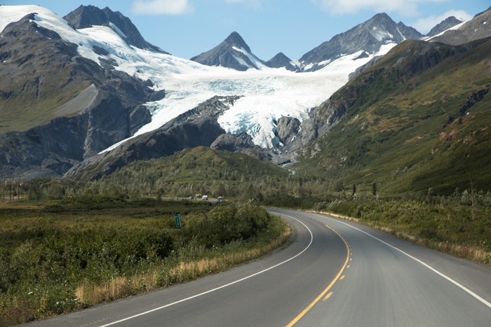
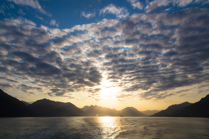
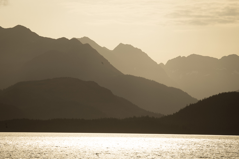
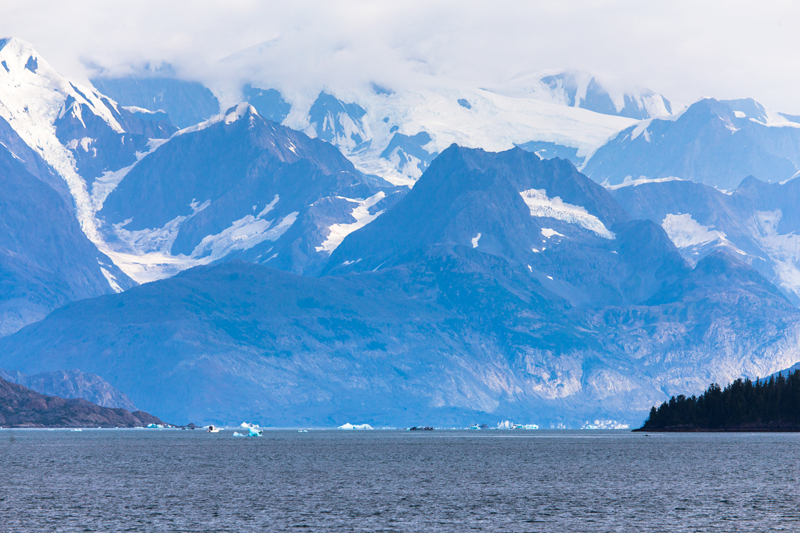
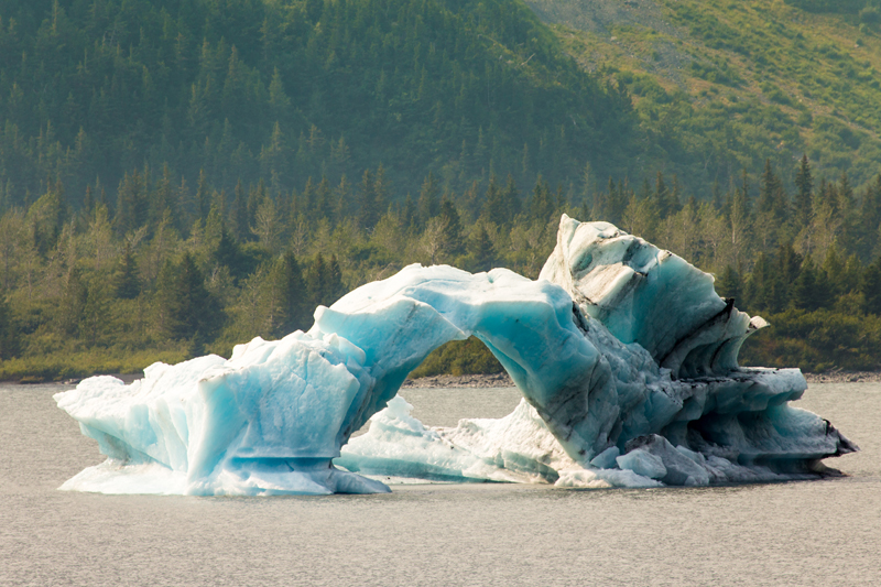
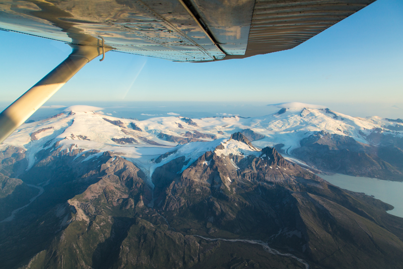
    Road conditions aside, it’s a spectacular drive through a tiny section of Wrangell-St. Elias National Park. Stretching out of 13.2 million acres, this is America’s largest national park – equivalent in size to Yellowstone, Yosemite and Switzerland combined, according to the NPS web site – and is accessible via just two roads, this and the 42-mile Nabesna Road at the north.

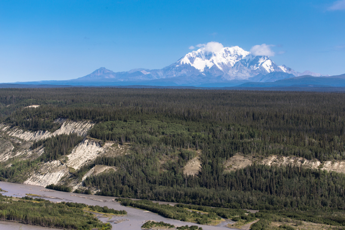
    This is real wilderness country, a landscape that is awe inspiring in scale and beauty, one of endless forest, snow-capped mountains and pristine blue lakes. The only sign of man’s presence is the occasional homestead or remnants of the old Copper River and Northwestern Railroad that used to haul copper from the Kennecott mine.

    By late morning we pull up at the car park outside McCarthy – visitors’ vehicles can go no further – and head for the narrow footbridge that connects the town with the outside world. There’s a phone at one end so you can call the hotel and they will then send a shuttle to meet you at the other end of the bridge. That’s the idea at least.

    I try four times but there’s no answer. What’s to do? Well we’re certainly not turning back so decide to walk into town with our luggage. (This isn’t quite as ridiculous as it sounds; our hotel has warned us that rooms are small so we should pack all we need in a carry-on size bag.)

    There are two roads on the other side of the Kennicott River, one straight ahead and one to the right. Fortunately I can clearly recall reading that you should take the road to the right, otherwise you’ll end up in the middle of nowhere. Or was it the other way round? And yes, after a sweaty half hour or so spent hauling our wheeled cases over stones and through ruts and puddles, it’s abundantly clear to one and all that I have compounded the misery of the caffeine-free morning and a never ending dirt road drive by f***ing up on our walk into McCarthy. No words are spoken; they don’t need to be.

    Halfway back to the bridge our saviour appears in the form of Neil, who’s passing by on his way to have a dog speyed. “You guys lost?” he asks, probably unnecessarily. We explain the situation and he instructs us to jump in the back of his truck. As we head back he calls the hotel to tell them there will be two discontented guests awaiting collection at the bridge in a few minutes’ time. Thanks Neil.

    When we finally arrive at the hotel, we learn that Neil isn’t just any old Neil, but The Neil. Neil Darish, businessman. The guy who bought up most of the town’s businesses and has spent the last 15-20 years with the aim of injecting new life into this extraordinarily remote community. He owns the general store, the bar, the restaurant and yes, the hotel too. I’m guessing words were had with whoever should’ve taken our calls.

    If any of this sounds familiar, it’s because life in McCarthy has been played out on the small screen over the four year run of the Discovery semi-reality / documentary series, Edge of Alaska. It’s not always clear whether the producers wanted to portray Neil’s role as that of good guy or bad guy but he gets my vote.

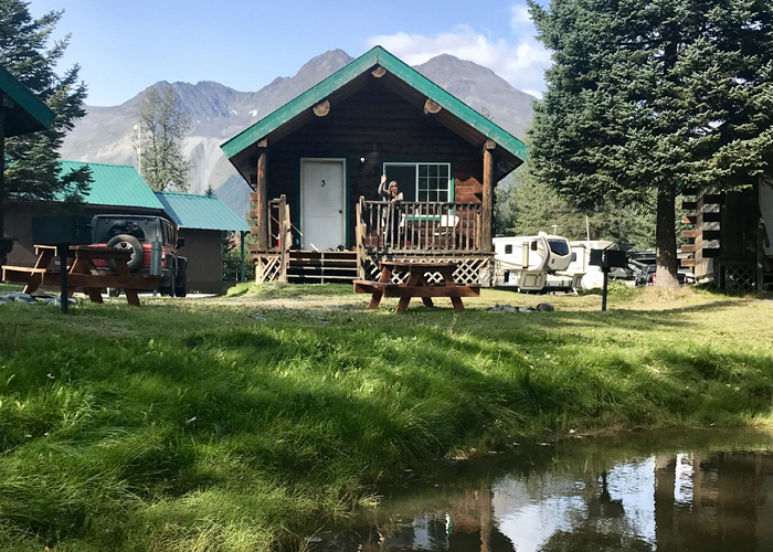
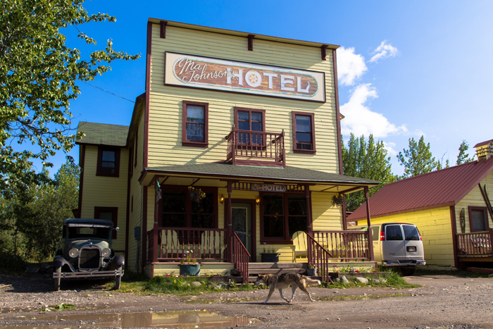
    The town’s hotel, Ma Johnson’s , is packed full of character, all squeaky floorboards, old furniture, tiny bedrooms and shared bathrooms. It wouldn’t do for more than a night or two but it positively oozes charm. There are no room keys because there are no locks – “There’s no crime in McCarthy” they reassure us – and we certainly don’t feel anything less than 100% secure and comfortable.

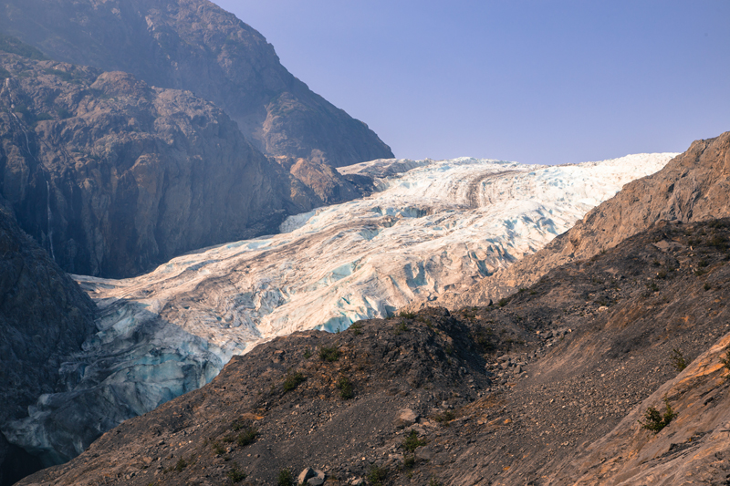
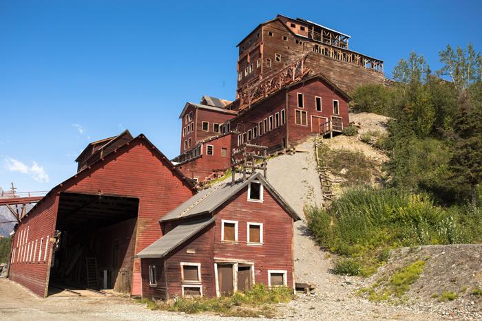
    Revived by coffee and lunch, we take the shuttle bus up to the historic mining town of Kennecott, five miles away. Once the richest known concentration of copper in the world, the mine operated from 1911 to 1938 and necessitated the construction of the 196 mile CR&NW railway and the formation of a steamship company to transport the ore.

    After it closed in 1938, it was left to rot until the 1980s, when people started to show an interest in the old buildings. Today, visitors come from all over the world to wander through its NPS-protected buildings, and marvel at the scale of the equipment needed to process ore in such quantities.

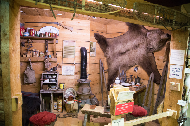
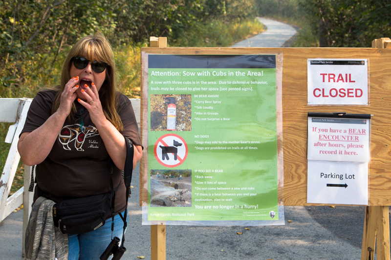
    We also find time to visit the McCarthy–Kennicott Historical Museum which is full of fascinating photos, documents, and artifacts relating to the town’s short but colourful history. One exhibit in particular catches our eye, the story of the McCarthy Massacre.

    In 1983, angered by the opening of the Trans-Alaska oil pipeline, 39 year old computer programmer Louis D. Hastings decided to hijack the weekly mail plane when it arrived in town, fly to the pipeline and blow it up. This plan involved killing anyone who got in his way, resulting in six of the town’s population of 22 being shot dead before his rampage ended. And we’ve been told there’s no crime in McCarthy … WTF?

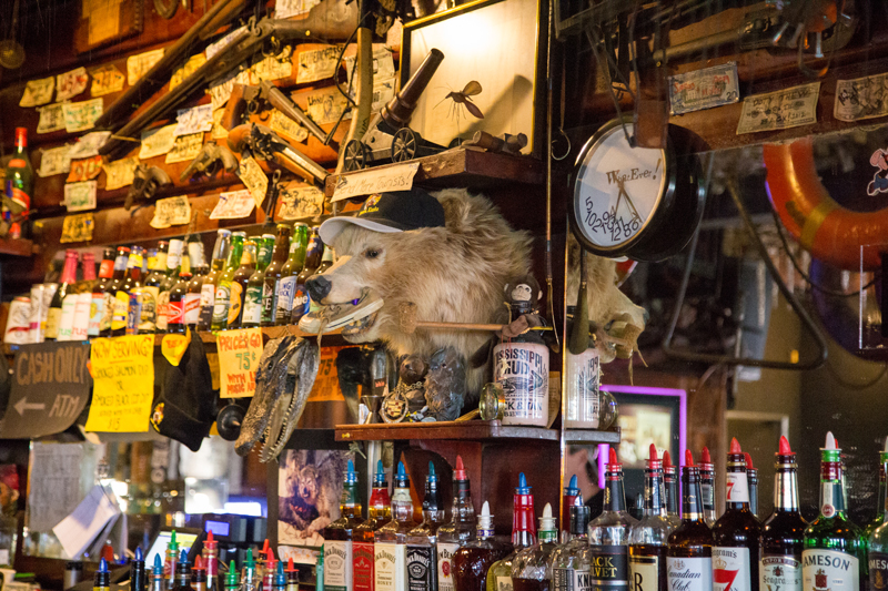
    Our evening begins with local beers in The Golden Saloon in the company of a couple of gregarious Texan bikers who delight in telling us the McCarthy Road takes less than two hours on two wheels (not that I think this would have enhanced the experience as far as Carole’s concerned).

    From here we move next door to what may well be the most impressive of Neil Darish’s achievements, The McCarthy Lodge. Originally a cannery building on the coast, it was moved here in 1916 and served as a store before being used as a hunting lodge.

    It is now the location of a fine dining restaurant specialising in locally reared duck and pork, Copper River Red Salmon, and other Alaskan seafood including halibut and black cod. We go with belly pork and halibut cheek appetisers, share an elk and mash main and finish off with a boozy pudding of some description. It really is extraordinary, without doubt the best meal of our entire trip. Someone tells us that there are just four qualified sommeliers in the whole of Alaska, and two of them work here. Whether that’s true or not I don’t know but it wouldn’t surprise me.


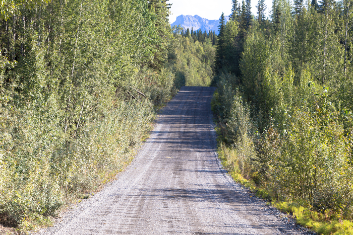
    A section of the 60-mile McCarthy Road


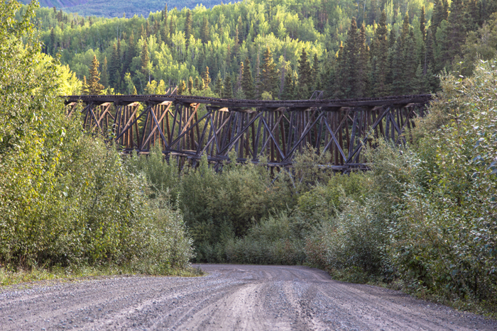
    Gilahina Trestle, built for the Copper River and Northwestern Railway


    Kennecott MIne buildings


    Ma Johnson's Hotel, McCarthy


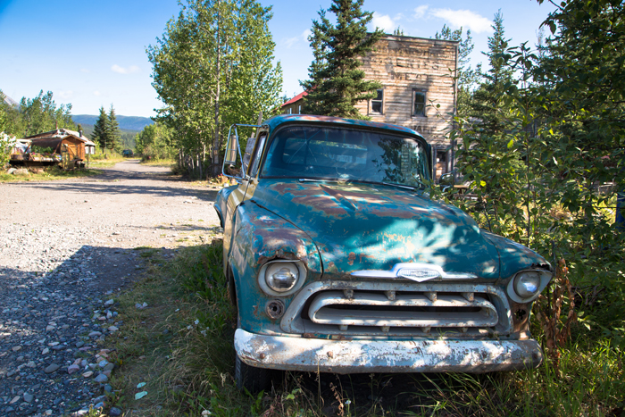
    Downtown McCarthy - location of the 1983 massacre
    Last edited by Tom_H007; 05-04-2020 at 11:05 PM. Reason: added map

  2. #22

    Default Day 12 (Sunday August 18)McCarthy to Valdez

    It may – to borrow the words of Basil Fawlty – be a case of “stating the bleedin’ obvious” but it’s amazing what a difference a good night’s sleep, a hot breakfast and a couple of coffees makes. Yesterday we completed the McCarthy Road without any of the above and, for Carole at least, it was an eminently less than enjoyable experience.

    Today we tackle the return leg well rested, fed and caffeinated, and the drive is a delight. The morning light is beautiful, the sun rises behind us to burn away the clouds, and even the potholes appear shallower and less likely to snap an axle.


    Click here for this RTA Library Map

    By mid-morning we’re passing through Chitina and, after a coffee stop in Kenny Lake, we’re soon back on the Richardson Highway with today’s destination, Valdez, just 80 miles south.

    In a land blessed with such staggering scenery you begin to run out of superlatives but it’s hard to imagine a more spectacular drive than the second half of this short journey. The first 30-40 miles are far from forgettable but then – wallop! – everything seems to change in an instant and we’re struck speechless by the scale of the mountainous landscape into which we’ve been catapulted by Alaska Route 4. The road winds its way between the mountains, rising and falling over the foothills, passing fast-running rivers grey with glacial silt (aka rock flour, generated by the grinding of the ice on the bedrock).

    Worthington Glacier is the best known and most accessible of the many glaciers along the route. Eye-catching from miles away and ever more impressive close up, it appears to flow down the mountain like lava from a volcano (it’s actually retreating but more slowly than many others: its location, Thompson Pass, is the snowiest place in the state). There’s a viewing platform just short hike away but we drive on, stopping instead at a pull-out point a few miles on where we just sit in silence and gaze out over the vastness towards distant peaks, waterfalls, lakes and forests. Wow. Just wow.

    The final treat along the way is Keystone Canyon, a spectacular gorge just a few short miles of Valdez. Walls of slate, some almost perpendicular, rise up above the Lowe River for three miles, and in places the canyon narrows to as little as 100 feet. Numerous small waterfalls tumble down to the river and two – Horsetail Falls and Bridal Veil Falls – are spectacular enough to warrant their own turnouts.

    Once in Valdez, we head to The Fat Mermaid by the dock for an excellent fish & chip lunch, then take a short stroll around town. It doesn’t take long to notice that Valdez appears to have an abundance of bunnies. Or, as some locals prefer to describe it, an infestation. Everywhere you look there are feral rabbits. In gardens, crossing the road, beside boardwalks, under cars. There are literally hundreds of them.

    No one appears to know for sure how they got here but the variety of colours means they’re not wild. One person confidently tells us there was a rabbit farm nearby and some escaped; someone else is certain that they arrived in town when their owner, an old lady, passed away. Opinions are equally mixed. Some feed them over the winter, others want practice this making illegal. To most visitors, they’re just cute hence the fairly unlikely theory that they were deliberately introduced as a tourist attraction. Yeah … they’re nice enough, but …

    The rest of the afternoon is spent at our wonderful little cabin at Valdez KOA Campground. We light a fire, make a coffee, catch up on email, sort the bags, read a little – all the things that are good to do every now and then on a road trip, in between the exciting bits. And in the evening I nip back into town for takeout pizza from The Fat Mermaid, and a couple of small beers while I wait. I could get to like Valdez.


    Return journey on the McCarthy Road


    Heading out of Wrangell-St. Elias National Park


    Worthington Glacier


    Spectacular scenery along the Richardson Highway


    Keystone Canyon


    Valdez KOA Campground
    Last edited by Tom_H007; 05-04-2020 at 11:21 PM. Reason: added map

  3. #23
    Join Date
    Mar 2016
    Location
    Phoenix, Arizona
    Posts
    816

    Default

    Fabulous report, Peter. I'm right there with you. Keep it coming!

    Rick

  4. #24

    Default Day 13 (Monday August 19): A Day in Valdez

    When we first planned this trip, our original intention had been to spend just a night in Valdez before taking advantage of the Alaska Marine Highway in the form of the Valdez – Whittier Ferry. However, it turns out that this runs every second day – eastbound one day, westbound the next – so we have bonus 24 hours in town and there’s plenty to do.


    Click here for this RTA Library Map

    We start off with breakfast at The Fat Mermaid (yes, it really is that good) then pay the first of a number of visits to the Solomon Gulch Hatchery on the opposite side of the fjord known as Port Valdez. The hatchery releases more than 250 million salmon fry every year and in late summer, approximately 16 million of them return. Some are harvested for their eggs, most are caught by the local fishing fleet.

    Our visit coincides with the return season and the sea outside the hatchery is a seething mass of salmon attempting to enter the hatchery via the fish ladder. While this is an impressive sight in its own right, it’s not the only reason we’re here: the arrival of the salmon attracts bears as well as people and we’re told that it’s common to see them catching salmon by the tidal pools along the road. Sadly they don’t make an appearance for us (and we come back a couple more times during the day) but we tried.

    On the way back into town we spend a pleasant half an hour exploring the Valdez Memorial Cemetery, the final resting place of residents from as far back as the late 1800s. There’s a leaflet you can pick up that pinpoints the graves of some of the more eminent names in the city’s history. And history is very much the focus of the next stop on our list, the Valdez Museum.

    I’m slightly embarrassed to admit that we arrived in Valdez with next to no knowledge of the place; it’s somewhere we included on our route for simple reasons of geography, a stepping stone to the Kenai Peninsula. A couple of hours in the museum quickly fills this gap in our knowledge.

    There are exhibits on native culture, the arrival of Captain Cook, Spanish then Russian exploration, the Gold Rush, the Trans-Alaska Pipeline System, mining, and fishing but two events stand out above all the rest.

    The first was the Good Friday Earthquake of March 27, 1964. With a magnitude of 9.2, this was the second most powerful earthquake ever recorded and caused multiple tsunamis as well as landslides both on land and under the sea. The waterfront area of Valdez was washed away with the loss of 32 lives and the rest of the town deemed unsafe. Over the course of the next three years, the entire town was relocated to its present day site.

    The second event was the Exxon Valdez oil spill in March 1989, when the Exxon Valdez oil tanker ran into Bligh reef, approximately 25 miles away, resulting in one of the world’s worst ever human-caused environmental disasters. While it is now more than 30 years since 11 million gallons of crude oil poured into Prince William Sound, it effects on industries such as fishing and tourism are said to be still felt.

    Understandably, both events feature prominently at the museum, and recent years have seen significant upgrades to the exhibits with the addition of rarely-seen artifacts and interactive materials.

    After leaving the museum we decide to visit the Old Town site and, truth be told, that’s all it is: the site where Valdez used to stand. Those buildings that weren’t moved were burned down so all that’s there now are a few historical markers indicating what used to stand on each lot.

    And the rest of the day’s excitement? We’re almost two weeks into our trip so it’s time for some laundry back at our hotel (the Best Western Valdez Harbor Inn, selected for its proximity to the ferry harbour); early evening beers at, where else, The Fat Mermaid; and then – on the recommendation of the guy serving us – back to the hotel restaurant for overpriced scallops and overcooked halibut, without doubt the worst meal of our entire trip.


    Salmon at Solomon Gulch Hatchery


    Valdez mural


    Recreation of a settler's cabin at Valdez Museum


    Ice cream time


    Valdez Harbor


    Beer in the sun outside The Fat Mermaid
    Last edited by Tom_H007; 05-06-2020 at 07:50 PM. Reason: added map

  5. #25

    Default Day 14 (Tuesday August 20): Valdez to Seward on the Alaska Marine Highway

    Up bright and early to catch the Valdez – Whittier Ferry on what’s known as the Alaska Marine Highway System. The journey, approximately 100 nautical miles, takes 5 hours 45 minutes and once we’re on board there’s little to do other than find a seat, sit back and watch the world go by. Bliss.


    Click here for this RTA Library Map

    Despite us being among the first to arrive at the harbour (6:30 for a 7:30 departure), by the time our car is loaded all the front row seats are taken, and within minutes of setting sail, most of the occupants recline their seats and promptly fall asleep. Frustrating to say the least.

    This aside, the journey is an absolute delight. We set off as the sun is rising through a smattering of light, herring-bone clouds and by the time we enter Prince William Sound, the sky is a clear blue and the views of the mountains sensational. Our time is split between our non-prime (but still ok) seats, the café / diner / galley where we get breakfast and lunch (both excellent); and out on deck, excitedly pointing out icebergs and groups of sea otters, surely the cutest of all marine mammals.

    The final leg into Whittier takes us through Passage Canal where the mountains close in and huge glaciers pour down towards the sea to provide a spectacular end to a thoroughly memorable cruise.

    Whittier itself is one of America’s stranger towns. It was established during WWII as a deep water port and logistics base, a project that also required the construction of a 2.5 mile (4 km) rail tunnel under Maynard Mountain, without which the facility – then known as Camp Sullivan – could only be reached by air or sea.

    It remained an active Army facility until well into the 1960s and eventually became what it is today: a port of call for ferries and cruise ships and home to just over 200 people, the vast majority of whom live in a single 14-storey property, Begich Towers, built in 1957 to provide accommodation for military families and civil servants.

    The Buckner Building nearby is even larger – once the largest in Alaska – and was referred to as the city under one roof. As well as a mess hall and sleeping quarters, there was a movie theatre, bowling alley and even a jail. Today it sits abandoned to the elements, its grey concrete blocks reminiscent of the worst of Soviet architecture.

    The tunnel– now called the Anton Anderson Memorial Tunnel – remains the only land-based route in and out of Whittier but, thanks to some very clever engineering and logistics, it is now open to road traffic as well as rail, all on a single lane. When a train is coming through, road traffic has to wait. And when it’s clear for vehicles, east- and westbound road traffic takes turns in half hour slots. (The rails are set slightly below the road surface in case you were wondering).

    Once out of the tunnel, the road – the Portage Glacier Highway – passes by Portage Lake and through the Chugach National Forest before reaching the junction with the Seward Highway, linking Seward with Anchorage.

    It is here that we first see for ourselves the effect that the Swan Lake Fire is having. The largest of several fires raging in Alaska this summer, it was caused by a lightning strike and has been burning since early June. More than 150,000 acres of forest either side of the highway between Sterling and Cooper Landing have been consumed, the Sterling Highway itself has been closed at times due to poor visibility and fire encroachment, and communities have been evacuated or instructed to be prepared at short notice.

    Its presence is immediately apparent from the dramatic change in the quality of light. Instead of the clear blue skies of the morning, the sun is obliterated by hazy smoke that hangs low in the sky, cloaking the tops of mountains like a dense fog. Fortunately for us, it only impacts our ability to see the landscape in its full glory today as we are heading south to Seward but it does raise slight concerns over the viability of the rest of our trip. We’ll see.

    Our home for the next three nights is an apartment at Sauerdough Lodging, built in 1907 and formerly a general store, meeting hall and brothel. Situated in downtown Seward, away from the hotels and restaurants of the port area, it’s perfect, with full kitchen so we can self cater, views over bustling 4th Avenue with its cafes and craft shops, and a choice of characterful bars (Seward Alehouse being my favourite) no more than 200 yards away.


    Leaving Seward under a beautiful sky


    Early morning view from MV Aurora


    Mountains, Prince William Sound


    Arriving in Whittier - Begich Towers in the background


    Iceberg, Portage Lake

    Last edited by Tom_H007; 05-07-2020 at 08:46 PM. Reason: added map

  6. #26

    Default Day 15 (Wednesday August 21); A Day in Seward

    Today had originally been set aside for a Kenai River rafting trip but sadly this had fallen victim to the effects of the Swan Lake Fire, the poor air quality making outdoor activity along the Sterling Highway a no go and forcing the outfitters, Alaska Wildlife Adventures, to close this operation down for the season.


    Click here for this RTA Library Map

    So instead we head out to nearby Exit Glacier, one of the most accessible glaciers in the state. As yesterday, the landscape appears through a haze of smoke. We stop to take a look out over the outwash plain where dead trees have been deposited by the waters of the glacier and it looks nothing short of apocalyptic, a desolate post-nuclear landscape in which the sun struggles ever to burn through. It’s sad of course, but makes for great photography!

    The park service normally offers guided hikes up to the glacier but these have been put on hold to protect the rangers’ health so we pick up the self-guided trail leaflet and take the ‘moderately strenuous’ hike up to the overlook. It’s a pleasant walk made slightly more exciting by a trail closure due to the presence of a sow with cubs who has been demonstrating ‘defensive behavior’.

    Aside from views of the glacier, we also get to see a dad ignore the multiple warning signs and clamber down the steep rocky slope below the overlook in order for his wife to photograph him with the main event in the background. Our enjoyment of watching this potential Darwin award winner dice with death turns somewhat sour when he instructs his son, who can be no more than 9-10, to join him. Clearly reluctant, the boy tentatively makes his way down, slips and begins to fall before regaining his balance. Dad’s reaction is to admonish him for such clumsiness before again posing for photos.

    We don’t hang around to see whether they survive the climb back up.

    By the time we’re back in Seward the smoke, while still casting a haze over distant mountains, has begun to lighten a little – maybe due to a change in wind direction – and we take a walk around the picturesque small boat harbor, its jetties lined with fishing boats and pleasure craft. We stop at the fish cleaning and filleting station where the overnight catch is being dismembered into shippable size portions.

    We get into conversation with a Texan guy who’s brought two halibut for processing (regulations limit catches to no more than two halibut per day) and as he explains, it’s not a cheap pastime. A day trip will cost in the region of $300-400. Processing and freezing is around $1.25/lb, so a good size halibut will cost upwards of $100 (200 lbs is consider trophy size, the world record is 496 lbs). Add in FedEx shipping at $150 per 50 lb box and this is likely be the most expensive fish he’ll ever eat. But I guess that’s not the point. Fishing aside, the main reason he and his wife are in Seward is to visit their son, who’s working the summer … on the fish filleting station. So maybe he gets a discount?

    On the advice of the son, we walk the 100 yards to Ray’s Waterfront for lunch, take a seat overlooking the water and enjoy a superb meal of roast garlic with cheese, following by seared ahi tuna. Signs proudly announce that Ray’s is a winner of Alaska's Best Restaurant Award, an accolade that seems suspiciously vague to me, but there’s no arguing with the quality of the food.

    And that’s it really for today. We head back to our apartment at Sauerdough Lodging, have a snooze, watch some TV, and edit/back-up some photos, before heading out for beer at the extremely characterful Yukon Bar and food at the highly rated Cookery and Oyster Bar.

    It’s easy to feel guilty when you opt for an afternoon like this, that you’re wasting opportunities to do things that you may never get the chance to do again (despite it being no more than a five minute walk away, we fail to visit Alaska Sealife Center, but it’s amazing how good a bit of unproductive downtime makes you feel when you’ve been full on for a week or two.


    Hazy smoke over the glacial outwash plain


    Trail closed due to bear presence


    Exit Glacier


    Fish cleaning and filleting station, Seward


    Smoke hangs over Seward's picturesque small boat harbor


    Yukon Bar, Seward
    Last edited by Tom_H007; 05-07-2020 at 09:06 PM. Reason: added map

  7. #27

    Default Day 16 (Thursday August 22): Kenai Fjords National Park

    Up bright and early for our Kenai Fjords National Park Tour, a wildlife and glacier cruise that will take us south through Resurrection Bay and then back up north via Aialik Bay to the Aialik Glacier.

    We’re instructed to check in at the boat harbour by 7:00 and to wait at the outfitter’s offices until invited to board for an 8:00 departure. All passengers obediently obey, with the exception of a group of Russian visitors who make their way straight to the boat and are rewarded with the pick of the seats. I know it’s not important in the overall scale of things but it still rankles six months later. Ah well. I need to get better at letting these things go.

    The tour itself is as wonderful as it could possibly be. The further we get from Seward, the less impact the smoke from the fires has on the light, and after an hour or so we’re once again enjoying brilliant blue skies and clear long distance views.

    Throughout the morning we’re treated to close up sightings of puffins, harbor seals, Stellar sea lions, and sea otters, and we spot a humpback whale whose tail fin or fluke is missing a large chunk (possible resulting from an orca attack). Throughout the trip, our captain – tirelessly supported by a helpful and friendly crew – keeps us informed of sightings and provides a constant stream of information on Kenai Fjords National Park and its wildlife.

    We arrive at our primary objective, the Aialik Glacier, and make our way between ice floes on which dozens of seals are basking in the sun. Once in position, the captain switches off the engines, allowing us to listen to the creaks and groans of the ice. Occasionally there’s a sharp snap and we see the splash of ice falling from the toe of the glacier into the sea.

    The difference between the speeds of sound and light means that by the time the sound of calving reaches us and we work out the direction it’s come from, the ice has usually already hit the water but it’s a spectacular sight nonetheless. It’s an experience to be savoured and I think everyone on board – captain and crew included – would have been happy to stay longer but time, tide, and timetables wait for no man so we head off on the return journey.

    As we approach the mouth of Aialik Bay, our captain informs us that we’re going to take a slight detour in the hope of encountering a pod of orca that has been seen nearby. This will mean he’s going to gun the engines across an open – and therefore choppy – stretch of sea so we should all take our seats. Unfortunately, the gap between this announcement and him hitting the throttle can be measured in seconds and there isn’t time for me to get off deck before controlled directional movement becomes a physical impossibility.

    I begin by clutching onto the handrail for dear life but as the speed increases I stretch my legs out and brace myself in a fairly awkward fashion against the lower rail opposite. And to the consternation of some and no doubt amusement of others watching from inside, I have no option but to maintain this undignified position for the next quarter of an hour or so.

    Finally we reach our goal and a more comfortable speed /calmer waters, and I’m able to relax a little and enjoy the trip again. And within moments, we find ourselves in the midst of a pod of maybe 20 or more orcas. It’s a magical experience and the crew appear as excited as we are; we’re told that this is the best sighting they’ve had in weeks.

    Everywhere we look, these sleek, torpedo-like animals are surfacing to spout, barely creating a wave as they glide gracefully through the water. Occasionally one breaches completely, something that would be easy to anthropomorphize as an action of sheer joy but is actually believed to be a way of communicating when other noises (such as a nearby boat) could mask acoustic signals.

    Again, time constraints dictate that we must leave before anyone would really like but it’s been the icing on top of an already rich cake, and – sadly – the end of what has until now been a wonderful day. I don’t know whether it’s the effect of those 15 minutes spent bouncing though the waves or the come down from the adrenaline of the whale sightings but, either way, I suddenly feel more than a little queasy and on the advice of the crew, spend the journey back to Seward on the lower deck at the rear of the boat, in the company of one or two similarly afflicted passengers. Ah well, it was worth it.


    Heading out of Resurrection Bay


    Aialik Glacier


    Seals basking on ice floes


    Leaving the glacier


    Sea otters


    Sea lions on a rocky outcrop


    Pod of orcas

  8. #28

    Default Day 17 (Friday August 23): Seward to Homer

    We’re on the move again today, heading west on the Sterling Highway then south to Homer. This brings us into close proximity of the Swan Lake Fire that has been ravaging the area for weeks and its impact is immediately apparent. A blanket of dense smoke reduces visibility to no more than 50 yards or so; businesses have shut up shop and painted ‘Closed for the season’ messages on wooden pallets outside; pull-out areas – all shut off to public access – are packed with the vehicles of firefighters; and in many places the trees lining the road have been reduced to charred skeletons.

    It’s the scale of the fire and resulting damage that’s most shocking; how do you even begin to tackle something this large? I guess it’s a matter of containment and protection of life, and accepting that nature will eventually run its course.


    Click here for this RTA Library Map

    Once we’re west of Sterling, the worst of the smoke is behind us and by the time we reach bustling Soldotna, it has completely disappeared and we’re enjoying clear blue skies once again.

    We’re suckers for local museums, especially those where they’ve gathered together a collection of old buildings, so the Soldotna Historical Society’s Homestead Museum is an absolute treat. The main display, housed in a log cabin, contains a wealth of artifacts relating to the development of the area through homesteading and what I find particularly interesting is just how recent this history all is.

    When you visit this kind of museum in, say, Wyoming or Oregon, you’re going back as far as the wagon trains of the mid-19th century and the Homestead Act of 1862. Here in Soldotna, it was the Homestead Act of 1947 (giving priority to WWII veterans) that tempted settlers to a place that had until then been the preserve of hunters. For us baby boomers – people of an age my Dad used to describe as “entering one’s early prime" – these settlers were our parents’ generation so many of the items on display here will probably be familiar from early childhood days.

    The museum is located in the unspoilt woodland of Centennial Park and a path leads the way to other buildings including original dwellings, Slikok Valley School (built in 1958), and a larger building housing an outstanding display of wildlife mounts.

    It is here that we also learn the story behind the state flag. In 1926, a contest was held in which schoolchildren throughout the territory were invited to submit designs for a flag. Thirteen year-old Billy Benson, an orphan of Russian-Aleut and Swedish descent, came up with the idea of the constellation of Ursa Major – the Great Bear – to symbolise strength and the North Star to represent Alaska’s location, and his design was adopted as the official flag for the Territory of Alaska on May 2, 1927. How have we spent more than two weeks here without hearing this story until now?

    From here we head south, stopping in Ninilchik to take a look at the famously picturesque Russian church that stands on the hill above the original settlement of the village. Built in 1901, the Holy Transfiguration of Our Lord Chapel is a small white and green building crowned with five gold onion domes, each topped off with a distinctive Russian Orthodox three bar cross. Out front there’s a small densely overgrown cemetery. The fact that the wooden crosses marking the graves are almost overwhelmed by weeds seems strange given that the markers themselves are brilliant white and many are adorned with what at least appear to be recently placed bouquets of flowers (man-made rather than fresh).

    A mile or so further on we stop for a surprisingly good lunch at Rosco’s Pizza and less than an hour later we reach the southern terminus of the Sterling Highway in the form of Homer – or, to be more precise, Homer Spit, the 4.5 mile strip of land that extends out into Kachemak Bay.

    Homer Strip is a scruffy, scrappy looking place, an unpromising stretch of real estate on which the city of Homer has built a road, residential properties, industrial units, restaurants, hotels, and retail outlets, as well as a fishing harbor and ferry / cruise ship port. It is the heart of Homer’s tourism industry and a destination for thousands of visitors hoping to enjoy the landscape, catch fish, and watch bears. And it’s the latter that has drawn us here.


    Fire damage along the Sterling Highway


    Limited visibility means slow going


    Coffee kiosk just east of Soldotna


    Soldotna Historical Society’s Homestead Museum


    Holy Transfiguration of Our Lord Chapel, Ninilchik


    Sunset, Homer Spit
    Last edited by Tom_H007; 05-07-2020 at 09:30 PM. Reason: added map

  9. #29
    Join Date
    Jan 1998
    Location
    Las Vegas, Nevada
    Posts
    13,002

    Default Those are the Good Times!

    Quote Originally Posted by Peter Thody View Post
    ... Fortunately I can clearly recall reading that you should take the road to the right, otherwise you’ll end up in the middle of nowhere. Or was it the other way round? And yes, after a sweaty half hour or so spent hauling our wheeled cases over stones and through ruts and puddles, it’s abundantly clear to one and all that I have compounded the misery of the caffeine-free morning and a never ending dirt road drive by f***ing up on our walk into McCarthy. No words are spoken; they don’t need to be.
    It is fortunate that Carole has always been a good sport on these adventures...

    Pretty cool that you met Neil and thanks for sharing the challenging parts of your trips with us. Those are the moments that always live the longest in our memories -- and generate the best stories whilst holding a pint!

    Mark

  10. #30

    Default Day 18 (Saturday August 24): Bear Watching, Katmai National Park

    Ever since our first road trip in 2005, a meandering 4542-mile route from Chicago to Seattle, Carole’s enjoyment of America’s most wonderful landscapes has from time to time been compromised by the expectation of imminent death by bear. This hasn’t actually stopped us camping in the Redwoods or following a lonely trail in Glacier National Park, but where there are bears, the fear is always present.

    Now, if there’s one thing Alaska’s famous for (aside from the fact that every second person appears to be part of an extreme survival reality show), it’s its bears. You can’t have an Alaskan nature documentary without footage of ursus horribilis catching salmon at Brooks Falls. So, to use an entirely inappropriate metaphor, bears are the elephant in the room on this trip.

    As they say though, the best way to overcome one’s worst fears is to confront them face on. And that’s why we find ourselves parking up at Homer Airport while it’s still dark, pulling on waders, and signing an endless number of forms absolving our outfitters, Alaska Bear Adventures, of any responsibility for anything that might befall us over the course of the next few hours.

    There are a dozen of us and we’re split into three groups of four, each assigned a pilot/guide. Ours is Derek, the most experienced in both flying and bear scouting terms, and he leads us out onto the airfield for a pre-flight briefing. As well as highlighting our aircraft’s various safety/rescue features, he also explains that, while bear spray is not carried (it’s an unpressurised cabin so aerosols are strictly forbidden), they do have distress flares that could be deployed in a bear’s direction if absolutely necessary, but in 15 years, they’ve never had cause to do so.

    Briefing over, he asks our group whether this is the first time for any of us in such a small (6-seater) plane. “No? So it’s just me then”, a joke he obviously rolls out every time but it puts a smile on my face at least.

    And with that, the three planes are airborne and we’re on our way southwest in search of at least some of the 3,000 grizzlies that call Katmai National Park home.

    The sun rises as we’re in the air and the views of the mountains, rivers and glaciers are as spectacular as you could hope for. At one point we bank steeply so Derek can check for bears far below but there’s nothing doing so we head on over more snow-capped ranges before making our descent towards Cape Douglas.

    The landing is surprisingly smooth given that it’s on a pebbly beach strewn with large pieces of driftwood and as we climb out, there they are. A couple of hundred yards or so away, a sow and two cubs are making their way towards the grassy bank that runs the full length of the beach. A frustratingly distant and brief sighting, but a sighting nonetheless.

    Our groups split up again and we head separately into the high grass towards the Douglas River beyond. We move slowly and carefully in single file, and all the while Derek is in radio contact with the other guides, letting them know where we are and advising them on where they should go. And then suddenly he stops and signals for us to crouch down. Dead ahead of us in the thigh deep grass we can make out the unmistakeable shape of a grizzly. We’re reassured that he’s a good 50 yards away but I’d be surprised if it ‘s much more than half that (not that I’m going to pace it out to prove a point!), and we just kneel and watch him tear pieces off a large salmon. He knows we’re here – he glances towards us every now and again – but shows no interest beyond that.

    After a while we move on and head down the other side of the bank onto a flat open area of sandy beach, mud flats, and the Douglas River. At first we spot just a solitary bear, splashing around in a tidal pool teaming with trapped fish, but gradually others appear, emerging from the grass or ambling towards the river from the distance.

    Within 20-30 minutes of our arrival, we are surrounded by bears, some gorging in the pools, some chasing prey in the river, some moving away to enjoy their catch somewhere a little more private. At one point I reckon there are as many as eight or 10 of them in view. We move across the flats to get a closer view of those in the river, then kneel down and settle in to watch. Travelling the States is full of unforgettable experiences but there aren’t many to equal this.

    As with our orca adventure 48 hours earlier, we have fallen incredibly lucky: the previous day our guides had only seen two bears all morning.

    And yes, even Carole appears enraptured. I say ‘appears’ because we have agreed ahead of things that she wants to handle this her own way, without any pressure from me, so we haven’t actually spoken a word to one another since arriving at the airport!

    The only time her body language betrays a sense of discomfort is when a very large female walks up river within a matter of yards of our group (Carole is closest to the river) but we barely warrant a second glance, so focused is she on the next catch. At this time of the year, when spawning salmon return, bears enter a state known as hyperphagia, in which their appetite becomes almost insatiable and they can consume as many as 100,000 calories in a day. So full are the bears in the tidal pools that we see them catch fish, bite the brain and then discard the flapping body.

    A couple of hours later, memories created (and memory cards full), we make our way slowly back to the beach and clamber on board for the return flight. It has fulfilled a dream and left us both appreciative of just how lucky we are to have been able to experience such an adventure.

    As for the rest of the day … to be honest we spend it in a bit of a daze, probably the after effects of such a huge adrenaline rush.

    Just for the record, we have a superb lunch (seafood chowder, octopus poke) at the Little Mermaid, widely held to be the best restaurant on Homer Spit, and a bit of a lie down in the afternoon. In the evening we a beer at Land’s End at the tip of the Spit and another at the famous Salty Dawg Saloon; followed by seafood/salad to go from Captain Pattie’s Fish House next door to our lodging.

    It’s all great, but the impact of our Alaska bear adventure has overwhelmed everything else.


    Heading for Katmai National Park


    Bear in the grass


    Hunting for salmon in the tidal pools


    So who's boss?


    Hunting salmon in Douglas River


    Just don't forget, I know you're there


    Four bears, the Douglas River and Mount Douglas behind - what a view!


    We made it!


    Safely back in Homer

Similar Threads

  1. Disneyland Resort - 2019 Trips
    By DonnaR57 in forum RoadTrip Field Reports
    Replies: 8
    Last Post: 05-30-2021, 09:00 AM
  2. Indianapolis-Jackson Hole WY 2019
    By ecd0889 in forum Planning Summer RoadTrips
    Replies: 4
    Last Post: 07-31-2018, 10:12 AM
  3. I say, Hey! Who's goin my way on the Alaskan Highway?
    By Netha in forum Planning Summer RoadTrips
    Replies: 10
    Last Post: 03-06-2012, 01:41 AM
  4. An Alaskan Adventure
    By RoadTripper Mike.S in forum RoadTrip Field Reports
    Replies: 2
    Last Post: 01-20-2008, 01:38 PM
  5. Ideas for an Alaskan Adventure in September?
    By Don Woodmancy in forum Off the Beaten Path
    Replies: 3
    Last Post: 06-01-2002, 03:53 PM

Posting Permissions

  • You may not post new threads
  • You may not post replies
  • You may not post attachments
  • You may not edit your posts
  •