Fantastic geyser view captures!


Fantastic geyser view captures!

Thanks! I had plenty to choose from. I kept a log of the photos I took on this trip, and on that one day alone, I fired off no less than 747 frames. I always bracket my exposures when the light is tricky, but even with that, I ended up with a heckuva lot of great pictures!Originally Posted by Mark Sedenquist

Rick
This very lengthy RoadTrip Field Report is finally nearing conclusion, but before I finish it, I want to back up for just a second and correct a factual inaccuracy. In post #10 of the thread, our friend Donna, one of RTA's RoadTrip Gurus, asked me if the route that I'd described near Mount St. Helens in Washington State went through the little town of Carson. Here's her original question:
This was my reply:
And I was absolutely wrong about that! My answer was based on faulty memory and a quick look at Google Maps. When our map wizard, Tom Herbertson started adding RTA maps to the various segments of this thread, he discovered that Trout Lake didn't fit my narrative. Among other things, there was no fire station. My memorabilia from this RoadTrip was in storage (which is why I didn't turn to it when Donna first asked the question). I dug it out, found the map of Washington State that I'd used, and sure enough, the route I'd followed was highlighted in faded yellow:.
So, I DID go through Carson, not Trout Lake, and no doubt followed the same series of National Forest roads that Donna drove back in the '80's. At any rate, many thanks to Tom for his diligence, and apologies to Donna for my lazy response!
Rick
No problem, Rick! It was more curiosity than anything. Our trip was back before I kept trip journals (I know, *shame* on me). I remembered Carson because we tried to find a motel there.
I've enjoyed every bit of your trip journal, as it brought back memories of so many of our trips. You did it all in one, we did it over several and over the past 36 years.
Donna
Day 54: Saturday, August 15th
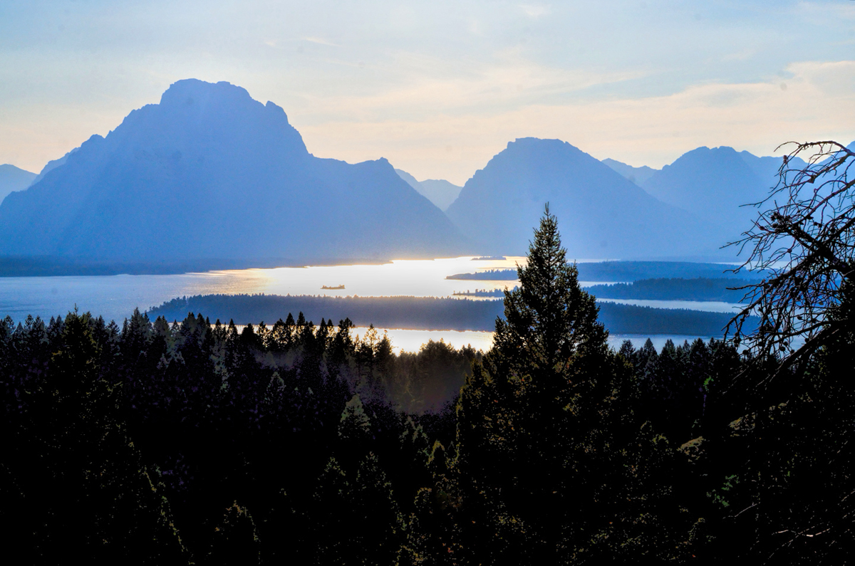
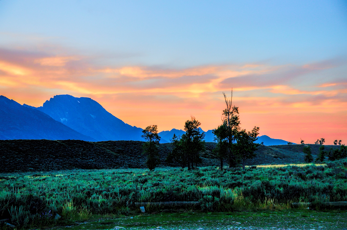
We woke up to partly cloudy skies and a glorious view of Jackson Lake. The jagged ridge of the Teton Range was lit by the rising sun, with wispy remnants of the morning fog encircling Mount Moran, partway up the lower slopes.
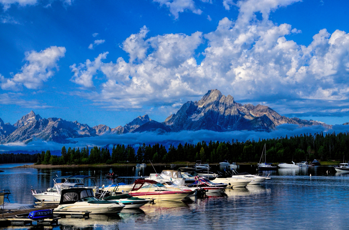
The Colter Bay Marina was a two-minute walk down the hill from our cabin. 12,600 foot Mount Moran is prominent in the background, wearing a fluffy skirt of leftover fog.
We had breakfast, then checked out of our rustic cabin and drove south a few miles to Jackson Lake Lodge, the sister property to the Colter Bay cabins. The lodge was quite the opposite of rustic. The main building had an elegant lobby featuring huge windows that filled the west wall from the floor to the very high ceiling, framing a stunning picture-postcard view of the Teton Range. If cost was no object, and if we’d had the luxury of planning ahead, there would have been no contest, because the location alone was worth the lofty price of the rooms. From the lodge, we drove down to Jenny Lake, where there was another campground, another expensive hotel, more fabulous views, and a Visitors Center, where we inquired about the availability of camp sites.
Due to seasonal road closures (snow, mud, road construction, etc.) some of the maps displayed in this thread are not displaying properly or you might see pop-up windows reporting errors found with the route. Unfortunately, the map data used to create these maps enforces these "Time-outs" if a particular road segment is closed. In the case of the pop-up windows (alerts), please click the "OK" or "Close" button and the rest of the page will display properly. In the case on some of the maps where the route seems all jammed up -- reloading the page where the map is displaying seems to solve the issue. All of these problems go away once the winter closures of the roads end. So, everything will look fine in the North American summer months.
Click here for this RTA Library Map
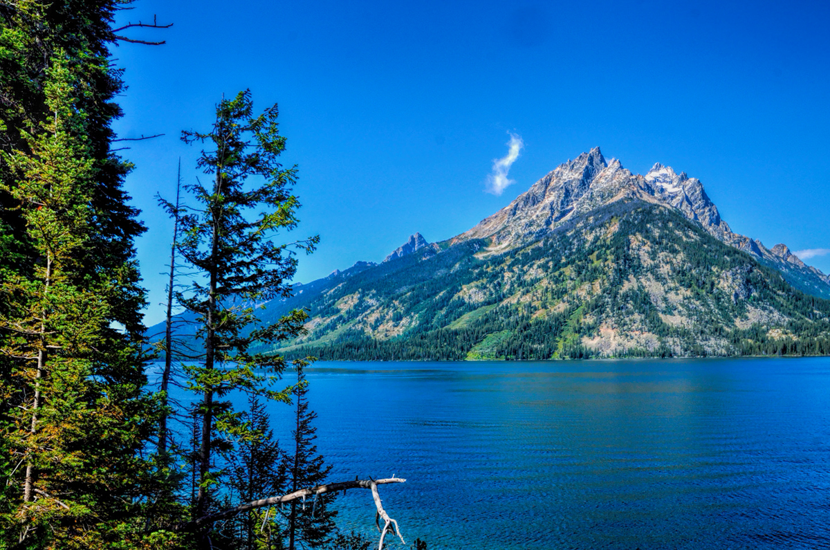
Jenny Lake, at the north end of the incredibly beautiful 48 mile-long valley known as Jackson Hole
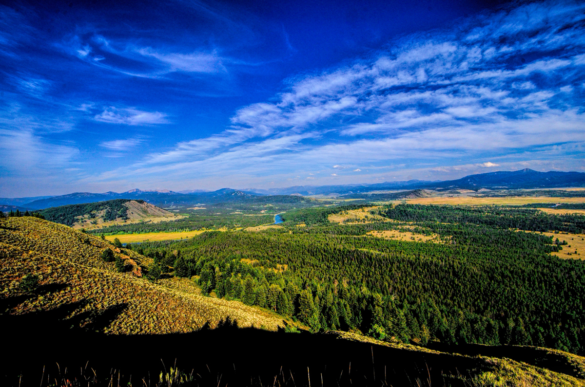
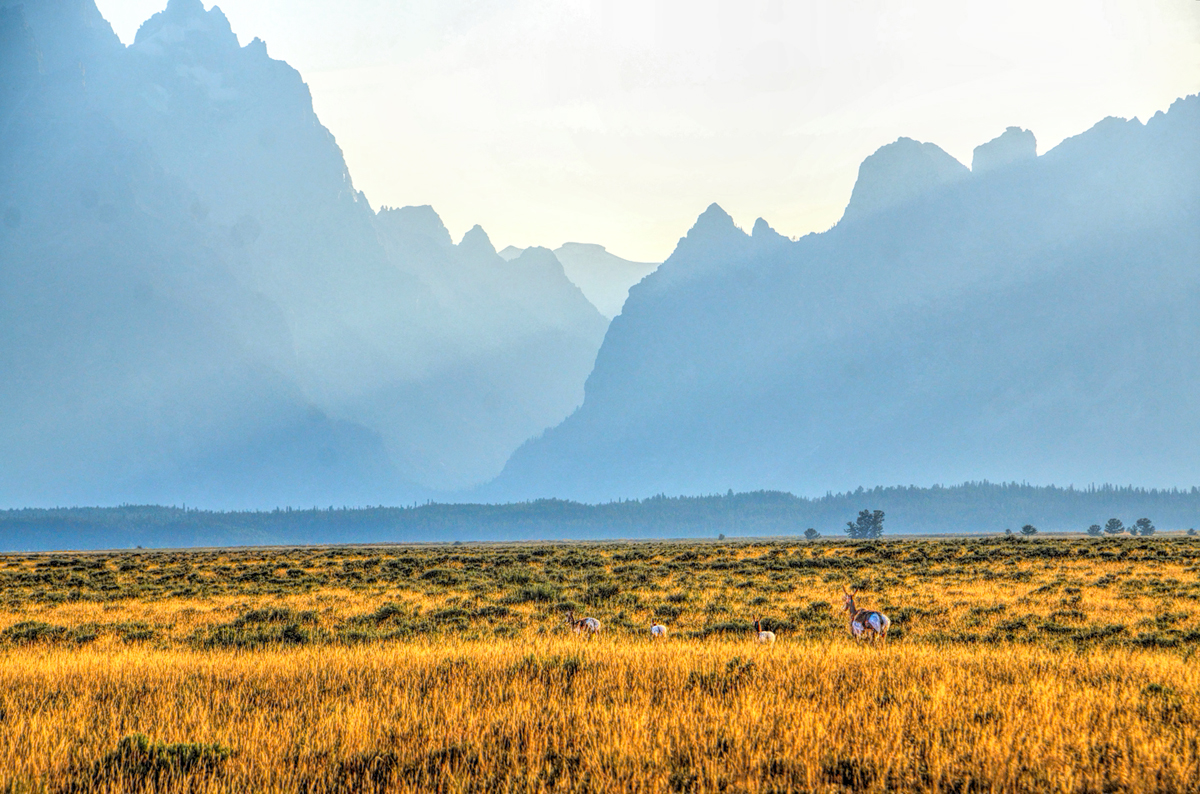
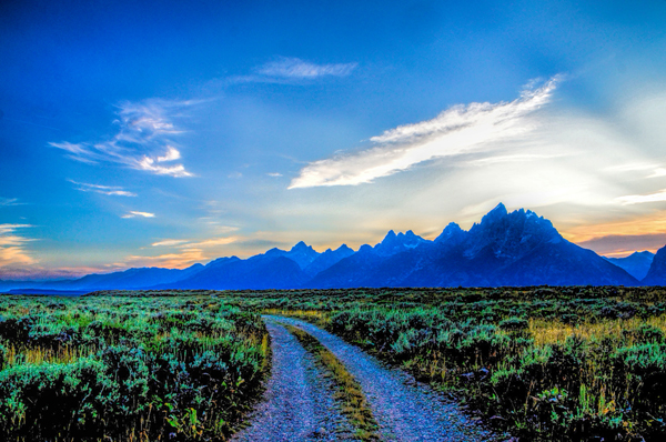
The Jenny Lake campground was full, as was our second choice, the Signal Mountain Campground. The Park Ranger recommended that we try the Gros Ventre campground, just south of the park entrance. That one was a large first-come, first-served campground near the Gros Ventre River, and because it was some distance away from all the rest, it very rarely fills up (or so we were told). We drove south from Jenny Lake to Moose Junction, then jogged north on US 191 to Antelope Flats Road, where we spotted the first of many pronghorn antelope that we were going to be seeing on this day.
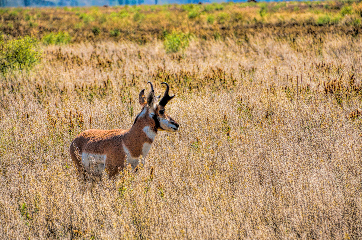
Pronghorn Antelope, beautiful animals that are found in abundance in Grand Teton National Park.
Pronghorns aren’t true antelope. They’re actually distant cousins to the giraffe, but they’re truly impressive creatures when you see then in the wild, especially when they’re on the run. The pronghorn is the fastest land animal in North America, capable of bounding across the grassy plains at speeds that can reach 55 mph! From Antelope Flats Road, we turned down a dirt track called Mormon Row, a historic section of the National Park where a number of old buildings erected by Mormon pioneers have been preserved. The setting is magnificent, showcasing what is arguably the best view of the Teton Range to be found anywhere, inside or outside the National Park.
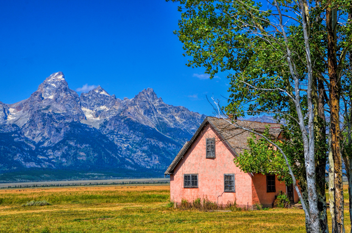
John Moulton Homestead, part of the Mormon Row Historic District
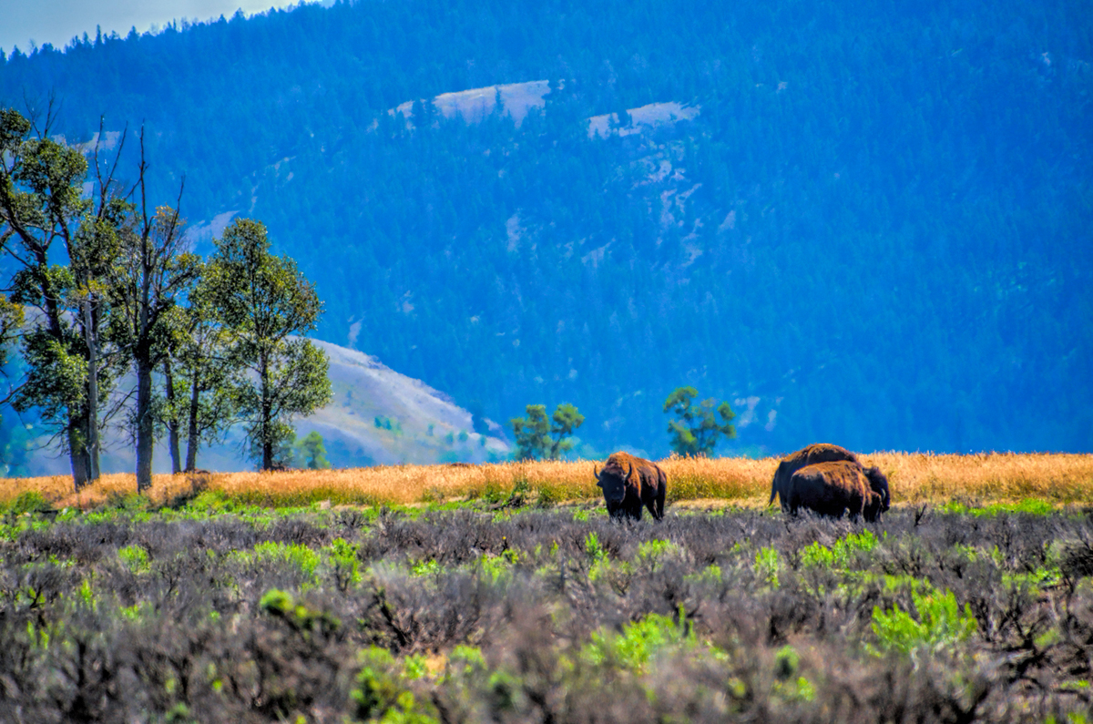
As we drove along past the historic homesteads, I spotted a few bison grazing in a big flat area.
Bison grazing near Mormon Row
I stopped the Jeep for a minute to take a few pictures, and I can remember thinking to myself that under the right conditions, this would be a spectacular photo opportunity. The mountains, which were beautifully decorated with pockets of glacial ice at their higher elevations, faced to the east. If I could get out there early enough, I could position myself for a potentially awesome photograph with grazing buffalo in the foreground, and the jagged, saw-tooth ridge of the Tetons in the background, perfectly lit by the rays of the rising sun. Would it be worth getting out there in the cold and the dark, just for the sake of yet another photograph? I figured I could wait until the next morning to answer that question, when it came time to crawl out of my warm sleeping bag—or not!
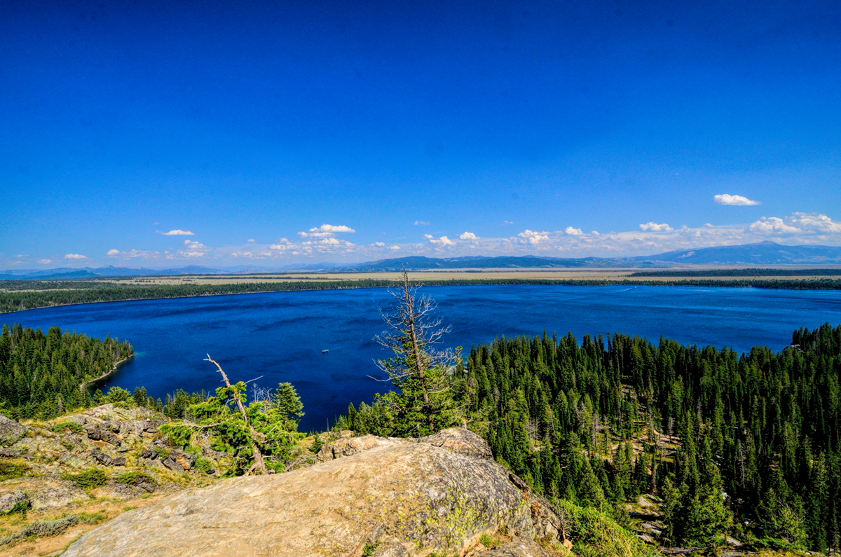
The campground was just a bit further up the road, and there were indeed plenty of spaces, despite the fact that it was a summer weekend. We paid the discounted Senior Fee for a reasonably good camp site, and set up the tent, one last time. With our space for the night duly secured, we drove back to Jenny Lake, where we booked passage on a little ferryboat that crossed the water to access some popular hiking trails. Neither of us was terribly big on strenuous hiking at that stage of our lives, so we settled on a relatively short trek, a 2 ½ mile round trip to an overlook called Inspiration Point. The hike started out easily enough…
The beginning of the trail from the Jenny Lake boat dock to Inspiration Point
…but it quickly got very steep, and by the time we reached the top, we were puffing and wheezing like the hopelessly out-of-shape old dudes that we’ve become. Inspiration Point was a pretty cool view:
The view from Inspiration Point
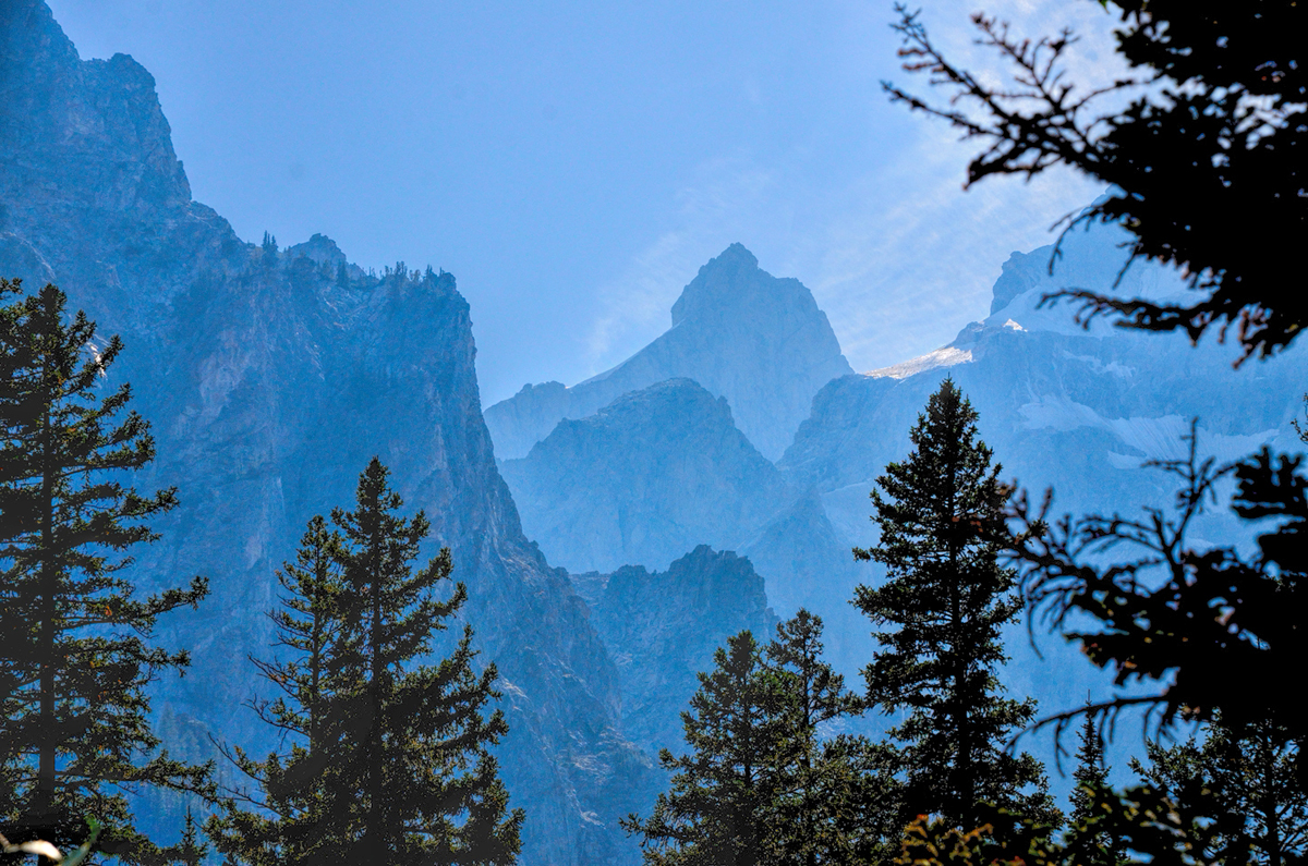
We could see Jenny Lake down below, as well as the Jackson Hole valley, and the Gros Ventre mountain range to the east. Pretty impressive! Before heading back down, we hiked part way up a different trail into Cascade Canyon, which was quite beautiful.
The view looking up Cascade Canyon toward the jagged peaks of the Teton Range
Fortunately, the hike back down was a whole lot easier than the hike up had been. We took the ferry back across, and then drove up nearby Signal Mountain, where we found great views in every direction:
View of the Snake River from atop Signal Mountain
Jackson Lake and the Teton Range, as seen from atop Signal Mountain
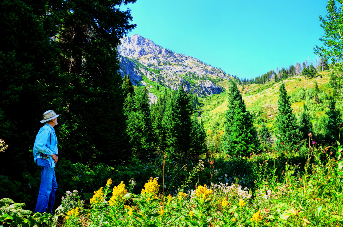
Heading back to the campground, I let Carl talk me into an alternate route that he’d found on the map—a dirt track called the River Road. “It’s only about six miles,” he assured me. “It shouldn’t take more than half an hour.” I’ll file that quip under “Famous last words,” because I was about ready to kill him before we were done. That “six miles” was much closer to 20 miles, which took well over two hours, and it was some of the most rugged four-wheeling I’ve ever done. There were at least a few places where we would not have made it without four wheel drive; steep, rocky slopes that had us climbing over boulders, uphill pitches with deep loose gravel, and more than a little bit of mud left over from the recent rain. The views were amazing, and I never tired of watching the pronghorns running free through the tall grass.
Pronghorn antelope running through the grass at the start of the “River Road,” a back-country romp along a barely-there dirt track that followed, roughly (pun intended) the course of the Snake River as it flows through the northern section of the beautiful valley they call Jackson Hole
There were several forks where we had to guess which way to go, and places where the road skirted REALLY close to the precipitous edge of a high cliff above the Snake River.
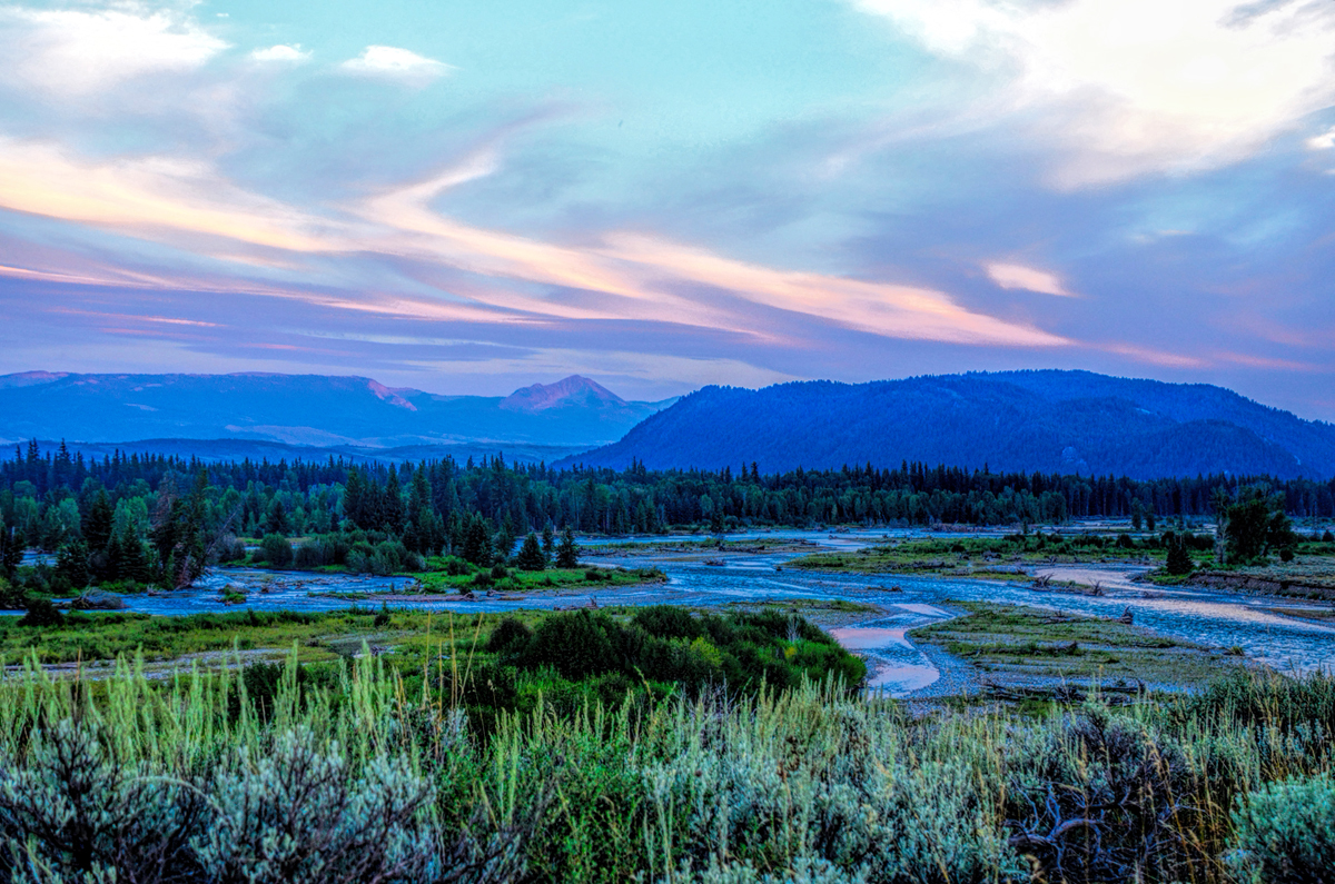
The Snake River, as seen from the River Road
At various times, we were seriously wondering if that crazy road would EVER get back to the highway—but we were reassured when the condition of the road improved…
One of the “improved” segments of the River Road. Other parts of the road weren’t nearly this nice; I actually needed my Jeep’s four-wheel drive in several places, where loose rock turned uphill stretches into a slip and slide
…and we finally saw a couple of other vehicles that had come in from the north. The sun was going down, and I really didn’t want to get caught out there after dark:
Sun going down over the Tetons
Right at dusk we were getting close to what I hoped was the highway, and we saw something odd off in the distance:
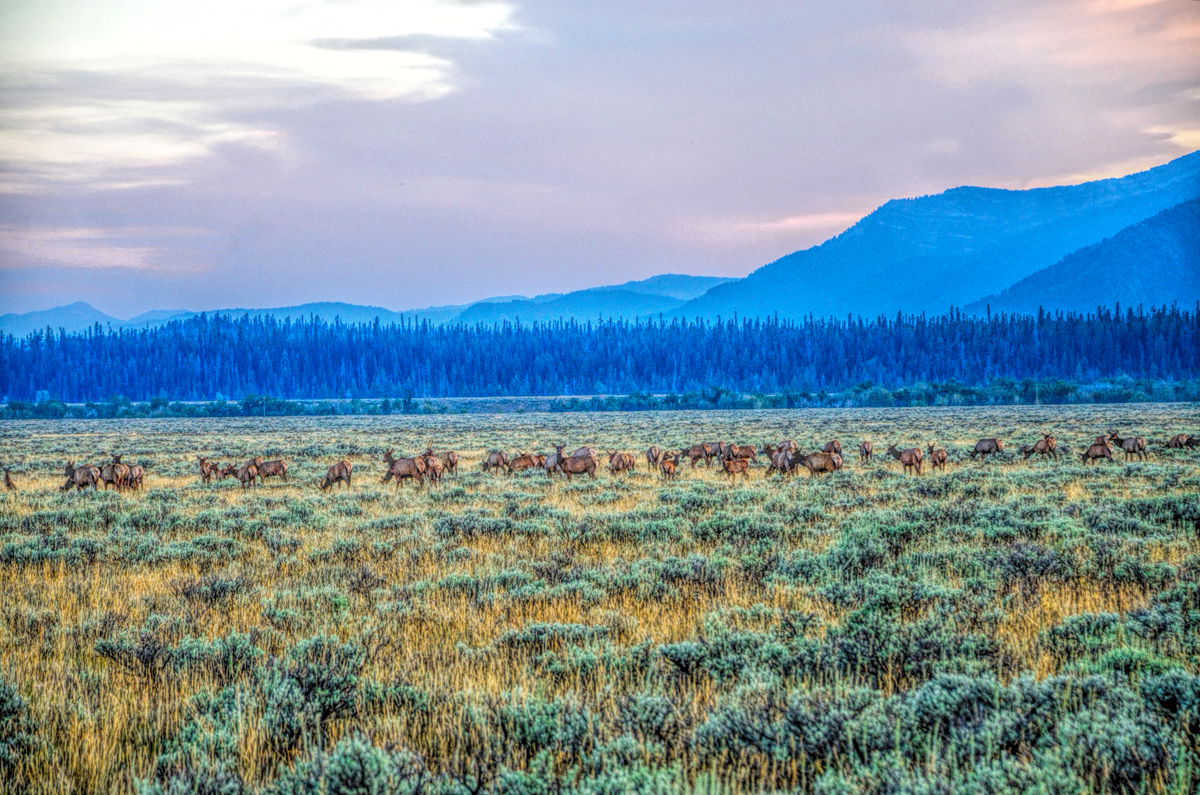
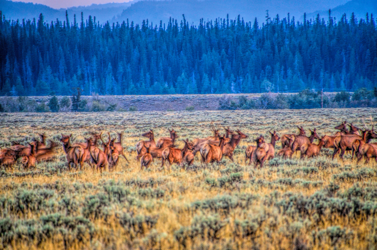
At the south end of the River Road, I saw a dark line across the landscape that looked like it was moving
I zoomed in with my telephoto lens, and realized that what we were seeing was a huge herd of elk—which was really a thrill!
Zooming in closer with my telephoto lens, I realized that I was looking at herd of elk, a small part of the much larger herd that calls this valley home
It was full dark by the time we got back to the campground. The night was cold, and crystal clear, so we were treated to another fabulous view of the Milky Way. There was no meteor shower, but it was still stupendous!
Next up: Buffalo Sunrise!
Last edited by Tom_H007; 01-18-2022 at 02:49 AM. Reason: updated closure alert explanation
Well, you've certainly given Tom a challenge as he works on the map covering this leg!
mark
Mark:
All the roads described in this post about the Tetons can be found on the map that's included with the official National Park Service brochure for Grand Teton National Park, available at the following link: Grand Teton Brochure Map.
The link defaults to a "Park Tiles" view, so you have to select "Brochure Map" from the drop-down menu at upper left. There's enough detail there that it should be (relatively) easy for Tom to reconstruct the route with his customary precision.
I can't thank you both enough for adding all those maps to this thread. That will be very useful for anybody who might want to follow in my footsteps (or should I say, in my tire tracks)!
Rick
Rick,
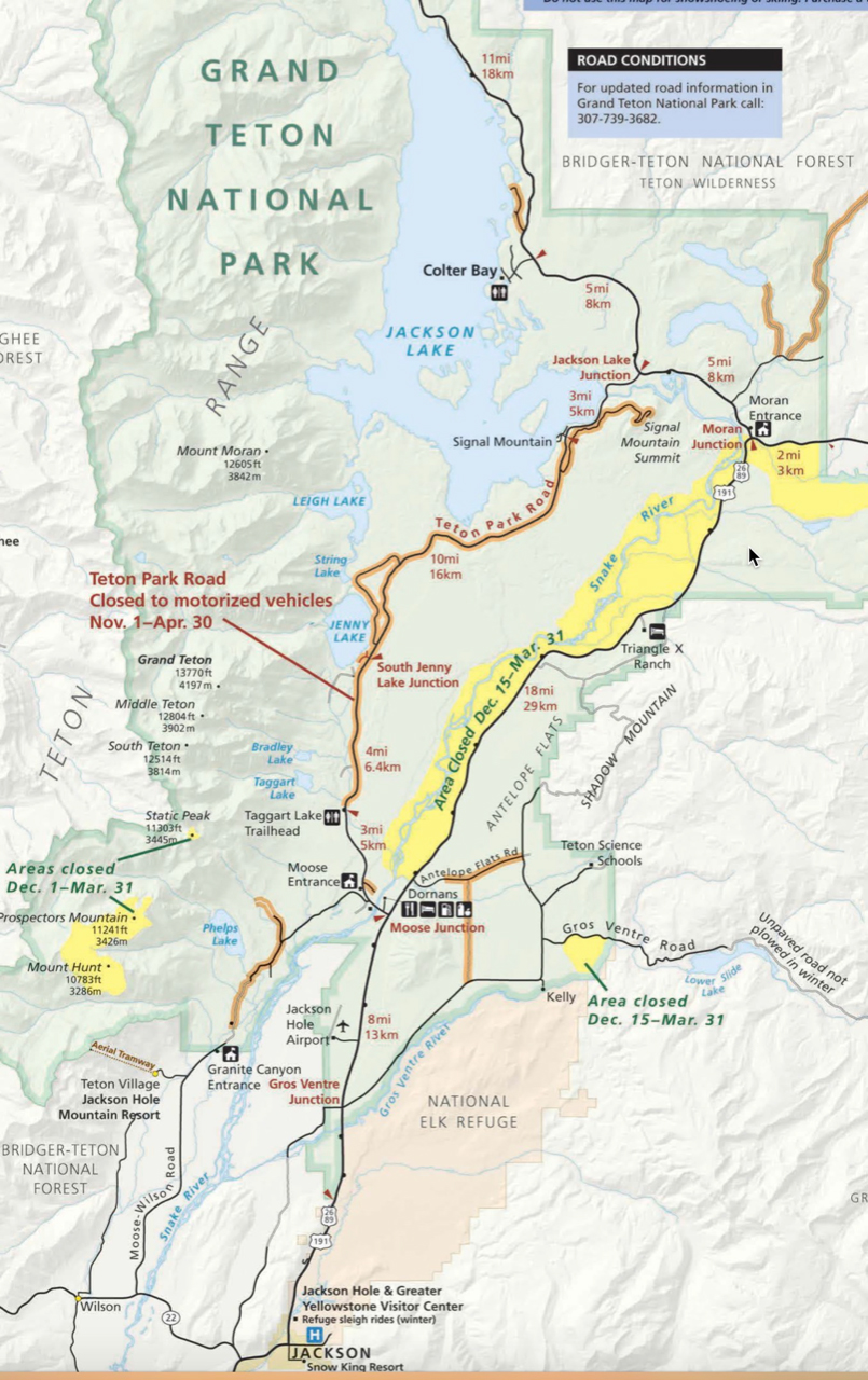
Thanks for the link -- but that's not the source of the difficulty. If the roads are closed due to snow, Tom can't create this time of year.
As can be seen on this official NPS map. Normally the road doesn't open until May 1st. Tom will add the RTA Map when the data is available.
Map courtesy of the NPS
Mark
Last edited by Mark Sedenquist; 02-27-2019 at 09:08 AM. Reason: added NPS map
Mark:
They really ought to develop a toggle that would allow folks to select their season when using mapping software, or perhaps an override for seasonal road closures. Failing that, I reckon the map for this leg will have to wait until spring!
Rick
Rick,
This restriction grew out of a legal necessity. Too many deaths have occurred from consumers using Google Maps, without employing common sense, and driving onto what should have been closed roads due to seasonal closures Google's owners decided that they could not continue to have that kind of exposure.
This restriction is relatively new -- perhaps only 10 years old.
Mark
 Posting Permissions

 Reply With Quote