Page 1 of 3 123 LastLast
Results 1 to 10 of 25
  1. #1
    Join Date
    Jan 1998
    Location
    Las Vegas, Nevada
    Posts
    12,935

    Default Eaton Fire in Pasadena, California

    Eaton Fire

    IC is in Farnsworth Park -- Staging engines and strike teams in my former home.

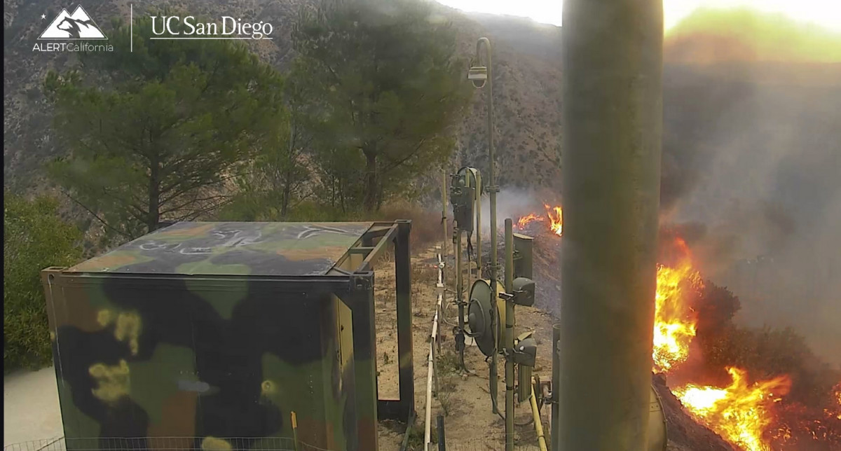
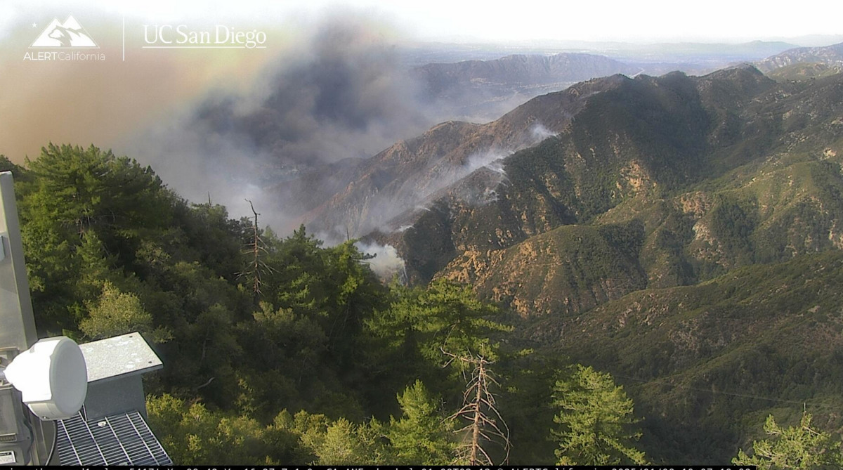
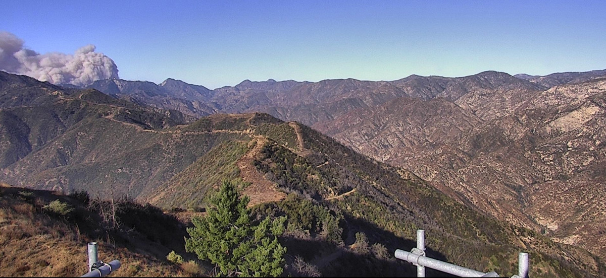
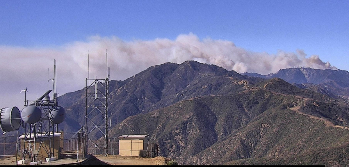
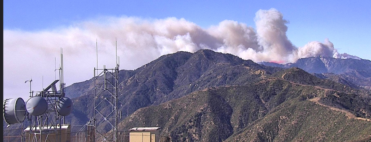
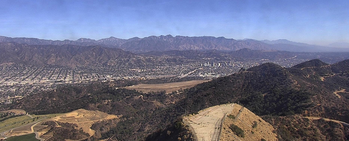
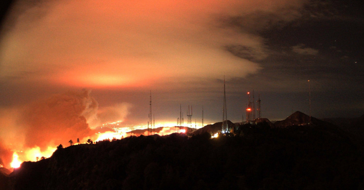
    This is the view from Mt. Disappointment -- Eaton Fire


    7:20 pm

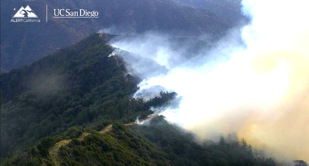
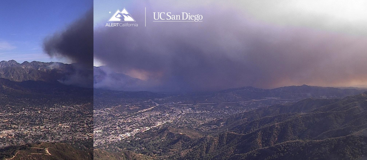
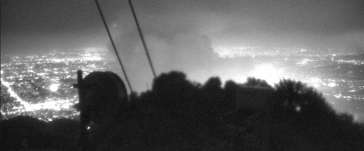
    This is from the Burbank (Verdugo area) looking towards east Pasadena

    7:51 pm

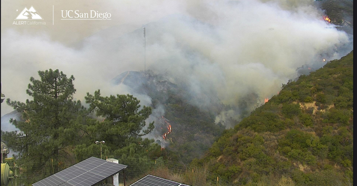
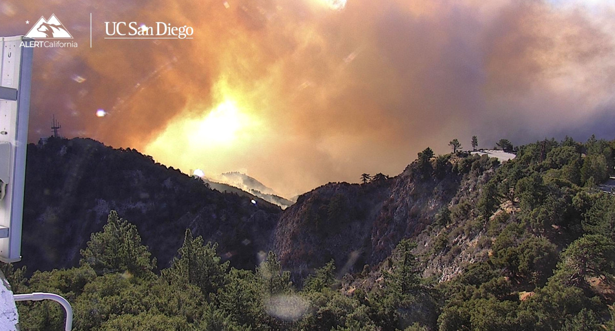
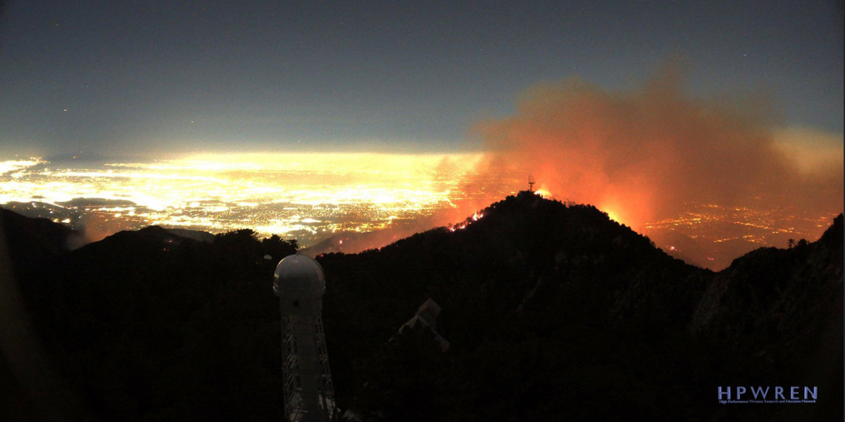
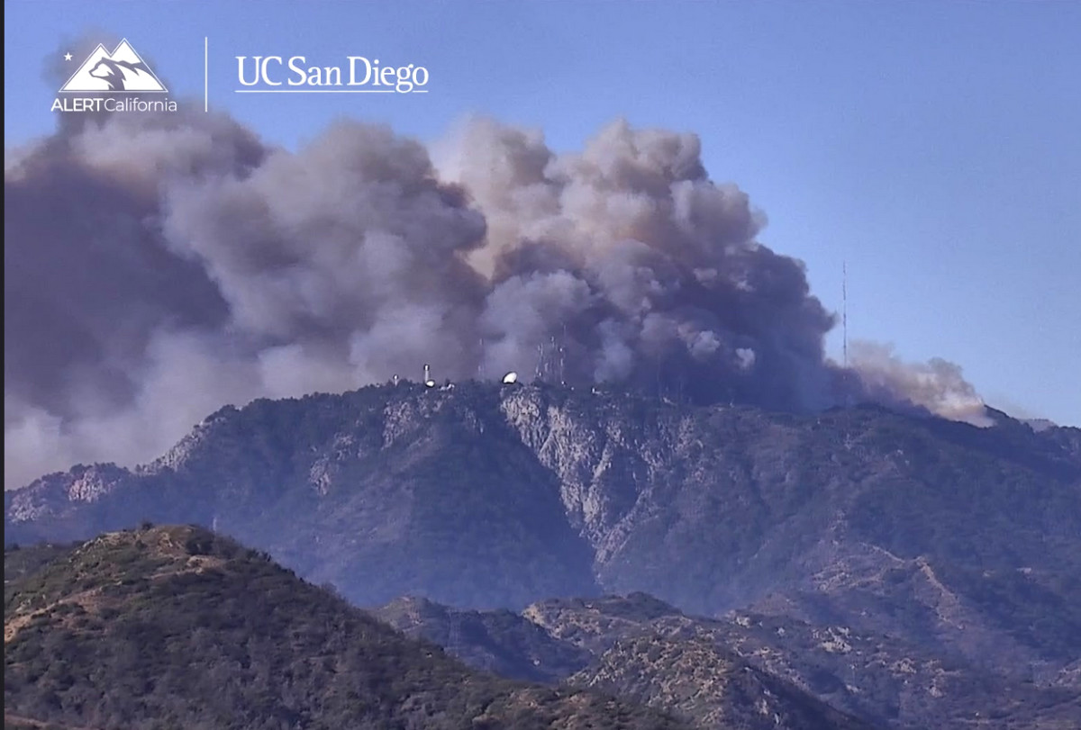
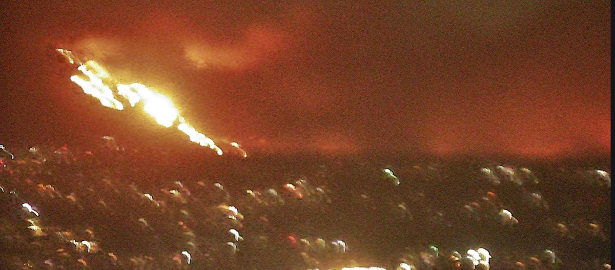
    This is from Mt. Lee in Los Angeles looking at Pasadena


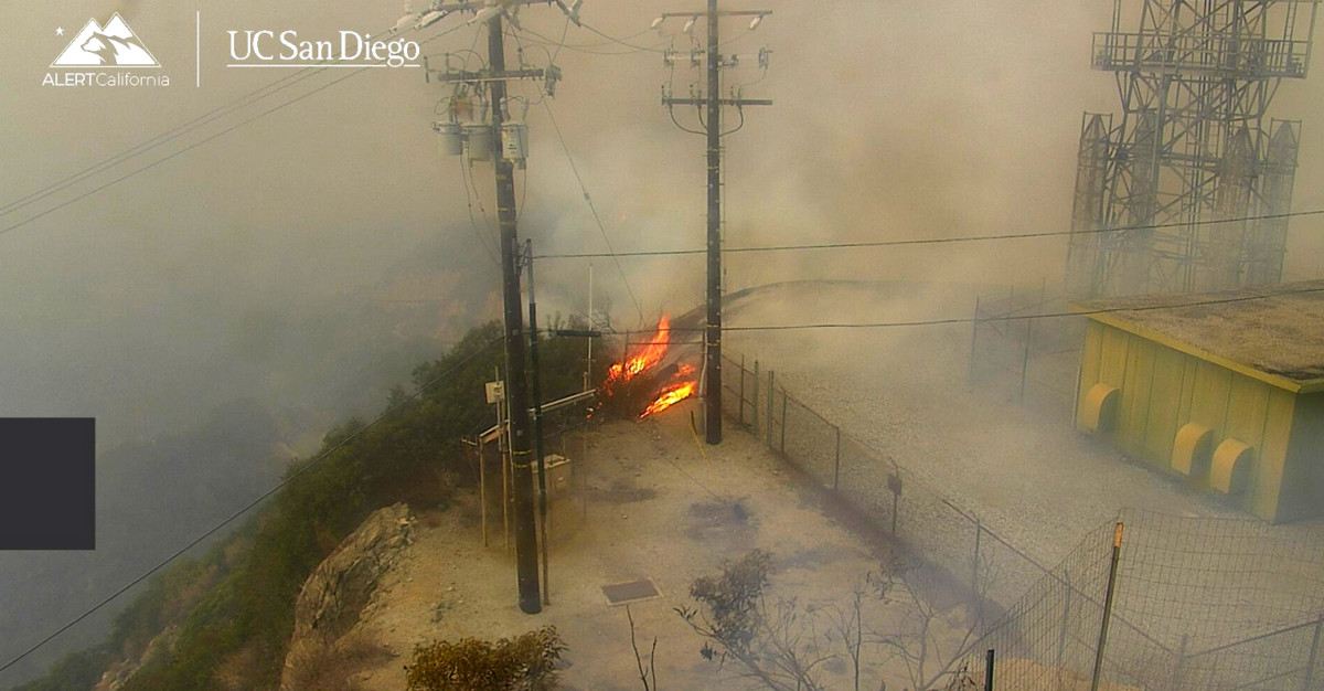
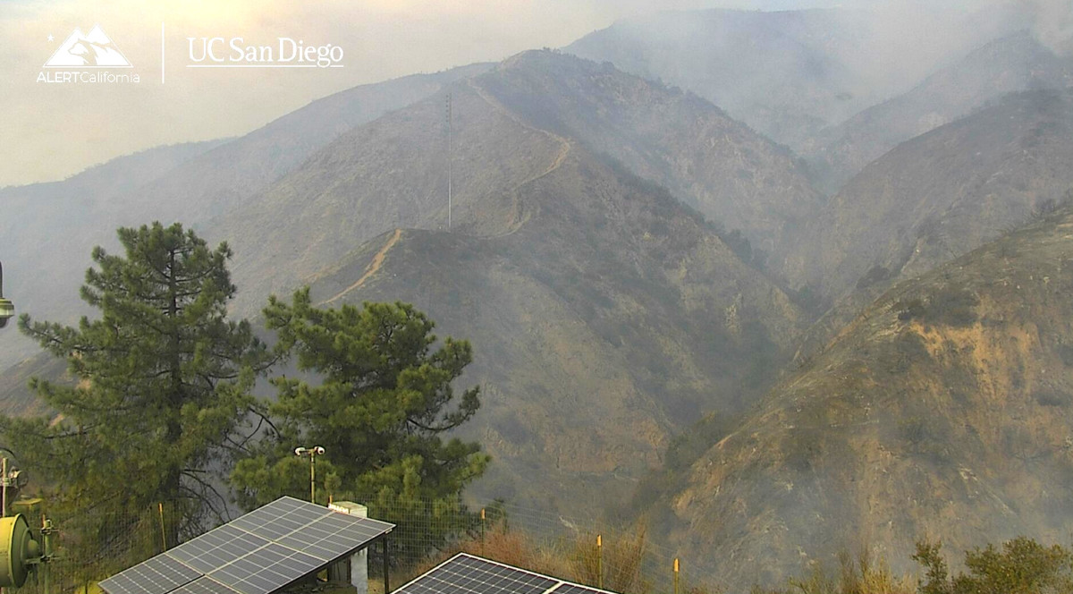
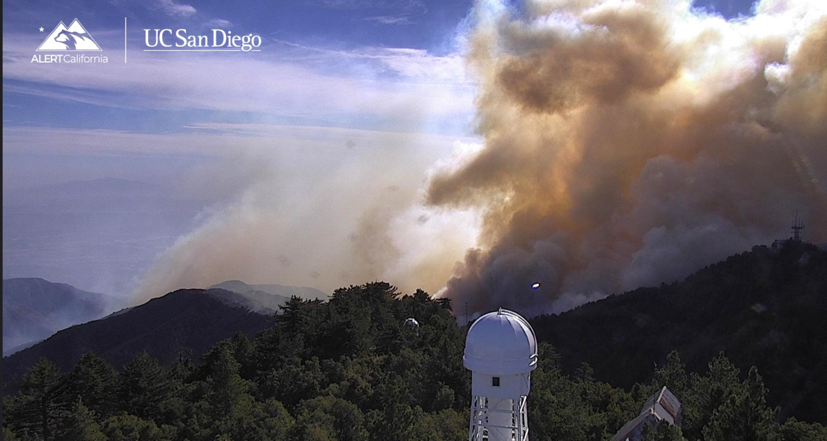
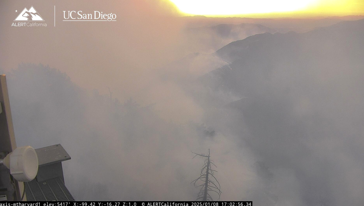
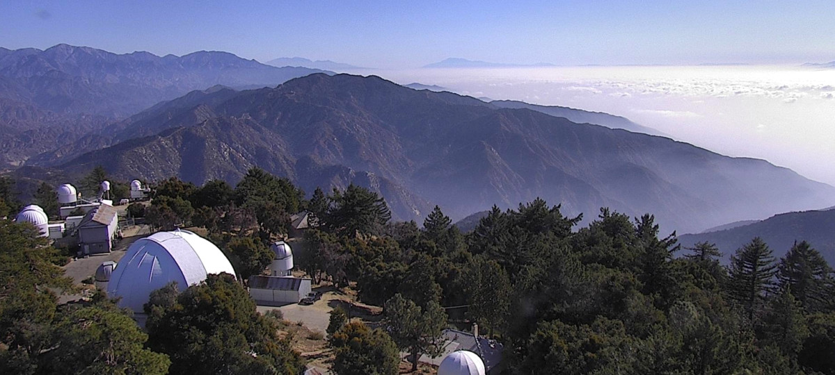
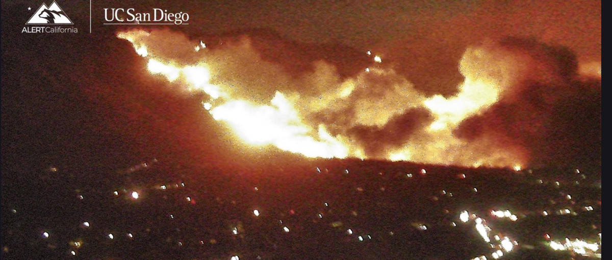
    This is the view from the Mt. Wilson Web camera at 5:15 am this morning.


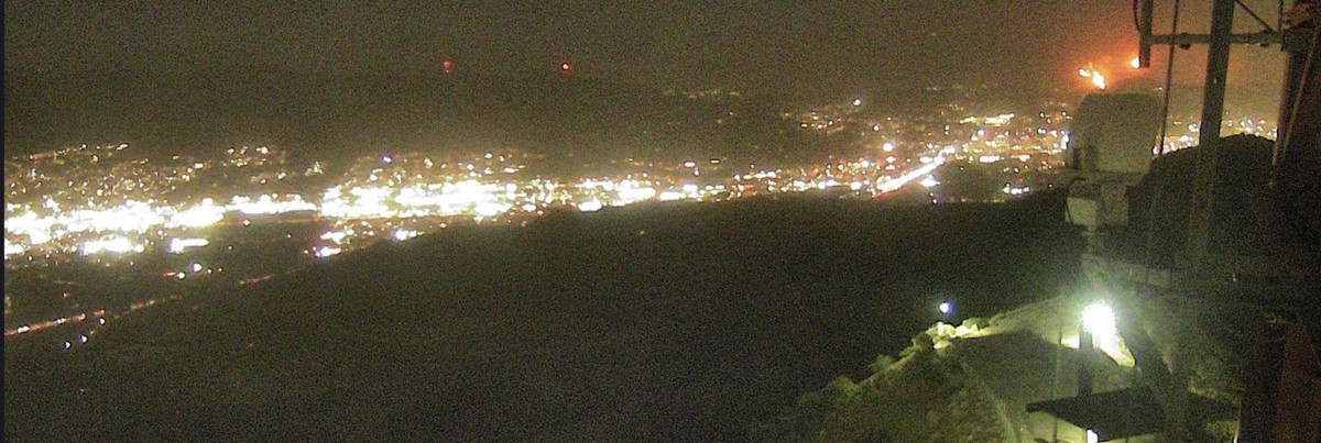
    This is from the Verdugo Fire (Burbank) looking at the Eaton Canyon area

    05:23 am
    Last edited by Mark Sedenquist; 01-08-2025 at 06:23 AM.

  2. #2
    Join Date
    Jul 2007
    Location
    South of England.
    Posts
    12,133

    Default Hard to watch.

    Watching updates on the news here in the UK. It looks like Hell on Earth, devastating!

    Dave

  3. #3
    Join Date
    Jan 1998
    Location
    Las Vegas, Nevada
    Posts
    12,935

    Default

    I have fire channel scanners on -- lots of rescues underway now.

    Lots of friends and family evacuated last night

    mark

  4. #4
    Join Date
    Jan 1998
    Location
    Las Vegas, Nevada
    Posts
    12,935

    Default Winds drastically reduced

    Repeater station along Chantry Road in Arcadia at 8 am:


    Winds drastically reduced

    Ops reports fire on both sides of Chantry Road all the way to Chantry Flats.

    8:25 am

    Active fire burning east from the Chantry Road

    08:32 am

    This is over at Mt. Harvard Web cam looking to the east.

    10:00 am

    So, this is from the Mt. Harvard Cam.
    The burned canyon is the upper Eaton Canyon -- Mt. Wilson is just out of view to the right (east) of this photo.

    10:15 am

    This is the Chantry Flats drainage looking west towards Sierra Madre

    11: 00 am

    This is the camera on Mt. Wilson looking west -- I think that is the Red Box Road and parking lot at Mt. Wilson on the right.

    1:00 pm

    And this is from Mt. Wilson looking east towards Altadena.

    1:08 pm

    This from the Verdugo Tower -- you can see the spot fire in Millard Canyon and the smoke has lifted some.


    Mt Wilson looking South -- Fire has slopped over the ridge

    7:00 pm

    Nearly all of the fire cams that I have been using for this fire went offline last night -- I believe the fire has cut off power to their locations or burned the repeaters.

    Radio Traffic suggests that fire will impact the Mt Wilson Observatory in less than 30 minutes.
    Here is a view from Pine Mountain looking NW towards Mt. Wilson.

    January 9th 9:15 am

    This was Mt. Howard around 5 pm on the 8th active fire below the repeater -- cam out of business seven minutes later.


    Heavy push to Mt. Wilson (seen from the Pine Mountain tower)

    10:15 am

    Slurry Drop on Mt Wilson

    10:43 am

    Mt. Wilson Zoomed in

    11:11 am
    Last edited by Mark Sedenquist; 01-09-2025 at 12:11 PM.

  5. #5

    Default

    I hope all of your friends in the area are safe.

    Saw this yesterday. Brings it home somewhat (particularly the latter part): https://youtu.be/-W2lE1bVlMc

  6. #6
    Join Date
    Jan 1998
    Location
    Las Vegas, Nevada
    Posts
    12,935

    Default About a dozen friends

    Craig,

    We know about a dozen families that lost their homes. I have been assisting where possible.

    Fortunately, many of our family and friends didn't suffer damage--but the destruction of these fires is nearly mind-boggling.

    What I found interesting in that video that Craig posted was how far away some of the supporing engines were from. There was a rig from Bishop, California -- they must have gone code 3 the entire way to get there by the time the video was shot.

    I have seen other video posted by family and friends -- but this is a pretty compelling imagery.

    Mark
    Last edited by Mark Sedenquist; 01-18-2025 at 08:22 AM.

  7. #7

    Default

    Sorry to hear that, Mark. Must be an impossible time for them (as you will know all too well) so let's hope someone steps up to help them. [sorry I was going to post something political but it's not the time or place for it -- I hope that your friends' maintained their insurance and those companies pay out quickly in order to at least put the roof back over the heads even if the house will be somewhat empty]

  8. #8
    Join Date
    Jan 1998
    Location
    Las Vegas, Nevada
    Posts
    12,935

    Default Diligence is still called for

    It's not out yet!


    This is at Mt. Wilson looking east, there is some smoke below in the canyon, most of the active fire line would be the right of this image, but there are no cameras facing that. (Actually, there are some, but they are offline right now.)

    I have been monitoring fire channels for the last couple of hours. There is active fire along the NW section of the fire line. Not a lot of smoke -- but still a source of concern.

    AA (Air Attack) has been flying over the fire for two hours. And a helitanker (it is a Sikorsky S-64F) is now actively dumping water on some of the hot spots near Mt. Lowe and Mt. Wilson.

    There is a predicted wind event tomorrow that could bring sustained winds at 20-30 mph and gusts to 60 mph to the fire area. So, no one has relaxed much.

    Despite the good relations and press briefings, I have found no evidence that FEMA has done anything to help local residents yet. Pretty much the same experience I had when our home burned in a wildfire in 1993. I suppose that FEMA funds are in use to pay for fire departments and the National Guard, but at the homeowner level -- very poor support.

    And while none of our family lost homes -- there were still several encounters with would-be looters. One weird thing about such fire events, is that otherwise reasonably conscientious people look at burned-out neighborhoods as a "free zone" where everything is like a giant scavenger hunt. At our fire in 1993, tourists showed up with metal detectors and shopping bags looking for artifacts. And it happened a few times on this fire at houses that family and friends were guarding.

    Mark

  9. #9
    Join Date
    Jan 1998
    Location
    Las Vegas, Nevada
    Posts
    12,935

    Default a gorgeous day in Los Angeles.

    This is the view of a gorgeous day in Los Angeles. Taken from Mt. Lee looking to the NE. Those tall buildings are downtown Glendale, California.


    January 21st at 11:36 am.
    No fires visible.

    San Gabriel Mountains in the back of the frame.

    Mark

  10. #10

    Default

    Quote Originally Posted by Mark Sedenquist View Post
    One weird thing about such fire events, is that otherwise reasonably conscientious people look at burned-out neighborhoods as a "free zone" where everything is like a giant scavenger hunt. At our fire in 1993, tourists showed up with metal detectors and shopping bags looking for artifacts. And it happened a few times on this fire at houses that family and friends were guarding.
    I should say unbelievable but, sadly, it doesn't surprise me. At least not these days. You kinda would of thought there was a little more decency in the world back then.

Similar Threads

  1. Advice needed: leaving Florence OR to Pasadena CA
    By Debtcook in forum Spring RoadTrips
    Replies: 2
    Last Post: 04-19-2014, 04:25 PM
  2. Madison to Pasadena. What car and which way through the Mountains?
    By billharford in forum Fall & Winter RoadTrips
    Replies: 5
    Last Post: 12-12-2010, 05:21 PM
  3. las vegas-pasadena
    By phil49 in forum Fall & Winter RoadTrips
    Replies: 1
    Last Post: 08-05-2005, 12:45 PM

Posting Permissions

  • You may not post new threads
  • You may not post replies
  • You may not post attachments
  • You may not edit your posts
  •