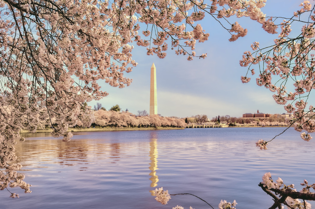
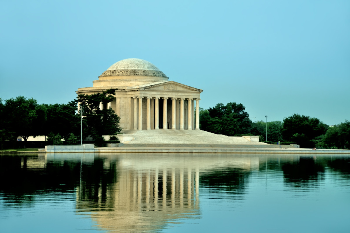
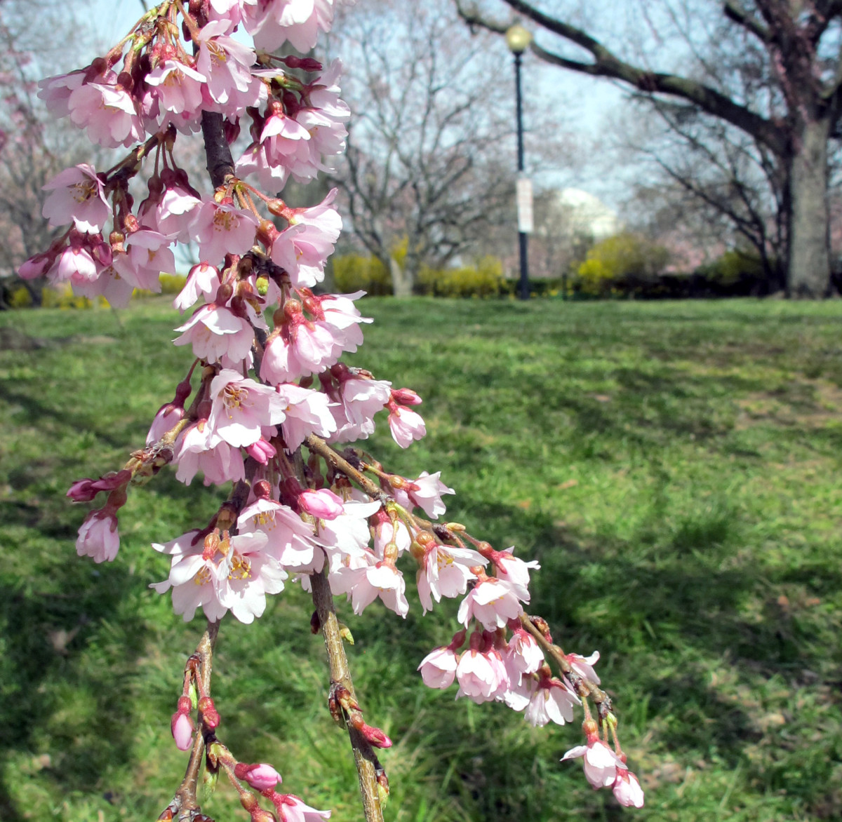
Cherry Blossoms on the National Mall. Can't quite remember exactly where this was. There is a memorial in the background.
Photo by Megan Edwards on April 4, 2013


Cherry Blossoms on the National Mall. Can't quite remember exactly where this was. There is a memorial in the background.
Photo by Megan Edwards on April 4, 2013

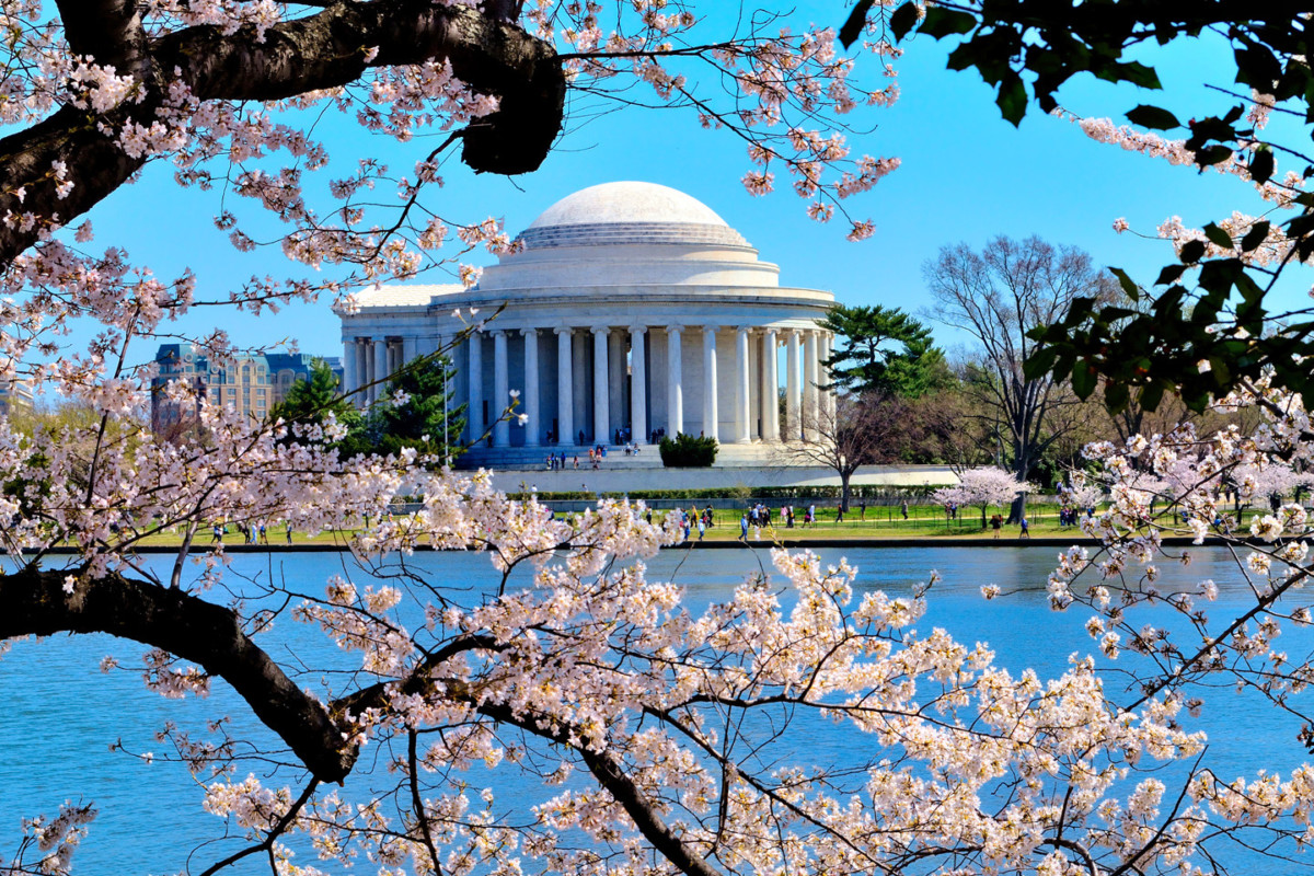
The Jefferson Memorial, to be precise. When i worked in DC, my office was a short walk from the National mall, so I got to know that part of the city pretty well. I must have taken at least a bazillion photos of each of those monuments, and at Cherry Blossom time, I knew exactly where to stand:Originally Posted by Mark Sedenquist

Rick
Oh yes, I knew I should recognize it.
This is the photo I was looking for yesterday:
Rick
Rick,
That is quite gorgeous!
Mark
Thanks! You might get a kick out of what I said about the Jefferson in my blog:
"Of all the stately monuments in Washington, the Jefferson Memorial has always been my personal favorite. I love the graceful neoclassical design, and the way the clean white marble reflects the light when the sun is low in the sky. The bronze statue of President Jefferson, 19 feet tall, weighing in at 10,000 pounds, is set in the center of an interior space thats open to the world on all sides, allowing in a lovely breeze from across the Potomac. I get the feeling that Mr. Jefferson would have appreciated the setting, off by itself at the edge of the tidal basin, on land reclaimed from the swamp that covered most of the area before they decided to build a city here. The monument is elegant in its simplicity, yet imposing enough to match its purpose, as a perpetual cenotaph to one of the primary founders of our democracy, and a monument to his ideals.
As a subject for photographers, the Jefferson has it all: columns and curves, sculpture, carved inscriptions, a dome! The Tidal Basin serves as a reflecting pool, and, for a couple of weeks every spring, the whole business is surrounded by flowering cherry trees. If you cant find a way to turn all that into a great composition, youd best set aside your camera, and find a different hobby!"
Rick
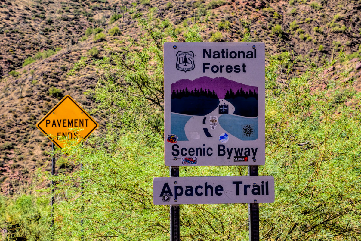
AZ 88, otherwise known as the Apache Trail, is (was?) one of my favorite drives in my home state. Built in the early 1900's to transport the men and material required for the construction of Roosevelt Dam, it runs (ran?) from Apache Junction to Roosevelt Lake, providing access to Canyon Lake and Apache Lake as well, along with some of the wildest countryside in Arizona. The roughest section of the Trail, through Fish Creek Canyon, was never paved. It was narrow, and rocky, and, well, ROUGH, but those of us who love that sort of thing loved it dearly. Why do I keep using past tense? Because flooding and subsequent landslides back in 2019 effectively closed that rough section of the Apache Trail. The estimated cost of repairs is ridiculously high, and very difficult to justify. They have nevertheless managed to reopen some five miles of the problem section--but it's only open to high clearance four-wheel drive vehicles. Anything more remains contingent on elusive Federal funding.
The Apache Trail is (was?) an optional segment of Scenic Side Trip #11: Phoenix to Hobrook; a scenic alternative to Interstate 17.
Rick
Read more about Rick's book here and see a map for all of the routes he wrote about.
Last edited by Mark Sedenquist; 11-30-2024 at 08:59 AM.
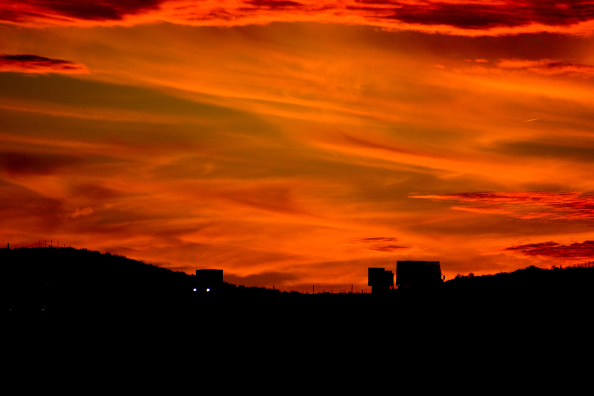
Taken east of Holbrook on Interstate 40 (along a stretch that was, at one time, good ol' Route 66).
Rick
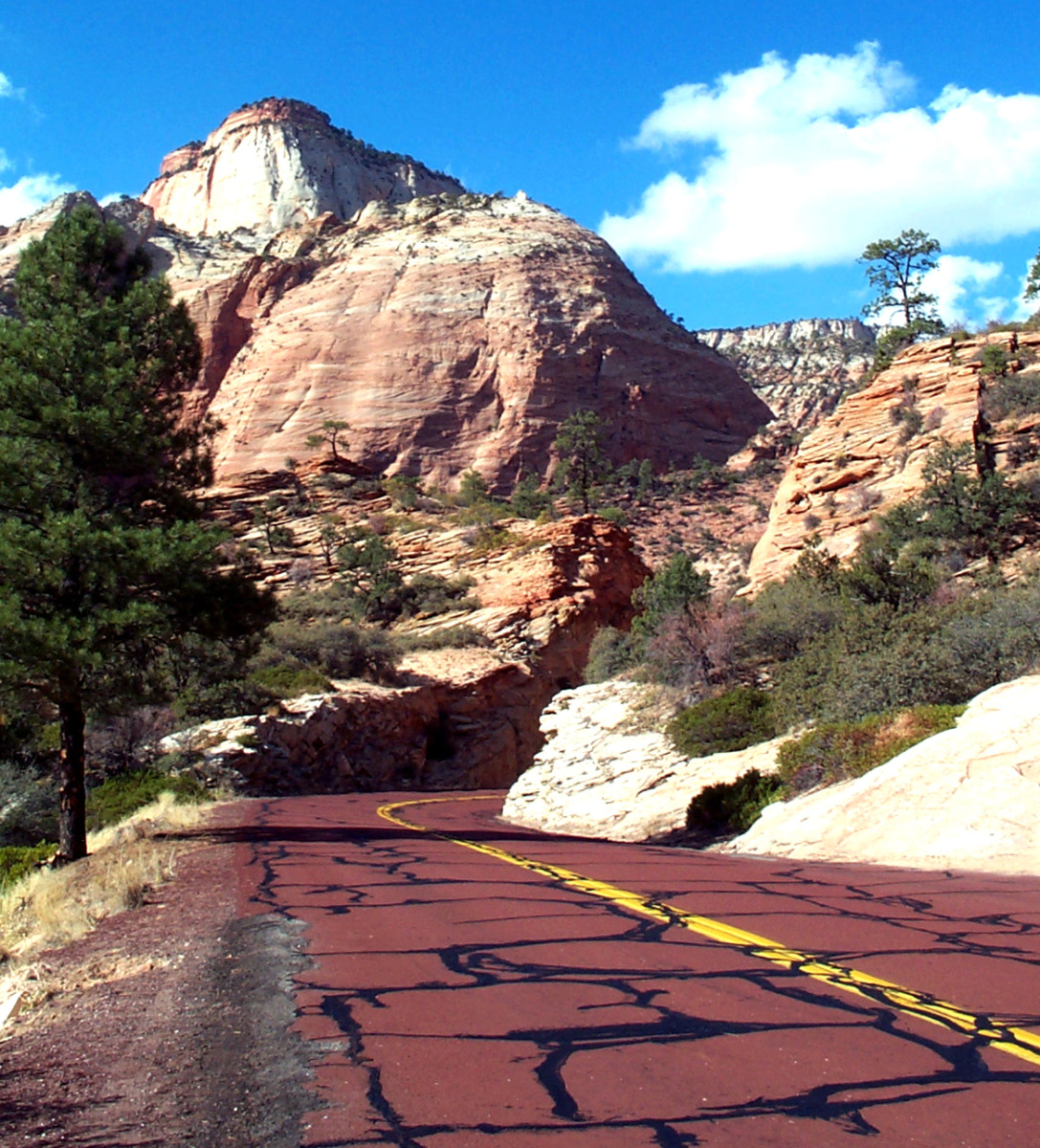
East side of Zion National Park -- Summer 2001
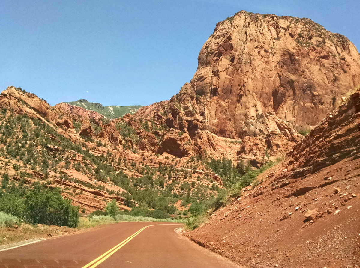
Kolob Canyon, Zion National Park
(Megan Edwards, June 2015)
 Posting Permissions

 Reply With Quote