Page 3 of 26 FirstFirst 1234567891011121314151617181920212223242526 LastLast
Results 21 to 30 of 256
  1. #21
    Join Date
    Mar 2016
    Location
    Phoenix, Arizona
    Posts
    668

    Default Dave nails it again!

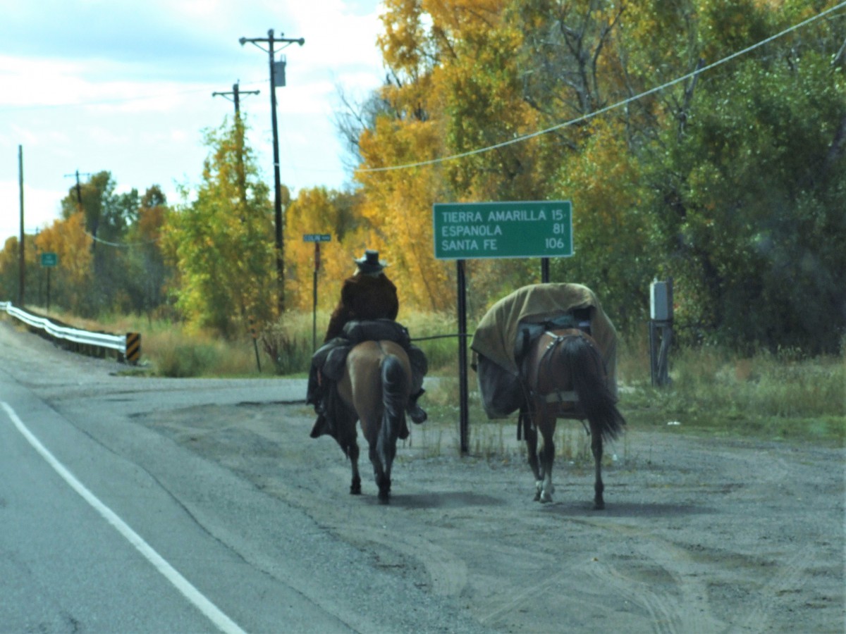
    Good job, Dave; that's a yes on both counts. This is the beginning of Scenic Side Trip #25, which runs from Santa Fe north to Abiqui, and on to Tierra Amarilla, where it connects to US-64, which it follows up and over 10,507 foot Brazos Summit (the highest point on any through highway in New Mexico), across the Rio Grande Gorge, then through Taos, Angel Fire, and Cimarron before reconnecting with I-25 in Raton.

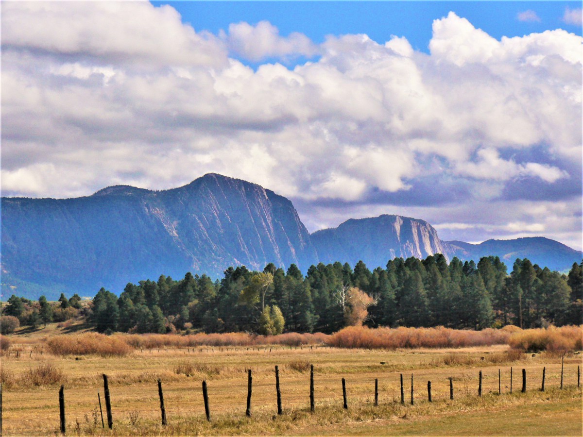
    I really love this particular Side Trip. Abiqui was both the home and the primary inspiration to Georgia O'Keeffe, one of the foremost American painters of the 20th Century, and you can really see her work in the surrounding landscape. The road north from there, US-84 past the Ghost Ranch, is strikingly beautiful, with red rock cliffs and interesting geological formations, but it's US-64 east from Tierra Amarilla that's the real thrill. When you reach Brazos Summit, you get the view of the Mystery Cliff in photo #5. That's the Brazos Cliffs, a gigantic block of Precambrian quartzite that's more than 2,000 feet tall, and yes, that's big enough to disrupt the weather flowing in from the plains.

    For drivers who love twisty roads, it should be noted that US-64 up and over the summit is considered one of the finest motorcycle routes anywhere. I'm always talking about my, "Oh, Wow!" moments, the views, events, or unique scenes off the side of the road that make my eyes go all-the-way wide. The unobstructed view of Brazos Cliffs provided an "Oh, Wow!" moment. The ride down the other side on US-64? Now that was an "Oh, boy!" moment, and it went on and on for miles, with sweeping curves, expansive views, and (almost) no other traffic. I don't have pictures of that section of road. When I'm having that much fun driving, I totally get into a zone, and I don't even think about stopping for photos!

    Rick

  2. #22
    Join Date
    Mar 2016
    Location
    Phoenix, Arizona
    Posts
    668

    Default And now, for our next installment

    Okay, this next one is a slow pitch right over the plate, so I fully expect you guys to knock it out of the park with one swing.

    These pictures were all taken from a road that is actually a 35 mile long loop off a heavily traveled US highway. Name that road, the hill, and the house that has seen much better days. The loop is nicely paved, and it's one of my all-time favorite short drives.


    Rick

  3. Default

    Hehe....so you're making my other guess of Sunset Crater come true!

    WOW...it's been a long time since we've been to Wupatki National Monument but those are the ruins in the area and there is lava flow there too. So my guess is the Sunset Crater-Wupatki Loop Road which I've always known as Road #395.

    Utahtea

    P.S. Would it be ok if I start a thread so people can guess Petroglyphs and Pictographs?

  4. #24
    Join Date
    Jul 2007
    Location
    South of England.
    Posts
    11,967

    Default I thought that rock looked familiar !!

    The road north from there, US-84 past the Ghost Ranch, is strikingly beautiful, with red rock cliffs and interesting geological formations, but it's US-64 east from Tierra Amarilla that's the real thrill.
    We actually headed south on US84 from Pagosa Springs and drove east on 64 on our Denver loop roadtrip to the Rio Grande gorge to Taos.


    This lump of rock was captured somewhere along the route. Could it be the Brazo cliffs?


    Dave.

  5. #25
    Join Date
    Mar 2016
    Location
    Phoenix, Arizona
    Posts
    668

    Default That was fast!

    Utahtea, you are correct. The road was the Sunset Crater-Wupatki Loop, which is spittin' distance from Flagstaff off US 89. It's a perfect little detour for folks that are heading up to the Grand Canyon by way of Cameron. In my book, it's part of Scenic Side Trip #15.

    I love the idea of a thread about petroglyphs and pictographs. Feel free to start one, or if you'd like, you can piggyback on this one. Here's one of my favorites; not for the artistry, but for the story that goes along with it. See if you can guess the location, or the symbolic meaning of this petroglyph:

    Last edited by Rick Quinn; 05-01-2020 at 04:18 PM. Reason: Added map link

  6. #26
    Join Date
    Mar 2016
    Location
    Phoenix, Arizona
    Posts
    668

    Default

    Quote Originally Posted by Southwest Dave View Post

    This lump of rock was captured somewhere along the route. Could it be the Brazo cliffs?


    Dave.
    Dave:

    From the look of it, I'd call that a good bet!

    Rick

  7. Default

    Quote Originally Posted by Rick Quinn View Post

    I love the idea of a thread about petroglyphs and pictographs. Feel free to start one, or if you'd like, you can piggyback on this one. Here's one of my favorites; not for the artistry, but for the story that goes along with it. See if you can guess the location, or the symbolic meaning of this petroglyph:


    I don’t remember if I’ve seen this petroglyph but my best guess of the symbol would be a fish.

    Utahtea

  8. #28
    Join Date
    Mar 2016
    Location
    Phoenix, Arizona
    Posts
    668

    Default Appearances can be deceiving!

    Quote Originally Posted by Utahtea View Post
    I don’t remember if I’ve seen this petroglyph but my best guess of the symbol would be a fish.

    Utahtea
    Utahtea, that's exactly what I thought, and we were both wrong! This particular symbol was etched into the rock below an overhang in Canyon del Muerto, the northern section of Canyon de Chelly National Monument, which is one of my favorite places in all the world.

    Here's another petroglyph from the same site, more recent, and much easier to interpret:


    Hunters after a deer, and because they are on horseback, it had to have been done after the arrival of the Spaniards, which makes it Navajo, as opposed to Hopi or Anasazi.

    Here's a little bit of back story: in 2013, I'd just bought a gently used Jeep Grand Cherokee, and I wanted to take it for a proper test drive. At that time, it was still possible to tour inside Canyon de Chelly using your own four-wheel drive vehicle, provided you hired an authorized Navajo guide to ride along with you, and I figured that would be perfect for my purpose. I'd done that trip once before, way back in the '80's (driving a big honkin' Jeep Wagoneer), but I'd always wanted to do it again, and really take my time about it, along with at least a bazillion photographs.

    My friend and I got lucky, because the guide we chose couldn't have been better. A Navajo woman who was born and raised in the canyon, and had worked as a guide there, on and off, for 30 years. We engaged her services for two full days, and I told her that I had a particular interest in <<wait for it>> petroglyphs and pictographs! On the first day, we spent a good ten hours in Canyon del Muerto. We saw what I came to see (and more!), and I gave my newly acquired Jeep Cherokee a truly Grand workout, slaloming through deep sand, climbing over boulders, and churning through mud deep enough to stop a lesser vehicle in its tracks. That Jeep got such a mud bath that first day that we were compelled to give her an appropriate moniker: "La Reina Sucia," the Dirty Queen, a name that stuck (just like that gummy red mud!)

    But I digress. The best thing about that two days in the canyons was the running commentary by our guide, Sylvia, who had a story for every rock and ruin. I tried to absorb as much of that as I could, but with so much going on, there was no way to remember more than a fraction of it. I did get my bazillion photos (close enough), but I had major after-the-fact regrets for not having had the foresight to make an audio recording of our guide, especially the many things she had to say about the hundreds of petroglyphs that we saw on that trip. In January of 2014, just two months after we were there, the Navajo Tribe changed the rules, and permanently banned privately owned vehicles from touring inside Canyon de Chelly (on the canyon floor). You can still go, but you have to travel, not only with a guide, but in a vehicle provided by a Navajo owned tour company. There were a number of good reasons for making that change, but I'm most certainly glad I got to do what I did while it was still possible!

    Anyway, a couple of years later, I was working with the photos I took on that trip, and I got a brilliant idea. I loaded a very specific series of those photos on my laptop, drove up to Chinle, and I hired Sylvia to sit with me for a couple of hours while we went through the photos, and she talked about them, while I recorded our conversation. When we came to the petroglyph in the picture, here is my transcript, word for word:

    "Looks kind of like a fish bone," I said, pointing to the symbol etched in the sandstone of the canyon wall.

    "No," she replied. "This one here is like the world. Way down there before humans were ever made, before life was ever made. This is the Black World," she said, pointing to the lowest horizontal line. "Then, the Blue, the Yellow, and the White World. And then the one on top right here is the world that we live in; and so that’s the 5th world. This is supposed to be a ladder going up from one place to the next. So this is our world, where we live, and when we die we go up into the next world, which is the spirit world. This is the 5th world, and they call it the Glittering World, because we have a lot of different colors here. They call it the Glittering World because everything glitters like when it rains, the water gives off a sparkle and when it snows, it does that too, and then during the summer you’ll see the leaves give off a shine. Even for us humans, we give off a shine through our pores; even our eyes, they glisten."


    Whew! So much for the fish bone theory! And it's a very good illustration of just how much we don't know about the Ancestral Pueblo people who carved those symbols in the first place. The Navajo didn't originate in the region where they live today. By the time they arrived in the Southwest, the Anasazi, as we call them, were long gone from Canyon de Chelly, so there was never any overlap between those people and the Navajo, never a direct connection, but even so, I have no reason to doubt Sylvia's interpretation of the signs on the walls of her canyon. When she was a toddler, she lived here:


    Her great grandfather painted that cow, known as the Standing Cow. ("If there can be a Sitting Bull, why not a Standing Cow?") As regards her qualifications? I rest my case!

    There is soooo much that we'll probably never know, but isn't it grand, just to see these things, and to apply your sense of wonder?

    Rick

    (P.S.: your turn!)
    Last edited by Rick Quinn; 05-02-2020 at 09:41 AM.

  9. #29
    Join Date
    May 2011
    Location
    Central Missouri
    Posts
    5,857

    Default

    IMG_5919

    So....where am I????

    Edit: Same photo, larger scale.


    Donna
    Attached Images Attached Images
    Last edited by DonnaR57; 05-02-2020 at 04:43 PM. Reason: enlarged photo

  10. #30
    Join Date
    Jan 1998
    Location
    Las Vegas, Nevada
    Posts
    10,917

    Default A great story.

    Quote Originally Posted by Rick Quinn View Post
    Her great grandfather painted that cow, known as the Standing Cow. ("If there can be a Sitting Bull, why not a Standing Cow?") As regards her qualifications? I rest my case!
    A great story. Thanks for sharing the details.

    Mark

    With Respect to Donna's photo: hmmm -- Buffalo National River in Arkansas?

    Mark
    Last edited by Mark Sedenquist; 05-02-2020 at 05:13 PM.

Similar Threads

  1. Where Am I -- Volume III
    By Rick Quinn in forum RoadTrip Field Reports
    Replies: 83
    Last Post: 07-16-2020, 09:22 PM
  2. Where Am I -- Volume II
    By Rick Quinn in forum RoadTrip Field Reports
    Replies: 118
    Last Post: 06-23-2020, 05:07 PM
  3. Toronto to NYC - Where to stop / Where to stay ?
    By Wilder in forum Fall & Winter RoadTrips
    Replies: 1
    Last Post: 10-16-2007, 06:19 PM
  4. Where oh where to cleanse myself?
    By imported_Chuck in forum Gear-Up!
    Replies: 5
    Last Post: 10-29-2002, 05:09 AM

Posting Permissions

  • You may not post new threads
  • You may not post replies
  • You may not post attachments
  • You may not edit your posts
  •