 230 miles - About 8 hours
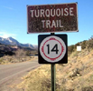
Thanks to Interstate Highway 25, (I-25), one can drive from Santa Fe to Albuquerque in about an hour, but there is a scenic alternative that follows historic pioneer trails. Following the Turquoise Trail, we'll swing by the towns of Los Cerrillos, Madrid and Golden. There is even a stop at Tiny Town to see 'the art that dies to live.' This route also includes a drive on the Sandia Crest Byway to the top of Sandia Crest. At I-40, this route continues south on the Salt Missions Trail along the base of the Cibola National Forest to historic US Highway 60, with visits to the Abo and Quarai ruins that are part of the Salinas Pueblo Missions National Monument.
Here are just a few of the highlights on this route:
Santa Fe, New Mexico (Starting point)
Starting at the heart of the Santa Fe, be sure to check out the wording of the plaque of the 'Soldier's Memorial' in the center of the town square. There are several interesting shops and the St. Francis Cathedral is at the southern end of the plaza the Georgia O'Keefe Museum is only about a block north of the plaza.
Los Cerrillos, New Mexico (mile 23)
Los Cerrillos has a population greater than zero, yet it's considered a ghost town. The main street provides a great example of what the little towns on the Turquoise Trail are like (e.g. an old church along with old buildings, little houses, and dirt roads).
Madrid, New Mexico (mile 27)
The 'Welcome to Madrid' sign says Madrid was founded 1891-1957 and re-established in 1970. These days Madrid is an artist's community with places to eat and places to shop. Madrid is home to Maggies Diner, which was built by Disney for the movie Wild Hogs.
Golden, New Mexico (mile 37)
With the exception of scenic views of Mother Nature, there's not much to see in Golden, but we mention it because it was the site of the first gold rush west of the Mississippi River (circa 1825).
Sandia Crest Byway, New Mexico (mile 49)
There is a turn-off for the Sandia Crest Byway, it's about 12-miles one-way and I recommend a quick drive to the top of the road. At an elevation 10,678 feet, Sandia Crest offers excellent views of Albuquerque below. Beware... it can be chilly even during the summer months. The Sandia Crest Byway has numerous parking areas for people to stop and enjoy the surroundings. Tree Spring Trail is one of the more popular hiking trails in the Sandia Mountains. Access to the Tree Spring Trail head is at the Sulphur Spring Picnic Ground approximately two miles west of NM Highway 14.
Junction: Turquoise Trail/Salt Missions Trail (mile 83)
At I-40 the Turquoise Trail ends and the Salt Missions Trail begins. It's a short drive
west on I-40 to Albuquerque, but this route continues south to US Highway 60.
Quarai Ruins: Salinas Pueblo Missions National Monument, New Mexico (mile 141)
Quarai is one of the three historic missions/pueblos that are the Salinas Pueblo Missions National Monument. These are great ruins to explore because you can see them up close and feel them with your feet and hands.
Mountainair, New Mexico (mile 150)
Mountainair is a small, but thriving town located on historic US Highway 60. A visitor center for the Salinas Pueblo Missions National Monument is located in Mountainair. one of the murals can be seen here.
Abo Ruins: Salinas Pueblo Missions National Monument, New Mexico (mile 160)
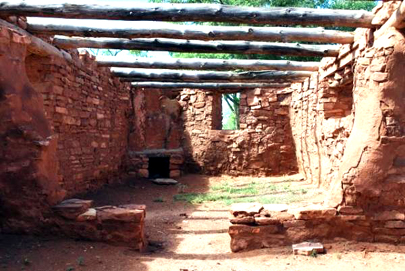
Abo is one of the three historic missions/pueblos that are the Salinas Pueblo Missions National Monument. Abo is 1/2-mile north of US Highway 60 on NM Highway 513.You are free to wander among these ruins; in other words, you are not limited to looking at them from afar.
Albuquerque, New Mexico (mile 230)
Albuquerque is a great destination point. Albuquerque's Central Avenue is 18 miles of Route 66. Albuquerque has numerous historic buildings, outstanding murals, the Sandia Tramway, and the Rio Grande River. The Petroglyph National Monument/Volcanoes Day Use Area are found on the westside of Albuquerque just north of I-40.

Abo Ruins, Salinas Pueblo Missions National Monument


Message from RoadTrip America