Getting
Out There: |
Directory of all "Getting Out There" Articles> |
Interstate 70 through Eastern Utah by Mark Sedenquist
(Continued from page 3)
|
Here are some things to look for when you stop at the viewpoints:
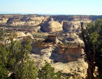
Devils Canyon (mile 116) and Eagle Canyon -- on the west-bound side, both provide glimpses into the deep canyons .
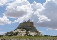
Ghost Rock (mile marker 126) -- This megalith was an important landmark for early explorers and was named because in stormy weather, the base of the formation often disappears making it look like is floating on a cloud. North of I-70 is an area known as Secret Mesa that was home to outlaws and rustlers. Evidence of their habitation can still be found.
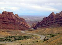
Spotted Wolf and Black Dragon (mile marker 142) -- Spotted Wolf is my all-time favorite roadside view. As I-70 snakes its way down Spotted Wolf Canyon and though the reef, it's possible to see for miles and miles and miles to the southeast.
As you make your way down this steep descent, keep one eye on the cliffs. On two occasions I've spotted mountain lions high up on the cliffs watching the traffic flow past them.
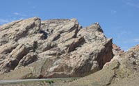
San Rafael Reef (mile marker 146) -- This viewpoint is only accessible from the west-bound lanes but offers an unparalleled view of the sandstone cliffs that were lifted nearly 70 degrees from vertical. Informational panels detail the "Uranium Fever" that swept through here between 1950 and 1956. There is also a memorial to a Utah Highway Patrol officer who was killed in the line of duty in 1993.
Just south of the San Rafael Reef viewpoint
is an unmarked gravel road (on the west-bound roadway) that
leads to the Black Dragon Pictograph area. This one-mile road
ends at the mouth of Black Dragon Canyon where extensive pictographs
can be seen, including one panel that may be related to an
ancient calendar system.
Next: Goblin Valley and Green River>
Mark Sedenquist
April 16, 2006

