Getting
Out There: |
Directory of all "Getting Out There" Articles> |
Interstate 70 through Eastern Utah by Mark Sedenquist
(continued from Page 2)
|
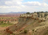
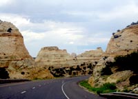
The town of Richfield offers a full complement of traveler services at mile marker 37, or you can travel up to Salina on US-50 at exit 54 for a quick meal as you get ready to ascend to the most magnificent segment of this drive. Mile 86 is the starting point of what I consider to be the most scenic 72-mile stretch of the Interstate highway in the country. Between Fremont junction (at SR-10) and the picturesque town of Green River (a major tributary to the Colorado River) lie eight view points with evocative names like Ghost Rock, Devil's Canyon and Spotted Wolf. While not all of the view points are accessible from both directions, I make always make a point of stopping at as many as I can when I pass through this area. I-70 bisects an extraordinary, kidney-shaped geologic formation known as the San Rafael Swell. (see satellite map)
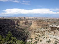
The San Rafael Swell is actually an anticline -- a huge dome that was formed by pressure deep within the earth. As the earth buckled upwards, the various layers of rock reached the surface and caused a rippled effect of rock formations. These formations have subsequently been eroded by wind and rain, resulting in some very unusual and beautiful formations. The Swell is 50 miles long and about 30 miles wide. The eastern edge, with its jagged sandstone and deep canyons, is called the San Rafael Reef. Although I-70 is the only paved road in the area, there are 2,000 miles of dirt roads and trails to entice adventurous travelers. Here is more information about the Swell.
Throughout the Swell area, is it possible to find petroglyphs from a number of cultures and dating back as far as 2,000 B.C. In addition, scientists have found many intact allosaurus dinosaur skeletons. In the Cleveland-Lloyd Dinosaur Quarry in the northern part of the Swell, palentologists have excavated over 12,000 bones. Here are a couple of books that can provide plenty of background information for exploring this vast area: Steve Allen's Canyoneering the San Rafael Swell and Michael Kesley's Hiking and Exploring Utah's San Rafael Swell.
Next: What to look for at the viewpoints>
Mark Sedenquist
April 16, 2006
(Updated June 4, 2021, RTA)


