


DAY 14: From Tulum to Escárcega, via Muyil, Becán, and Chicanná
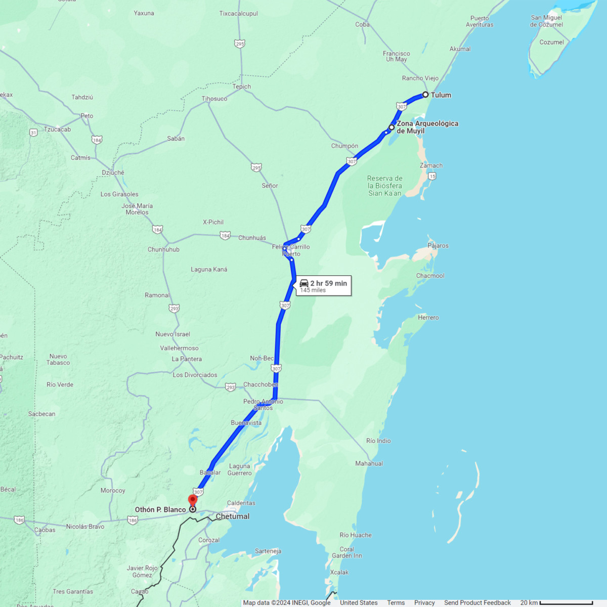
On Day 14, we had one last French Bakery breakfast at our hotel, the Maison Tulum, then we gassed up the Jeep, checked the oil and tires, and hit the road. MX 307 is the principal north-south highway connecting the cities and towns along the Riviera Maya. From Cancun to Tulum the road runs parallel to the coastline. After Tulum, it veers slightly inland before dropping south to Chetumal, on the border with Belize.
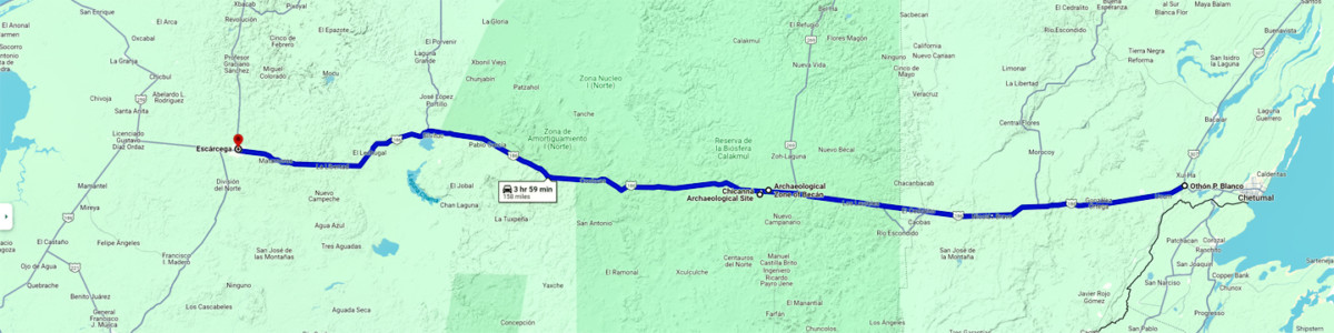
We planned to head in that direction, but we’d decided against crossing into Belize, so at the junction with MX 186, Just before Chetumal, we would be turning west toward Escárcega, on the other side of the Yucatan peninsula.
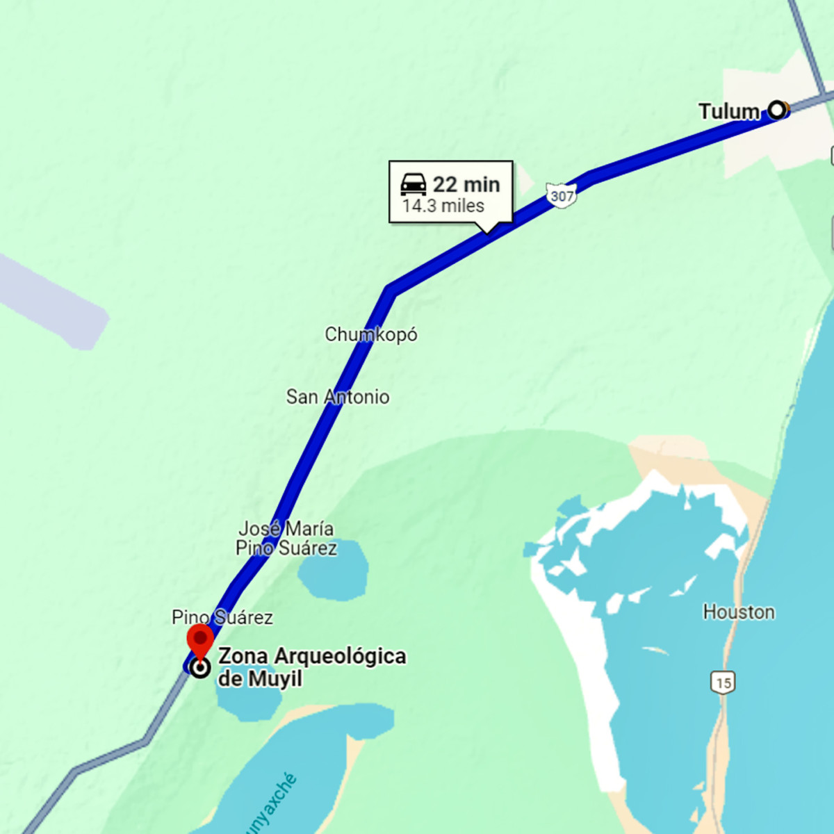
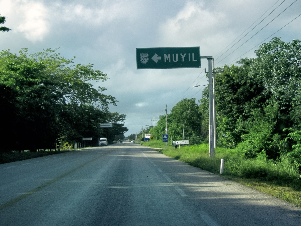
We planned to visit at least three Mayan sites this day, beginning with a place called Muyil, which neither of us had ever heard of before I noticed it on our map. It was just 15 miles south of Tulum, but it had a reputation for being one of the least crowded attractions in the area.
MUYIL
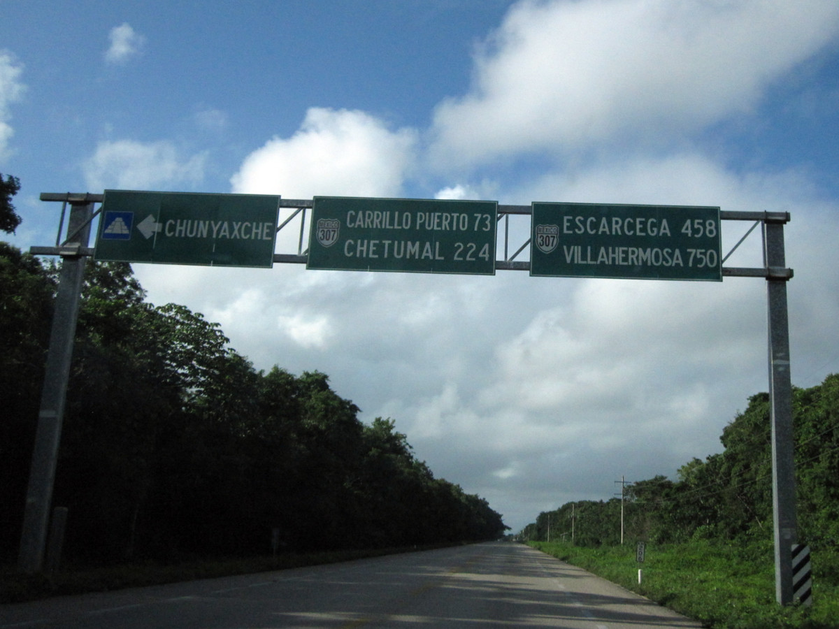
The name of the Mayan site is Muyil, but the surrounding community is Chunyaxche, and the two names seemed to be interchangeable.
First we took the turnoff for Chunyaxche, then the turnoff for Muyil.
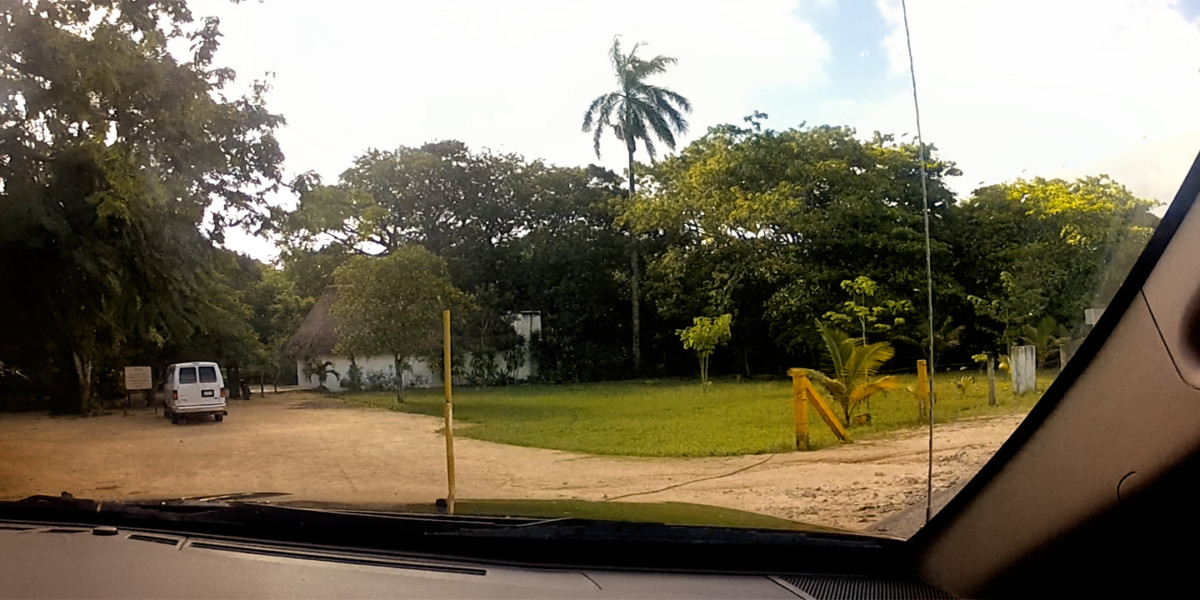
For being so close to Tulum, Muyil had an isolated, far-away feel to it, and they certainly weren’t kidding about the lack of crowds. We arrived just past 9 AM, and wandered the grounds for close to an hour. The whole time we were there, we were the only visitors in sight.
The parking lot was right beside the road; the only vehicle in view belonged to the caretaker.
Parking was free, and entrance to the ruins was just 50 Pesos apiece (less than $3), making this the cheapest ruin we’d been to so far. Then again, it was also the smallest ruin we’d been to so far. Muyil/ Chunyaxche was named for two adjacent lagoons, connected to each other and to the sea by canals. Big canoes filled with trade goods plied the Caribbean coastline in the Mayan era, and they used the lagoons as a safe harbor. Muyil provided docks, and became a transfer point for goods moving inland. Trade gave them the wealth required to build a serious pyramid, large enough to belie the small size of their community. (Ever larger monumental construction was the ultimate form of one-upsmanship among Mayan Nobles).
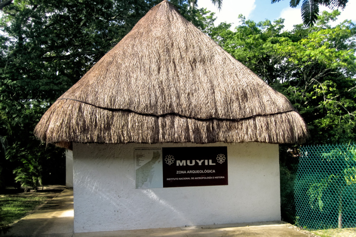
Just beyond the rustic ticket booth,
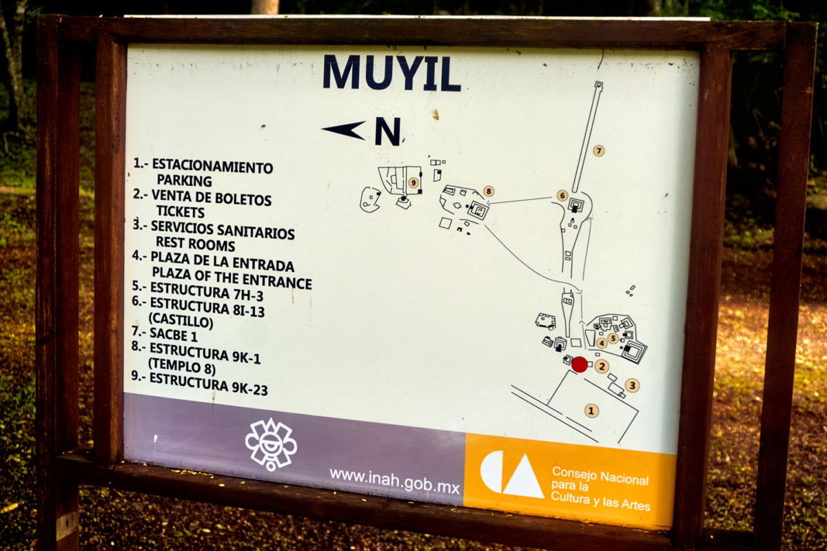
a pathway leads past a site map:
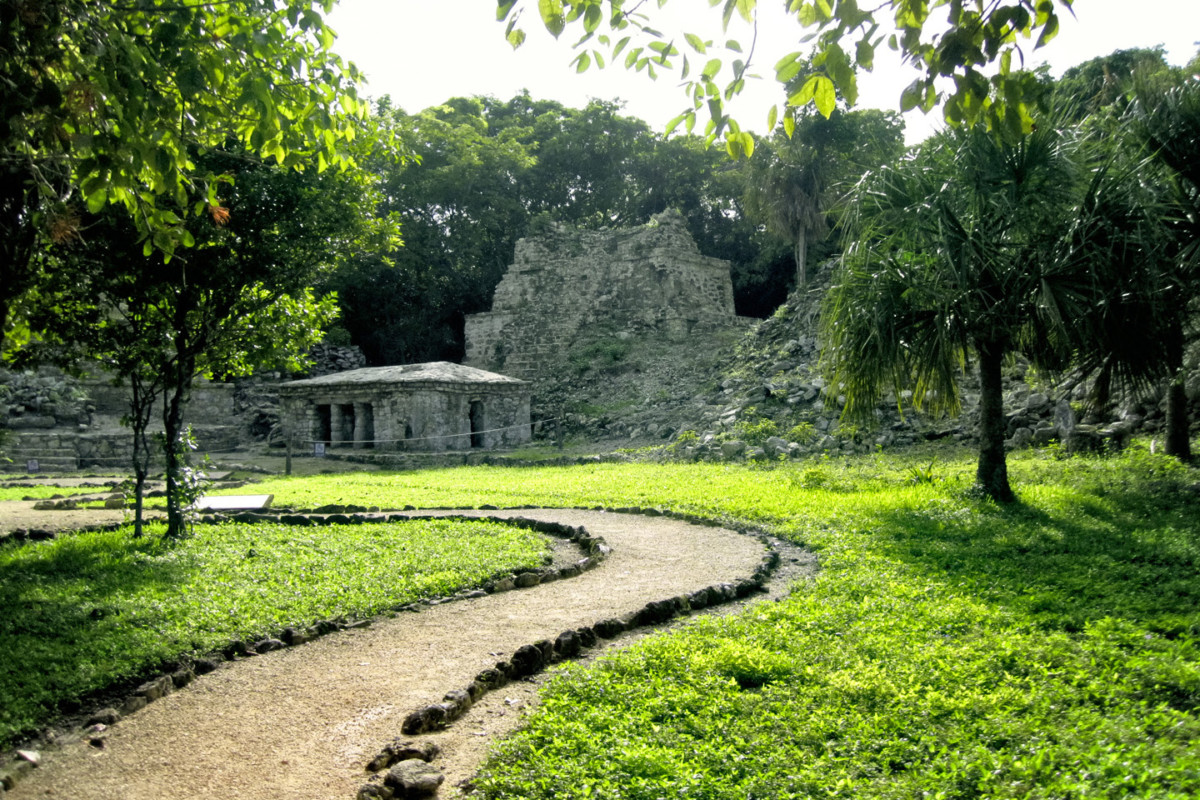
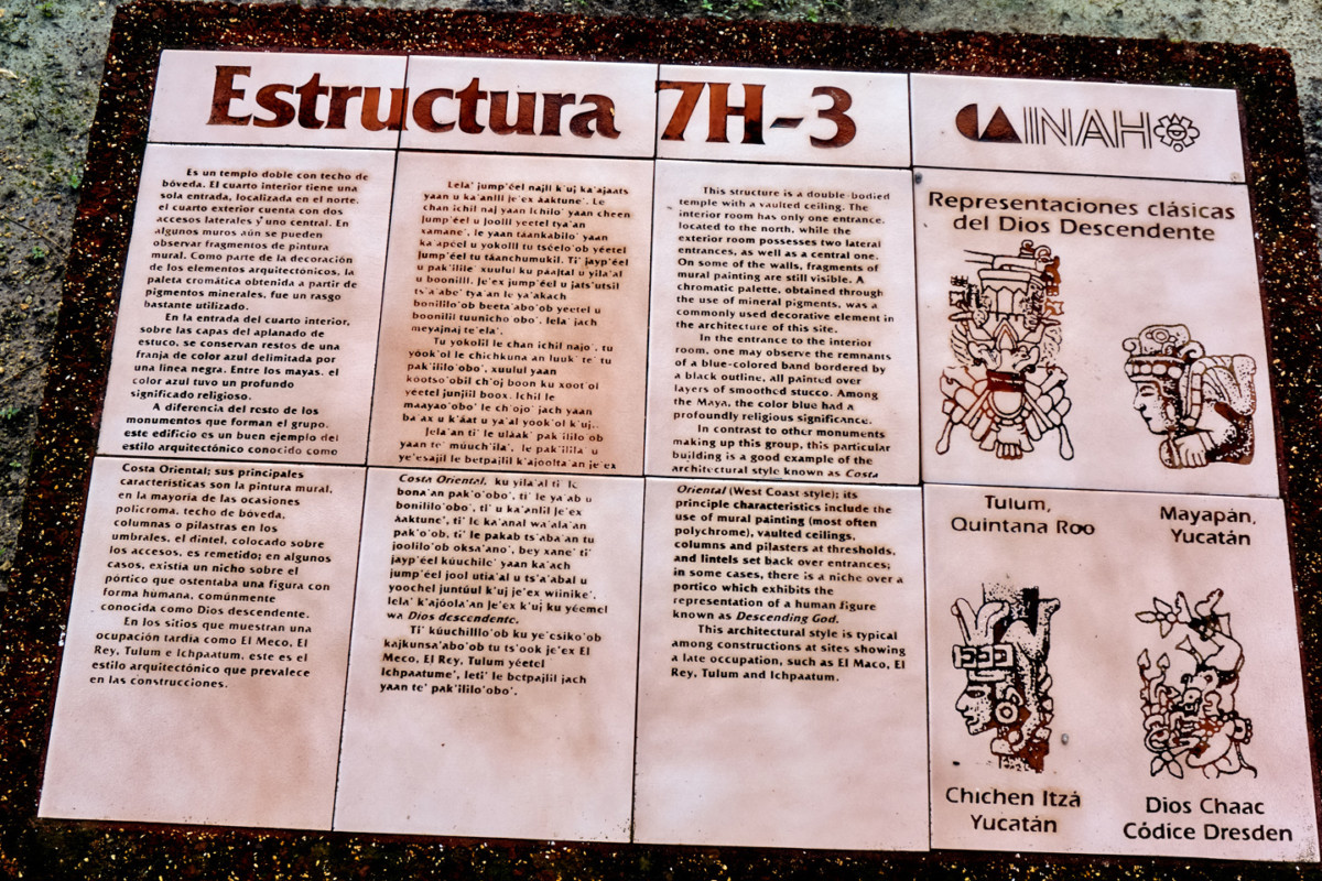
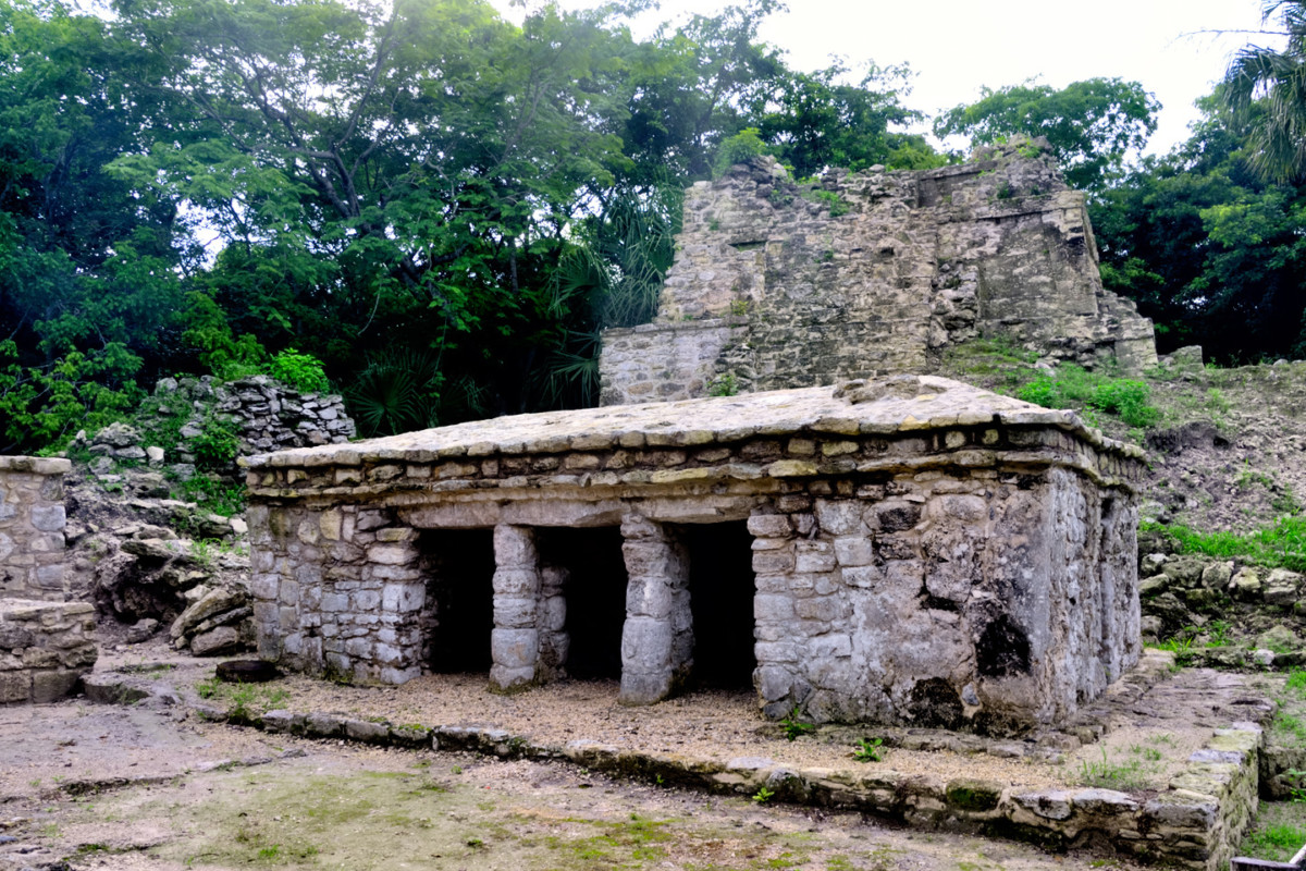
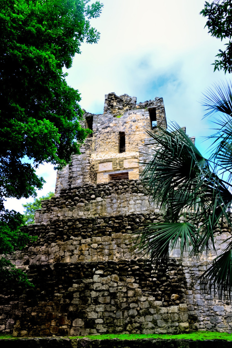
and other signage to the first of Muyil’s buildings, a temple known as “Estructura 7H-3,” a relatively intact structure reminiscent of the building style we saw at Tulum, with a vaulted concrete ceiling, and faded remnants of painted murals on some interior walls.
The temple is backed by several larger structures that are crumbling into rubble.
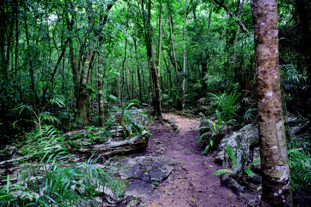
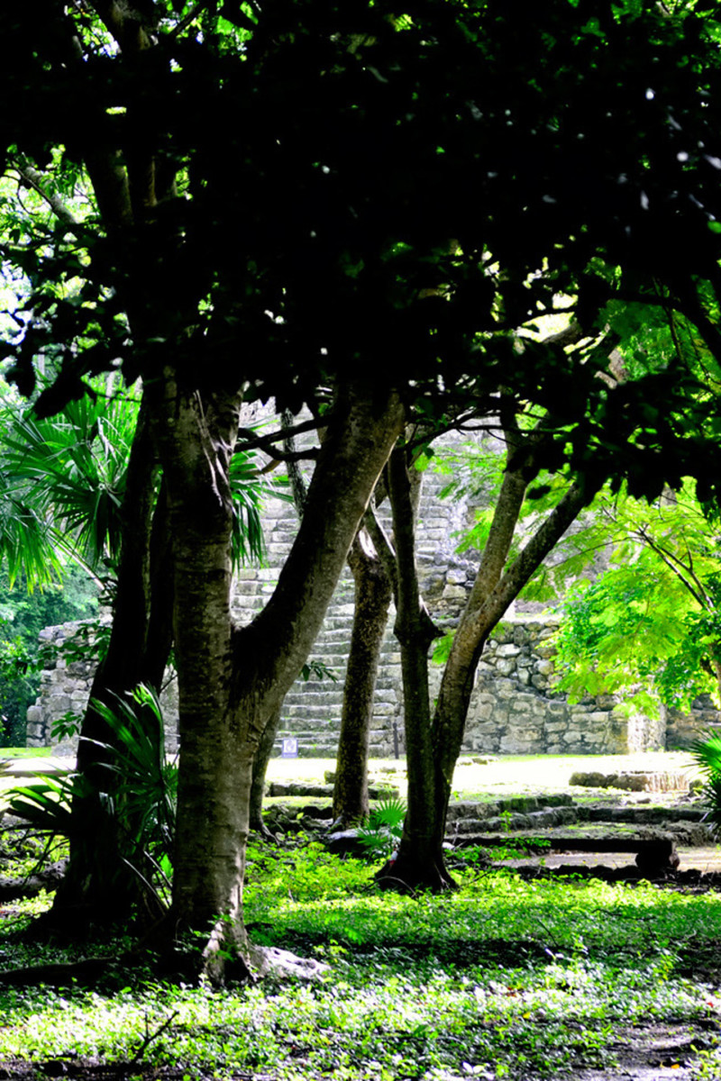
We wound our way through the forest on a well defined path,
and after five or ten minutes we approached a large clearing.
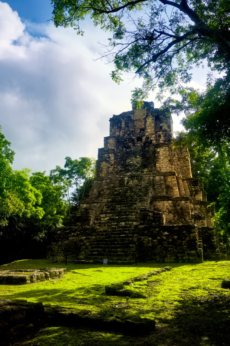
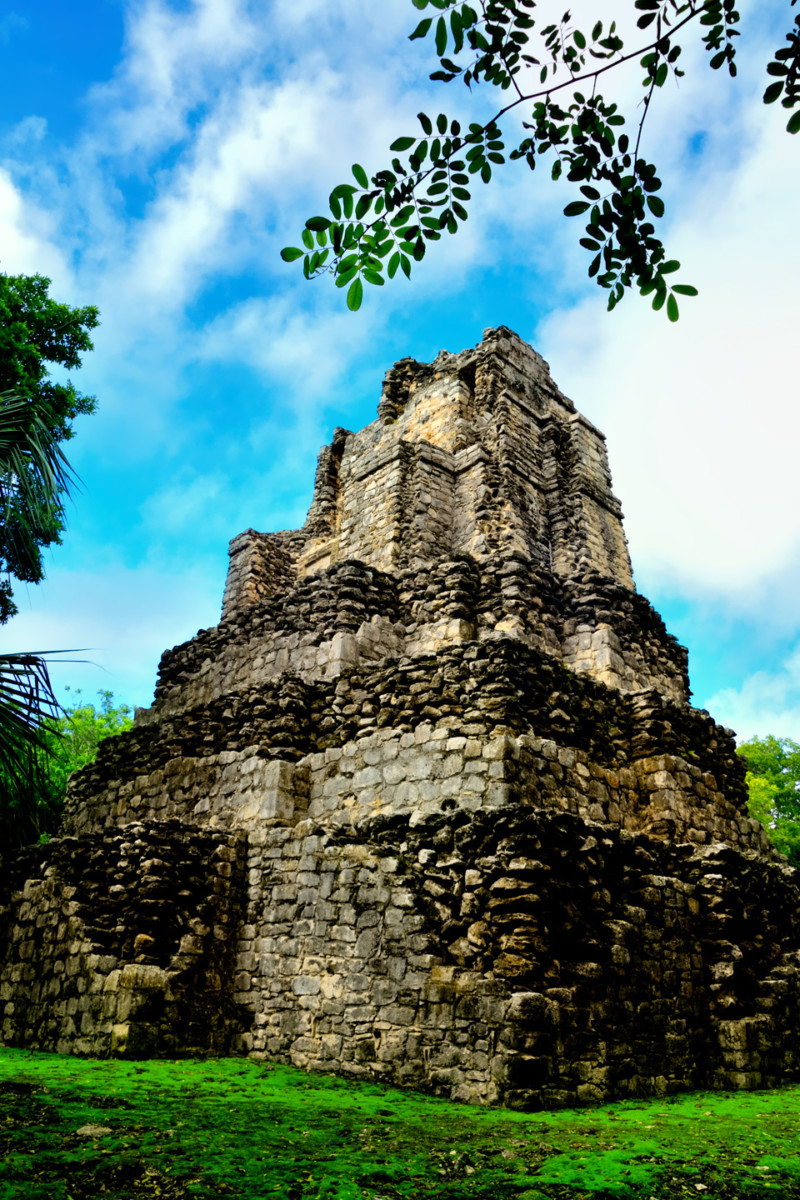
Muyil’s largest structure is the Castillo, a tiered pyramid built of stacked stones mortared together. When viewed from the front side, it’s much like the Peten style pyramids of Tikal.
Rising up above the tree tops, this five-tiered stone pyramid was impressive! The painted stucco that once smoothed the exterior is long gone, along with at least half of the carved and fitted facing stones. What’s left, at least on the back side, is clearly exposed as a very large pile of rocks.
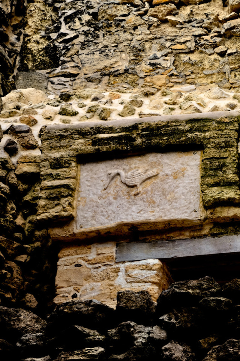
Near the top there were two stone panels with birds–herons–carved in relief. The caretaker was quite proud of these, as they were newly installed reproductions that he considered “much nicer” than the originals.
Officially, the pyramid is Structure 8-I-13, often referred to as the Castillo, the Castle. It’s not huge, as pyramids go, topping out at just over 50 feet, but it’s definitely imposing. Try to imagine: the equivalent of a five story building, with a three story grand staircase, just appearing, out in the middle of nowhere? Boo-yah!
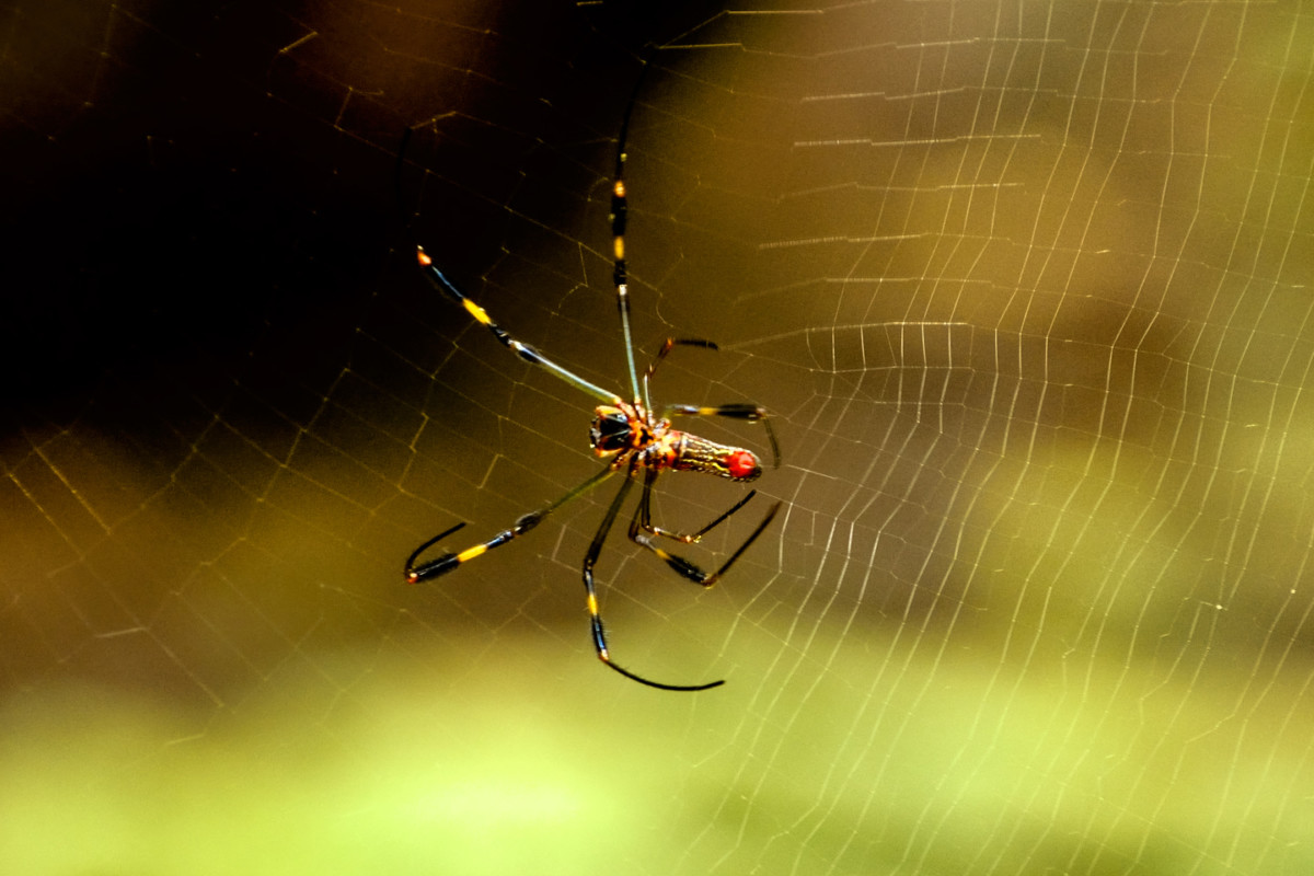
Continuing along the path was like hiking in deep jungle, but there was an incongruous, almost continuous rumble as the trucks passing on the nearby highway hit a downgrade, and applied their engine brakes. (BRUUMMM-bum-bum-BRR-A-A-A-P-P-P!) Mike was filming with his Go-Pro camera while we walked, and came within an inch of smacking face first into a barely visible silken web strung across the path at eye level.
The spider was a golden orb-weaver, known for huge, complicated webs; fortunately for us, this one was a dude. The females of that same species are 80 times larger than the males–think, tarantula size. Nose to nose with one of those? No—just—no, but thanks, anyway.
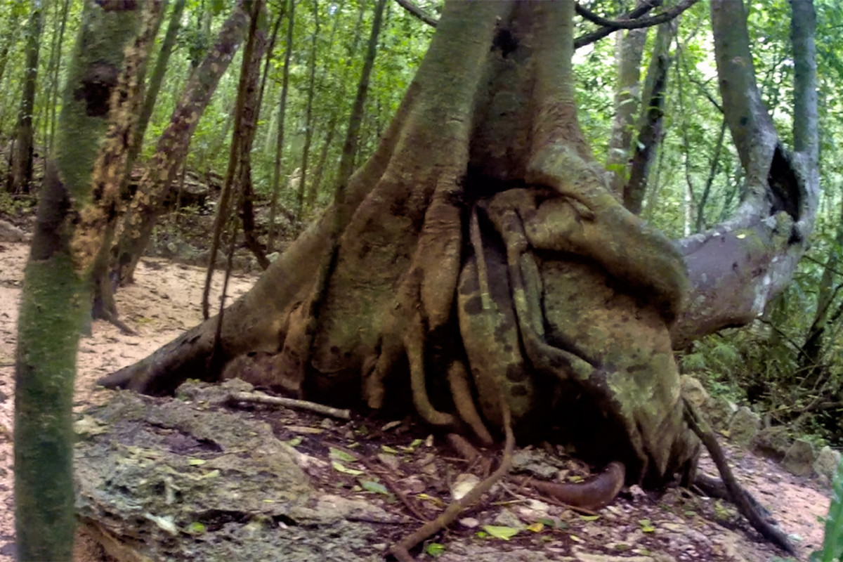
Strangler fig, with buttressed roots!
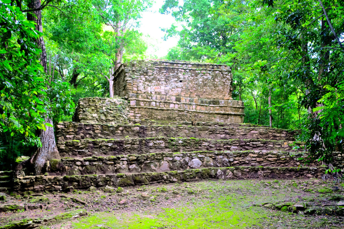
We kept going most of the way along the path, to Structure 9K-1, aka Temple 8, aka the Pink Palace; so called for the reddish tint of the stone;
According to the site map, there was another temple further ahead, at the ultimate end of the path, but right about then, the dark clouds that had been building since we arrived opened up and started POURING on us! Mike was well behind me, still viewing the world through his Go-Pro, so intently that he almost missed me when I came running toward him. “Let’s get out of here,” I shouted as I lumbered past, “Before we get soaked!” I used my raincoat to shield my cameras, leaving everything else exposed, so by the time we got back to the Jeep, I looked like I’d been showering with my clothes on.
Next up: Heading South on MX 307

 Reply With Quote
