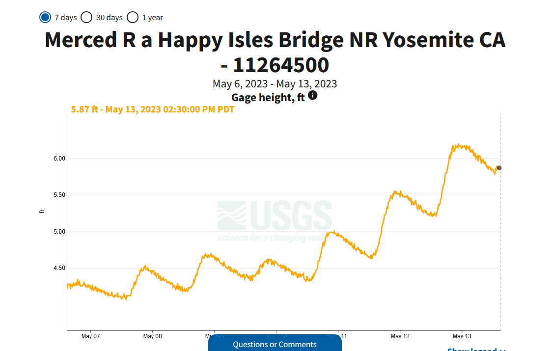
Yep, the melt seems to be getting underwayOriginally Posted by Mark Sedenquist

May 15th at 6:30 am PDT at the Happy Isles Bridge on Merced River in Yosemite NP

Before May 1st
Between May 1st and 7th
Between May 8th and 15th
Between May 16th and 23rd
Between May 24th and 31st
Between 1st June and 8th
Between June 9th and 16th
Between June 17th and 24th
Between June 25th and July 1st
After July 1st

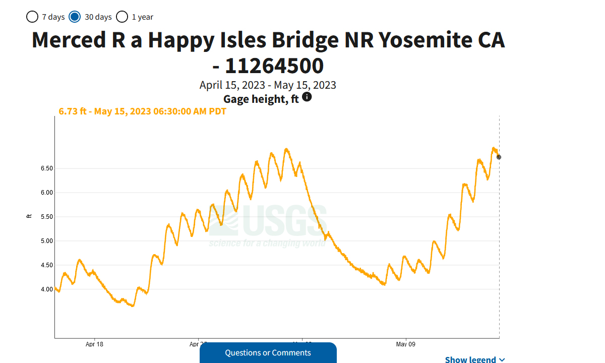
Yep, the melt seems to be getting underway
May 15th at 6:30 am PDT at the Happy Isles Bridge on Merced River in Yosemite NP

Yosemite Valley Flooding NPS
Also some great photos from Yosemite Facebook page.Alert 2, Severity closure, Yosemite Valley Flooding
Yosemite National Park is open. However, Housekeeping Camp and Lower and North Pines Campgrounds are closed. Additional closures are possible. We plan to announce any additional closures two days in advance.
If you are planning to visit Yosemite I would recommend checking for latest conditions before travelling.
Dave.
The pictures say it all -- wow. Thanks for sharing those. We just met with a lot of folks last night who also live here in MO, and are from California. Several still have family back there and were saying how much different it is with dry rivers now having moving water!
Donna
I made my first trip in almost a year on US-395 on the East side of the Sierra, between South Lake Tahoe and Mammoth Wed/Thurs 5/10-11. I drove past closed Tioga and Sonora Passes,
6702TiogaSign.jpg
and unusual for so late in the Spring, closed Monitor Pass, which does not really save me any time and misses less expensive gas in Gardnerville, NV. Monitor has since re-opened. See https://sierrarecmagazine.com/caltra...ass-on-may-12/
I skied Mammoth 5/10-11, then Kirkwood on my way back to San Jose on 5/12. Kirkwood ended daily operations April 30, then re-opened for Friday to Sunday 5/5-7 and 5/12-14. A lot of snow remains above Carson Spur, CA-88 about a mile W of Kirkwood.
6722CarsonSpur.jpg
Mammoth plans to have skiing through July 31. Photo of me taken by friend on 5/10. Top of mountain is about 11,000'
IMG_2418a.jpg
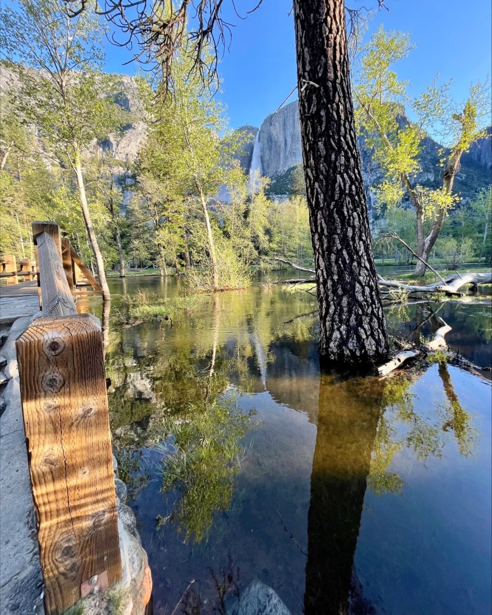
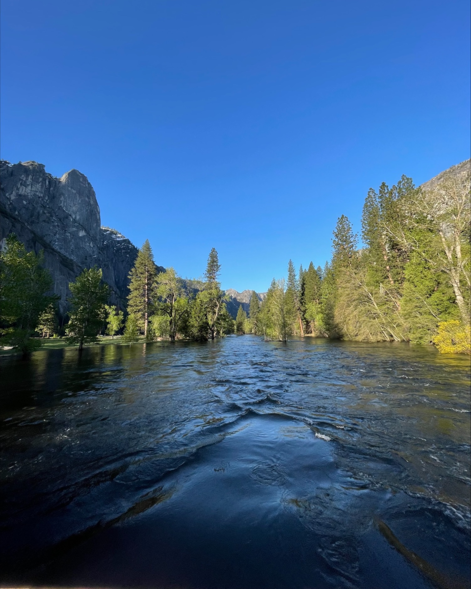
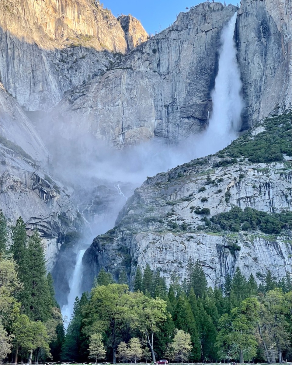
Given the water levels in the meadows, I figured that the Merced River HAD to be deeper in other places. Sure enough. This is from the Pohono Bridge in the park:
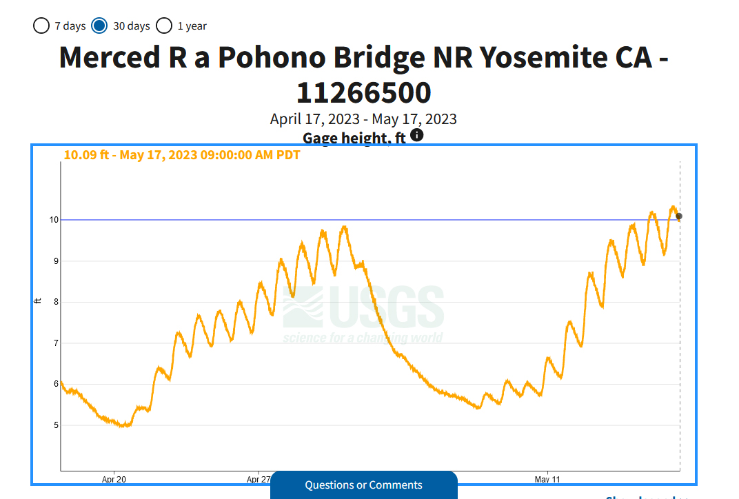
May 17th at 9:00 am PDT
My goodness, that is a lot of snow. Open to July 31st!
That's amazing.
Thanks for sharing the news.
Mark
The gauge at Pohono Bridge went over 12-ft a couple of hours ago. I am trying to remember how that bridge works -- but it seems like 12-feet must be over the road by now. Does anyone remember or know?

 RoadTrip Guru & Enthusiast
https://water.weather.gov/ahps2/hydr...=pohc1&wfo=hnx
23.45 Flood of record...1/3/97. $178 million damage to Yosemite Valley.
12.5 Northside Drive and Southside Drive, which are the main roads in Yosemite Valley, become flooded and are closed to traffic.
10 Western portion of North Pines Campground located at the east end of Yosemite Valley between the confluence of the Merced River and Tenaya Creek begins to flood. Water rises to the base of the swinging bridge downstream from Chapel Meadow.
9.5 Portion of Lower Pines Campground becomes flooded. Limited site-specific evacuations begin at Housekeeping Camp located along the south-facing bank of the Merced River. (Upstream from Sentinel Bridge and downstream from Stoneman Bridge)
9 Chapel Meadow (south side of river) and Cooks Meadow (north side of river) begins to experience overflow.
7 RIVER IS CLOSED TO RAFTERS AND FLOATATION.
6702TiogaSign.jpg
I don't think it's been mentioned here that 395 just N of Lee Vining was closed on Feb 26 due to a series of avalanches probably from slopes in my picture. CalTrans started escorting vehicles through avalanche closure area during limited hours on Mar 23 and 395 was open without escort on Apr 7. This turned 2 hr drive from Minden, NV to Mammoth into 5 hrs.
Another unusual closure is 120 E of Lee Vining to Benton Hot Spring remains closed. If you want to go from Lee Vining to Benton or Tonopah, you need to go down to Bishop, adding many miles and more than 30 minutes to your trip.
See https://dot.ca.gov/caltrans-near-me/...ergency-repair for details on both closure.
Last edited by Mark Sedenquist; 05-27-2023 at 06:21 PM.
Yes I saw pictures of Lee Vining and there were significant amounts of snow along the roadsides. Thanks for the updates on the Eastern end of CA120 towards Benton Hot springs. The good news is that following April 1st surveys they predict Mono lake will rise by 5.5 feet during 2023 which is great for the habitat.
Dave.
 Posting Permissions

 Reply With Quote