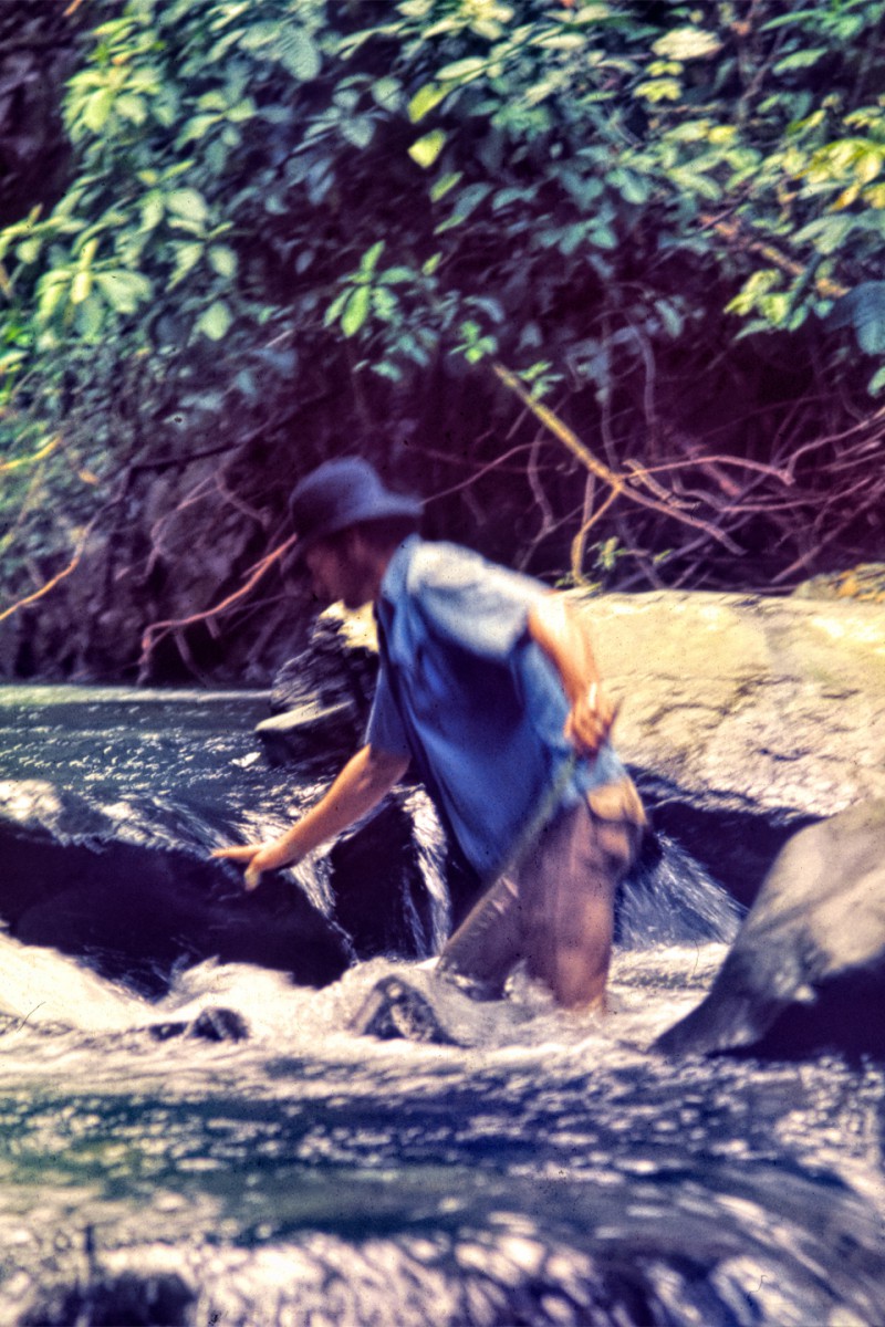
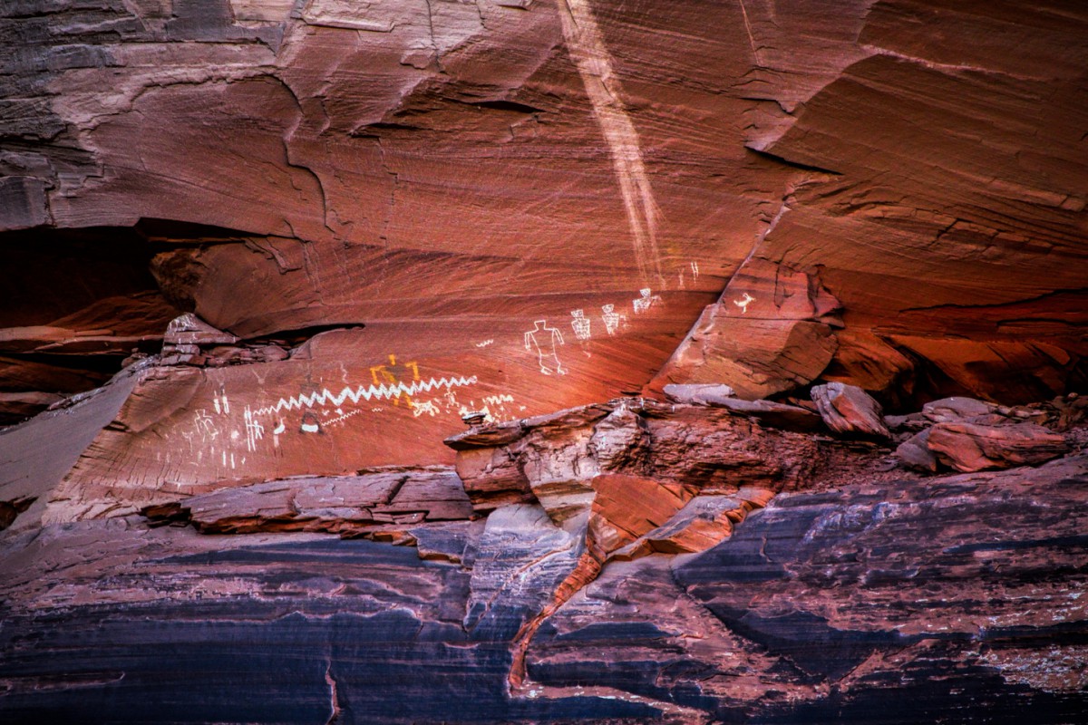
Another one from Nevada:
(Photo credit: Base Camp Las Vegas/Deborah Wall)
Elevation is 5100 feet
It is thought that dotted line could be a calendar or perhaps a time line.
And a clue about the access:
(Photo credit: Base Camp Las Vegas/Deborah Wall)


Another one from Nevada:
(Photo credit: Base Camp Las Vegas/Deborah Wall)
Elevation is 5100 feet
It is thought that dotted line could be a calendar or perhaps a time line.
And a clue about the access:
(Photo credit: Base Camp Las Vegas/Deborah Wall)

Originally Posted by Mark Sedenquist

All these wonderful places I have NOT been to! The Photo credit of Las Vegas being the base camp helped locate it with google. Those petroglphys sure look white. The closest I've been was when we were looking for aliens on their special highway. I must say searching for these has lead me to so many new places I'm going to have to explore!
Utahtea

I'd best disqualify myself, since I have a well-thumbed copy of Basecamp Las Vegas. Flipping through it again just now, I was reminded of what a truly beautiful book it is. Sue Campbell's work on the design is instantly recognizable; as good as it gets! (Though I may be biased, since her design work on my book won a national award!) There's plenty of stuff that's of interest in that book, even for people like me who are no longer avid hikers, and despite the title, it covers a territory that goes well beyond the Las Vegas area. It's really good stuff!
Anyway that calendar/timeline looks a bit like a railroad track. Whenever I see something really different, like this thing, I have to wonder if it's the same age as the rest of the petroglyphs in the panel. (Just sayin')
Let's see if someone else can identify the location.
Rick
Since no one else has ventured a guess I'm gong to spill the beans.
This is White River Narrows petroglyphs and it is about 150 miles north of Las Vegas. I've never been, but we were close when we did the Extraterrestrial highway (Hwy 375) in Nevada a couple of times. Now I plan to make it a destination!
Utahtea
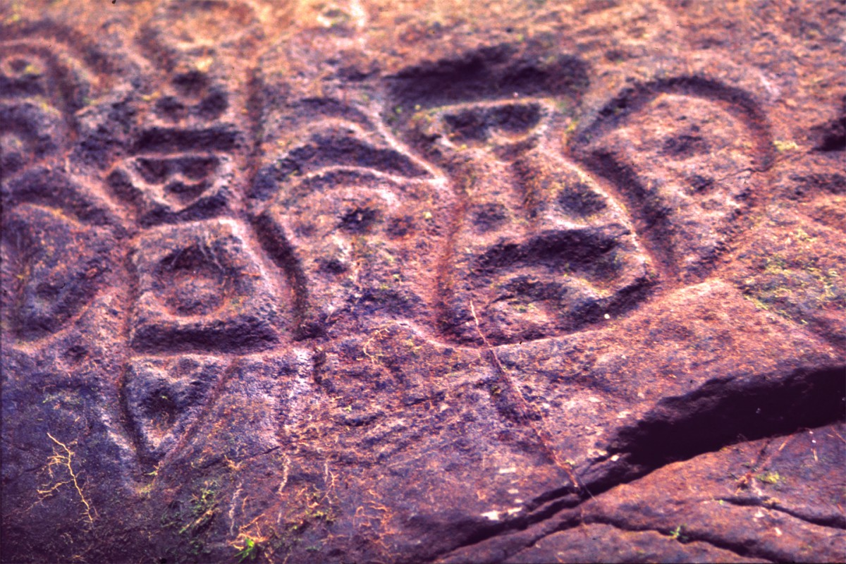
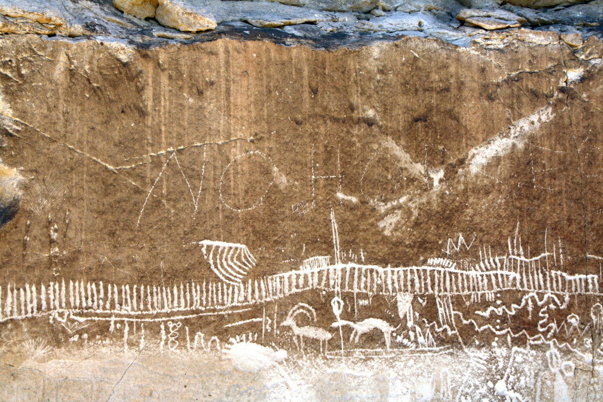
Next is a fascinating selection of petroglyphs that they do believe have significant meaning. It is not far off a major Interstate. The road to the area was paved around 2015.
The V shape petroglphy has a nick name of a common item that wasn't invented until the late 1800's.
This area is just filled with wonderful petroglphys! This is just a small sample!
My HINT picture. You have to figure out what it represents.
Do you know the name of these petroglphys?
Bonus points for naming the V shaped one!
Extra credit for what's near by!
Utahtea
The V-shaped thing looks like a cotter pin. Or maybe a clothes pin, but there aren't any petroglyphs (that I could find) named after any kind of pin, so I took a closer look at the V-shaped thing and noticed the little teeth on it. Kind of like a Zipper! Aha! These, then, are the Parowan Gap Petroglyphs, and the V, which was probably related to astronomical observations, is commonly known as: The Zipper! The site is close to I-15. On the way to the petroglyphs you'll pass some Dinosaur tracks? (I'm not sure that last is what you're looking for; I don't actually know this area at all!)
Rick
Rick,
Correct on all accounts! I gave to many good clues! ;)
The dinosaur tracks area is well marked on the road and just a little ways from the Parowan Gap Petroglyphs. What is interesting about these dinosaur tracks, they are natural cast or as I call them "outies" instead of foot print tracks that most people have seen.
Utahtea
That is such an outstanding panel.
Thanks for sharing the image!
Mark
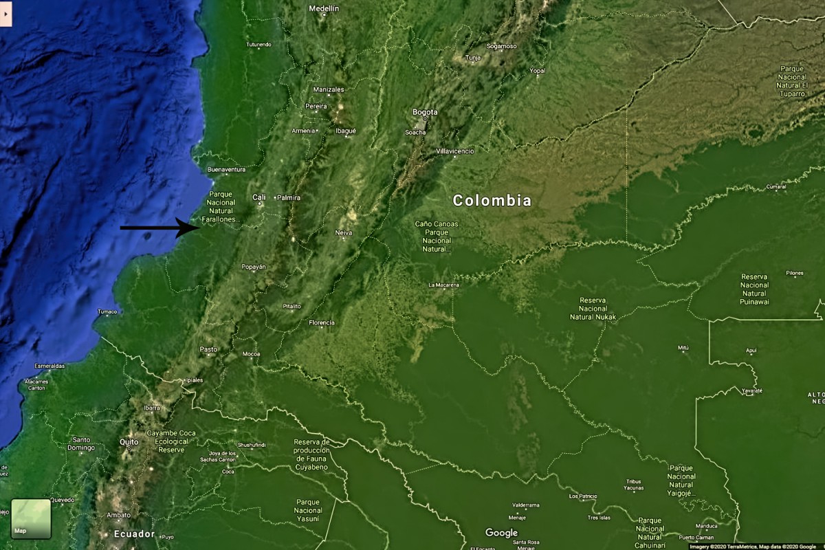
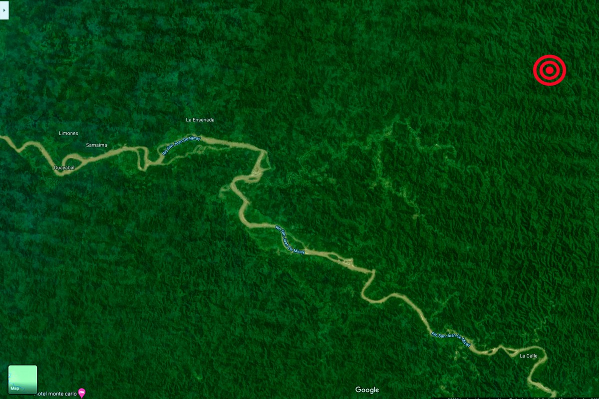
This next set of petroglyphs has quite a story attached. I won’t make you guess the location. In fact, I’ll even show you a map pinpointing just exactly where they were, because the location is a crucial component of the tale I’m about to tell, and to the best of my knowledge, this is the first time that any photos of these particular petroglyphs have ever been published by anyone, anywhere, in any format.
Toward the end of 1971, almost 50 years ago, I was a student at Antioch College, working toward a degree in Anthropology, with a special emphasis on the Andean cultures of South America. Antioch is in Ohio, but during my final year, I took advantage of a program that allowed me to complete my studies independently. I gave them two proposals, a plan A, which involved an expedition into the heart of a wild Colombian rain forest, and in case that didn't work out, I had a plan B, a safer but probably less exciting archaeological study on Colombia's Caribbean coast. They provided me with an academic advisor on the faculty of the University of the Andes in Bogota, Colombia, and I embarked on a course of independent field studies that played out like the script of an adventure movie, ten years before the debut of Indiana Jones.
Why Colombia? The mere mention of that country conjures images of Pablo Escobar and the drug cartels, and the violent guerrilla wars that have plagued that region for decades. Most travelers give Colombia a wide berth, for all the good reasons stated, but back in my day, none of that stuff had happened yet. In the early ‘70’s, there was actually a lull between the guerrilla wars, and Pablo Escobar was still a second-rate car thief in his home town of Medellin. Cocaine wasn’t even a thing yet in the United States, so there were no drug cartels, and coffee was still Colombia’s number one export (just ahead of bananas). The Colombia that I knew back in those days was a peaceful, yet tremendously exciting place to be, raw, untamed, and overflowing with potential.
I knew a guy down there; I’ll call him Paul. He was a very sketchy character, a burly ex-Marine with “unresolved legal issues” that were keeping him in semi-permanent exile outside the United States. Paul fancied himself to be a treasure hunter, and in his world view, undisturbed archeological sites were in the same category as buried pirate loot. Being on the academic side of the pot-hunting equation, I obviously couldn’t condone that kind of an attitude. In fact, we had heated arguments about it, but I was nevertheless intrigued by what Paul was doing, so I tagged along on some of his digs, and we became the unlikeliest of friends.
The petroglyphs were an accidental discovery, not at all what we were looking for, and because they didn’t fit within the parameters of my project, they were never even mentioned in the written report that secured my degree. When I look back on it now, from the safety of a perch that’s many thousands of miles away and half a century into the future, I can see it all much more clearly. In fact, I can sum up the entire experience in two words:
Holy crap!
The whole thing started in the bar of the Hotel Del Caribe, which, at the time, was the fanciest watering hole in Cartagena, the charming Spanish colonial city on Colombia’s Caribbean coast. Paul and I had just finished a successful dig and we were knocking back a few beers by way of celebration when a guy walked in, wearing a white linen suit straight out of a Humphrey Bogart movie, with a knockout brunette on his arm. Paul couldn’t stop himself from staring when they walked by, and he was being so obvious about it, I was afraid Mr. Linen Suit was going to do something regrettable. Thing was, Paul wasn’t even staring at the girl. He was staring at her jewelry: she was wearing a gold chain around her neck, and dangling from that chain was a raw gold nugget the size of a hen’s egg, obviously real, and obviously heavy.
After they sat down and ordered drinks, Paul walked over and introduced himself. Two hours, and half a dozen rounds later, we bid the tipsy couple good evening, and walked away with a prize: the proverbial cocktail napkin, straight out of Tales of the Gold Monkey. On one side, our new friend had drawn a map, and on the other side, he’d written a brief letter of introduction addressed to one “El Manco,” a one-eyed, one-armed half-breed homesteader who lived in the middle of the wettest jungle in the world, and made his living panning for gold. (I’m not kidding about any if this! There’s no way I could ever make this stuff up!)
Mr. Linen Suit was an American, and the woman was his Colombian wife. He was a gold miner, and he’d found that nugget, along with quite a few more, while working a portable dredge in the mountainous jungles just inland from Colombia’s Pacific coast. He had recently pulled up stakes after the authorities caught wind of his operation and demanded unreasonable tribute. That was a shame, because he’d been doing very well, and the area was still essentially untapped.
Paul, not wanting to be outdone, bragged about some of his own exploits, how he’d been digging up gold artifacts and valuable ceramics from ancient burials. Linen Suit reached into his jacket pocket and pulled out a small bundle, which he unwrapped and handed to us. There in the creased folds of a silk handkerchief were a half dozen primitive fish hooks, and some fragments of what must have been a larger ornament, all fashioned from pure gold. We asked where he’d gotten them. Seems there was a small settlement near the place he’d been dredging, four families eking out a meager living on the outer fringe of the Colombian frontier. The men in the settlement all worked for Linen Suit during his time in the area, and, inspired by what he was finding with his dredge, they spent their spare time panning gold by hand in nearby streams. One of those men, the aforementioned El Manco, had panned out the fish hooks and a variety of other man-made objects from a place they called the Quebrada de los Indios, Indian Creek. The cocktail napkin would take us to El Manco, and El Manco would take us to the place where he’d found those little treasures. What we hoped to find, in a perfect world, was the place where the treasures had originated.
Colombia’s Pacific coast has to be one of the world’s least inviting stretches of shoreline. Hundreds of miles of mangrove swamp, backed by impenetrable jungle. There are no roads, few settlements, and only one port of any significance: Buenaventura, which is located in a stinking, swampy estuary that floods at high tide. The city is widely considered the armpit of civilization (though sometimes, a different body part is cited for the comparison); prone to pestilence and rife with violent crime--even back in those relatively calm and peaceful good old days. If we were actually going to do this thing, Buenaventura would be the jumping off point, and from there, we’d be heading into territory that had never even been mapped!
The whole business was beginning to look dangerously complicated, so we decided it might be best to seek advice from someone who had done that sort of thing before. Paul had another friend, a guy named Jaime who was an antiquities dealer in the city of Cali, which is quite close to Buenaventura. We flew down there and met him at his opulent home, which was more a museum than a house, filled near to bursting with some of the most extraordinary ceramic artifacts I’ve ever seen; the best of his personal collection, which he was all too eager to show off. We told him the general outline of what we were hoping to do, and he was immediately intrigued; so much so that he agreed to help us in any way that he could, but only on the condition that he be allowed to join us, along with his bodyguard, an affable young guy named Gustavo.
It took the best part of a month to make all the arrangements. For me, that involved a quick trip back to Ohio, and some long conversations with the Antioch Abroad people, who helped me with all the paperwork hurdles required for me to get actual academic credit for a proposal that raised more than a few eyebrows. All of that worked out, and by the time we were all assembled on the stinking Buenaventura waterfront (the whole place positively reeked of dead fish and swamp gas), we had added a fifth member to our expedition: Ed, a random guy who had been staying at Paul’s place in Bogota, and decided to join us “just for the heck of it.” We hired a shallow draft open boat for the first leg of the journey, two full days motoring south through the mangroves to the mouth of the San Juan de Micay river, and then up the river to a place called Puerto Lopez. It was raining buckets the whole time we were there, but the local folk (all four dozen of them) appeared to be quite used to it. I found out later that this tiny hamlet on the bend of that obscure river has the distinction of being the rainiest inhabited place on planet earth, receiving in excess of 400 inches in an average year!
The place we had to go from there wasn’t a whole lot drier. We transferred to pair of dugout canoes, of the sort that will sink straight to the bottom if you so much as lean too far to the left or right—as Ed found out the hard way. We traveled up creeks so dense with vegetation that they couldn’t use their paddles, they had to use long poles, literally shoving us through the tangle. We stayed the night sleeping in hammocks on the porch of a settler’s house that was built in a tree, high above the riverbank. After a second day in the canoes, we finally arrived in San Francisco, the tiny settlement that had been Linen Suit’s base of operations. El Manco was easy enough to find. He was thrilled to receive word from his former boss, and more than happy to guide us to the Quebrada de los Indios.
Our expedition, from that point, lasted another week. I mentioned that there were no roads? There were no trails, either, so the only way to travel any distance was by walking in the creeks.
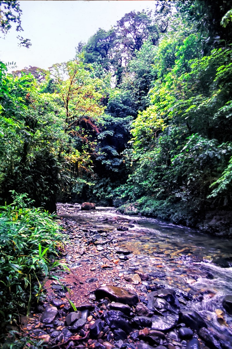
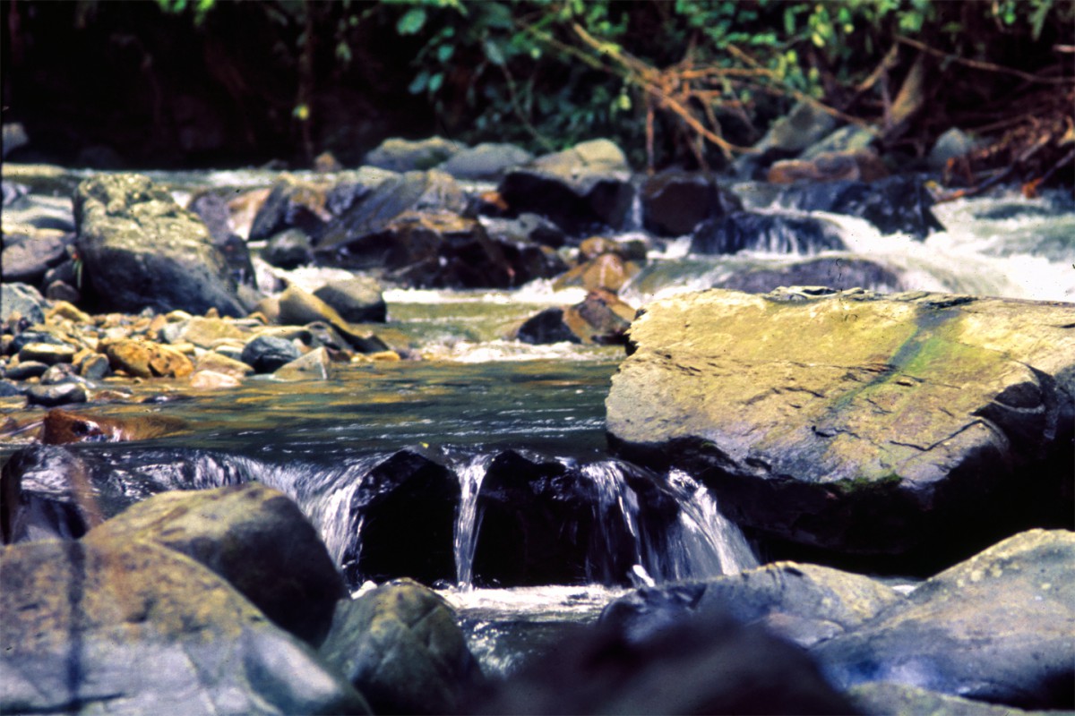
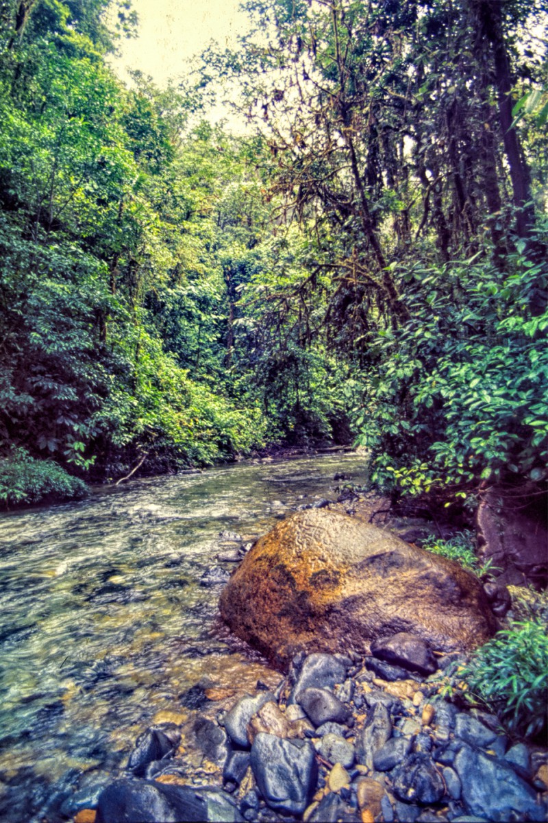
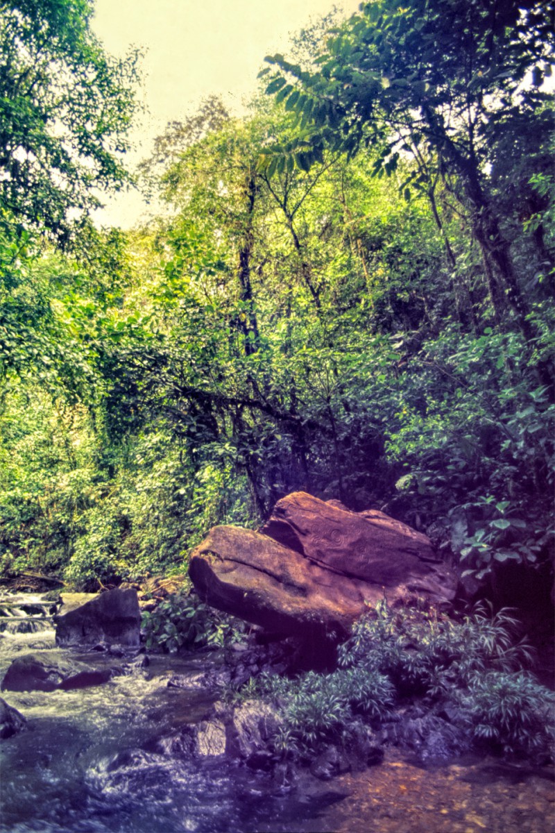
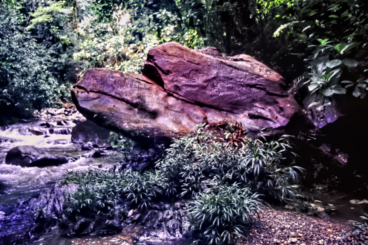
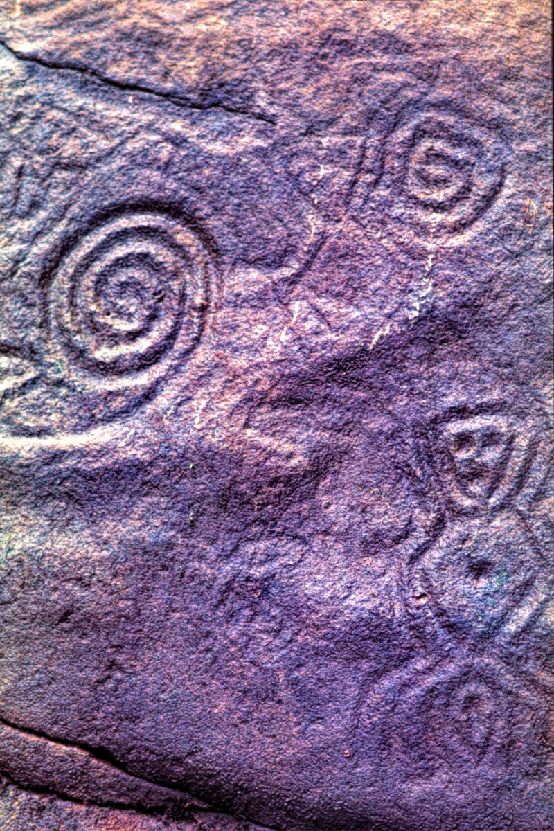
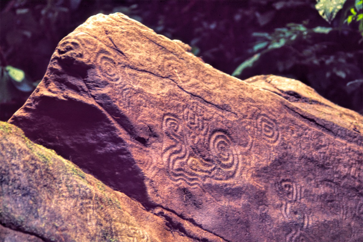
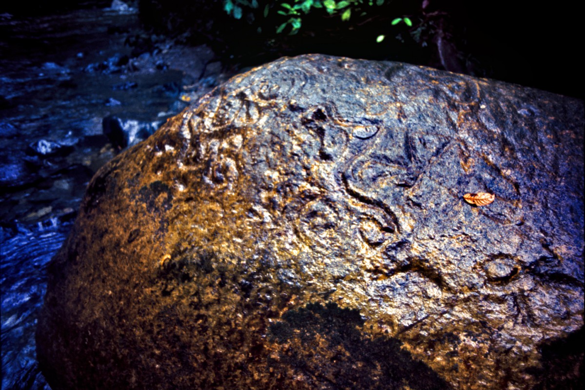
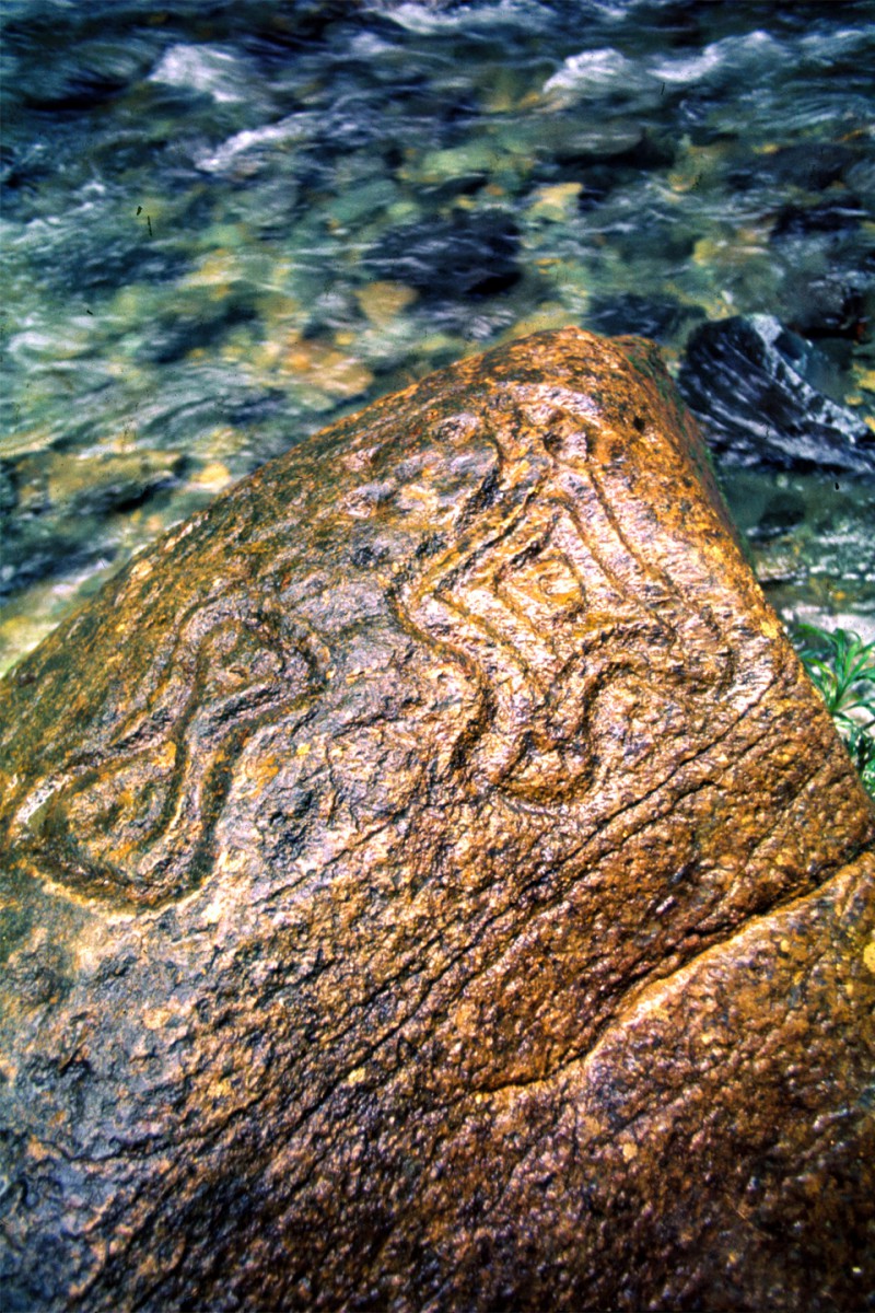
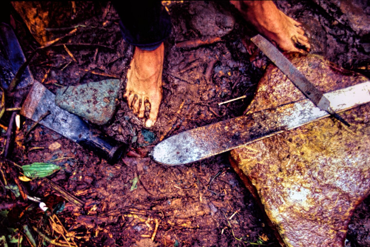
Usually the water was up to our knees. Sometimes, it was all the way up to our armpits, and we walked holding our gear high over our heads. At one point, I can remember inching sideways along the face of a cliff, where what little path there had been had crumbled away in a recent slide, but we got where we needed to go, thanks, in no small measure, to our remarkable one-eyed, one-armed guide. We searched hard, we really did, but we did not find any ruins, or artifacts, or any hard evidence that there had ever been any permanent human settlement in the vicinity of this blank spot on the map. What we did find, much to our delighted surprise, was a dozen or so large rocks that had been carved with symbols, depictions of serpents and monkeys, spirals, hollows, and deep, deep grooves.
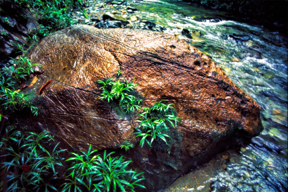
Our guides knew about some of the carvings. That’s the reason they chose this spot for us to set up our camp, but the best carvings were on a large boulder that was, when we came upon it, completely covered in a thick layer of moss. When we peeled back that moss, revealing these symbols for the first time, probably in hundreds of years?
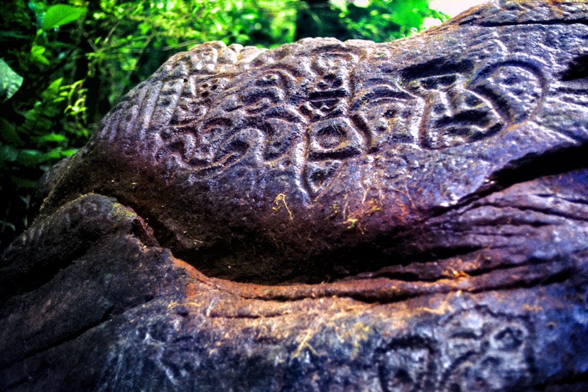
The boulder had what appeared to be a face carved into it, almost like the prow of a ship!
And then there was the back side of that same boulder:
There were more carved boulders on both sides of the creek, representing—what?
I’ll tell you, from that experience, I can honestly say that I know what it’s like to be the first person to discover something totally cool. These are not the sort of petroglyphs we see in the southwest. These things were carved deeply into hard stone, without the benefit of metal tools; a process that had to require an enormous amount of effort, and more than a little time. This area is still a blank on the map, both geographically, and historically. We caught a glimpse, just a peek, at something that happened there in the distant past, for reasons we’ll probably never know.
We suffered on that trip; a bunch of city dwellers, woefully unprepared for the intensity of that place. It was like camping under a waterfall; everything was wet, all the time, (with the possible exception of my precious Nikon F, with which I took these pictures). We had jaguars in the camp at night, huffing around the tents and leaving muddy footprints. We had snakes. We had bugs that were the stuff of nightmares, and we ran out of edible food. Ultimately, El Manco came back for us, and guided us back out, then transferred us into canoes like so much sullen baggage. We made the journey down the river and through the mangroves in shell-shocked silence; it was all so familiar, the simple reverse of the trip we’d made less than ten days before, though it seemed a whole lifetime had passed. There’s something about the deepest jungles that drains the spirit of civilized men. Such a chaotic profusion of life and death can be more than a little overwhelming.
Back in Bogota, I consulted with my advisor at the University of the Andes, and we concluded that even though my trip to the jungle was exciting, there wasn’t enough meat to it to warrant a full semester’s worth of academic credit. That left me with a choice: go back to the jungle and search out more of those petroglyphs, or run with Plan B: the survey of the archaeological site on the Caribbean coast. This was a major site that hadn’t been studied (at all) by anyone; I knew about it, because I'd been on a dig there with my buddy Paul. Plan B came with a beach house on a beautiful bay so isolated it was practically a private paradise. Needless to say, I ran with Plan B, but that’s another story altogether, for another time.
Last edited by Rick Quinn; 05-28-2020 at 06:48 AM.
I reckon I got a little bit off-topic with that last one, though I must admit that it was fun (for me, at least) to resurrect those old photographs, and weave together my memories of that long ago adventure.
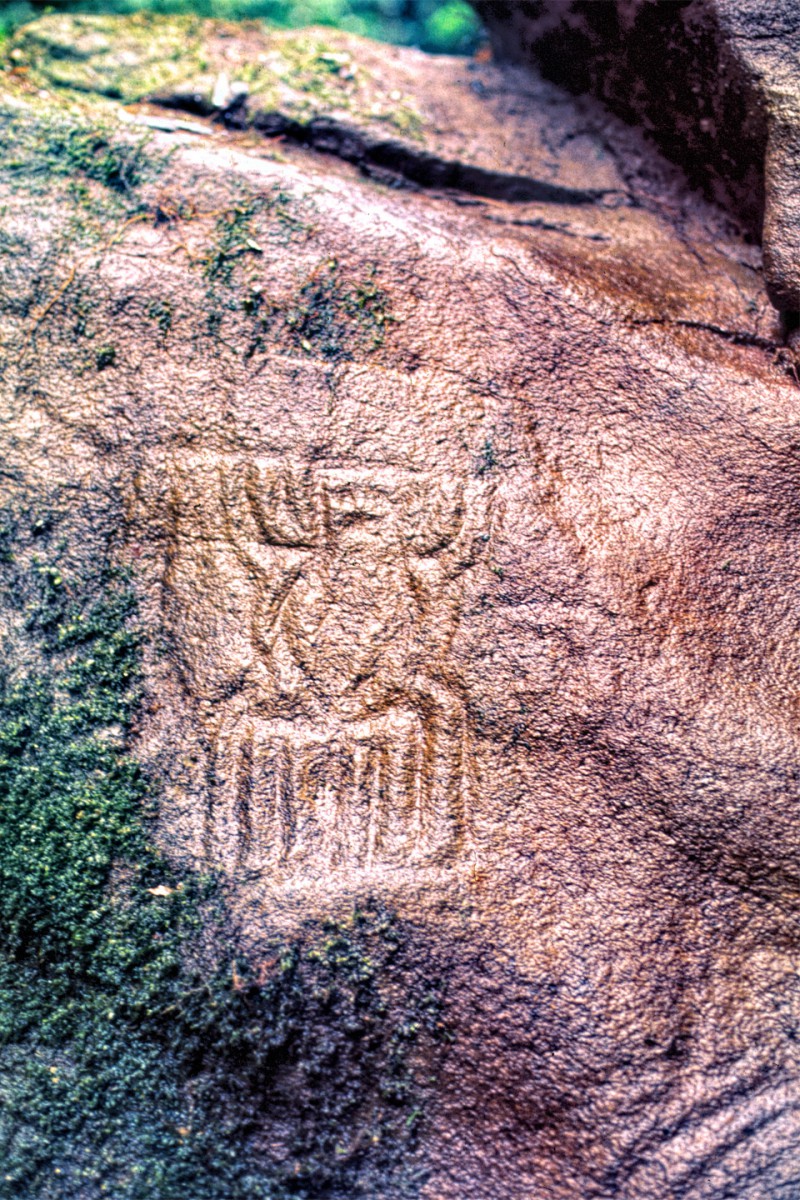
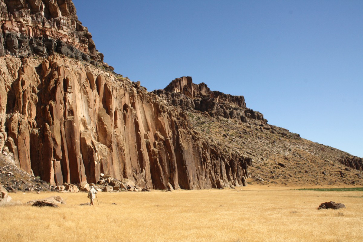
There was a time, not so very long ago, when the Western U.S. was every bit as wild, and just as full of surprises as that Colombian rain forest. It must have been quite a thrill to be one of the real pioneers, the first to forge new routes to the west when practically the whole continent was unknown territory. The first Europeans to explore this next location would have had quite a lot to process. I wonder what they must have thought when they saw this next rock art panel?
Can you name this rock art, or identify the location?
Bonus points: your best guess as to what the heck is going in here!?
Rick
 Posting Permissions

 Reply With Quote