Page 1 of 3 123 LastLast
Results 1 to 10 of 22
  1. #1
    Join Date
    Mar 2016
    Location
    Phoenix, Arizona
    Posts
    808

    Default Into the Heart of the Grand Canyon

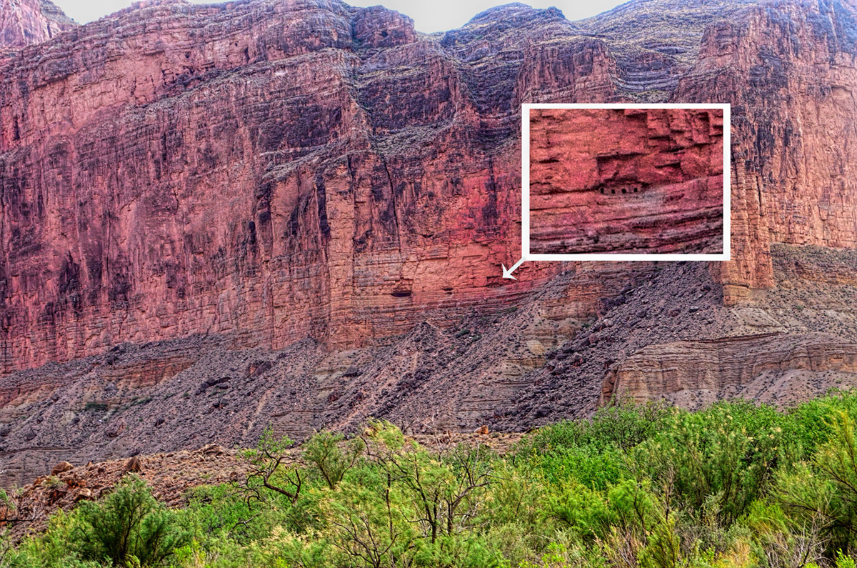
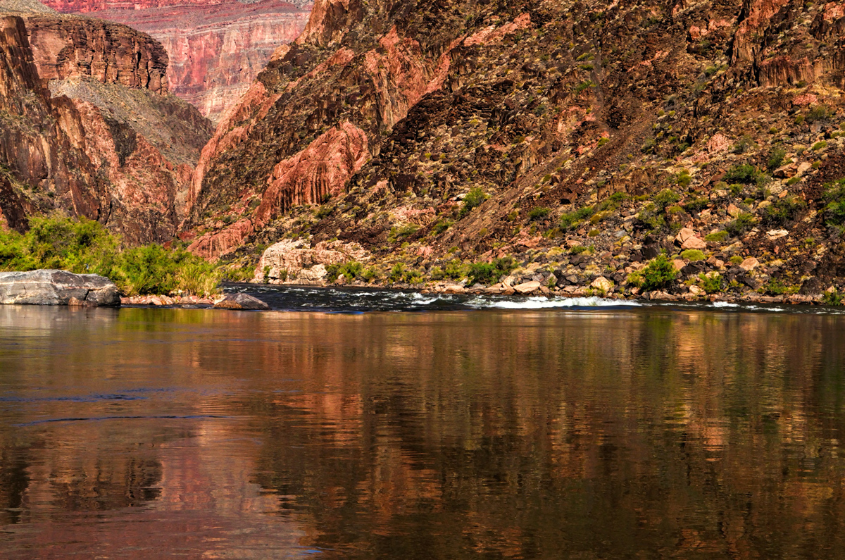
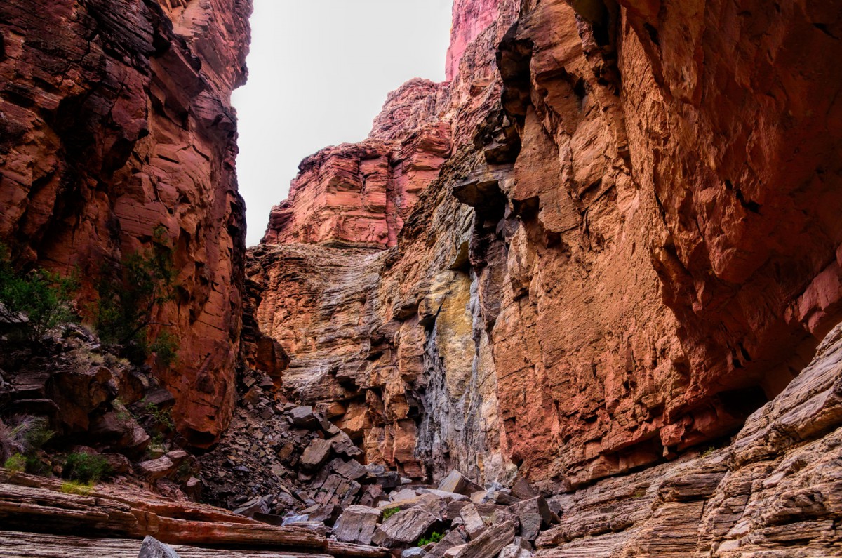
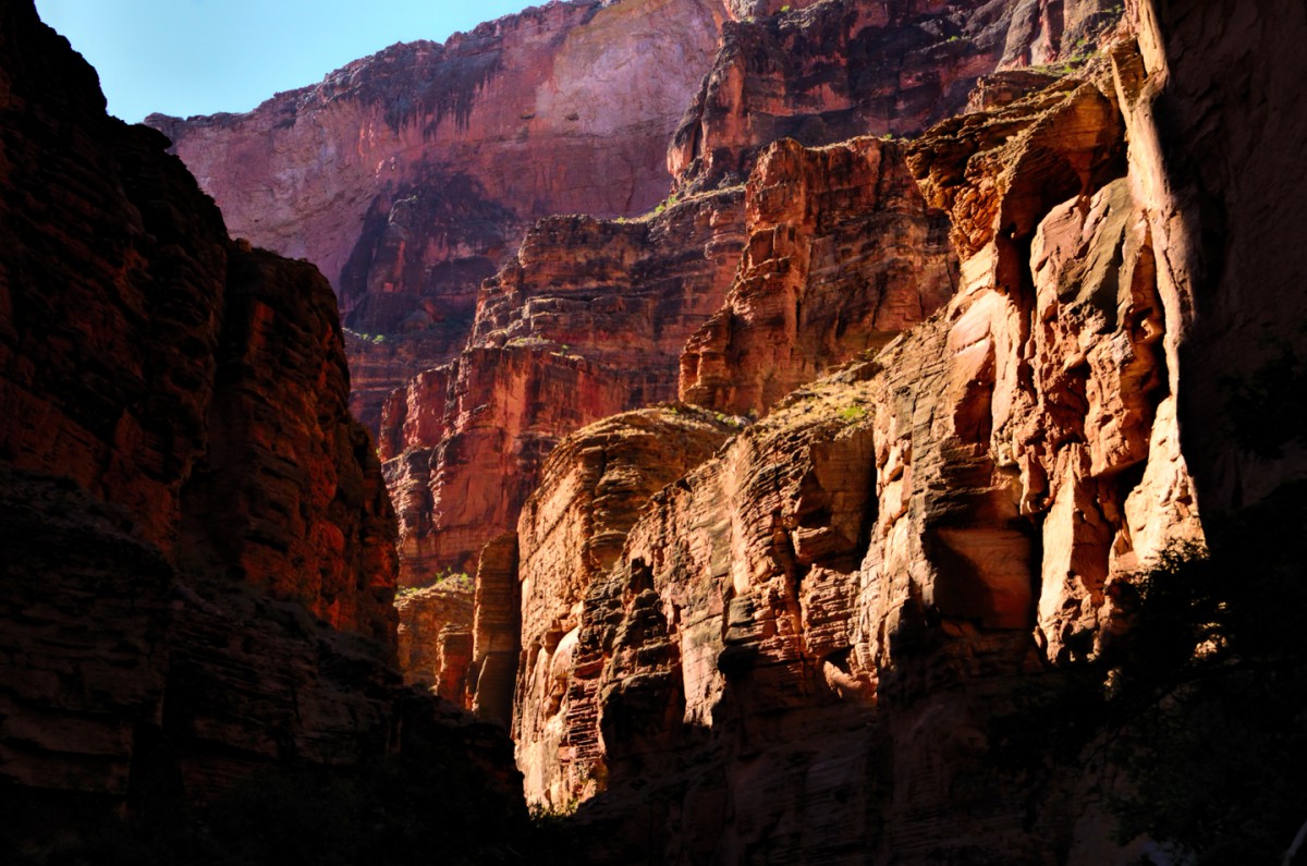
    There are hundreds (if not thousands) of posts on this forum that mention the Grand Canyon. It’s one of the most popular Road Trip destinations in the U.S., if not on the entire planet, and it’s well deserving of all that praise and attention. The Grand Canyon is incomprehensibly huge: 277 miles long, 18 miles wide, and as much as a mile deep, filled with buttressed palaces of angular multi-colored stone, stacked in layers upon layers that ripple off into the distance, as far as the eye can see. It’s tough to wrap your head around anything quite that big, so most of the millions of people who see it every year don’t even try. To the typical visitor, the Grand Canyon is nothing but a spectacular panorama. They stop at one or more of the viewpoints on the north or south rim, marvel at the one-of-a-kind landscape, and take their photos. Then they drive away happy, because they’ve “done” the Grand Canyon.

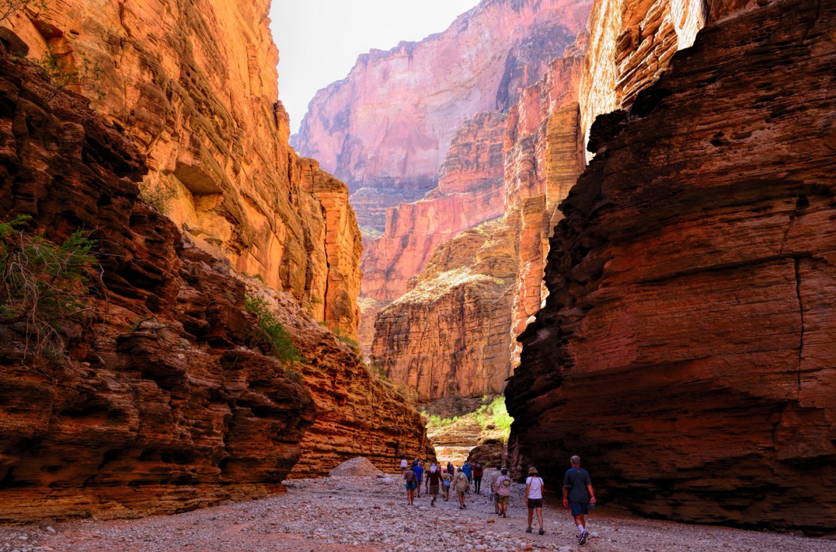
    Would it surprise you to hear that there’s quite a bit more to this certified wonder of the world than the sliver of a slice that’s visible from Mather Point, or Desert View, or Point Imperial, or any of those arbitrary spots along the rim roads where parking is provided? No need to answer that question; we all know that it’s true. There are many intrepid souls who explore the depths of the canyon on foot, following an extensive network of trails, but let’s face it, not everyone is physically capable of such a strenuous hike. What goes down must come back up, and that slog of a climb back up is a killer!

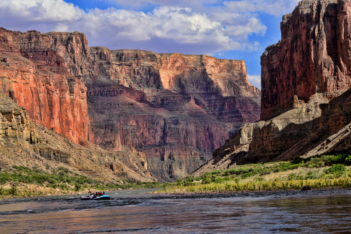
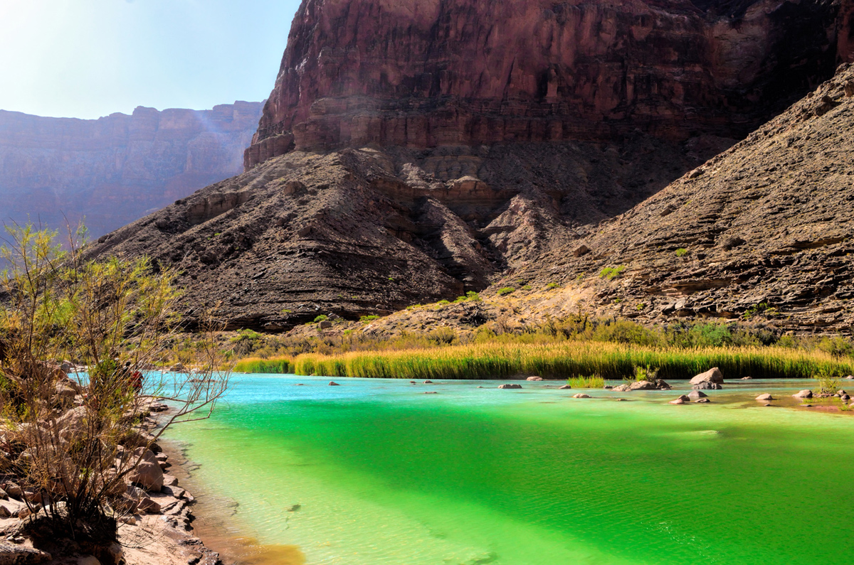
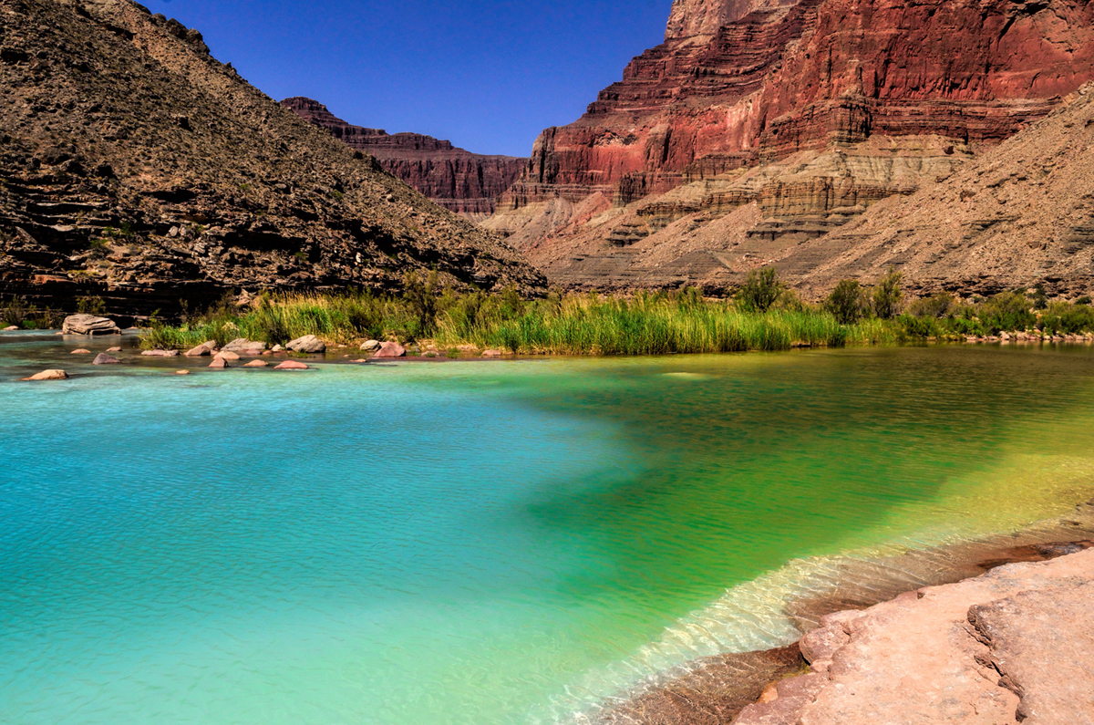
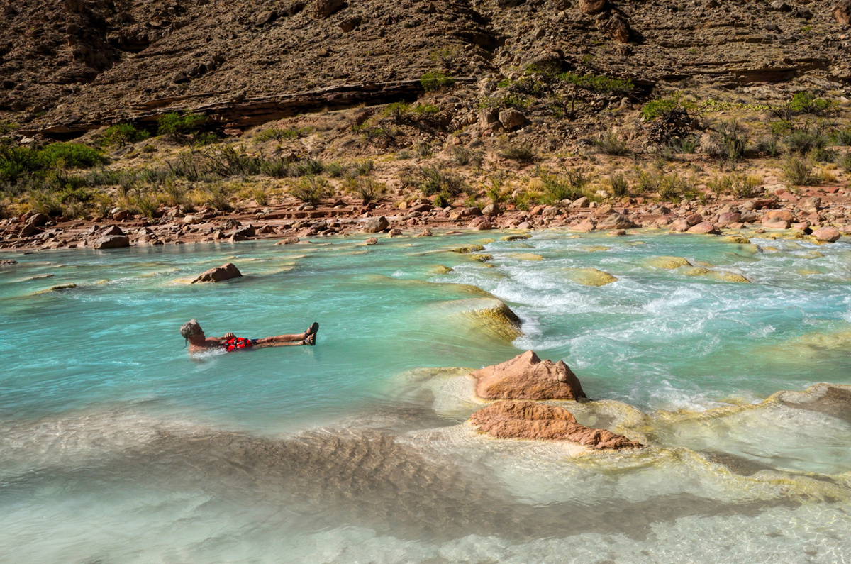
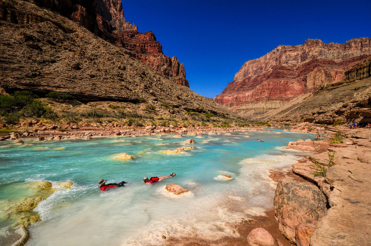
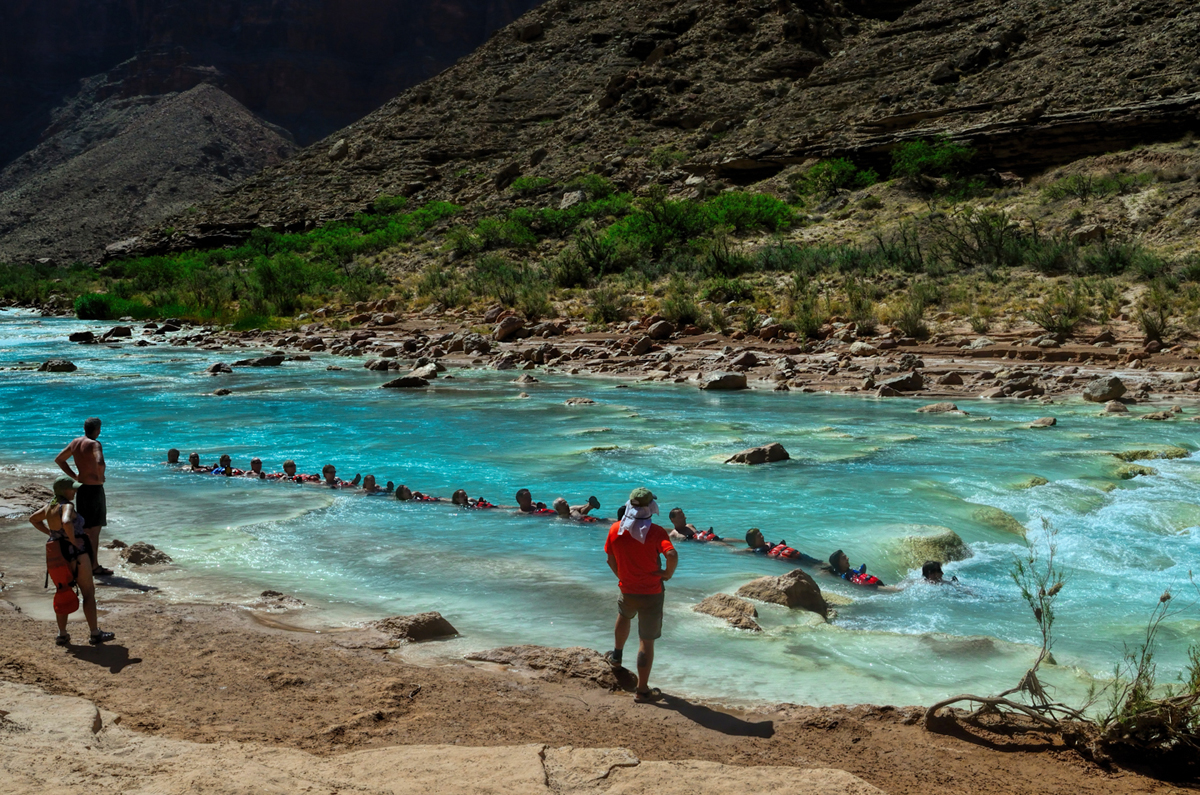
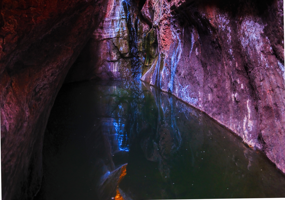
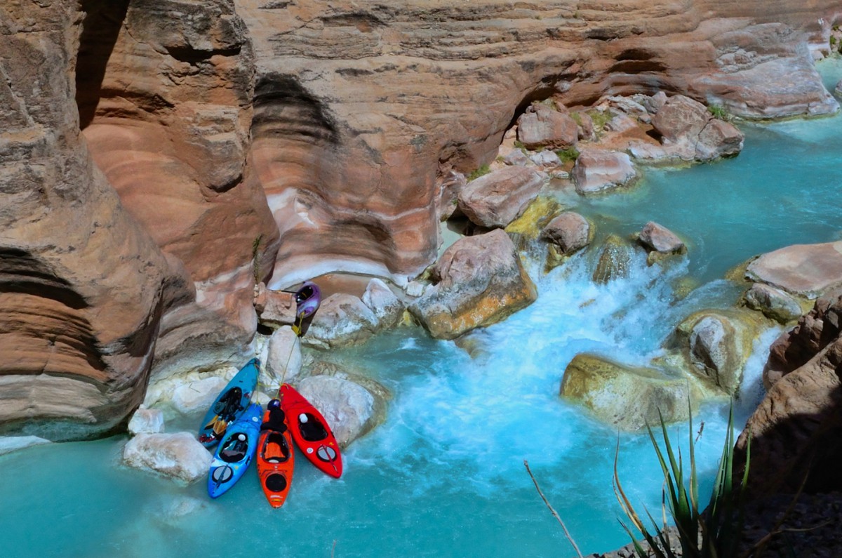
    Is there any other way to get into the heart of the Grand Canyon? Yes, indeed. The Grand Canyon is threaded along its entire length by the Colorado River. You can ride that river on a raft—but, fair warning; it’s not a leisurely float. There are more than 100 named rapids along that stretch, including some of the most thrilling whitewater in the world. If you want to see ALL of the Grand Canyon? The Colorado River will take you there, but in the process, you’re going to get really WET! (And it might just change your life!) Want to know what it’s like? Read on!

    THE BEGINNING:

    I’ve never been big on the thrill sports, at least, not personally. Ski jumping, big wave surfing, skydiving? (To name just a few). I’ll watch other people do those things, but I’ve never been tempted to so much as try any of that crazy stuff myself. Life in general is risky enough for my taste, and large jolts of adrenaline tend to give me the jitters.

    A few years back, my friend Rick (yes, there’s another Rick) cornered me at work, and asked me if I’d be interested in joining a Grand Canyon River trip that he was organizing. He must have caught me in an unusual mood, because I surprised the heck out of both of us by NOT turning him down flat. Instead, I asked him, “When?”

    "June of next year," was the reply. That was more than a year away! I have trouble planning ahead for the weekend, much less planning an elaborate trip a whole year ahead of time, but my friend pressed me. "If I can sign up enough people," he said, "we'll get a group rate, a terrific discount, and by planning it now, we'll be going at the absolute best time of year." He knew these things, as he explained, because this was going to be his third river trip through the Grand Canyon, and he had the inside track.

    "How much?" I asked. And he told me. It was a lot, of course, but I was still intrigued.

    "If you want to go," he urged, "you'll need to put up a $300 deposit before the end of this month. And the balance by March 1st of next year, 90 days in advance of our launch date."

    "Let me think about it," I countered.

    "Don't think too long," he said, "or you'll miss out." He gave me a link to the website of the rafting company--CRATE, Colorado River And Trail Expeditions. "They're the best", Rick said. "If you decide to go, I can guarantee you won't be sorry. My first river trip was the most amazing thing I've ever done. The second trip was even better. I can hardly wait to get back out there again."

    I did my research, I really liked what I saw, and, long story short, I wrote out the check for the deposit. March 1st of the next year was still a long way off, so I tucked the notion of a rafting trip into the back of my brain and went on about my business. Time flew, as time tends to do, and when I received notice that the balance was suddenly payable in full, it actually caught me by surprise. "Whoa," I said, looking at the invoice. "That's a lot of money!" Was I having second thoughts? I checked the CRATE website again, looked at the amazing pictures, read the testimonials. "Life changing" was a recurring theme. So the answer was: No! I was not having second thoughts. I wrote out another, much bigger check, signed all the release forms and other paperwork, and formally booked my place on the raft, leaving from Lee's Ferry on the 1st of June, just 90 days away. At that point I was committed, and I started getting excited about it. "I'm really doing this thing!" I said to myself. "Damn! This is going to be great!"

    When the day arrived, I was ready. I'd been to the sporting goods store, bought a floppy hat and the right kind of outerwear and waterproof shoes. I'd bought a waterproof camera as a backup to my big Nikon, something I could use even with waves crashing across the deck. I bought extra batteries, extra memory cards, sunscreen, salt tablets, and a leash that strapped my glasses to my head. "Bring it on," I said smugly, to nobody in particular.

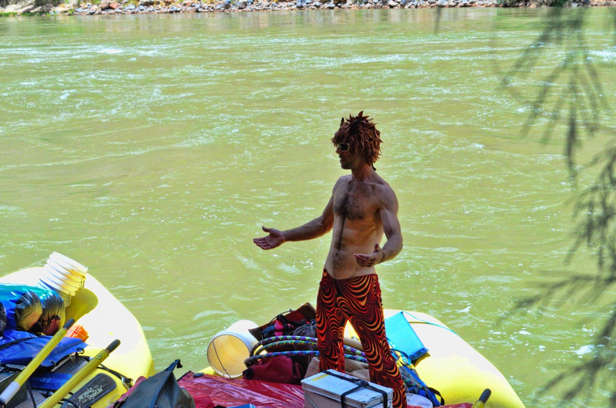
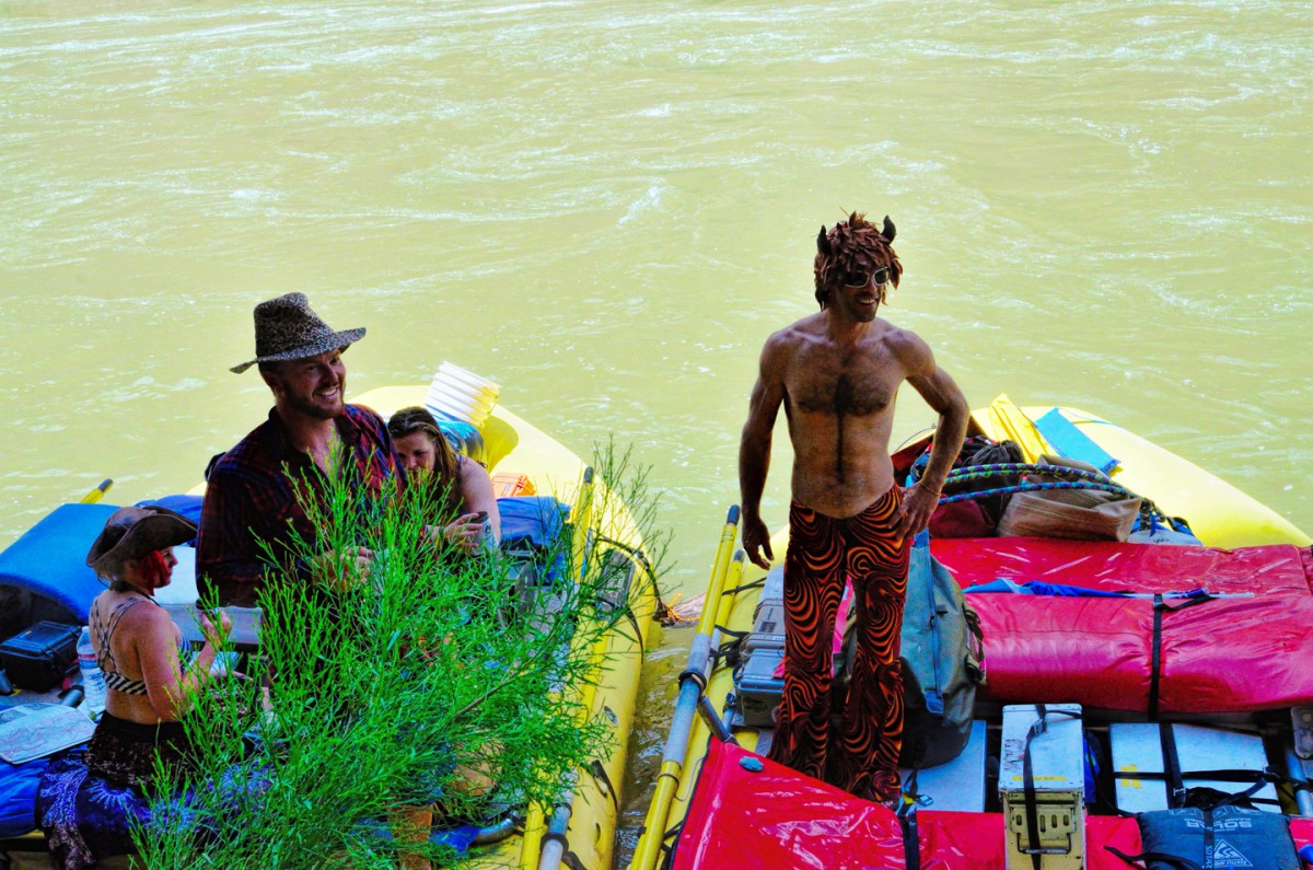
    We were to meet our group at a hotel in Las Vegas, the night before the trip began, and everyone would ride together on a chartered bus from Vegas to Lee's Ferry. Rick and I drove from Phoenix to Vegas in his pickup, arriving at the hotel just in time for the meet and greet. Despite having organized the trip, Rick only knew two of the people, a couple from Seattle. The rest were friends of theirs, and friends of their friends, and friends of their friend's friends, some two dozen in all, counting Rick and I. Most of the group was retired, or close to it, and pretty much all of them were from the Seattle area. These folks were veteran travelers, hikers, trekkers, and every one of them was every bit as ready for this as I was.

    DAY ONE: We’re off, into the enchanted depths of the Grand Canyon!

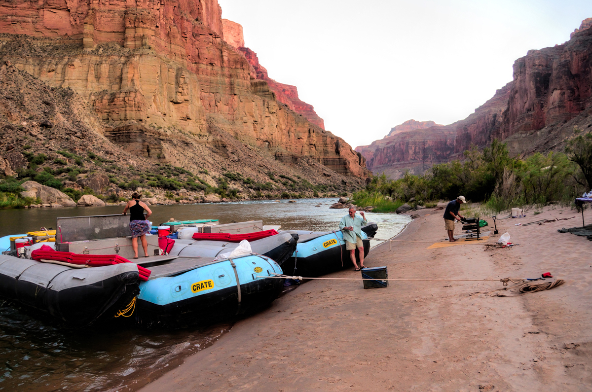
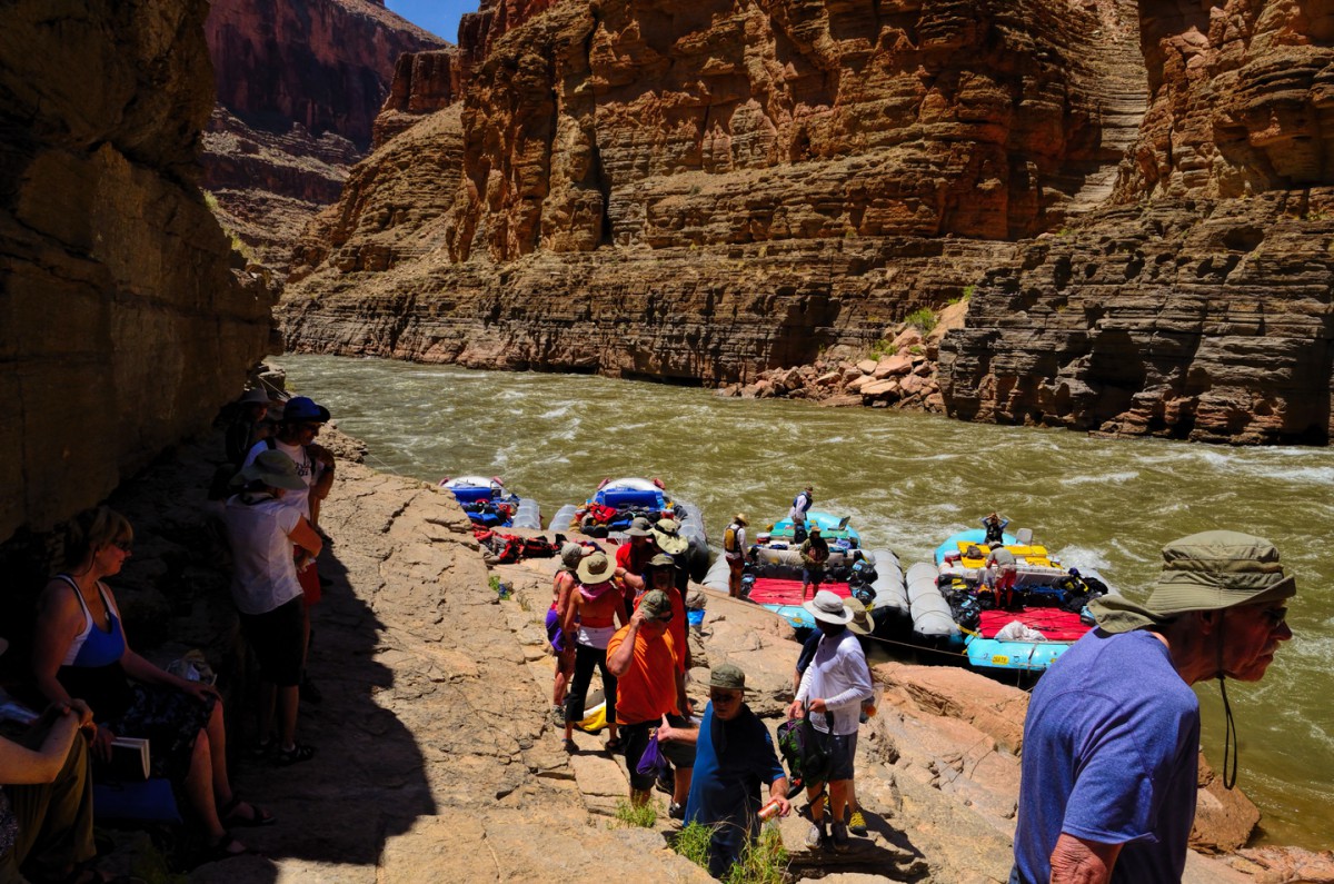
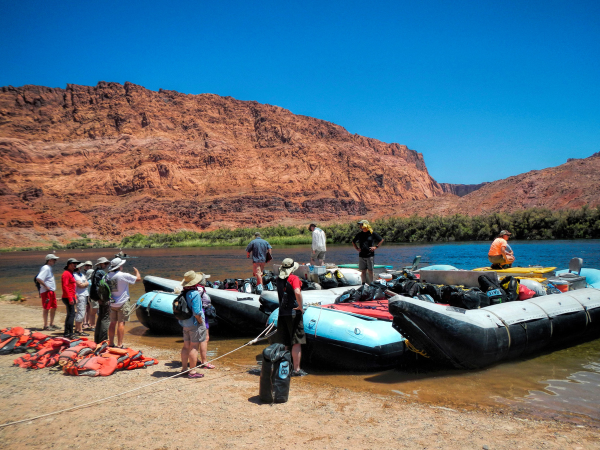
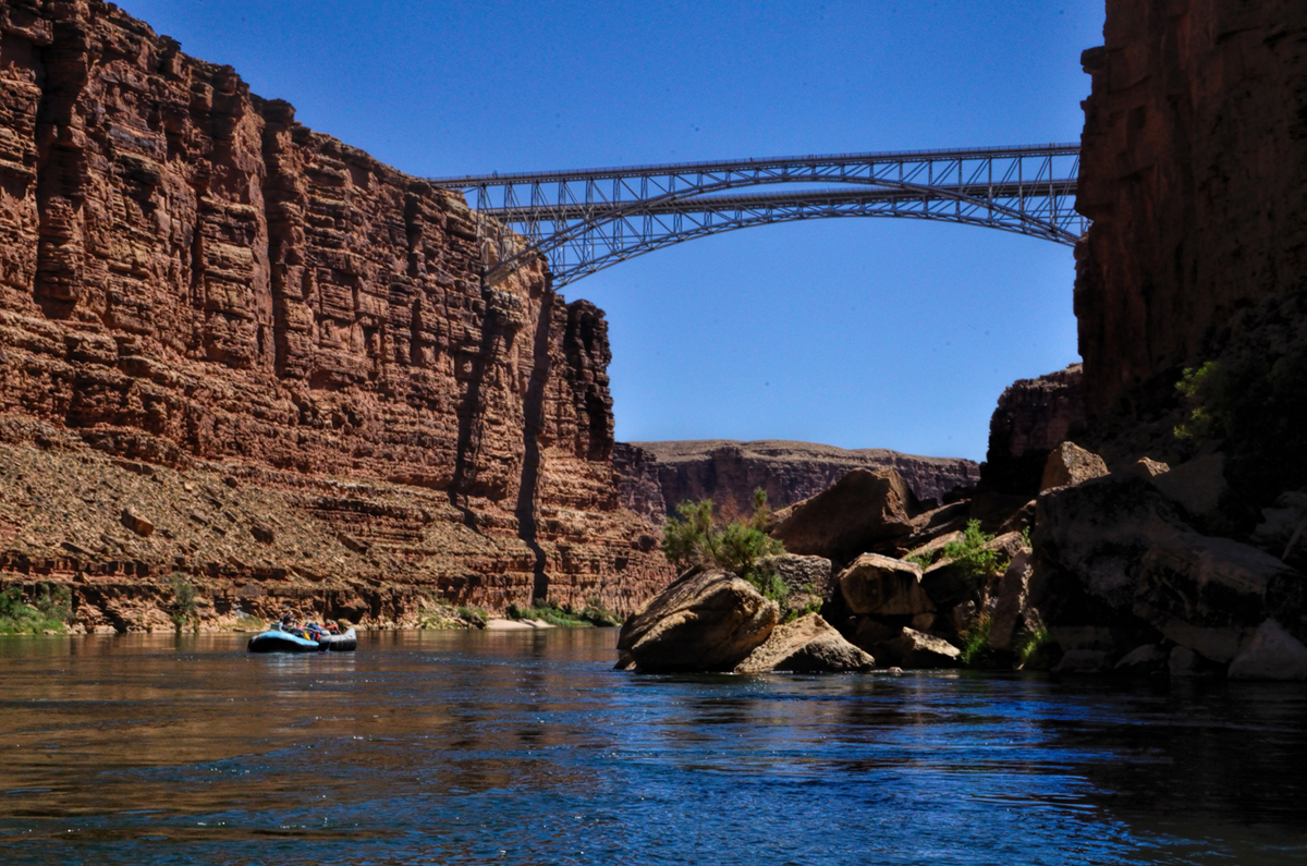
    The bus left the hotel quite early--Lee's Ferry was five hours away, and the sooner we got there, the sooner we'd be on the river. We made time on Interstate 15, through flat, scrubby desert east of Vegas, passed the town of Mesquite, crossed the Arizona strip (the isolated northwest corner of the state), on up to St. George, Utah. We left the Interstate just beyond St. George, drove east to Hurricane, then followed UT 59 southeast back into Arizona again, passing through the infamous community of Colorado City. (I won't describe that place here, but you can click the link if you're curious). A bit further down the road, we stopped in the tiny town of Fredonia, where CRATE has a small warehouse facility. We had lunch there, bought some T-Shirts, and picked up two of our guides, who rode with us the rest of the way to the put-in. The scenery started getting a lot more interesting past Fredonia, as we drove up and over a ridge of mountains cloaked in pine forest. A side road to the south off Highway 89A led to the North Rim of the Grand Canyon, but we kept going, past the Vermilion Cliffs National Monument, past Navajo Bridge, where we got our first glimpse of the river, then on down to the Lee's Ferry camp ground, right on the river bank. Our two big pontoon rafts were pulled partway onto the beach, and our other two guides were already there, loading the gear.


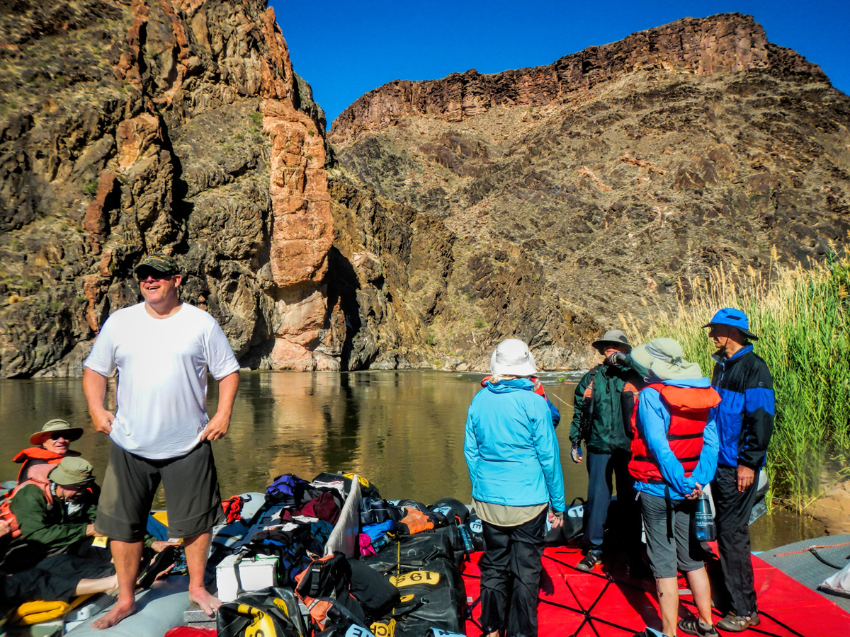
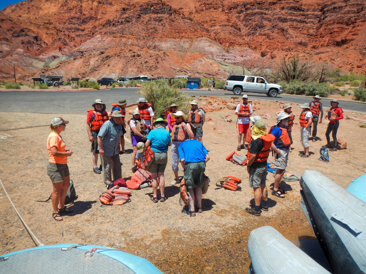
    The rafts had to carry enough food and water to last two dozen people for more than a week, not to mention camping gear, an extra outboard motor, and everything else we were likely to need, because once we got on the river we were on our own, at least as far as Phantom Ranch, which we wouldn't hit until the end of day three. The guides gave us an orientation of sorts, showed us how to set up the cots we'd be using, how to properly seal the watertight duffel bags we'd be using for our personal gear, then pretty well ran through the checklist of how things worked and what we should expect, and what would be expected of us.


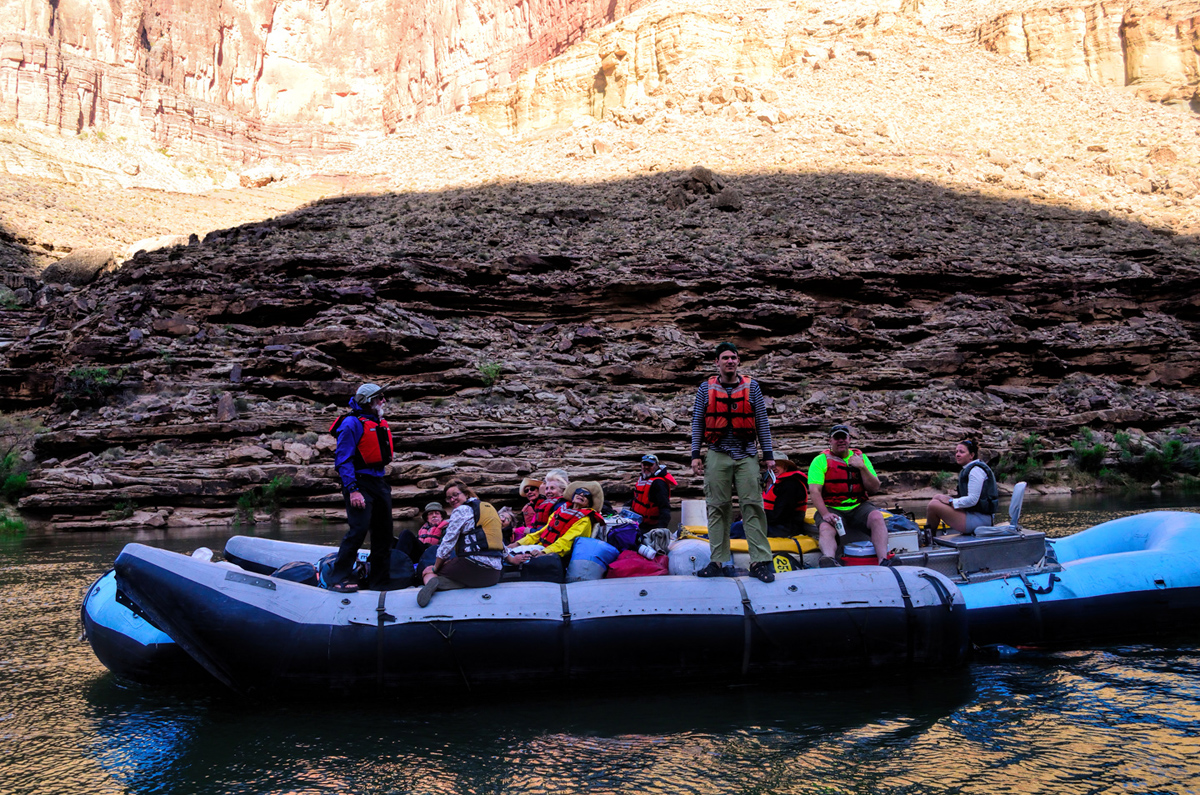
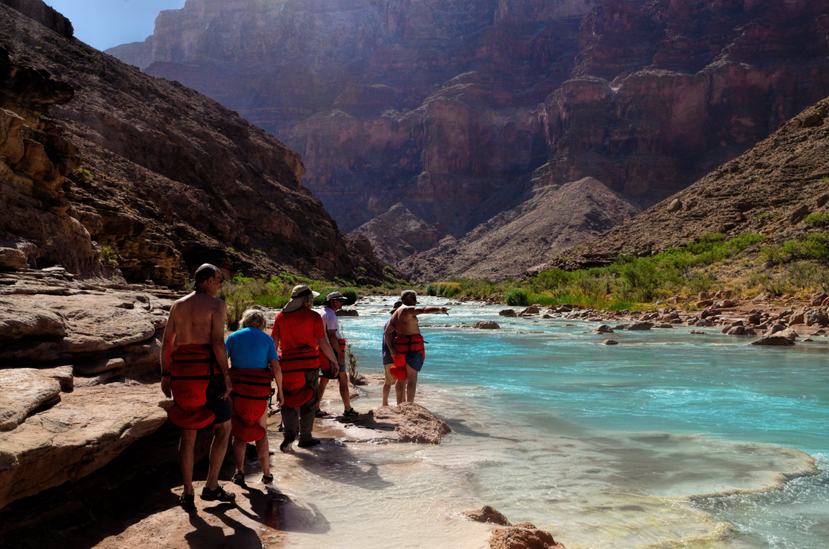
    Everyone donned an orange life preserver; we all climbed aboard one raft or the other, and found a spot to sit. The two rafts were shoved away from the beach until they floated free, and the boat drivers eased them into the middle of the channel.


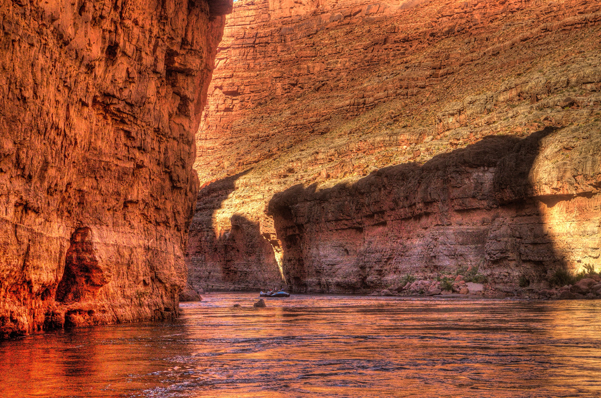
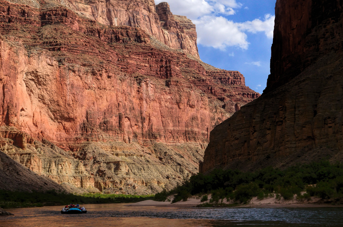
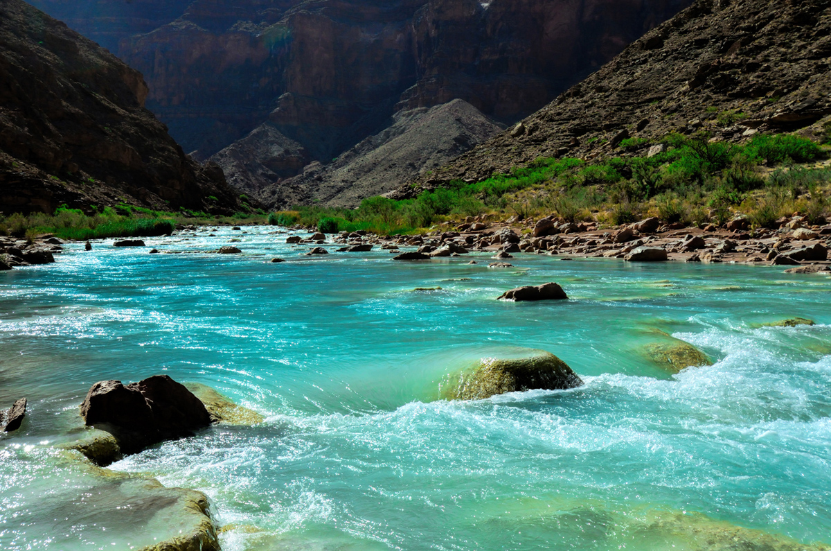
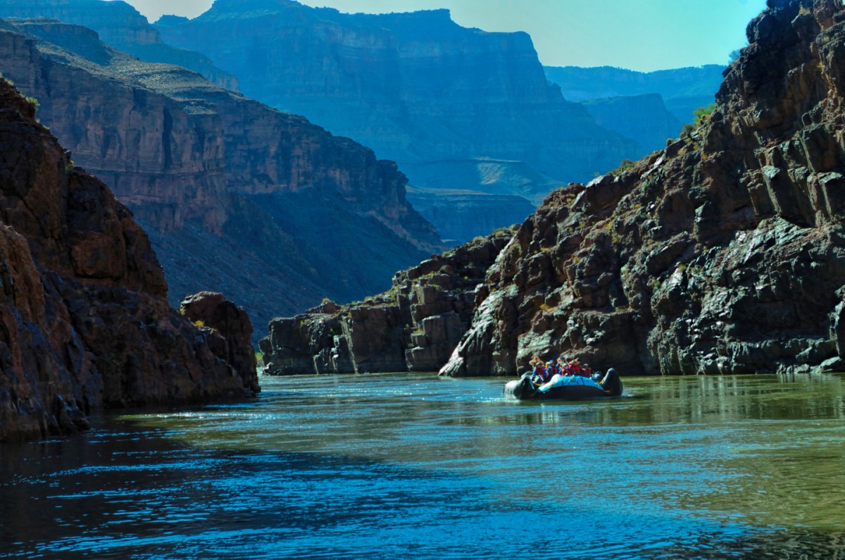
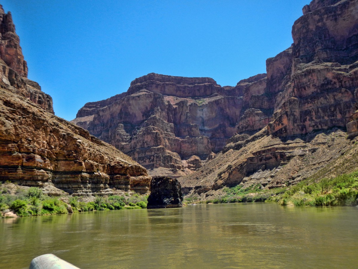
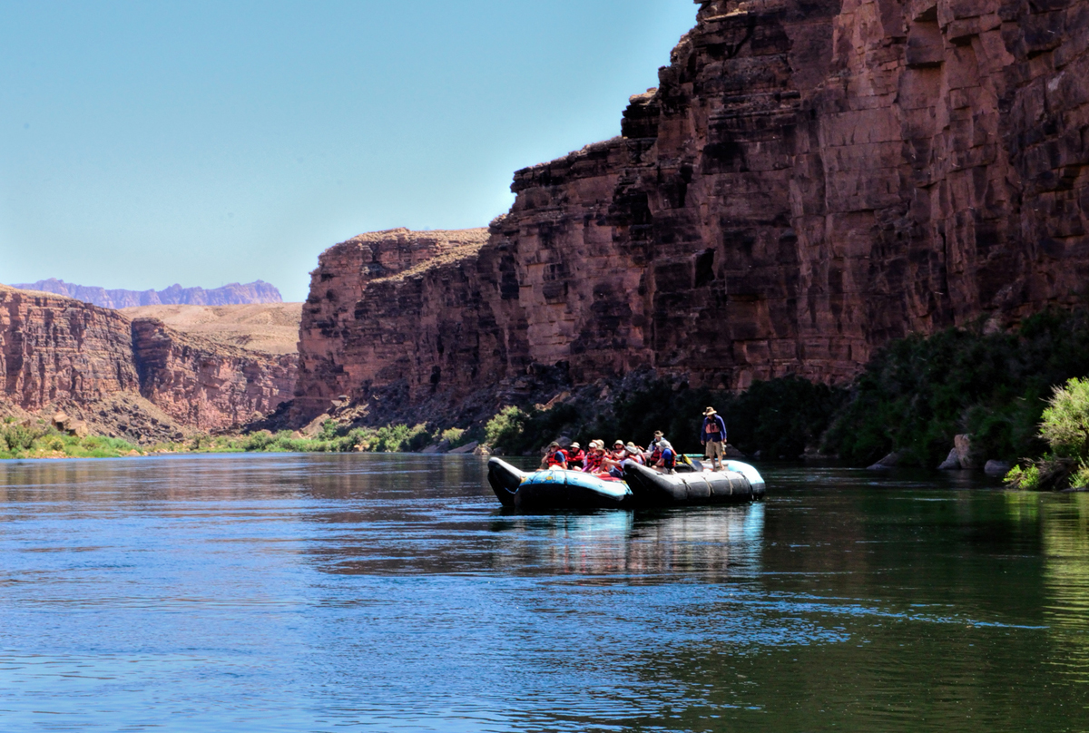
    We were mostly moving with the current, but the beach dropped behind us pretty quickly, and in a matter of minutes we were out there, rafting down the Colorado River, heading squarely into the enchanted depths of the Grand Canyon!


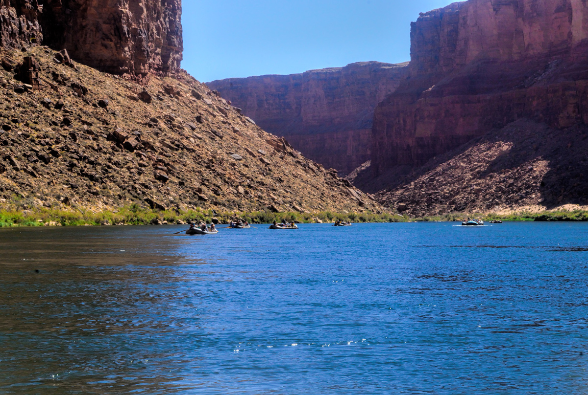
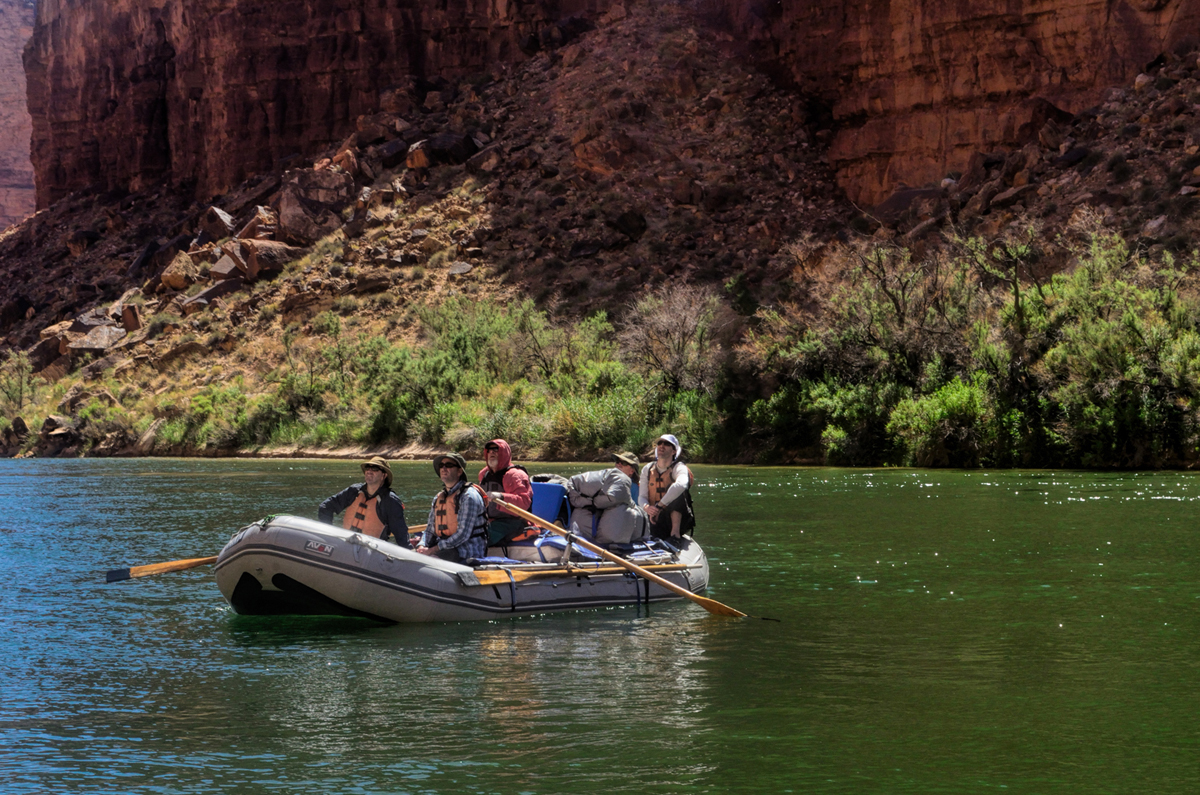
    We passed by a flotilla of slower moving oar boats, smaller craft that hold, on average, four to six people.


    With the oar boat expeditions, you get a lot more intimate with the river, but if you care at all about comfort? The pontoon rafts are like floating palaces by comparison, and they're a heck of a lot safer in the rapids. At mile four we passed underneath Navajo Bridge, where Highway 89A crosses the Colorado River headed south toward Flagstaff.


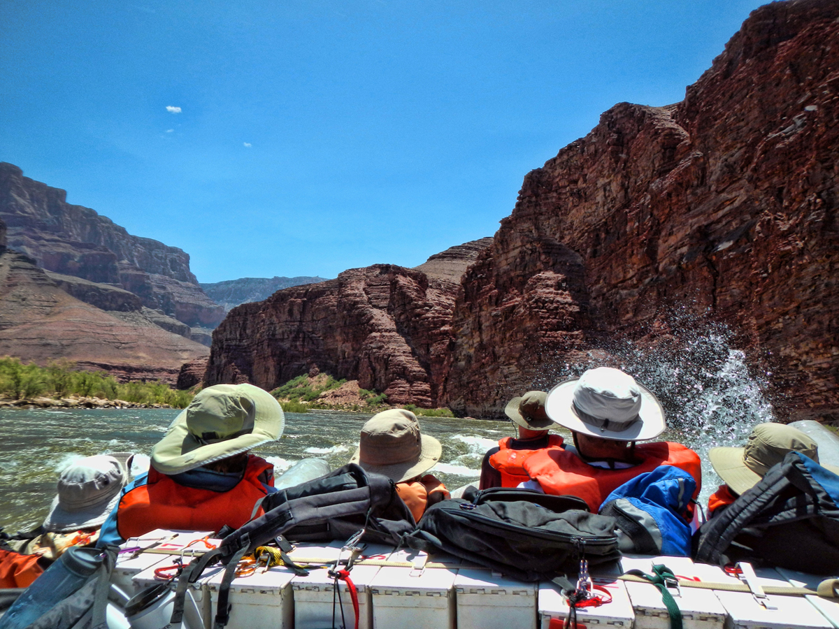
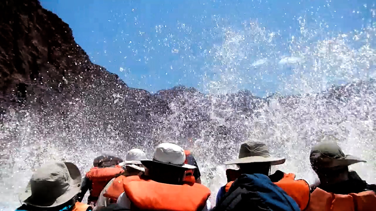
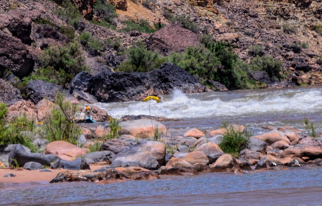
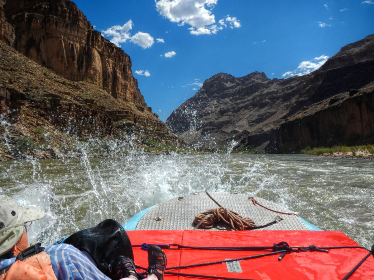
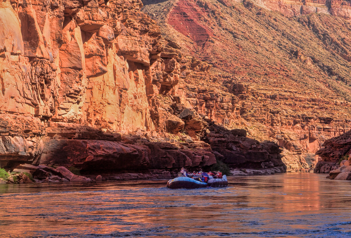
    That's the only crossing of the river for automobiles between Glen Canyon Dam and Boulder Dam, the entire length of the canyon, so once you cross that line, that's where the trip really begins. We hit our first real rapid just four miles later: Badger Creek, and three miles after that another, Soap Creek, followed by yet another called the Sheer Wall Rapid. We were feeling pretty smug about it--already almost veterans, when Mikenna, the driver of our boat, gave us sobering instructions: "If I yell out 'two-hander'" she said, her tone quite serious, "that means you'd best find the nearest rope, or whatever you can grab, and hold on with both hands! I really mean that. Both hands!" The instruction was timely, because the next rapid, House Rock, was a two-hander. The raft started bucking the moment we hit the whitecaps. There was a good-sized hole, a whirlpool, on the left side of the river, so we ran to the right, chopping across waves that splashed over the deck and gave us a good soaking. Twice. Or maybe it was three times? Ha! It was an absolute hoot!

    "YEAH!" my friend Rick yelled aloud. "That's what I'm talking about!"


    Beyond the rapid we were floating serenely once again--such a sharp contrast! One minute we're peacefully floating, basking in sunshine; the next minute we're crashing and thrashing though standing waves higher than our heads! Next? We're calmly floating again past the beautiful rock walls of the canyon--but now, we're wide-eyed, pumped, sputtering, and soaking wet all the way to our skivvies!

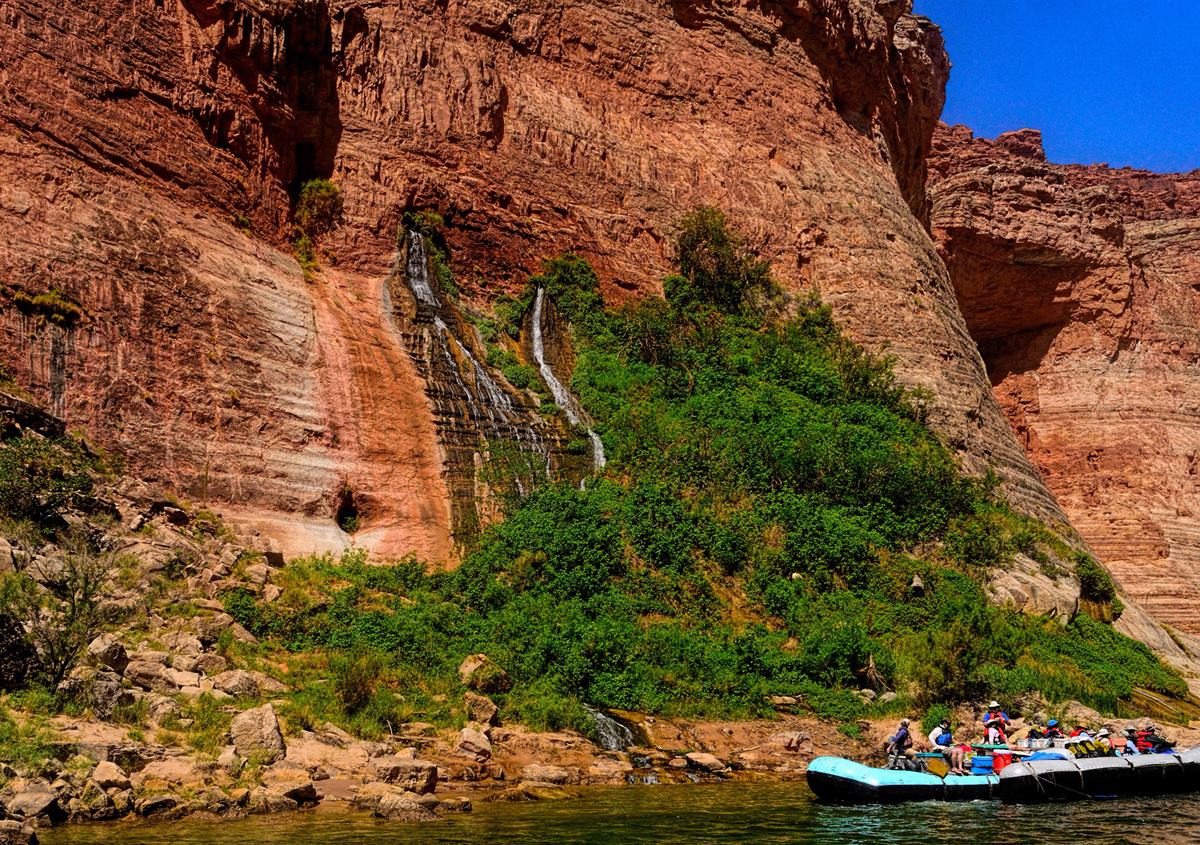
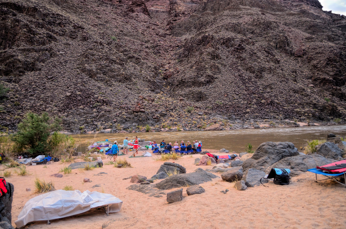
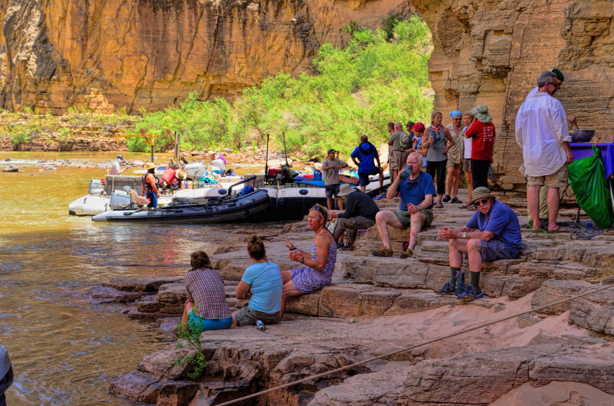
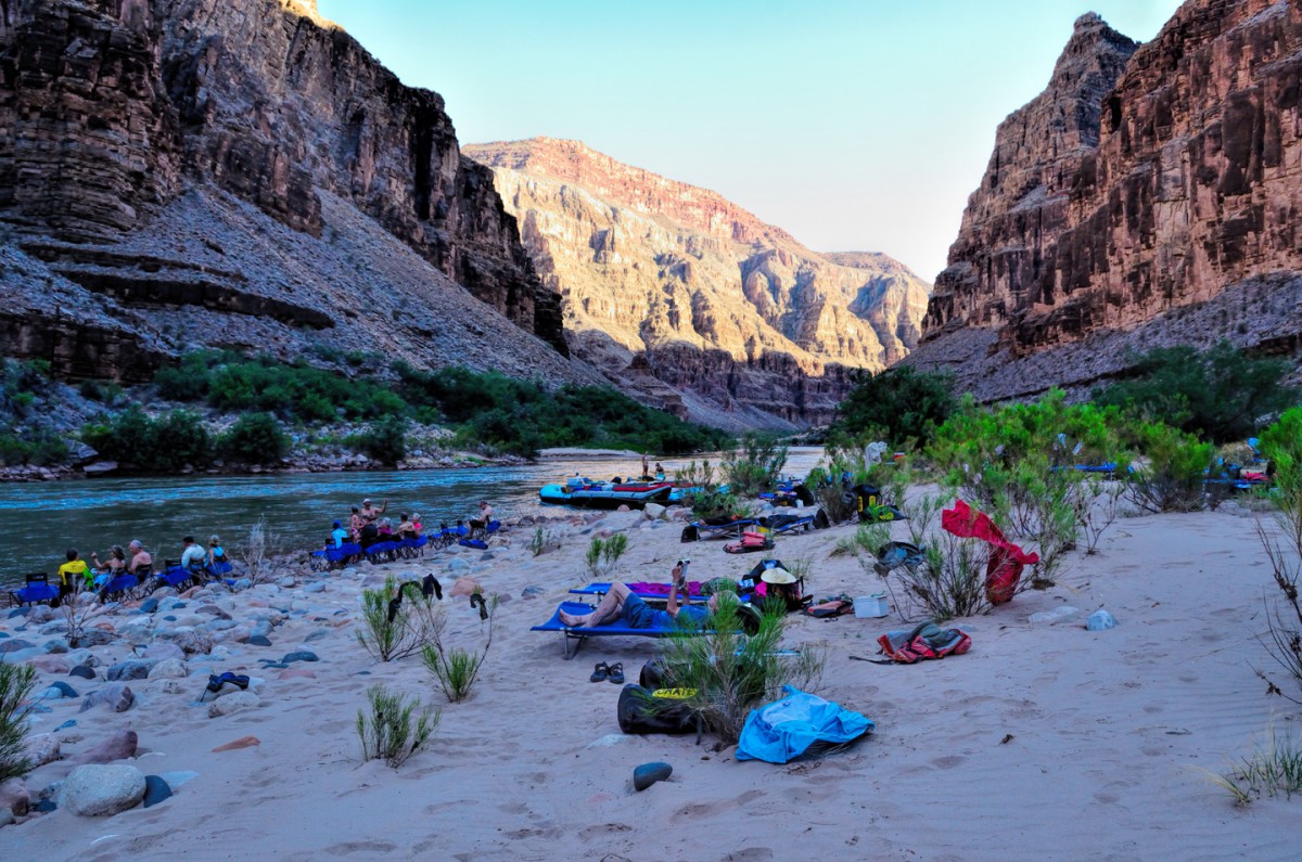
    It was already getting on toward late afternoon, so at mile 19 we pulled over and anchored the rafts by a wide beach, our camp site for the first night. The waterproof black rubber duffels, nearly fifty in all, were unloaded by a human chain, the bags passed from hand to hand and piled up well away from the water's edge. Each of us located the two that were emblazoned with our assigned number, in my case, the blue #5 with my personal gear, and the yellow #5 with my personal sleeping kit--a folding cot, a sleeping bag, and a tarp. There were tents stowed separately on the rafts in case of inclement weather, but we didn't need them on this first night--or on any other night, as it turned out, because (spoiler alert!) the weather proved to be perfect for us throughout the entire trip. The next step was critical: staking out the perfect spot to set yourself up. Had to be flat, preferably not too rocky, and with enough separation from the other campers to lend a modicum of privacy. The cots were a challenge at first. They unfolded a particular way, and the legs had to be inserted into carefully aligned holes in the frame a particular way and everything stretched tight. If you got the sequence wrong you had to start over, and there was quite a bit of fumbling and scratching of heads until we figured out for ourselves exactly how the danged things went together. Personally, I hadn't been camping in years, and I hadn't slept tentless under the stars since I was a kid. This was likely to be a very long night--but I was ready for it. At least, I hoped that I was.

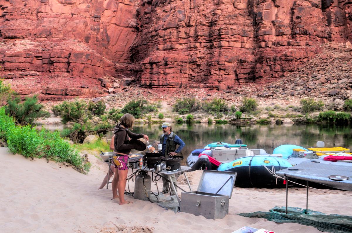
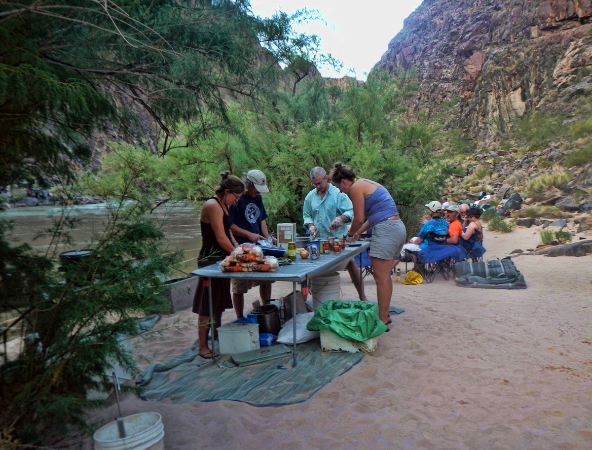
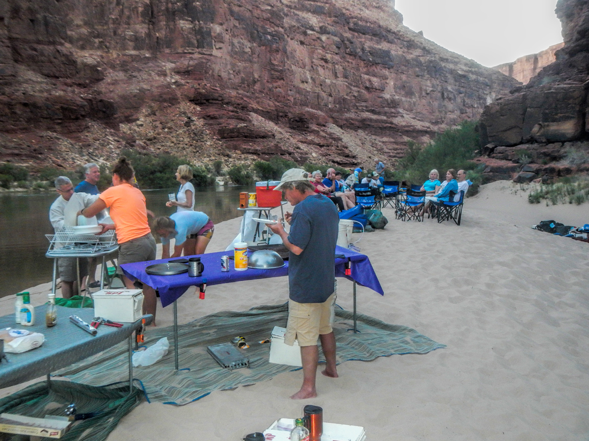
    While the passengers were busy messing around with our cots and whatnot, the crew was busy setting up tables and cooking equipment, getting started on our dinner, the first of the many great meals prepared for us alfresco on isolated Grand Canyon beaches.


    When the food was ready, we all straggled over to the buffet and served ourselves. I can't recall exactly what we ate that first night, but I do remember that it was good stuff. It's a universal truth that everything tastes better on a camping trip--and this was truly the ultimate camping trip. After dinner we sat around in folding camp chairs, getting acquainted, sharing travel stories, some of us drinking canned beer that was reasonably cold from being suspended in net bags, towed behind the rafts in the icy water. By 8:00 or so, the last of the light was fading. It seemed a bit early to be going to bed, but we were all tired from the journey, and once the last of the light was gone, there was really nothing else to do. Campfires aren't allowed on the Grand Canyon beaches. If they were, the available fuel would soon be exhausted, and the pristine nature of these wilderness camp sites would ultimately be spoiled. The goal was to leave the camp site exactly as we found it, no trace of our stay in that spot, aside from our footprints in the sand. That meant that if you had to relieve yourself, you did so in the river (seriously), or you used one of the two portable toilets that were set up each time we made camp. Those things were a story unto themselves, but it was all part of a routine that became very familiar by the end of the trip.

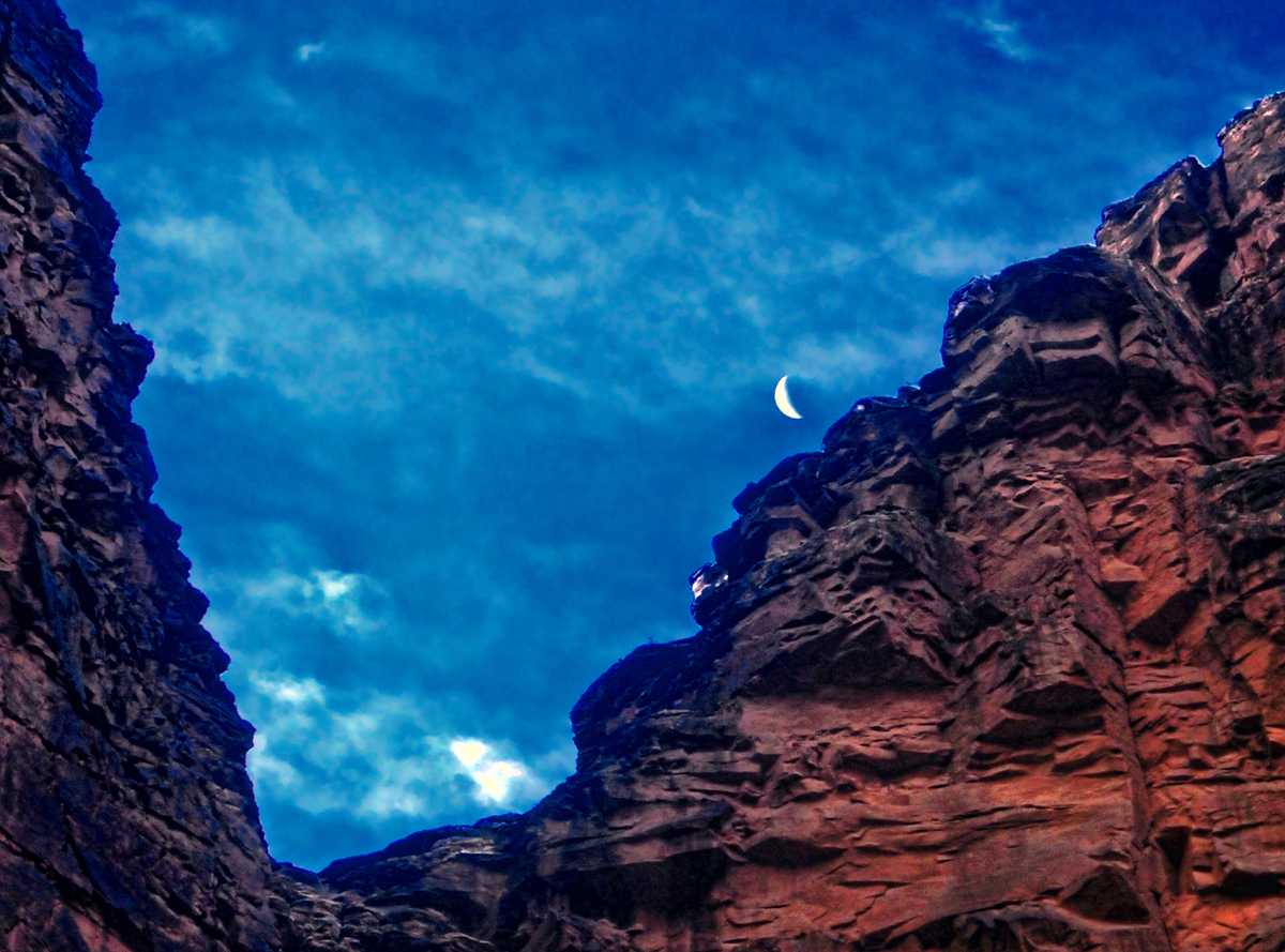
    When darkness fell, it fell like a brick. I laid on my cot, staring up at the stars, the multitude of stars, ALL of the stars. I listened to the small sounds and quiet conversations going on around me until they faded away, leaving nothing but the sounds of the river, surging steadily past, leaving me drifting...

    Next up: Day 2: The Roaring Twenties, Redwall Cavern, and the Bridge of Sighs

  2. #2
    Join Date
    Jan 1998
    Location
    Las Vegas, Nevada
    Posts
    12,997

    Default My photos all burned -- I am going to enjoy this.

    I spent three weeks on the Grand in October, 1980 on one of those rubber boats where all of the bailing was done by the riders. I paddled a bit too -- but it was a skill that I never quite mastered. There were two self-baling boats in our group -- but I preferred the challenge of the smaller boats Several of the guides from that first trip -- have remained friends to this day and I've done several private trips with some of them.

    After putting the rafting supplies back into storage, I and a mate from Sydney spent another 10 days hiking in the Canyon.

    I took lots of photos too -- but all of that photo record burned in the wildfire in October 1993.

    Mark

  3. #3
    Join Date
    Mar 2016
    Location
    Phoenix, Arizona
    Posts
    808

    Default DAY TWO: The Roaring Twenties, Redwall Cavern, and the Bridge of Sighs


    Sunrise, Moonset in the Grand Canyon

    Day two, our first full day on the river, dawned clear and cool. I awoke even before first light, restless on my cot, and slept out, after going to bed so danged early. The moon was just going down as the sun was finally coming up.


    The crew was up and running around before most of the rest of the passengers even stirred, and a big pot of cowboy coffee was brewing almost immediately. (For the uninitiated: cowboy coffee is a handful of coarse grounds tossed into boiling water. The finished product is poured into your cup through a strainer.) No coffee snobs in this group--in that setting, that unfiltered coffee tasted great, and we all loved it. The raucous call to "COFFEE!" quickly became a welcome, first thing in the morning tradition, and we'd stand there sipping that stuff, sand between our toes, waiting patiently for the bacon and eggs or the pancakes and sausage or the whatever was on the menu on any given morning.

    The crew didn't overtly hurry us along, but we hadn't come all this distance to stand around on the shore, so shortly after breakfast we started breaking down the camp. The cots were easier to take apart than they were to put up, and at that point, the design was actually starting to make sense. We shook the sand out of our belongings as best we could (the fine sand was ubiquitous, and got into pretty much everything), re-stuffed our waterproof duffels, and did our best to properly seal them, rolling down the top, squeezing out the air, and cinching the straps as tightly as was humanly possible. We staged all the bags near the boats, and a reverse version of the human chain moved the bags from the beach back onto the rafts, where the crew lashed them all into place, then we suited up, in full battle gear (hats, ponchos, raincoats), with our all-important orange life preservers over top of everything else. We'd been warned: the first section of our Day Two journey was known as the "Roaring 20's", an infamous series of rapids that we'd be hitting, one after another, for the next ten miles.


    Rounding that first bend in the early morning light

    When we first launched the boats that morning, the river was calm, serene, but it got down to business pretty quickly. First up was North Canyon Rapid, less than a mile downstream from our camp, followed rather quickly by 21 Mile Rapid, 23.5 Mile Rapid, 24 Mile Rapid (a borderline two-hander), 24.5 Mile Rapid, Cave Springs Rapid, 27 Mile Rapid, and, last but not least, 29 Mile Rapid.


    Indian Petroglyphs

    Somewhere in the middle of all that, in one of the calm stretches, we pulled over on river left and climbed a small hill, where we got an up-close view of some ancient petroglyphs, symbols etched into the dark layer of mineral, “desert varnish”, that coats the large boulders in this area. These symbols, of uncertain significance, were left there by Indians living near or passing through this area hundreds of year ago. I couldn’t find any reference to this site on maps or in any of my guidebooks, so I’m honestly not sure what it was called.

    Back on the rafts, we traveled a few more miles, hit a few more rapids, and exited the roaring ‘20’s, with no small measure of relief. At the end of that run, we really were becoming veterans, and despite the fact that we were all soaking wet, we really were feeling pretty smug about ourselves.


    Vasey’s Paradise

    A couple of miles downriver on the north bank we came upon an interesting spot called Vasey's Paradise, a natural spring flowing out of the canyon wall, creating a unique ecosystem of mosses and ferns growing wild and dense on the side of the cliff. There was also a bit of poison ivy, so it was best to look, but not touch. The place was named by John Wesley Powell, in honor of a botanist who traveled with him on his expedition through the Rockies, the year before his first exploratory expedition down the Colorado in 1869.


    Redwall Cavern

    A mile or so beyond Vasey's Paradise, on the left had side of the river, the cliff opened up to form a massive cave at the waterline, a natural amphitheater carved out of the Redwall sandstone by the scouring action of high-water floods over the course of many thousands of years. The construction of Glen Canyon Dam put an end to those violent seasonal floods, but their cumulative effect from seasons past could be readily seen in this place, known as Redwall Cavern. Powell, the first visitor to describe this spot for the masses, speculated that the space would accommodate 50,000 people. I'm not sure what he was thinking, or how he proposed to get them all down there, but, regardless, I think that estimate is more than a little exaggerated. It’s big, but not THAT big.


    The Bridge of Sighs

    Leaving Redwall, we cruised through an area of sandstone cliffs that had been carved by wind and water into fantastic shapes reminiscent of an ancient civilization crumbling to ruin. In the middle of all that we passed a formation known as the Bridge of Sighs, one of the very few natural arches in the Grand Canyon that's visible from the river. Next, on river left, there was a jumble of logs in an alcove well up the cliff face. This was the Anasazi Bridge, remnants of what had once been a log bridge built by the ancients to traverse a gap in one of their trails.


    Layers upon layers of rock in those walls, Bright Angel Shale exposed at the bottom

    Then came President Harding Rapid, where the river splits around a large boulder in the middle of the flow, and after rounding a steep bend in the river, we got our first view of Bright Angel shale, an ancient gray rock that’s covered, everywhere but here in the Grand Canyon, by multiple layers of limestone and sandstone, each layer representing a different geologic era.


    Nankoweap Granaries

    Further down, Nankoweap Rapid, and there, halfway up the side of a massive cliff, the Nankoweap granaries, a famous archeological site consisting of a largely intact adobe wall, with four rectangular windows, sealing off an alcove that was used by the ancients to store grain. High up the cliff, their stores were safe from foraging animals, and for the most part, safe from raiders. It’s possible to hike to the site, up a famously scenic and horrifically steep trail, but, alas, it was getting late in the day, and we didn’t have the time. I settled for a telephoto shot, taken from the raft as we glided by.

    The next few miles were among the most breathtakingly scenic along the whole length of the river. The cliffs and buttes were a perfect composition, the different colored layers of stone were all but glowing in the afternoon light, and we had this incredible world all to ourselves, not another boat in sight.


    A certified “Oh, Wow!” moment on the Colorado River

    Just before Kwagunt Rapid, at about mile 56, we pulled over alongside a beach. This was the last large campsite above the confluence of the Little Colorado River, which would be our first destination the next day. The confluence is one of the most popular side hikes for river runners. If we managed to get there early enough the next morning, hopefully, we’d beat the crowds.

    We unloaded the rafts like a well-oiled machine, then we each laid claim to our preferred sleeping spot, scouting around the area for just the right location. Near the bathrooms? Far from the bathrooms? Near the kitchen? Near the water? Everyone had their preference, and there was plenty of space, the advantage of the larger camp sites. The cots were a little easier to set up on the second night, but not by a lot.


    While the crew prepared our dinner, us paying passengers lounged in our folding camp chairs, relaxing with juice or cold beer, marveling at the surroundings. This had been quite a day. Rapids galore in the roaring ‘20’s, amazing caves, Indian ruins, extraordinary vistas. All of that, and this trip had just barely started! What next?

    Next up: Day 3: The magical mystical Confluence, the Little Colorado Conga Line, and Phantom Ranch

  4. #4
    Join Date
    Mar 2016
    Location
    Phoenix, Arizona
    Posts
    808

    Default Day 3: The Confluence, the Little Colorado Conga Line, and Phantom Ranch

    The call to “COFFEE!” was welcome indeed, followed by another good breakfast of pancakes and whatnot. With the confluence of the Little Colorado beckoning, we struck camp and loaded the rafts in record time. We started out by immediately running Kwagunt Rapid, piece of cake, followed, in short order, by 60 Mile Rapid, even easier.


    At mile 62 we came to a side canyon on river left, and that’s where we pulled over and anchored, running the bow of each big raft up onto the soft sand, so that pampered passengers wouldn’t have to get their feet wet stepping out.

    The Little Colorado River is one of just two major tributaries to the (big) Colorado River within the State of Arizona, and it travels some 300 miles from the forested mountains of Eastern Arizona to this spot on the Navajo Reservation. The confluence, where the two streams come together, marks the true beginning of the Grand Canyon proper, and the entire area is sacred to the Indians, both the Navajo and the Hopi tribes, as well as the Zuni, the Havasupai, and the Hualapai. As we hiked upstream from the big river, following a well-worn trail, it was immediately apparent why this place was considered so special. The waters of the Little Colorado are a turquoise blue that is so startlingly bright it doesn’t even look real—the result of an unusually high concentration of calcium carbonate, refracting the light in a peculiar way. There’s a well-defined spot where that warm, turquoise blue water from the small river collides with the cold, deep green water flowing upstream from the big river.


    ”Little Colorado River, allow me to introduce the Big Colorado River.”

    The two dramatically different colors mix, forming a shifting, swirling line of chartreuse, with dark green water downstream, and bright turquoise upstream. That spot is the confluence, and it’s magical, unlike anything you’ve ever seen.


    The Confluence. Worth every penny of the price of admission.

    A project has been proposed, backed by some of the less traditional elements on the Navajo Tribal Council, to partner with a developer and build a tramway that would ferry paying passengers from the rim to this spot. Having been there, and seen that place, the very notion of such a thing is horrifying to me. The confluence is special mainly BECAUSE it’s so isolated, a rare vision, seen only by those who have earned the privilege, by running those rapids, or by hiking the steep trails that follow the small river down—the route that’s taken by the Navajo and the Hopi when they travel there for ceremonial purpose. It’s a place that simply isn’t meant for the masses. I can only hope that cooler heads will prevail, and that this beauty will be preserved intact. Click here for information about the effort to stop this project.


    Swimming hole on the Little Colorado River

    Further upstream was a popular swimming hole, more of a water-slide, where the Little Colorado River flows through a channel of smooth, rounded boulders coated slick by the minerals in the water.


    To protect your behind from getting bashed against submerged rocks, you had to strap your life jacket on upside down around your waist, with the neck piece under your crotch.


    Then you entered the water and floated in a sitting position, feet forward, aiming for the slot between the white boulders at midstream. If you performed the maneuver correctly, you got a pretty good, fast ride down the chute.


    Then you let the current carry you 40 or 50 yards downstream, where you could make your way to the bank, climb out, and hike back to do it again. This was great fun, albeit a little silly, with everyone walking around with life jackets covering their bums. We kept at it for the best part of an hour, until other rafting parties started arriving, and it got a bit crowded:


    The Little Colorado Conga Line

    After leaving the confluence, we hit Lava Canyon rapid at mile 66, then Tanner Rapid at mile 69, and Unkar (a two-hander!) at mile 76. Somewhere along that stretch we pulled over at a shady spot on river right and had some lunch. The day was heating up, and I was starting to get a little light-headed. With all the water around, I wasn’t remembering to drink enough, and I was starting to get dehydrated. I spoke up about it, and was glad that I did: the river guides had some electrolyte tablets, which helped me quite a lot.


    A family of geckos entertained us during lunch, scampering around the limbs of the big tree we were using for a canopy, while the ravens, ever present, watched from on high waiting to swoop in and search for scraps the moment we pulled away.


    After lunch, more rapids: Nevills Rapid, a two-hander, followed by Hance Rapid, the biggest and baddest we’d seen so far. Hance was a monster—multiple large rocks constrict the channel at that point, creating powerful hydraulics. The water is extra swift, and the level of the river drops 30 feet from one end of the rapid to the other. It was serious business, and sobering: a testament to the skill of our river guides. Hance was quite a ride, but the river wasn’t done with us yet. Less than two miles down we hit Sockdolager, an aptly named two-hander. (Sockdolager is archaic slang for a “knockout punch”). Three miles after that, Grapevine Rapid, another two-hander, followed by 83 Mile Rapid, Zoroaster Rapid, and last but not least, 85 Mile Rapid.


    A family of Bighorn Sheep, checking us out

    At some point along that stretch we spotted a pair of Bighorn Sheep, and as we moved past them, we realized that it was a family herd, a ram and a ewe and a pair of youngsters. While we watched, they bounded effortlessly up the near vertical cliff and disappeared from view.

    After rounding a shallow bend, we came upon a startling site: an iron suspension bridge crossing from one side of the river to the other, 50 or 60 feet above the water.


    Kaibab Bridge, near Phantom Ranch

    This was the Kaibab Bridge, built in 1928 and still in use by hikers and mule riders coming down from the South Rim, and making their way to Phantom Ranch , a complex of rustic cabins a mile north of the river, at the very bottom of the Grand Canyon. Many rafting trips either begin or end at Phantom Ranch—shorter trips, for those without the time or the means to run the whole length of the canyon. You can get on at Lee’s Ferry, as we did, and then get off at Phantom Ranch, after which you’ll have to hike (or ride a mule) 7 miles back up to the South Rim, or 14 miles to the North Rim. Alternatively, you can hike down to Phantom Ranch from either rim, and join a rafting party that will take you the rest of the distance through the lower canyon to Pearce Ferry, or to one of the other take-out points near Lake Mead. My personal recommendation? Do the whole thing–especially if you’re only going to do it once!

    Phantom Ranch has the distinction of being the only place along the length of the river where you can contact civilization. There’s a phone that you can use in an emergency, you can pick up supplies, you can recharge your water tanks, and you can buy fuel for your outboard. Not to mention ice cold lemonade. We didn’t actually need any supplies, but we still pulled over to the bank and tied up for an hour or so. Those who needed something from the store, or who just wanted to see Phantom Ranch, hiked the mile or so up the trail to the old hotel (built in the 1920’s). Those of us who didn’t feel like hiking hung out in the shade near the rafts.

    We pulled away from Phantom Ranch, thinking we were just about done for the day, but the river wasn’t quite finished with us yet. We hit Bright Angel Rapid just below the bridge, and Pipe Springs Rapid just a mile further downstream. A mile beyond that? Horn Creek Rapid, even bigger than Hance, and even though the drop is a mere 9 feet, Horn Creek produces enormous waves that can make it, at certain water levels, one of the most difficult in the canyon. Do I need to add that Horn Creek was a two-hander? And that it most definitely woke us all up.

    Following on the heels of the Horn, Salt Creek Rapid was an afterthought, just a baby rapid, and immediately after we got through it, we pulled over at a fair-sized camping beach on river left, just above Granite Rapid, another monster.


    We could hear it rumbling from our campsite as we set up our cots and prepared for dinner. Our next day, Day Four? Day Four was going to be a bear, and it was going to start out with a bang.

    Next up: Day 4: Unforgettable whitewater in the Inner Gorge, plus Blacktail Canyon and the Great Unconformity
    Last edited by Rick Quinn; 05-09-2019 at 12:02 PM. Reason: added a missing detail

  5. #5
    Join Date
    Mar 2016
    Location
    Phoenix, Arizona
    Posts
    808

    Default Day 4: The Inner Gorge, Blacktail Canyon, and the Great Unconformity!

    We broke camp perhaps a bit less eagerly on Day Four, most of us thinking about the huge rapids we’d be hitting, pretty much straight out of the gate. Whitewater—that was one of the main attractions on this river trip, but yesterday we’d had our first taste of the serious rapids, and the line-up today was, hands down, the heaviest of the entire trip, a linear maelstrom known as the Inner Gorge. I can’t speak for the rest of our party, but for me, at least, it gave me pause. I’m not a strong swimmer, never have been, and the thought of something going wrong, and of me being tossed into that mess without the raft? With currents like an express-train, towering waves, submerged boulders, and whirlpools big enough to swallow a thirty-foot long raft? That thought wasn’t just sobering; it was, quite frankly, terrifying. This day wasn't going to be a leisurely float down an occasionally rowdy river. This day was going to be either the thrill of a lifetime, or a watery nightmare.

    Some of the rafters had formidable gear—head-to-toe rain suits, Gore-Tex parkas, pricey, well designed, and properly fitting protection against the elements. Others had the equivalent of a disposable raincoat from the Dollar store, and they were perfectly content with that. Me, I was in between the extremes, with a hodgepodge of an old windbreaker, a raincoat I wore when I worked as a Letter Carrier (thirty years before), and some rain pants that I picked up for ten bucks at Sports Authority. (Note to self—in 20/20 hindsight--when it comes to rain gear, you get what you pay for). Anyway, I was neither the best, nor the least prepared, but when it came down to it? It’s only water. And I wasn't going to die—not as long as I managed to stay with the boat. The pontoon rafts are well designed for running these rapids. They’re literally hinged in the middle so that they’ll flex in both directions when rolling over big waves. The pontoons lend stability, and the boats are heavy, with a low center of gravity, so they're hard to flip. That’s not to say that it’s impossible to turn one over—it happens, and even though it’s rare, it definitely isn't pretty. A lot depends on the skill and experience of the person piloting the raft. Our guides were among the best, and they’d run these same rapids dozens of times, so my confidence level was high.

    The crew reiterated all their warnings and safety precautions while we suited up. And most of the group was excited, eager at the prospect of our impending challenge. That mood was infectious, and by the time I settled into my spot, at the back side of the front portion of the raft, I was excited as well. “Bring it on,” said that little voice in my head. “This is the real deal—it’s why you’re here!”


    First you hear the rumble. Then you see the whitecaps where the river rounds a bend…


    Salt Creek Rapid was first, Just a short distance down from the camp site. We sailed right through that one, breached a couple of small waves that sent playful splashes across the deck. But then, after a few hundred yard of calm water, we eased around a bend. I could hear a low rumble ahead, and caught a glimpse of whitecaps in a jagged line. Granite Rapid, an 8 on the Western River scale of 1 to 10, with an 18 foot drop. “Two-Hander!” John called out, his tone speaking more loudly than his voice. The raft started picking up speed. The water ahead was boiling chaos. We hit the first set of waves, raising great clouds of spray. The raft bucked, lurched, crashed through a big wave that washed completely across the deck, high enough to hit the passengers above and behind me on “the couch”, the cushioned row of seats atop the storage bins, just aft of the point where the raft flexes. I was spluttering, soaked all the way to my neck, and all the way through every bit of my clothing, those cheap rain pants useless against that kind of a deluge. Another wave crashed across the deck, and a third. John gunned the engine, barely audible over the roar of the currents, motoring hard to the left to avoid being swept against the rock wall on the right—and then we were though it, intact, upright, still pointed nose first downriver, just as we’d started out. A hooting and hollering cheer went up from the passengers, a loud “YEAH!” from my friend Rick, and then John stood up from his seat in the stern and called for our attention. “That was the warm-up,” he said. “Next up is the Hermit. It’s a THREE hander.” John and his partner grinned at each other as he sat back down and twisted the throttle, accelerating the big raft downstream.

    Click HERE to see a You Tube video of a series of small boats running Granite Rapid (with varying degrees of success)

    “Holy crap!” said that little voice in my head. "What have you gotten me into?" I shifted around for a better position, and a stream of water poured out on the deck from the sizable puddle in my lap. Once again, there was a stretch of calm water, and once again, we heard an ominous rumbling in the distance before we could even see the rough water ahead. Around a slight bend, the level of the river dropped visibly and the current rushed forward like a horizontal waterfall, huge standing waves churning in the middle distance. Once again, the raft picked up speed, and once again, we were pointed straight into the middle of it. The raft nosed up a big wave, creaking loudly as it flexed, then it fell into a trough, lurched, and rolled up over the next big wave, no longer pointed quite so straight. Spray was everywhere, we were already soaked, and then, as if out of nowhere, a wave that towered over our heads completely engulfed us. For the space of a few seconds, I had the sensation of drowning! I was unexpectedly and completely underwater, and I needed air! We bobbed up out of it, the outboard shrieking, and then another wave crashed across the deck, almost as big as the first, slapping me square in the face. We bobbed up behind that one, bucked a few more times, caught just a little more spray, and then we were through it, still moving pretty fast, but back to flat water. “YEAH!” Rick yelled, pumping a fist in the air. And then came loud cheers from the rest of the group, congratulating John on the magnificent job he’d done, getting us through that monster in one piece.

    Click HERE to see a You Tube video of the Hermit

    A mile further on, we were still a little shell-shocked as we negotiated Boucher Rapid, a mere 4-5 on the 1 to 10 scale. It was big enough to splash us, but after Granite and the Hermit, it was really nothing, and we were starting to feel pretty smug once again. Reading our minds, John stood up in the stern. “Don’t get too comfortable,” he warned. “The next one is Crystal. Some say it’s the toughest rapid on the river. That’s an opinion, but it’s a Class Ten. The Hermit was pretty gnarly today, but even at that it was only a Nine.”

    “How does Crystal stack up to Lava Falls?” someone asked.

    “Lava Falls is the other Class 10,” John replied. “But that’s not today. Crystal is today.” We approached the big rapid, but just before we got to it, John pulled over to the bank, at the base of a small hill. The other raft followed us in, and pulled up alongside, Mikenna at the helm. “I’m going to scout it,” John explained. “The currents are tricky here. From the top of the hill I can get a preview, so I’ll know how it’s running today.” The two Johns disappeared up the slope, and were gone at least ten minutes. Mikenna filled us in on the history of the rapid. Prior to 1966 Crystal was little more than a riffle, but in December of that year a history-making storm dumped as much as 14 inches of rain at the North Rim, and the resulting floods down the side canyons created a debris field at the mouth of Crystal Creek that restricted the flow of the river by 80%. At that point, Crystal Rapid became a monster, literally a killer, until a massive flood that was intentionally released from Glen Canyon Dam in 1983 significantly rearranged the riverbed, and tamed the worst of the danger by spreading underwater boulders downstream. Even at that? It was still a Class 10.

    The two men came down from the hill, and they seemed to be smiling, so we took that as a good sign. The two rafts pulled away from the bank, back into the channel. We hit the rapid, and the river roared and boiled, rolling waves of emerald green water capped with froth. We hurtled past an island of rocks in the center of the channel, keeping right, and then we entered the main rapid, a churning mass of foaming water and standing waves, currents running in every direction, holes big enough to trap even a raft as big as ours. John chose the safest course, well to the right, which still gave us one hell of a ride, climbing high over waves, plummeting through troughs, bucking and splashing and hooting and hollering, but it was more fun than fear. It was technically more challenging, and a powerful testament to John’s skill, but not as brutal on us passengers as the Hermit.

    Click HERE to see a You Tube video of Crystal Rapid at high flow.


    Taking a moment, after three major rapids…

    The next hour was relentless, one rapid after another, but none that matched the intensity of that Grand Trio: Granite, Hermit, and Crystal. That run, in the heart of the inner gorge of the Grand Canyon, is some of the most thrilling whitewater in the world, the magnificent setting adding exponentially to the experience. Downstream from Crystal we hit Tuna Creek, a major rapid in its own right, then Lower Tuna (sometimes known as Willie’s Necktie), followed by the Jewels: Agate, Sapphire, Turquoise, 104 Mile (Emerald), Ruby, and finally, Serpentine. After Tuna, the others are pretty much of a blur, but I’ll have to tell you, that whole section of river, starting from the moment we left our camp that morning, really had been the thrill of a lifetime, and, get this: we were barely two hours into our day!

    At mile 108, just before Bass Rapid, we pulled over on river left, where we could see an old steel boat chained to the rocks, maybe twenty feet up the slope from the small beach.


    This was the Ross Wheeler, abandoned in this spot in 1915 by a guy named Charles Russell, who was trying to make a movie about the river, only to be utterly defeated by the rapids, losing everything save for his life and this hulk of a boat. He hiked out of the canyon on South Bass trail, leaving the Wheeler to the elements. After nearly 100 years, the old girl was still in remarkably good shape. Personally, I can’t even imagine running those rapids in a boat like that. The pioneers who did this sort of thing first, the original river runners? Those people were either completely fearless, or crazy out of their minds.

    Leaving the Ross Wheeler site, we immediately hit Bass Rapid, then Shinumo, 110 Mile, Hakatai, and Waltenberg. Any one of them by itself would have been a blast. Taken all together, after the morning we’d just had? They were nothing but another blur. You can only get just so wet. Once you get to that point, being splashed by yet another cold wave doesn't matter nearly as much, and in the warm sun, it was actually quite refreshing.

    At mile 116, we finally got a break, when the rafts pulled over to river left at a side canyon known as Elves Chasm. There were waterfalls running over smooth rock into pools lined with moss and algae, at the base of a narrow canyon walled by chunky cliffs built of hundreds of layers of various kinds of stone, with shelf-like terraces studded with bright green scrubby plant growth. Half the party followed John on the trail up the canyon to Elves Chasm proper, a grotto in the cliffs where small waterfalls pour over mossy boulders into clear pools, surrounded by beautiful ferns. The trail involved some climbing. “A scramble,” as John described it.


    Waterfalls below Elves Chasm

    Some of us chose to stay below, enjoying the far more accessible, if less dramatic waterfalls near the river bank.
    We had lunch somewhere along this stretch, and then continued a few miles downriver to another stopping point:


    Entering Blacktail Canyon

    A place called Blacktail Canyon, where we’d get an up close look, close enough to touch, of "The Great Unconformity.” We were deep, deep into the Grand Canyon’s inner gorge, where there were layers of rock that are among the oldest naturally exposed strata anywhere in the world. The strata are like tree rings, a measure of the geological history of the earth, and their sequence is predictable. The Redwall limestone that was level with the river in Marble Canyon was now high up the cliffs, atop various other exposed layers of Muav Limestone, Bright Angel Shale, Tapeats Sandstone, and at the very bottom, black Vishnu Schist, and pinkish Zoroaster Granite, the basement rocks, stone that dates back 1.7 billion years. Normally, there are multiple layers of sedimentary rock known as the Grand Canyon Super Group sitting atop the basement rocks, and the Super Group is topped by the Tapeats Sandstone, various layers of limestone, and more, ending with the Kaibab formation at the very top. In this section of the Grand Canyon, the Super Group, which represents nearly a billion years of history, is missing. The Tapeats Sandstone sits directly atop the Vishnu Schist—the Super Group, that entire section, is just plain gone, worn away by the geological process over the course of an incomprehensible span of time.

    Blacktail was a slot canyon, like a crack in the earth, but it wasn't smooth sandstone.


    Blacktail Canyon

    Angular blocky walls of stone comprised of dozens of layers rose up steeply on both sides of a narrow trail. We made our way up the path from the river into the cool, deep shadows of the canyon, following twists and turns.


    The Great Unconformity, where a billion years of history simply go missing…

    John stopped at a particular spot and pointed out a section where the schist was still separated from the sandstone by a layer of lighter-colored rock that tapered to a wedge. Beyond the point of the wedge, the sandstone and the schist sloped together and joined, one atop the other. “That's a remnant of the Super Group,” John explained. “And that point, right there, is where a billion years of history go missing.” I walked over and peered at it, tried to imagine what it represented—volcanoes, ancient seas that rose and fell and drained away, millions of years of wind and water scouring the rock into sand, and blowing it across the landscape. I took a close look, spanned it with thumb and forefinger. A billion years, right there. It truly was incomprehensible. We moved on up the trail then, heading deeper into the canyon through narrow corridors of light and shadow. Blacktail Canyon was extraordinary. It was like walking through a deep cave that was open to the sky through a narrow gap, revealing this fairyland of stone and shifting shadows.


    The trail dead-ended, at least for our purposes, at a deep pool of water, dark green and thick with algae. A hidden treasure, not seen by all that many people in the broad scheme of things, and there was an overwhelming sense of isolation. We were intruders here in this secret place, and we spoke in hushed tones, for fear of disturbing the perfect silence.

    Click here for more about The Great Unconformity.

    We made our way back out of the canyon to find the other John, the assistant boat driver, standing beside the head of the trail, tuning a guitar.


    Impromptu performance in Blacktail Canyon

    As the rest of the party made their way out of the shadowy slot canyon, we all stopped in this spot, and had a seat, while John played his guitar and sang a couple of tunes for us, his voice echoing eerily in that narrow space, but beautiful, and a perfect coda to our magical excursion into the cold stone heart of the Grand Canyon.

    It was after 3:00 when we left Blacktail, and the shadows were already growing longer in the Inner Gorge, but we had more rapids to negotiate before we could call it a day. In the next ten mile stretch we hit eight of them: 122 Mile Rapid, Forster Rapid, then Fossil, with a 15 foot drop, followed by Mile 127, Mile 128, Specter (which was quite respectable), finishing off with a pair of 8’s, both two-handers: Bedrock, which skirted around a large rocky outcropping, and Deubendorff, with some scary holes that John skillfully bypassed. We were barely fazed by any of it. We’d been splashed, dashed, bucked, bounced, swooped, swirled, and swept is so many different directions it was becoming old hat, but it really had been a very long day. When we finally pulled over to a beach on river right, Stone Creek, I’ll have to admit that it felt pretty good to be stopped.

    Camp was set up, a familiar routine now, and while the crew prepared our dinner, we sprawled in our camp chairs.


    Day 4 Camp site

    I was still a little dazed by the whole thing, scenes of frothing, churning whitewater playing over and over in my head. Fleecy white clouds were piling up above the canyon rim, nearly filling the narrow patch of sky, until the lowering sun set them afire, a Grand Canyon sunset display that was the finest we’d seen, worthy of the spectacular setting.


    A fitting end to one of the most amazing days of my life.

    Next up: Day 5: The Granite Narrows, Deer Creek Falls, and the blue-green marvel of Havasu Creek

  6. #6
    Join Date
    Jan 1998
    Location
    Las Vegas, Nevada
    Posts
    12,997

    Default Leave the outboards behind

    Rick,

    Next time you ought to do Crystal Rapid in a human-powered raft. The growling of the holes is mind-boggling when you are pulling with every bit of strength you possess to slip beyond the inexorable pull of the currents around some of the rocks. I have kayaked Class 4+ rapids on other rivers and my memories of Crystal still make my hands sweat.

    Mark

  7. #7
    Join Date
    Mar 2016
    Location
    Phoenix, Arizona
    Posts
    808

    Default

    If you didn't already watch them, you should definitely check out the You Tube videos that I linked to in my post. One of them is a film of some seriously crazy adrenaline junkies running Crystal in an oar boat during a water release from Glen Canyon Dam, when the flow was increased from the normal 24,000 cfs up to 40,000 cfs. It's impressive! Here's that link again:

    Running Crystal Rapid at 40,000 cfs!

    Rick

  8. #8
    Join Date
    Jan 1998
    Location
    Las Vegas, Nevada
    Posts
    12,997

    Default

    Yeah, but those are still self-baling rafts. We did it where the crew has to bale nonstop -- there is no such thing as hanging on and enjoying the view. Everyone works! In Crystal and a couple other big runs -- we purposely took a side wave -- filling the raft, making it hard to flip.

  9. #9
    Join Date
    Mar 2016
    Location
    Phoenix, Arizona
    Posts
    808

    Default Day 5: The Granite Narrows, Deer Creek Falls, and Havasu Creek

    After breaking camp and setting out on the river, we immediately hit Tapeats Rapid, right at the mouth of Tapeats Creek. Compared to the big ones, this was just a toddler, only 4-5 on the scale, but in the early morning, before the sun shines full on the canyon floor, it's cold on the river, and the splashing icy water wasn't exactly cause for celebration. A short distance further down, at 135 Mile Rapid, we got splashed again, but it turned out to be well worth the inconvenience, because immediately beyond the rapid, we entered the Granite Narrows.


    At this point, the Colorado flows between steep rock walls just 76 feet apart, which makes this, officially, the narrowest section of the river. Everything downstream from this gorge is lower than here in terms of mean elevation, and there were other sections of the canyon where the vertical distance from river to rim was greater, but even still, this was a very special place. It felt like we were gliding through the sub-basement of the Grand Canyon, surrounded by granite that predated the ancient seas, rock that coalesced from volcanic soup when our planet was first being formed.

    A mile further down, the topography changed, and the cliffs lining the riverbank shifted from granite back to sandstone. We came around a bend, and on river right there was a cove with a beach that was lush with plant life. A cascading stream poured through a fissure high on the side of the cliff, creating a sizable waterfall close to 100 feet high. This was Deer Creek Falls, a popular stopping point for rafting trips--not only for the falls themselves, but for the trail that leads up Deer Creek to a beautiful narrow gorge, a sculpture in sandstone carved by the creek.


    The rafts pulled over to the bank, and we all piled off. There wasn’t going to be enough time for the hike, not on this trip, but that waterfall was most definitely worthy of a closer look. We had to scramble over some slippery boulders, easily done, then we spread out at the base of the cascade, staring up at it. Waterfalls are fascinating to us humans in some primal way, a tangible force of nature. Falls of any size are rare treasures, and beautiful, whether they’re a simple single stream pouring over a cliff, or a massive marvel like Niagara or Victoria or Iguazu. Deer Creek was at the simple end of that spectrum, but impressive nevertheless, especially in that setting. The falls tumbled into a pool surrounded by a lush grotto of ferns and mosses, a pleasant bass rumble in counterpoint to the constant rushing sound of the nearby river.


    The water is heavily mineralized, like all water in this region, so the constant spray and splash has coated the surrounding red sandstone with a rime of travertine, flowing patterns, but solidified, like melted wax.

    We spent an hour or so exploring the area around the falls, then climbed back aboard the rafts and ran some more rapids: Fishtail, Kanab, Matkatimba, and Upset. That last was an occasionally VERY rowdy rapid, ranging from 3 all the way to 8 on the scale, depending on the water level. Upset Rapid was named after an incident involving Emery Kolb, one of the very first Grand Canyon river runners, who famously dumped a wooden boat in this spot back in 1923. Somewhere along that stretch we spied another pair of bighorn sheep foraging on the riverbank, a ram with a fairly serious set of those horns, and a ewe with a much daintier pair.


    As we were to discover a bit later that morning, we were in a part of the canyon highly favored by these magnificent creatures, so the sighting wasn’t remotely unusual, and we’d be seeing a lot more of them before days end. A few miles beyond Upset Rapid we hit Sinyala, which was not remotely memorable, but three more miles beyond that, at mile 157, we pulled over to the bank at one of the most amazing locations on the river. The place that we tied up was at the very beginning of a rapid, a place where the water was flowing very swiftly indeed. Docking the raft in that current required some tricky maneuvering, but our guides had been here many times before, and they knew exactly how to handle it.


    We’d arrived at the mouth of Havasu Creek, which, like the Little Colorado River, is a perennial water source that carries an unusually high concentration of calcium carbonate and magnesium.


    Result: it has that same, unearthly turquoise color, and it deposits travertine on everything it touches. I’d seen Havasu Creek before, though I’d never been this far down it, never all the way to the big river. Almost 25 years earlier, a friend and I had hiked from the rim down to the Havasupai Indian reservation, where we visited the world class waterfalls that spill over travertine cliffs near the village of Supai. The village is the home of the small tribe known as the Havasupai, “people of the blue-green waters”, and the only way to get there was to either hike eight miles down from the remote parking area at Hualapai Hilltop, or ten miles up Havasu Canyon from the river. Havasu Falls, the primary attraction, is a very special place. The fact that it’s not accessible by road holds down the number of visitors, and the lack of crowds makes it all the more magical. Prior to this trip, that had been my premier canyon experience, a spectacular hike, but fairly grueling, and now, here I was back at Havasu Creek once again, and I’d hardly had to hike a single step.


    The trail from the riverbank led upward, a bit steeply at first, following above the course of the creek as it passed through a steep-walled gorge, a slot carved into the sandstone by the flowing water.


    The sheer cliffs that lined the gorge were stained with white travertine bathtub rings, marking the higher water levels from rainier seasons.


    Havasu Creek is perhaps the most popular stop along the route for river runners, so there were not only other big rafts tied up at the bank, there were also a number of colorful kayaks tied up in the creek.

    It was already mid-day, so the place was getting crowded, by Grand Canyon standards. As many as twenty people were there ahead of us, but it’s a big area, and in the whole time we were there I don’t think we actually saw more than two other people who weren’t in our group.

    The trail meandered for a mile or so, finally dropping down level with the creek, giving us access to a series of perfect swimming holes. There’s something about that exotic turquoise water that welcomes swimmers--you have to get in it, if only to assure yourself that it’s real. The creek was cool, but far from cold, and a welcome change from the icy water in the river.


    We stopped at a particularly inviting spot to swim, relax, and eat our lunch, sandwiches that we’d pre-made and brought along with us. Sitting beside that creek, chowing down--it was like having a picnic in the Garden of Eden.


    Wandering around this extraordinary setting with my camera I spotted a big raven who posed for me atop a boulder.


    And then came an even bigger thrill—a desert bighorn sheep calmly drinking from the sparkling creek, no more than fifty yards downstream from me.


    I snapped pictures at a prodigious rate, moving around for a better angle of view. The bighorn, a ewe, crossed to the other side, where she joined her partner, a young ram with smallish horns.

    Only the rams grow the seriously big horns, and the size of them is dictated by the age of the animal. Most of the sheep we’d seen were apparently younger, which made sense. The animals had been considered endangered, due to the prolific herds of non-native wild burros that competed with them for their meager food supply. To bring the problem under control, the park service issued a mandate to shoot the burros on sight, to exterminate them, but after protesters and animal rights activists intervened, an expensive “capture and relocate” program was implemented, and many of the burros found new homes. As a direct result, the bighorn population was finally on the rebound.


    We spent a wonderful afternoon lounging by this beautiful creek.


    Then, reluctantly, we made our way back down the trail toward the rafts, passing by a whole family of bighorns grazing along the banks.

    They were apparently quite used to seeing people in this area, because they were unruffled by our presence, and made no move to run off when we approached. Had we gotten too close I’m sure they would have moved, at least, but it was quite obvious that they did not consider us a threat, and I got some great photos.

    Back on the boats, we immediately hit Havasu Rapid, just a small one, and a bit anticlimactic after the wonders of Havasu Creek. After that, a very leisurely float, ten miles at most, pulling over on river right at the bottom of Tuckup Canyon, just before 164 Mile Rapid. Following our familiar routine, we set up camp for the night, everyone staking out their perfect spot on a beach strewn with multi-colored boulders. We’d stopped a little earlier than usual, so we had plenty of time for a change. I took a walk to explore Tuckup Canyon, but didn’t get very far.


    A serious rock fall blocked whatever trail there may have been, so my hike came to an abrupt halt less than fifty yards in.

    No matter. At the bottom of the Grand Canyon, you don't have to go off on a hike to find wondrous scenery. There are wonders in every direction, everywhere you look.

    Next up: Day 6: National Canyon, and Lava Falls, the most infamous rapid in the Grand Canyon

  10. #10
    Join Date
    Mar 2016
    Location
    Phoenix, Arizona
    Posts
    808

    Default DAY 6: National Canyon, and Lava Falls, the gnarliest rapid on the Colorado River

    Day 6! At this point, it was beginning to feel like we’d spent a year on the river. The call to “COFFEE!” rang out loud and clear, bringing the party back to life as we all stirred from our cots.


    The beach where we’d set up camp still in deep shadow, but the sky was beginning to lighten overhead. We had our breakfast, drank more of the strong coffee, broke down the cots and packed our gear, veterans by now, almost (but not quite) comfortable in our surroundings. Pampered though we were, with most of the hard work being done by the crew, this was still a rugged trip. I wasn’t accustomed to sleeping on a cot under the stars, and as much as I appreciated the magnificent views of the milky way overhead each night, I wasn’t getting particularly good rest. I was staying clean, more or less, washing in the frigid river every day, but by that sixth day, I would have happily paid a week’s wages for a real hot shower. This far downriver, the water was no longer 45 degrees, so our stash of canned drinks, suspended in net bags dragging in the river beneath the rafts, was no longer cold. Talk about roughing it! We were all hot, wet, filthy, and sunburned, on top of being exhausted. All of that I could handle, but warm beer? That was beyond the pale. By that 6th day, I probably would have sacrificed a body part for a bucket of ice! And then there was the notion of sharing a camp toilet with 25 other people. We were all becoming reasonably good friends after most of a week together, but seriously, folks, there are limits!

    When it came time to load the boats, we were ready, and we were back on the river and motoring away well before 8 AM. 164 Mile Rapid, pretty much of a riffle, was just below the camp, and not far beyond the rapid, a couple of miles at most, we pulled over on river left for our first excursion of the day, National Canyon.


    This was not a slot canyon like Blacktail, but it wasn’t all that large, either. National Canyon had been carved into the sandstone by rainy season floods over the course of hundreds of thousands of years, and in this relatively dry season, there was no water running in the stream. Only a little mud and some shallow puddles choked with moss and algae, fed by moisture that had seeped down from a rock lined spring just a bit further up the canyon. The spring was a year-around water source, but the volume was low, so its entire output soaked into the parched soil long before it reached the river.


    By the time the sun cleared the canyon walls, shortly after we began our hike, temperatures started climbing. It was only the first week of June, but summer comes early to the depths of the canyon, and the rocks tend to magnify and concentrate the heat. By the time we got to the spring, most of us were ready to jump in the pool and cool off.


    The blocky sandstone cliffs rising up in every direction were quite extraordinary, and the jumble of multi-colored rock that littered the canyon floor was testament to the power of the floods that can rage through this area after heavy rains. In Arizona’s monsoon season, mid-July through August, river runners can get quite a different perspective. Powerful storms, which come mostly late in the day and last well into the evening, can make camping under the stars a bit problematic, and normally dry side canyons can fill quite rapidly with muddy, fast running water. But there are benefits as well: the rapids on the river run faster and deeper, and cascades can spring from almost anywhere on the canyon walls, adding a rare element of beauty to the scene. Too much rain in too short a span of time is another story altogether, because flash floods can be deadly if you’re in the wrong place at the wrong time. Experienced outfitters pay close attention to the weather. Being prepared for it, and knowing where NOT to set up a camp, can make all the difference in the world.

    There was no rain this day, and no clouds, either, so we all worked up a fair bit of a sweat on the hike back down the canyon to the rafts. Setting out again, we hit Fern Glen Rapid almost right away, and a couple of miles further down was Gateway Rapid, a little bigger, with a ten foot drop. We actually welcomed the splashing this time, and John, the boat driver, knew just how to steer into those waves, making sure we all got at least a little bit wet. Next was a relatively quiet stretch, which gave us ample opportunity to contemplate our next challenge, which was coming right up: the big Kahuna, the one we’d all been waiting for: Lava Falls, the only Class 10 rapid in the canyon other than Crystal. Lava Falls isn’t the biggest rapid in the Grand Canyon, because it has a relatively short run, but even at that, it’s widely considered to be among the gnarliest stretches of whitewater in North America.


    We passed a large chunk of black rock sticking out of the river on our left, a plug of solidified lava from the core of an ancient volcano. That was Vulcan’s Anvil, the landmark that announced our impending arrival at Lava Falls, which is sometimes referred to as Vulcan, after the Roman god of fire. It’s the lava deposits beneath the surface of the river that created this rapid, but the anvil was the only piece of it that showed above the surface.

    “Two Hander!” John called out rather gleefully, and we all clung to the ropes for dear life as the raft picked up speed. We were headed straight for the boil of the rapid, which was roaring like a freight train, bearing down. John hadn’t bothered to scout this one first. He knew what he was doing, and his confidence really showed. We entered the churning whitewater pretty much dead center, then moved hard to the right to avoid the standing waves and the big holes in the middle of the channel. We got good and drenched at least three times, almost like running under a series of waterfalls, bucking and lurching like crazy, but the whole thing was over in less than a minute. Once we got to calmer water, John swung the nose of the raft around, pointing it back upriver toward the rapid, and held it stationary in mid-channel, gunning the outboard just enough to nullify the current, waiting and watching while Mikenna piloted our second raft, and the other half of our party, through the dangerous rapid. She may not have been as experienced as John, but she handled it like a pro, and in no time at all, our whole party was safe and sound on the other side.

    A group of smallish three-passenger oar boats was pulled over to the bank at the top of the rapid when we first entered it. Once Mikenna’s raft was clear, she turned around nose first as well, and both boats stayed in place to act as spotters for the little guys, who had deliberately waited for us to pass, for that very reason. No matter how experienced the boatman, small rafts are in serious danger of flipping in these big rapids. If that happened, and if those rafters turned into swimmers, we’d be there to help fish them out of the water once they passed through the worst of it.


    The first of the small rafts entered Lava Falls, two dudes, one of them on his feet at the oars, macho man, and quite dashing, wearing a helmet with horns and a pair of skin tight pants with a garish flame pattern. They sailed through it like it was nothing, shouting gleefully, a couple of well-seasoned river runners.


    The second boat carried two women, and when they hit the biggest wave, the gal handling the oars was very nearly thrown out! Somehow, she managed to hang on tight, and she stayed with the raft, but it was a very close call. The third raft was a guy and a gal, and the same thing happened to them—the raft bucked high in the air, but this time, the young woman, who was crouching in the prow, was thrown completely clear of the raft, tossed into the middle of the rapid headfirst. We were horrified, imagining the worst, but she was a trooper, and she’d obviously done this sort of thing before. She bobbed up to the surface almost immediately and swam for it, with powerful strokes, not rattled in the least, and her friends picked her up maybe a minute later, all of them laughing uproariously.

    John and Mikenna turned the rafts around then and headed for shore, a wide rocky ledge, the perfect spot to have our lunch.


    Two other rafts were already tied up at the ledge, a group we’d chatted with once before, further upriver. They were wildlife biologists doing a fish survey. Their technique was quite remarkable: they’d go out on the river after dark, when there was no other traffic, and they’d put probes in the water connected to big generators. The probes charged the water with a powerful jolt of electricity that stunned all the fish in the vicinity. The biologists would then net them, count them, and release them back into the river. The operation was repeated, over and over in different sections of the river, and from the results, they could extrapolate the fish population.

    While our crew was setting up tables and preparing our meal, the three oar boats we’d observed as spotters pulled up to the bank as well. They turned out to be an interesting ensemble. They were experienced kayakers from northern California, on a self-guided fourteen-day trip down the river, and they were basically fearless.


    Here I was, a pampered tourist who had paid big bucks to make this trip in maximum comfort, with minimal risk. And here were those young folk, doing it all on their own, and having the time of their lives. Was I jealous? Maybe a little. And perhaps a bit wistful—youth is a fleeting, undervalued commodity, and my hat is off to all the adventurous kids out there who make the most of it!

    After lunch, we climbed back aboard the rafts and immediately hit Lower Lava, a serious rapid in its own right with a 14 foot drop.


    A bit after that, 185 Mile Rapid, and just beyond, on river left, a windsock and an orange and white helicopter sitting on a concrete landing strip, the Whitmore Helipad. Many Grand Canyon rafters, those who have more money than time, end their trips at this spot, with a helicopter ride out of the canyon, cutting two full days and nearly a hundred miles of river out of their itinerary. While it’s true that the biggest thrills and the most amazing scenery is above this point, I’d have to say that I’m really glad to have had the opportunity to run the whole length of the canyon, from start to finish. If you’re gonna do it, says I, do it right, and do it all.

    Just past the helipad we hit Whitmore Rapid, at the foot of Whitmore Wash, then we had a long, quiet stretch of leisurely floating that lasted nearly 18 miles. 205 Mile Rapid was our last thrill of the day, a respectable Class 6 with a 13 foot drop. That woke us all up, and just in time. Beyond the rapid, we pulled over on river left, and set up our camp on a rocky beach.


    We were down to the home stretch now. The next day, Day 7, would be our last full day on the river.

    Next up: Pumpkin Springs, Travertine Falls, and Diamond Peak; assorted adventures on our last full day of rafting

Similar Threads

  1. The Grand Canyon: The View From the Inside
    By Rick Quinn in forum RoadTrip Field Reports
    Replies: 2
    Last Post: 05-26-2016, 10:08 AM
  2. Going back to the Grand Canyon-Need HELP PLANNING THE TRIP
    By ARVEE in forum Planning Summer RoadTrips
    Replies: 5
    Last Post: 11-06-2015, 12:28 AM
  3. Replies: 12
    Last Post: 04-07-2015, 01:56 PM

Tags for this Thread

Posting Permissions

  • You may not post new threads
  • You may not post replies
  • You may not post attachments
  • You may not edit your posts
  •