Page 1 of 2 12 LastLast
Results 1 to 10 of 11
  1. #1
    Join Date
    May 2011
    Location
    Central Missouri
    Posts
    5,943

    Default Vacation 2017, Trip #2

    And now, for the next part of the story -- completely different trip, same summer.

    DAY 1 – HOME to WOODLAND, CA – 513 miles - 11 hours (took our time)

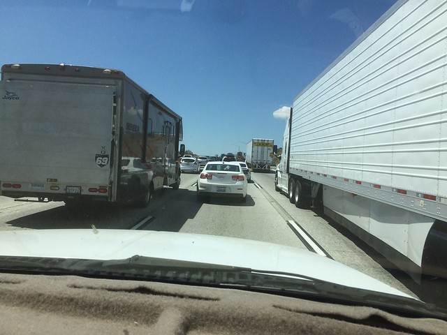
    We left in the wee hours this morning, wishing to get through LA before the rush began. Really, there was no traffic to speak of through LA and up the Grapevine. Got more cars once we were down the Grapevine and of course, trucks. We stopped at the Tejon Pass rest area and there were loads of cars with sleeping people in them. Stopped for breakfast at the exit before Buttonwillow, at IHOP. We were puzzled over the sale of "bio-diesel" and hoped that we wouldn't have trouble finding good-old diesel #2. (And later, did not.) Walking after the meal was in order, for both our own bodies as well as to take our time in getting where we were going.

    Comin' through the Grapevine:
    IMG_5402


    Sunrise:
    IMG_5404

    Next stop was at Coalinga Rest Area, for a walk and then a long rest of the eyes. It did both of us good, though I don't think we actually slept. Stopping in Santa Nella at our usual haunt, Rotten Robbie's, we found fuel was $2.77/gallon (yuck) and the truck was thirsty. However, 16.5 mpg was nothing to sneeze at, considering the uphill and the winds we were battling in places. Next stop was the Westley Rest Area, for another walk and rest of the eyes and to kill time, as we didn't want to try to check into our motel too early.

    Our choice was the Best Western Shadow Inn, as we wanted to try the BW chain, and the Internet price was right. We unloaded, got situated in a fairly decent room, then donned swim attire and went for a 20 minute swim. The pool water was absolutely wonderful, "just right". The room itself is quite nice, with a king sized bed, fridge and microwave in a nice cabinet that contains a working sink, TWO luggage racks, a small TV, a large desk, a loveseat and two chairs, and a “coffee table”. The bathroom is a wee bit small but no big deal, we're only here for a night. Everything is super clean and in good order, with plenty of lighting.

    This was supposed to be a 525 mile day, according to Google Maps planning. Leaving early was mostly to avoid driving through LA during the daytime. However, the other side of that is arriving at the destination before your motel is ready for new guests. If we had not taken our time at breakfast, and then two long rest area stops, we would have taken a little more than 9 hours to get here, instead of almost 11. Traffic through Stockton and Sacramento was fine, nothing too heavy. Now we are wondering what the traffic will be, north towards Redding and into Oregon.


    Donna

  2. #2
    Join Date
    May 2011
    Location
    Central Missouri
    Posts
    5,943

    Default Day 2

    DAY 2 – WOODLAND CA to ALBANY OR – 493 mi - 9-1/2 hours

    We left a little later than we usually do on a 2nd day, just at 8, after getting ice for the larger cooler at the mini-mart next door to the Best Western. We drove to Willows, about an hour down the road, before stopping for breakfast at a cute little place right next to the airport. The place was called Nancy's Airport Cafe, and they served some wonderful food.

    Then we drove and drove, stopping at a couple of rest areas. The one near Lake Shasta, just north of Redding, had a full parking lot, so we parked with another car in a long slot meant for RV's or trucks. (I hate to do that, but what else were we supposed to do?) At the rest area near Weed, which was located next to another airport, we waited as 4 cars pulled out all at the same time, so we had our choice. At that rest area, hubby and I took about a 13 minute walk, down to look at an old CDF plane which was obviously there as a “show-and-tell”.

    I-5 crossing Lake Shasta:
    IMG_5407

    The lake level has come up in the past year or so:
    IMG_5411

    Mt Shasta:
    IMG_5413

    Once across the Oregon border, we fueled up in Medford at a Fred Meyers. That was an adventure in itself, as the Gas Buddy map said one thing and the directional sign said another. Fortunately we believed the directional sign, which took us to the right place.

    Back on the freeway, we stopped at one more rest area. Oregon seems to go on and on. It seems to go up and down. While the morning's CA mountain passes heated up the transmission a bit, the ones in Oregon didn't even make it blink. We forgot how much you go up and down in Oregon.

    Pulling into the hotel at around 5:30, we had to wait in line for the one check-in gal to get through two others, then when we got up in line she said she didn't have a king room ready for us. Would we be okay with a double queen? Well, no, not really, we wanted a king. So she offered us a complimentary upgrade to a king spa room. No problem! It's a lovely room, with a jacuzzi right in the room.

    We took a brief dip in the indoor pool, which felt really great again after a full day on the road like that (9-1/2 hours). Then when we went back upstairs, I pulled out the cookware and dinnerware, and we had Chicken Alfredo in the room. Sort of wished we had a salad to go with it, but neither of us had wanted to stop at a store today!


    Donna
    Last edited by DonnaR57; 08-02-2017 at 09:08 PM. Reason: added photos, corrected typos

  3. #3
    Join Date
    May 2011
    Location
    Central Missouri
    Posts
    5,943

    Default

    DAY 3 – ALBANY, OR to SEQUIM, WA - 320 miles - 8 hrs 50 min (included 1-1/2 hr hike)

    Today was not the best day of our trip, that's for sure. Trying to find ice first thing, we finally found a Fred Meyer and got gasoline as well as ice. Later, I realized that my FitBit Charge, which had been in my purse, was no longer there. (I was wearing the other one.) Thinking back to the morning, I realized that it must have fallen out in the fuel station at Fred Meyer. This was discovered at breakfast in Wilsonville, 50 miles later. So I called back to the store and yes, someone had turned in my Charge! A phone call later, they had mailed it back to me, no charge. I must remember to send them a $5 bill for the postage, when we return home. In the meantime, I have only this other one, and it does not give me the time, my heart-rate, nor does it give me instant feedback about number of steps.

    Portland was the next headache. It got so bad that hubby had already vowed and declared that he did not want to drive this city in the opposite direction on Saturday. If that weren't bad enough, the truck started to buck and kick like it does when something is interfering with a sensor, while we were on the bridge about to cross into the State of Washington. Fortunately it didn't last long, but when you're in monstrous traffic, going up a bridge and your truck starts to revolt, you are scared.

    Finally getting off of I-5 at US-101 north, the drive was better for traffic, and for scenery, especially once we began to drive along the Hood Canal. The water is so green! At Hoodsport, we turned west to go into the Lake Cushman area and back into the Staircase region of Olympic National Park. Nice road for the first 10 miles, then it turned into hard packed dirt, then....yuck, washboard. When we hit the ONP border, it went back to paved road again. Had trouble finding parking at the trailhead, so we had to use the overflow lot. (We would have been upset if we'd have tortured our vehicle and ourselves to that washboard road and not gotten to take the trail.)

    The trail was a mile in each direction, plus the walk from the overflow lot to the trailhead itself. A bit of up, some rocky, rooty paths, but nothing that was a problem. Beautiful views of the Staircase Rapids. We turned around and went back the same way we came, but in retrospect, it would have been just as easy to take the northern trail back.


    Donna ONP 001

    Back to Hoodsport, then north again. No more stops until we got to Sequim and our evening motel at 4:30 pm. I had overplanned, so we didn't make it out to Port Townsend. Oh well. EconoLodge is a let-down after our nicer places of the past 2 nights, but it has everything we really need (except a pool).

    Went to dinner at a place recommended by the staff at the motel: Paradise Restaurant. It was a wee bit on the high priced side, but the food was excellent and the service decent. I ate way too many calories, but after the hike we took today, it worked out OK.

    When we got back to the motel, though, I looked at the tires because I thought I heard a rock in the tire. Instead, I found a nice, 1-1/2” long crack. After some debate, we decided to call AAA and have them change it to one of the spares, so that we could avert a blow-out or a flat on a road like Hurricane Ridge Road tomorrow. Evergreen Towing here in Sequim came to help, but he wasn't really equipped to deal with our large truck. Fortunately, we had everything except a decent truck gauge (will pick one up in Port Angeles, tomorrow) and an air pump. He had a small one of each.

    We are praying that tomorrow will be better.


    Donna
    Last edited by DonnaR57; 08-03-2017 at 08:56 PM. Reason: added mileage

  4. #4
    Join Date
    May 2011
    Location
    Central Missouri
    Posts
    5,943

    Default

    I apologize for the long duration between entries. Unfortunately, we ran into a couple of places with very slow Internet, where uploading photos was almost impossible, and other evenings were just plain busy!

    DAY 4 - SEQUIM, WA to FORKS, WA – 143 mi – sightseeing, 9 hrs

    Departing from our motel at 7, we stopped at a Safeway store to pick up ice as well as lunch supplies for today, then set off to Hurricane Ridge.

    Up, up, up. Smoky, smoky, smoky. When we got up there – 5242 ft – no visibility whatsoever. It turns out that a major fire in Canada, or combination of several, are cloaking the entire Olympic Peninsula in smoky air. BIG disappointment for both of us, but particularly for hubby since he has never seen this, and it was the purpose of the trip. We headed back down, stopped at the Olympic NP main visitor center, then went off to find fuel for the truck.

    First station – the diesel pump was almost inaccessible to us. It seems that we arrived just as the station's tank supplier had arrived. Second station – wouldn't accept our debit card and they wanted to hang onto our credit card or DL while we pumped. Um, no thanks, move on. Third station – a Shell station – finally, fuel. Truck got 17 mpg despite all that slow going yesterday.

    Off to the next spot, which was supposed to be Elwha River Road and the Madison Falls. Nope, that was in a major construction area, so we skipped it and went on to Lake Crescent. Found the Mount Storm King Ranger Station and set off on a 1.5 mile round trip to Marymere Falls. They were pretty, but nothing to get excited about. It was a good workout, especially the last 2/10th of a mile, up a lot of stairs.

    On the Marymere Falls Trail:
    Donna ONP 027

    Marymere Falls:
    Donna ONP 028

    Then we went off to the next spot, Sol Duc Hot Springs Road. After traversing 12 miles down that road, we pulled into the commercial Sol Duc area in search of a gift shop with national park t-shirts. Not a great selection of the non-Sol-Duc shirts, but we bought two. When we went back to the truck, lunch was in order, so we ate the sandwiches we bought and the mustard potato salad. Fortunately, there are forks in with the coffee stuff. It was a good lunch.

    Drove down to the Soleduck trailhead and set off on the trail to Sol Duc Falls. It was more of the same type of trail as the two previous to this, through old growth forest. But the falls on the end? Beautiful! And much more interesting than the Marymere Falls. That was another 1.5 mile round trip trail, so we ended up doing more than 3 miles, because we also had the steps to get from the vehicle to the trailhead.

    Sol Duc (or Soleduck) Falls:
    Donna ONP 037


    Donna ONP 042

    After Sol Duc, we were pooped. Back to the vehicle, drove the 12 miles back to US 101, made a left for Forks. When we finally got there, we stepped out of the truck into HOT weather. Looking at my phone app, it was over 95. The motel looked sweet, Olympic Suites Inn, and then they told us: NO AC in any of the rooms. No AC? In a motel in this day and age? There was nothing else available, everyone else was booked/full in a radius of 75 miles, except 1 which also had no AC. But for $140, that's ridiculous.

    Then we headed into town, just to see what Forks was all about and to stay in some air conditioning. Our younger daughter had read a series of books set in Forks, the Twilight books (and movies). So we drove around and took a few pictures for her, after stopping in Forks' rendition of Walmart: the Forks Outfitters, which consisted of an Ace Hardware (bought that tire gauge), a clothing shoppe (bought daughter a Forks Twilight shirt), and a grocery store (got more diet soda for me).

    A little later, we went back out to pick up some dinner, at The In Place. Hubby had Seafood Alfredo, and I had a chef salad. On the way back to the room, we went looking for “Bella's house”, found it and took a picture of it. It's falling apart, obviously nobody lives there or if they do, they don't take care of it. There's a big No Trespassing sign across the driveway.

    The weather is starting to cool down, so maybe we'll get decent sleep tonight. We opened all the windows, have three fans blowing (2 of them in the bedroom), it's noisy in the room from all the fans, but it's cooling down.

    The sooner we can leave tomorrow, the better.


    Donna

  5. #5
    Join Date
    May 2011
    Location
    Central Missouri
    Posts
    5,943

    Default

    For the Twilight series fans on here, here are places that the book mentions. Sorry, nothing was actually filmed in Forks or even out in La Push or Port Angeles.

    Forks High School:
    IMG_5434


    Tribal School Bus (think: Jacob)
    IMG_5436


    Bella's house:
    IMG_5438

    Performing Arts Center:
    IMG_5440


    Donna

  6. #6
    Join Date
    May 2011
    Location
    Central Missouri
    Posts
    5,943

    Default

    DAY 5 – FORKS, WA to ABERDEEN, WA – 145 mi – 7 hrs 52 min - mostly sightseeing miles

    We honestly couldn't wait to get out of that motel at Forks this morning. Neither of us had had a full night's sleep, because we were too hot. We stopped long enough in Forks to pick up some ice and some coffee, since my attempts to make coffee this morning were not very successful, and we didn't want to wait for the pot to brew.

    I should add this about Forks: there are NO retail chains here - all motels are no-name-brand, mom-and-pop type; no fast food chains, though there is fast food; no chain sit-down restaurants; no chain stores like Walmart or Target. It's a very small town, and judging by the way cashiers and waitresses were greeting people at the places we went, it's an "everybody knows everybody else" type town.

    Our first stop was about 32 miles down the road and another road, at the Hoh Rain Forest. We took part of the mini nature trail, and part of the Hall of Mosses Trail, to see the forest. Went as far as the Maple Grove, and I got so cold we turned around. Hubby didn't mind, as he was not visibly impressed with the rain forest.

    Donna ONP 055

    Donna ONP 059

    Donna ONP 064

    On the way out, we stopped at the Hard Rain Cafe to see about some breakfast. Long wait, followed by more issues: they had no real sugar, Coffeemate, or half-n-half for coffee. Hubby went outside, I just used the Splenda they had and the 2% milk while he raided our own coffee makings. The eggs were hard-fried instead of over-medium, the toast had no butter (only sugary blackberry jam), no salt and pepper or napkins were on the table.

    Our next stop was at Ruby Beach. Taking the trail down to the beach, it was heavy with drifted logs and there were lovely rock formations. We walked up and down that beach for an hour, enjoying the breeze/weather, the photography opportunities, and looking at the dead crabs on the sand.

    Donna ONP 072

    Donna ONP 075

    Donna ONP 084


    Donna ONP 093

    Later, we had a much better lunch at the Kalaloch Lodge (pronounced Clay-lock) and another half hour walk on the Kalaloch Beach, checking out the sand and sea life. We saw a whale spout!

    Donna ONP 098

    Donna ONP 103

    Continuing the drive, we decided that there wasn't much more to see that we wanted to see, so went on to Aberdeen. We found the Best Western Plus on the east side of town, needed to leave US-101 temporarily in order to stay there. It's a lovely place – indoor pool and spa (which we used immediately after unloading), nice room facilities, and more. Much better than last night!

    Decided that after a heavy lunch, a lighter dinner was in order, so we walked over to Burger King which is across the street. It gave us an opportunity to see how to get us back to the US-101 South, since we had to take US-12 to get to our hotel.


    Donna
    Last edited by DonnaR57; 08-08-2017 at 03:19 PM.

  7. #7
    Join Date
    May 2011
    Location
    Central Missouri
    Posts
    5,943

    Default

    DAY 6 – ABERDEEN WA to LONGVIEW WA via ILWACO WA and ASTORIA OR - 156 miles – 8 hrs 15 minutes

    There was no real hurry to leave the hotel this morning, so we had a leisurely get-ready and pack-out. Then stopped to have a hot breakfast in the BW's breakfast room. We both had an omelet. Hubby had sausage, while I had Canadian bacon and a little bit of plain yogurt with a few walnuts in it.

    It took us about an hour and 40 minutes to make it to our first destination, due to twisty roads and a bit of traffic for awhile. It was about 10:30 when we pulled up to Cape Disappointment State Park to visit the Lewis & Clark Interpretive Center there. Now, we've been to three other centers plus the Museum of Westward Expansion, and they all have different things. We spent 2+ hours there, including the short movie and purchasing a book and fudge (for hubby, not me) there.

    Cape Disappointment, covered by fog (typical):
    IMG_5449 (1)

    Just outside the Lewis & Clark Interpretive Center, is an old fort, Fort Canby, last used in WW2.
    IMG_5454


    Another half hour's worth of driving took us over a very long bridge across the Columbia River into Astoria, and out to Fort Clatsop. We viewed both movies and then walked out to see the Fort. It had a slightly different design than Fort Mandan (ND), but still, very similar. We couldn't spend a whole lot of time there, but we walked out to view where the canoe launch might have been. Didn't walk all the way to it, however, as that was another mile, one way.

    Bridge over the mouth of the Columbia, near Astoria:
    IMG_5465

    Fort Clatsop:
    Donna - Fort Clatsop 002

    One of the displays inside the Fort:
    Donna - Fort Clatsop 005

    On the walk towards the Canoe Landing:
    Donna - Fort Clatsop 014

    Fort Clatsop is located in a temperate rain forest. The Corps of Discovery chose to stay on this side (south) of the river, due to an abundance of elk in the area.
    Donna - Fort Clatsop 012

    Longview and our hotel room was another 1-1/2 hours down the road. At the advice of the two rangers on duty at Fort Clatsop, we took US-30 “the southern shore” route and then crossed the bridge at Rainier/Longview (the Lewis and Clark Bridge). The traffic was rather heavy almost the entire way, which wasn't too surprising considering that it's a weekday evening. The biggest back-up was trying to get on the bridge, with all of the commuters coming out of work. That wasn't nearly as long a bridge – maybe a mile. We have crossed a lot of draw bridges in recent days, since Hoquiam and Aberdeen.

    The motel is the Quality Inn at Longview. The GPS brought us in. There is an indoor pool, which we enjoyed after waiting for the staff to send a mechanic down to fix the door handle to our room (it fell off into hubby's hand and we almost couldn't get out). Then we changed clothes and went to Sizzler for dinner, always a good place and something we can't do any more since they moved out of our home area. Now I'm doing a load of laundry, which I hope finishes soon!


    Donna

  8. #8
    Join Date
    May 2011
    Location
    Central Missouri
    Posts
    5,943

    Default Day 7

    DAY 7 – LONGVIEW, WA to DUNSMUIR, CA – 417 miles – 8 hrs 10 m

    This morning, we packed up, loaded the truck, grabbed coffee at the hotel's breakfast room (instead of waiting for our machine to brew and then have the clean-up), and left. Our detour around Portland was as follows:

    Crossed the Columbia River into Oregon on Rt 433 over the Lewis & Clark Bridge, then turned east on US-30. At Scappoose, we fueled up at a Fred Meyer station, then drove about 5 miles further down US-30 and turned south on NW Cornelius Pass Road. This was an 8-mile short cut to US-26, which we took east for about 7 or 8 miles where we turned south on OR-217. Both US-26 and OR-217 were interstate-quality roads at those points. The 217 dumps you onto I-5.

    Proceeding on, we stopped for breakfast at Wilsonville again, but this time, ate at the Biscuits Cafe on the western side of the freeway. It's a little more difficult to find, then you are parked in a shopping center. The food was pretty decent, about on par with IHOP for pricing.

    I was on the phone for about 15 minutes, talking to Choice Hotels about the Sunday reservation, which was for Comfort Suites in Bakersfield. Our reservation was for a cash price, but we have enough points saved to make it a points overnight. It took 2 phone calls to make that happen, due to a dropped call the first time.

    After two cups of coffee, we stopped twice at rest areas (one had the restroom closed) then it was time to fuel up in Ashland. Fuel is about 20c cheaper per gallon over in Oregon than in WA or CA, so we took advantage of that and filled at a Chevron station.

    There were no more stops until we pulled into our day's destination. We had one slight issue with the truck, as we drove past the Weed Airport, so we surmised that there was some interference that caused the slight hesitation three times in about ¼ mile.

    Great view of Mt Shasta:
    IMG_5470

    Our day's destination was Cedar Lodge in Dunsmuir. It's a small, older motel with parking right outside the door. The reservation was listed as a queen though my paperwork confirming it, said “king”. They had no king rooms available, so they offered us the queen and a $10 discount. Sounded fine, it's just for one night. It was still using regular keys, which is very unusual these days.

    Dinner – well, in a town like Dunsmuir, there isn't a lot of choice. On top of that, there's a big Brew Festival about a mile down the road from the motel, right in the heart of the town. Went to the town's only grocery store, Dunsmuir Supermarket, hoping to buy some ready made fried chicken. No, they only had roasted chicken, and we didn't want to mess with that. With some disappointment, we brought back some frozen meals. I also bought a small package of pre-cut raw vegetables, and made a little “salad” from them with some Italian dressing.


    Donna

  9. #9
    Join Date
    May 2011
    Location
    Central Missouri
    Posts
    5,943

    Default

    DAY 8 – DUNSMUIR, CA to BAKERSFIELD, CA – 495 mi – 8 hrs 10 min

    Into the truck and on the road by 7:30 this morning, our first stop was in Shasta Lake City for ice at a Valero station, and McDonald's for a to-go breakfast. Back into the truck and on the road. Not too many stops, only for rest areas and for fuel at Rotten Robbie's at Santa Nella. The traffic got heavy around Stockton, and between Tracy and the time we exited the 5, it was very heavy – we have named I-5 the “Ho Chi Minh Trail, West”.

    We took CA-46, all 25 miles of it, over to CA-99, then took that south to Bakersfield. We situated ourselves in the Comfort Suites for 12,000 points (and no money). The place is lovely. We enjoyed the outdoor pool almost immediately after loading our stuff into the room.

    We went to Black Angus for dinner and ate way too much. I shared a chocolate fudge cake with my hubby – no way was that dessert for one person! I don't think I even want to know the sugar count or the carb count, though the calories were around 710. Exercise, Donna, exercise!

    IMG_5471


    Donna

  10. #10
    Join Date
    May 2011
    Location
    Central Missouri
    Posts
    5,943

    Default Last day!

    DAY 9 - BAKERSFIELD, CA to HOME – 262 mi - 4 hrs 27 min

    It was another leisurely morning, as we knew we did not have a long day on the road and we were in no hurry to catch up with Riverside/San Bernardino traffic. Both of our cups of coffee, and a little breakfast from the Breakfast Room for me, were taken in the room. Hubby had a couple of donuts that he had purchased at the grocery store in Dunsmuir and forgot to eat yesterday morning.

    While we were packing up the truck to leave, we met a family who were devastated, for very good reason: someone had stolen their car from the Comfort Suites parking lot, with a lot of their stuff in it (including a racing bike). They were from the Eureka area, though I wasn't sure if they had just left home or were returning home. Also wasn't sure about the type of car, but it had to hold 6 people and I heard the man tell the police on the phone, no, the keys were not left in it, and he was giving them a description of everything that was in the car. I felt so badly for them!

    We took CA-58 east, towards Tehachapi, Boron, and then US-395 down to I-15. The last 4 miles of 395 was one traffic light after another. We were looking forward to getting on the freeway again, but once we did, the traffic came to a very slow-and-go. It seemed that CalTrans picked that time (daytime, weekday) to close the left lane and everybody in that lane had to move over and make room. The traffic was heavy but moving well for the rest of the trip – hubby only had to get off his cruise control once more, and that was at “the pass” where the Border Patrol Inspection Station used to be in the northbound lanes. Then not again until we got off the freeway at our exit.

    Welcome back to SoCal at the top of Cajon Pass:
    IMG_5472

    Home looked good. It took us about 2 hours to unload and unpack, and decide what we were going to do about dinner. (I finally found a pound of ground beef in the freezer and just made a convenience meal.) I uploaded the rest of the photos that were in the camera, from Fort Clatsop.


    Donna

Similar Threads

  1. Vacation 2017, Trip #1
    By DonnaR57 in forum RoadTrip Field Reports
    Replies: 8
    Last Post: 07-23-2017, 05:46 PM
  2. Summer Road Trip 2017
    By Karinmcguire in forum Planning Summer RoadTrips
    Replies: 3
    Last Post: 02-11-2017, 09:32 PM
  3. Yellowstone road trip 2017
    By andy, lyns and the jew in forum Planning Summer RoadTrips
    Replies: 7
    Last Post: 11-24-2016, 11:28 AM
  4. Road trip October 2017
    By bennydaroo in forum Fall & Winter RoadTrips
    Replies: 7
    Last Post: 09-19-2016, 07:21 PM
  5. PNW Trip 2017
    By themightyhogarth in forum Planning Summer RoadTrips
    Replies: 14
    Last Post: 08-23-2016, 07:33 PM

Tags for this Thread

Posting Permissions

  • You may not post new threads
  • You may not post replies
  • You may not post attachments
  • You may not edit your posts
  •