Page 4 of 5 FirstFirst 12345 LastLast
Results 31 to 40 of 48
  1. #31

    Default Seeking Wisdom, MT - Day 29

    Tuesday, June 15, 2016

    Start: Sula, MT
    Finish: Missoula, MT

    Campground view


    Not as cold overnight as we feared, however we wanted to get going. We went up the road to enjoy a great breakfast at Sula Country Store. A little further down US 93 we turned east on MT 43, right at the MT-ID state line. We made a quick stop at another Continental Divide trailhead for a short walk at 7,251 ft.

    Paintbrush


    The drive over to Wisdom is beautiful, saw a pair of Sandhill Cranes along the way. We made a stop at Big Hole National Battlefield, the site of a brutal attack on a Nez Perce camp in 1877. This site, visitor center and battlefield, honors the men, women and children killed during that incident. Lewis and Clark camped in this area, Big Hole and Wisdom, and named several of the rivers.

    Wisdom is sometimes listed as the coldest spot in the nation, a couple of summer ago we came here to camp when it was reaching 100 degrees in Great Falls. Back on the road to Anaconda, then west on I-90 to Deer Lodge and a stop at Grant-Kohrs Ranch National Historic Ranch. This is a working ranch, established in the late 1800s, which preserves the history of cattlemen. Buildings are available to tour. While there a train came through, the teepee structures provided a contrast of eras.

    Grant-Kohrs Ranch NHS


    Continued west on I-90 into Missoula. We visited the Montana Natural History Center for a passport stamp; Ice Age Floods National Geologic Trail. This trail interprets a massive floods, about 12,000 to 17,000 years ago, caused by the melting of ice which changed the landscape. The Trail has sites in WA, OR, ID & MT. Currently the museum is not charging an entrance fee, a small museum with displays of local animals and fossils with good information plus an art gallery. There were spectacular photographs on display when we were here.

    More rain was predicted, plus we needed an oil change for the van, so we stayed at the Motel 6 in town. The mechanic discovered a bad tire on the front passenger side. We use Discount Tire for our tires, the closest one was in Kalispell, about 90 miles up the road and our next stop tomorrow. We decided to take a chance and head up there in the morning for the tire replacement (we made it).

    Wildlife Sightings

    Northern Harrier
    Black-billed Magpie
    American Robin
    Swallows
    Sandhill Crane
    American Kestrel
    Marbled Godwit
    Swainson's Hawk
    American Crow
    Common Raven
    Turkey Vulture
    Red-winged Blackbird
    Osprey
    Bald Eagle

    Mule Deer
    Columbian Ground Squirrel
    White-tailed Deer

  2. #32

    Default Tires & Hail - Day 30

    Thursday, June 16, 2016

    Start: Missoula, MT
    Finish: Sundance RV Park, Coram, MT

    The cars and pavement were wet when we woke up and there was a light rain falling. After a fast food breakfast we headed north on US 93 with one bad tire, inner edge of front passenger side worn down to metal mesh. Luckily it was cool and good road. On our way north we did take a detour to a new site for us, National Bison Range. It was a short detour off of US 93 and on paved roads to the visitor center. We did not do the tour loop as it was a dirt road and didn't want to stress the tire, or ourselves. The history at this site, managed by the US Fish and Wildlife Service, the same organization that manages the National Wildlife Refuges, is interesting. This site was established in 1908! We did see a few bison on our way in and out of the range - we will be back! This was another site for the Ice Age Floods NGT passport stamp, plus a special stamp celebrating 100 years, 1908 - 2008.

    National Bison Range


    Bison bi-products


    Ancient Bison Horns


    Bison Horn display


    We continued up US 93, then took MT 35 along the east edge of Flathead Lake. This was a shorter route to the north edge of Kalispell and definitely more scenic. We had an appointment at Discount Tire and they had us in and out very quickly. They also gave us a reference for a place to get an alignment, which we scheduled for the next morning.
    The shopping center had a Cabella's which typically has a smashed penny machine so we walked over there and got a set. We had a tasty lunch, and fresh beer, at MacKenzie River Pizza, Grill & Pub. This is a local chain restaurant, their interior decoration was was very attractive.

    So with our tire issue under control we headed east on US 2 towards Glacier National Park. The weather was turning cold and staying wet so we decided to find a private RV park with an electric hookup. Using Allstay Camp & RV I located a small park charging a reasonable rate. As we pulled in to register the skies opened - not just rain, but hail. After paying we continued into West Glacier and stopped at several sites to get the park's passport and for me to pick up the Junior Ranger booklet. An option for one of the activities was to interview a park ranger, a favorite activity of mine. At the end of the interview I asked her where was her favorite place in the park, she hesitated. With a gentle nudge I was able to have her tell me that the Two Medicine area of the park was her favorite - I told her that was our favorite area, as well. We had spent several days there a few years ago and were heading there tomorrow night (Donna57 - looks like you enjoyed it as well).

    We stopped in the village of West Glacier and enjoyed some pie and ice cream before heading back to camp. As we pulled in to park and set up an even stronger hail storm pounded us. I was able to get out, plug in and get the heater running. There was a short break in the rain which allowed us to get out and walk around before settling in for the night.

    Wildlife Sightings

    Brewer's Blackbird
    American Robin
    Red-winged Blackbird
    Black-billed Magpie
    Marbled Godwit
    Gull
    Hawk
    Northern Shoveler
    Cinnamon Teal
    Osprey
    Dark-headed Junco

    Bison

  3. #33

    Default US 2 & Two Medicine at Glacier NP - Day 31

    Friday, June 17, 2016

    Start: Coram, MT
    End: Two Medicine Campground (NPS), Glacier National Park

    More rain overnight, cold in AM. Glad to have hookups and heater in AM. Back into Kalispell for front-end alignment. We were told our alignment looked fine, he did make an adjustment based on what we told him about the damaged tire. Picked up a few supplies then headed east along US 2.

    Late yesterday evening Going to the Sun road, which traverses Glacier National Park, opened for the season. We have driven it several times over the years, but have decided not to do it again. Last time when we were here, July 2012, we took the shuttle all the way across and back. This was much more enjoyable, for all, the driver and passenger. We do enjoy taking US 2 along the southern edge of the park to get to the east side. A stop at Goat Lick, a small section of Glacier NP that US 2 crosses, we did not see any Mountain Goats. Glad we got to see them earlier in the trip near Grand Teton NP. This made for a good picnic stop.

    Goat Lick - Glacier NP


    The rest area at Summit, along the Continental Divide is a great stop. The obelisk id dedicated to Theodore Roosevelt for his "leadership in the conservation of national forests". There is also a geological interpretive sign for the Lewis Thrust Fault which is seen in the mountains across the road.

    Continental Divide


    Lewis Thrust Fault


    Our 'happy place' at Glacier National Park is Two Medicine. This is one of the least developed areas of the park with a campground, picnic area, general store and boat dock. A commercial boat tour is available, leaving several times throughout the day, as well as small boat rentals. When we arrived we checked in at the Ranger Station to see how cold it was expected to get tonight - 40 degrees. While there I turned in my completed Junior Ranger booklet and received my badge. In reviewing my booklet the ranger shared that a trail in this area was recently closed due to Grizzly Bear activity. The day before a ranger was patrolling the trail and went off trail to pick up some discarded orange peels, as she approached the trash a bear appeared and was aggressive. In grizzly country any food can attract bears and cause negative human-wildlife interaction. Closing the trail for a few days, after cleaning up the area, is a good choice. We enjoyed an afternoon of bird watching and decent temperatures. We had a great campsite with a nice view. After setting up camp I walked around the edge of the lake.

    Evidence of Beaver


    Common Merganser - we later learned she had been seen with chicks riding on her back.


    Columbian Ground Squirrel


    Sego Lily


    I attended the evening ranger program, the ranger was surprised that the attendance was lower than the evening before when it was rainy and cold. Then she said it was probably because the Going to the Sun Road had opened and had cleared out the campground. By evening the campground was about half full, just right for us.

    Wildlife Sightings

    American Robin
    American Crow
    Turkey Vulture
    Killdeer
    Common Merganser
    Yellow-rumped Warbler
    Golden-crowned Kinglet
    Great-blue Heron
    Ruby-crowned Kinglet
    Ring-billed Gull
    Osprey

  4. #34
    Join Date
    Jan 1998
    Location
    Las Vegas, Nevada
    Posts
    13,014

    Default Seeking Wisdom is a worthy enterprise

    I liked that "Seeking Wisdom"

    Mark

  5. #35

    Default Central Montana - Day 32

    Saturday, June 18, 2016

    Start: Two Medicine, Glacier National Park
    Finish: James Kipp Recreation Area (BLM), along US 191 at the Missouri River.

    Beautiful morning in camp. I got up earlier than usual and walked around the lake for some early morning pictures. Just as we were ready to leave a bighorn sheep crossed the lake outlet, near camp, heading towards the campground. People walking by scared it back across the water.

    Two Medicine Lake


    Flowers - Clematis


    Wild geranium


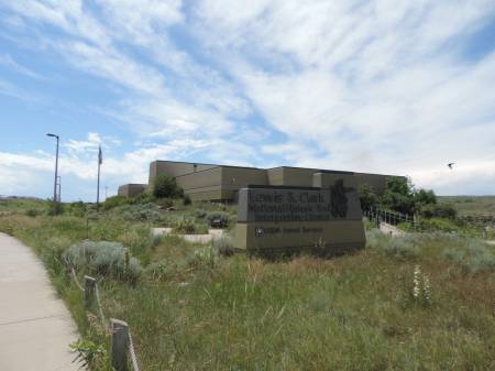
    We would have liked to stay another day, but the weather forecast was 80% chance of showers and thunderstorms beginning at noon and into the evening. So we headed east to Great Falls for the Lewis and Clark Interpretive Center, managed by the USFS. There is an entrance fee which is covered with any of the federal passes. The displays are excellent and well worth exploring as we have done several times over the years (see Donna57's write up). Just upstream is what is left of the Great Falls, not the same as when Lewis and Clark's expedition traveled through here in 1805. One island appeared to be a rookery for gulls.

    Lewis and Clark Interpretive Center - Great Falls, MT


    Lewis & Clark's route


    Great Falls


    We had two more sites in northern Montana to get passport stamps for my husband's postal cancellation collection; Upper Missouri River Breaks NM (BLM) in Fort Benton and Nez Perce NHP, Bear Paw Battlefield, at the Blaine County Historical Museum in Chinook, MT. The battlefield is south of town and has no developed services, just interpretive signs and picnic area. This is one of 38 sites that represent the Nez Perce NHP, as well as the Nez Perce NHT. As mentioned before it documents the history of these Native Americans and their struggle at the hands of the US Government, another injustice not to immigrants, but this time to the indigenous peoples of our country.

    Upper Missouri River Breaks NM - Fort Benton, MT


    Throughout the day we had been watching the weather as it kept coming up behind us, getting darker and darker. The Severe Weather warning included a tornado watch. Our plan was to go a little further east on US 2, then head south to camp along the Missouri River within the Charles M Russell NWR. As we headed east we passed 3 storm tracker radar trucks and other vehicles sitting in a truck stop. Our thought was as long as they weren't on the move and/or passing us we should be OK. As we headed south along MT 66 we passed a number of cars pulled off the road watching the weather to the west with cameras ready. Luckily within a short distance I could see we were south of the serious weather.

    By the time we reached our campground along the Missouri River all we saw were some light rain showers headed our way, which ended up going north of us. The wind was picking up which cooled off the hot, muggy air. This campground is managed by the BLM as part of the Upper Missouri River Breaks NM and Upper Missouri National Wild and Scenic River. It is also along the Nez Perce Auto Tour route and a campsite of Lewis and Clark in 1805. For a very remote campground it certainly had a lot of historic and natural value.

    Lewis and Clark campsite info


    Wildlife Sightings

    American Robin
    Ruby-crowned Kinglet
    Yellow-rumped Warbler
    Black-billed Magpie
    Mallard
    Common Merganser
    American Crow
    Common Raven
    Brewer's Blackbird
    Western Meadowlark
    Gull
    Swallows
    Canada Geese
    White Pelican
    Great Blue Heron
    Yellow-headed Blackbird
    Red-winged Blackbird
    American Coot
    Red-tailed Hawk


    Bighorn Sheep
    Coyote
    Cottontail Rabbit
    White-tailed Deer

  6. #36

    Default Pompey's Pillar to Bighorn Canyon NRA - Day 33

    Sunday, June 19, 2016

    Start: James Kipp Recreation Area (BLM), along US 191 at the Missouri River
    Finish: Grapevine Creek campground (NPS), Bighorn Canyon NRA, Ft. Smith, MT

    The wind died down at sunset, 10 PM and stayed quiet until sunrise,around 5:30 AM. Using the van to block the wind I was able to heat water for coffee & tea. This was important as it was over an hour of driving before we say a place that might have had coffee/tea.

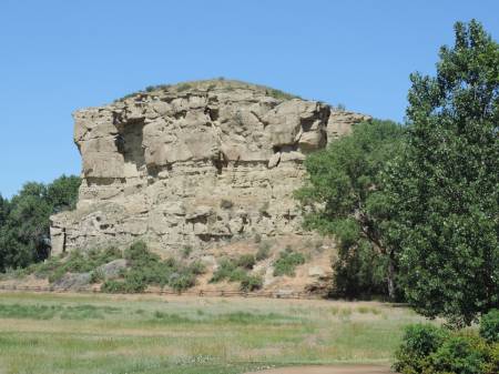
    Our first stop of the day was at Pompeys Pillar NM (BLM), east of Billings. Our last visit to this site was ten years ago, and about 2 weeks before they opened the visitor center for this site dedicated to the Lewis & Clark expedition. While there we met another couple from Sierra Vista, AZ who were traveling cross-country and visiting National Park sites. We spent time chatting about our travels. My husband discovered that the counter at the visitor center was an active post office! Even though it was Sunday the volunteer offered to cancel an envelope, with tomorrow's date, with the site's cancellation - a special treat for an avid collector.

    Postal cancellation in action


    Pompeys Pillar NM


    Replica of Clark's signature on Pompeys Pillar


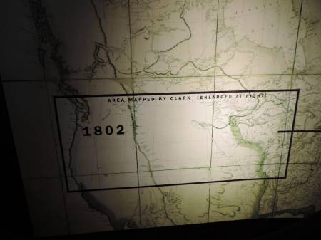
    The pictures below may be difficult to see in full, but they graphically show the impact of the Lewis and Clark's expedition on Westward Expansion. The first photo represents what the West looked like, on a map, prior to their trip. The large map represents what they mapped during their expedition. What they saw, recorded and experienced on this epic trip still intrigues me, especially considering the tools they used.

    Map of area prior to expedition


    Map after the expedition


    Back into Billings for lunch, smashed pennies, and gas at Costco before heading south, actually east on I-90. We made a quick stop at Little Bighorn Battlefield NM. This was Father's Day and we ran into a line at the entrance booth and a full parking lot, the busiest we have ever seen this site.
    From here we headed cross-country to Bighorn Canyon NRA, the Montana unit at Fort Smith. We had camped here last Fall and enjoyed the area, but thought the campground was not arranged well. The spaces could be crowded if it was busy. On this visit we spotted a campground across the bay, to the north and learned at the visitor center it was an NPS campground. We crossed the bay/river on a small dam, downstream from the large dam which forms Bighorn Reservoir in Wyoming and Montana. The campground only had a couple of sites occupied, we set up camp near the water's edge and thoroughly enjoyed an evening of birdwatching and relaxing.

    Yellowtail Dam - Bighorn Canyon NRA


    View looking south at Afterbay - Bighorn River


    Cedar Waxwing


    Wildlife Sightings

    Brewer's Blackbird
    White Pelican
    Canada Geese
    Mallard
    Common Raven
    Western Meadowlark
    Red-winged Blackbird
    Cedar Waxwing
    Western Kingbird
    Eastern Kingbird
    Yellow Warbler
    Belted Kingfisher
    American Goldfinch
    Killdeer
    Cliff Swallow
    Tree Swallow
    Gray Catbird
    Great Blue Heron
    Pheasant
    Say's Phoebe
    Bullock's Oriole
    Ash-throated Flycatcher
    Rock Pigeon
    Mourning Dove
    American Robin


    White-tailed Deer
    Black-tailed Prairie Dog
    Cottontail Rabbit

  7. #37
    Join Date
    May 2011
    Location
    Central Missouri
    Posts
    5,943

    Default

    We tried to fuel up at the Billings Costco - it's one of the few (now) that have diesel. Unfortunately, the lines were horrible, particularly for that diesel, as there were semi's looking to fuel there! It made us rethink our desires for Costco to put in diesel pumps across the US.

    Instead, we fueled up in Park City, MT.

    Donna

  8. #38

    Default

    Quote Originally Posted by DonnaR57 View Post
    We tried to fuel up at the Billings Costco - it's one of the few (now) that have diesel. Unfortunately, the lines were horrible, particularly for that diesel, as there were semi's looking to fuel there! It made us rethink our desires for Costco to put in diesel pumps across the US.

    Instead, we fueled up in Park City, MT.

    Donna
    Donna,
    I can only imagine the line for diesel, especially in MT with all of the pick up trucks! Many times we find the lines at Costco daunting, but the price difference keeps us in line - for Regular.
    Pat

  9. #39

    Default Seeking Cool - Through Wyoming into Colorado -Day 34 & 35

    Monday, June 20, 2016

    Start: Grapevine Creek Campground (NPS), Bighorn Canyon NRA, Ft. Smith, MT
    Finish: Laramie, WY

    Started the day with more bird watching in camp. Before leaving the area I completed the Junior Ranger booklet and received the enhanced badge, a nice image of a bighorn sheep. This was a driving day to get south and in place for cooler weather. Back to I-90 to I-25 to Casper, then a series of backcountry roads to Laramie. The highlight of the day were all of the Pronghorns with fawns.

    Wyoming has some areas that do not have a lot of public campgrounds. In order to get into Colorado the next day we decided to motel it in Laramie. It was in the 90s, the last 'hot' day in this spell. We enjoyed a quiet evening in the room.

    Tuesday, June 21, 2016 - First Day of Summer

    Start: Laramie, WY
    Finish: Green Ridge Campground (USFS), Grand Lake, CO

    Before leaving town we had a delicious breakfast at 17th Street Cafe, near the University of Wyoming. As we headed south we continued to see Pronghorns.

    Pronghorn doe and fawns - having twins is very common


    Our plan was to camp along the Laramie River, just into Colorado at Tunnel Campground. We have camped there several times and have always seen moose and had a cloud of hummingbirds at the feeder. Luckily, I checked the National Forest website and found it would not open for a few more days, not until 6/25.

    So, south into Colorado on WY 230 into Medicine Bow NF to Walden, CO. Along the way we finally got see our moose for this trip. We tried to get a photo, but she was shy. Just south of Walden we stopped at the Arapahoe NWR. We walked a short walk along the Moose-Goose Nature Trail along the Illinois River.

    Arapahoe NWR Mural


    Nesting duck


    Snow-capped Peaks


    Further south, then East on US 40 to Grand Lake, CO. This route brought us to the west side of Rocky Mountain NP. After setting up camp, in a nice shaded site, along Shadow Mountain Lake we went to the visitor center for Rocky Mountain NP for the Centennial stamp. Back into town, we continued our tradition of getting ice cream on the day we spotted our first moose. The campsite temperature of lower 70s was delightful into the evening.

    Wildlife Sightings

    Red-winged Blackbird
    Brewer's Blackbird
    Gray Catbird
    Cedar Waxwing
    Cliff Swallow
    Tree Swallow
    Gull
    Say's Phoebe
    Mourning Dove
    Western Meadowlark
    Canada Geese
    Common Raven
    Black-billed Magpie
    American Robin
    White Pelican
    American Crow
    American Coot
    Cinnamon Teal
    Grebe
    Canada Goose
    American Kestrel
    Black-billed Magpie
    Golden Eagle
    Yellow Warbler
    Yellow-bellied Sapsucker
    Hairy Woodpecker
    Northern Flicker
    Osprey
    Broad-tailed Hummingbird
    Mountain Bluebird

    Pronghorn
    White-tailed Prairie Dog
    Moose
    Wyoming Ground Squirrel
    Cottontail Rabbit
    Least Chipmunk
    Golden-mantled Ground Squirrel

  10. #40

    Default Criss-crossing Colorado - Day 36

    Wednesday, June 22, 2016

    Start: Grand Lake, CO
    Finish: Elk Creek Campground (NPS), Curecanti NRA

    The drive west from Grand Lake on US 40 follows the headwaters of the Colorado River, beautiful country. In Kemmling we went south on CO 9 and ran into our first, of several, road construction stops. Colorado has a short season for road work. Several of the stops were quite long, this one on CO 9 had a sign warning of 45 minute delays. We were held up about 20 minutes.

    At Silverthorne we reached I-70 and went west a short distance before we continued south on CO 9 through Frisco. Just north of Breckenridge, which is now an upscale ski resort we noticed large deposits of placer tailings, leftover from gold mining days. The piles of rock rubble are a result of dredging the Blue River and nearby streams for gold from 1898 to 1942.

    Just after crossing Hoosier Pass at 11,542 ft we saw a sign indicating we were entering the South Park National Heritage Area, an area with a rich cultural history including; Native American, Spanish, Mountain Men and Mining history. We stopped in Fairplay for the passport stamp for this area at the Pike NF office, then explored the old part of town. South of town there were significant placer tailings, like what we saw back in Breckenridge.

    Fairplay, CO


    Historic South Park City


    A lit bit further south we turned east on US 24 to visit Florissant Fossil Beds National Monument. We had not been there since they opened their new visitor center, the displays were very well done. The weather was closing in, dark clouds with a threat of a thunderstorm. They were anticipating closing the trails soon, so we just took our time inside.

    Florissant Fossil Beds NM
    Visitor Center


    Fossil Pine Cone


    Fossil Hickory Nut


    With a storm surrounding us we headed back west on US 24, through a couple more road construction stops to US 285 and the Arkansas River area. This was the first area in Colorado where we saw large crowds of summer tourists, mainly rafters. We stopped in Poncha Springs at Grimo's Italian Restaurant for a delicious meal. We had eaten here many years ago and was pleased to see it was still in business and just as good as our memory remembered.

    Our final leg today was on US 50 over Monarch Pass, at 11,312 ft, through Gunnison to camp at Curecanti National Recreation Area. While enjoying what was left of the evening we listened to a long-winded bird near our campsite, thinking it was a robin. We overheard a birder, walking by, mention they thought it might be a Sage Thrasher. With their help we discovered it was a Sage Thrasher and learned they were known for singing all night long - hmmm....

    Wildlife Sightings

    Mountain Bluebird
    American Robin
    Canada Goose
    Yellow Warbler
    Osprey
    Brewer's Blackbird
    Black-billed Magpie
    Northern Flicker
    Gull
    Sage Thrasher
    Great Blue Heron

    Elk
    Golden-mantled Ground Squirrel
    Fox Squirrel
    Wyoming Ground Squirrel
    Mule Deer with fawns
    Bison
    Pronghorn

Similar Threads

  1. 2016 Loop Trip, Missouri-South Dakota-Montana-Idaho
    By DonnaR57 in forum RoadTrip Field Reports
    Replies: 32
    Last Post: 04-06-2017, 08:36 PM
  2. Replies: 22
    Last Post: 02-21-2016, 02:18 PM
  3. Colorado, Wyoming, Utah trip July/August 2016
    By CrispyA in forum Planning Summer RoadTrips
    Replies: 7
    Last Post: 10-26-2015, 10:51 AM
  4. Colorado, Utah and Idaho Trip August 2011
    By cjsrq in forum Planning Summer RoadTrips
    Replies: 6
    Last Post: 10-08-2010, 05:17 AM
  5. Colorado, Wyoming and Montana….possibly Utah?
    By Voyage_Femme in forum Planning Summer RoadTrips
    Replies: 4
    Last Post: 06-21-2008, 09:56 AM

Tags for this Thread

Posting Permissions

  • You may not post new threads
  • You may not post replies
  • You may not post attachments
  • You may not edit your posts
  •