Page 4 of 13 FirstFirst 12345678910111213 LastLast
Results 31 to 40 of 126
  1. #31
    Join Date
    Dec 2008
    Location
    Melbourne, Australia
    Posts
    7,225

    Default An interlude

    It was when about to drive off the ferry, between Skagway and Haines, that I saw this sportscar with the Australian flag on it, among other things, so got to talk to the driver... who mentioned that he had brought his car over to drive, among other roads, the Haul Road.... the Ultimate RoadTrip. We were told to get in our car, and moved on, stopping only briefly to say a few words... far too few... in the car park once off the ferry. I then lost contact.

    Thought some of you may be interested in checking out these links... before they disappear. In Fairbanks, and how I made contact again.

    Lifey

  2. #32
    Join Date
    Dec 2008
    Location
    Melbourne, Australia
    Posts
    7,225

    Default British Columbia

    Left early the next morning, as I wanted to get to Prince George. But not before another little hiccup. I had fallen asleep with the internal lights on.....

    Two of the locals having breakfast in the restaurant at the truckstop were only too happy to employ jumper leads, and send me on my way. They would not take any reward, so gave each a souvenir keyring. That did surprise them.

    Once on my way, I was advised not to stop for fuel till I got to Kamloops. That ended up being one of very few stops made that day. (It was also clear that I was now well and truly in the land of $5+ per gallon.) Every road around this area is scenic. However, if I was going to get anywhere near my rough plan, I better not keep stopping to take yet another photo.

    Joined 97 at Cache Creek, and on my way north stopped at 100 Mile House. I recall not having time to stop there in 2004, and vowed I would find out what it was all about 'next time'. All up this road there is 30 Mile House, 70 Mile House, 150 Mile House, etc. At 100 Mile House visitor information I enquired about the 'mile house' part... 100 miles from where? She told me that during the gold rush, the prospectors stopped at these places which were *** miles from Lillooet. (I have fond memories of Lillooet, one of my best camping spots in 2004.)

    Once on the Yellowhead Hwy (16) is when I encountered my first wildlife. This was the first of countless bears I have seen since.


    My next stop was at Smithers. A neat little town where I thought it appropriate to wait a while. Spent some time driving around the town and local area. All very scenic mountain territory. Just had a most relaxing time. The local Safeway had a large sign up in the parking lot announcing 'Free Overnight RV Parking'. And I was not alone. The store closes at 11pm, and opens at 6am. Very convenient! Not only that, but their wifi was available throughout the carpark. I just made sure my computer was fully charged.


    This was the early morning view as I was leaving Smithers.

    In 2004 I had left Smithers and driven up the Cassiar. This time I decided to head to the coast first, and check out Prince Rupert. Not a very large place, but a lovely little town. The ferry terminal seemed a fair way from the town. Next morning I headed back to Terrace, less than 100 km up the road. The rain of the previous day had eased, and I planned to take this scenic road slowly, and relish and record as much of it as I could.

    Anyway, why would you want to hurry when this is the backdrop to your journey.


    This bridge was narrow enough, without that truck!

    And the continuing rain was creating waterfalls all along the road... some more spectacular than others. It was difficult to find safe parking spots to capture many of the best ones.


    Most of the way the railway line follows the road - and river - in this area. At one point I saw a freight train which went around two bends in the road, and I still could not see its end. (Would've made a great video for my grandson.)


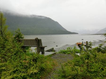
    At one of the rest areas along the river, I saw this small memorial, where no doubts, loved ones could come and remember.


    When on the following day I arrived at Kitwanga I called in at the truck stop on the corner. To my surprise there was the small truck I had seen driving on the railway tracks.


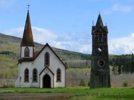
    Right behind the truck stop is the little church with its historic wooden bell tower.


    Next it was up Cassiar and off the Rand McNally atlas.

    Lifey

  3. #33
    Join Date
    Jan 1998
    Location
    Las Vegas, Nevada
    Posts
    13,002

    Default

    Do you remember what the memorial was to? Nice photos again today.

    Mark

  4. #34
    Join Date
    Dec 2008
    Location
    Melbourne, Australia
    Posts
    7,225

    Default Yes and No.

    I know it was between Terrace and Kitwanga on Hwy 16... a paved turnout on the south side of the highway. It was raining, and I was not going to get out of the car again. Figured I could take the pictures sitting in the car. Thought that enlarging it on the computer would show what is written on the anchor. But alas!

    From what I can make out the letters are: CL JEF ACKER or CL JFF AGKER. A google search did not bring up anything, and I could not find a reference to it in my (2004) Milepost. Neither did MilebyMile have any reference to it. And of course, I have no idea if there was a name on the other side of the cross.

    I just figured it was probably someone who had lost their life in a boating accident on this river, which looked more like a huge lake.

    Lifey

  5. #35
    Join Date
    Jul 2007
    Location
    South of England.
    Posts
    12,166

    Default Brilliant !

    I have enjoyed following all of the report so far, but this latest update has really brought the trip 'alive' for me ! I guess it's the great pictures of snowcapped mountains and open roads that done it for me ! [Nice Bear picture]

    Dave who is now getting desperate for a US 'Road trip fix' !! lol

  6. #36
    Join Date
    Dec 2008
    Location
    Melbourne, Australia
    Posts
    7,225

    Default Cassiar Hwy.

    On my first trip to AK I had chosen to travel the Cassiar (37) on the way up, and the Alcan back. But that was in 2004, long before my RTA days. This time the perspective was different.

    Not long after turning north there was a sign to alert me to what was ahead. (Remember, these are kms.)


    Figured it would be nice to make it to Stewart. I had not been there before. There was very little traffic, just enough to make one feel comfortable, but not enough to have to worry about other vehicles. And even though I was enjoying some clear weather, the mountains to the west were indicative of the weather one could expect going to the coast.

    The first stop of interest was at mile 85 - The Nass River Bridge.


    There is an interesting interpretive turn out just before the bridge (where the car is parked). But it was the almost inaccessible sign on the other side of the bridge (whence this photo was taken) which gave details of the bridge.


    It had the name of the bridge and that it was opened on July 8, 1932, and by whom. I was unable to get close enough to read it. This bridge spans the 400' gorge through which the raging Nass River flows. It felt quite eerie driving over this single lane bridge.


    Not much further on the car in front of me disturbed this bear, which was the biggest I had seen. It's coat so beautiful and shiny contrasted with the snow. It had been feeding at the edge of the road, but was quite a ways off by the time I got near.

    A little over 10 miles further is Meziadin Junction, where I took 37A towards Stewart / Hyder. Being early in the season, and with so little traffic, the bears seemed to be out in full force. However, as I neared they would always hurry away from the road. I realised that if I were to get a 'good' photo of a bear, I had better slow down, and not scare them too soon. My reward came not much further along the road.

    He was feeding on the shoulder of the road, and as soon as saw him I slowed to almost a walking pace, and let the car roll slowly to where he was.


    He was a roadwidth away from me, and after posing for this shot, continued eating. I sat and watched him for some time. He was not at all concerned about my presence. (Some people who have seen this photo said that the colour of the face indicate that this animal is sick.)

    Disaster!

    It was after I had taken this photo that my camera indicated the memory was full. I could not understand this, as I have never filled a card yet. Only the previous evening had I transfered my photos to the computer. Still I continued on my way, over the spectacular pass, on my way to Stewart, without being able to record it on this lovely clear day. It was not till later that day, at the library, that I discovered I had left the card in the computer.

    Drove straight through Stewart to Hyder, noting where the RV parks and campgrounds were, for future reference.

    Lifey

  7. #37
    Join Date
    Dec 2008
    Location
    Melbourne, Australia
    Posts
    7,225

    Default Hyder and Stewart.

    Hyder is a place everyone should visit... at least once. Few would ever bother going back for a second time. But it was an experience. There is no border security crossing into AK at Hyder. One just drives straight down the main street... such as it is.


    Even at 20mph, it was not possible to avoid all the potholes. The community centre seemed to be a good place to check out. This building, large by Hyder standards, and small by the standards of the rest of us, houses the fire brigade, gym / community meeting room (there was a meeting in progress), forestry and parks services, public toilets, the library and several other services. The librarian was in and the library was open.... and they had wifi. A recent addition. Out came the computer, and it is then that I discovered the card still in the slot. No one knew how to get the photos from the camera onto the computer. But at least, I was able to again use the camera.

    Hyder does not have a bank. Neither does it have fuel. There is a small grocery store which was open. Other small souvenir/craft shops appeared to be still closed. And it was not yet possible to get near the glacier, which is their main attraction. Apparently they had something like 28' of snow over winter... and the librarian told me that a brave lot of 85 residents wintered in Hyder.

    But it does have a post office. I took the opportunity to mail a letter I had forgotten to mail in MT.


    Even though I was there in mid afternoon, it was quite gloomy (as the photos indicate), compared with the ride I had had over the mountains earlier that day.

    It was time to leave Hyder.... probably never to return!

    Crossing back into Canada there is a border security. A lone solitary border guard. I waited for him to come out of his residence, and after checking my ID, and the usual questions he asked, "What made you want to go to Hyder?" "For the same reason as people climb Everest... because it is there!" He couldn't argue with that, and so, I asked if I could ask him some questions. Which I did.

    Sid was a likable young man, straight out of Border Security College. Figured he would enjoy a remote outpost (which is where all the newbies get sent), and after his four years there, would apply for a post where he would like to settle down. We must have chatted for some 20 mins, during which time one other vehicle came through. It is only when those who work in AK and live in Stewart, come through that he really has anything much to do. Another interesting border crossing.

    Stewart has quite a bit more to offer. A very nice bakery, some hotels which serve meals, and accommodation of all types. And the normal variety of other businesses. Having found all the RV and campgrounds still closed, I asked the lady at the service station, where I filled up, if she had any suggestions. All affordable accommodation was taken by the mine and construction workers. She suggested that I park at the Visitor centre, which also was still closed. But the toilets were outside, and not locked. Seemed like a good idea.

    By the picnic area with gazebo, toilets, etc. looked like a good spot. When I awoke in the morning, I found that it had been raining and snowing all night. The path I had taken in, was now one huge puddle. So big that I could no longer see where the gravel path went. It was 6am when I was ready to hit the road, but as I started to move, I could feel one wheel spinning. This was not good. The weather looked bleak, it was still raining with a bit of snow mixed in.


    Almost two hours later a gentleman came out of the bakery, a local senior who asked what my problem was. Not a problem! He drove the van out to the road, and would not take anything for it. Told me that he had been in the bakery for two hours, and if I had only come in and asked, he'd have driven it out earlier.

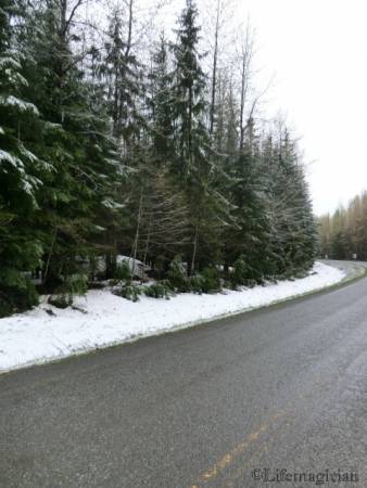
    8am, and I was on my way. These are a few shots I snapped of the fresh snow, and the road through the canyon.


    It is such a pity, as the previous day all these would have made fantastic shots. At the Bear Glacier, the turn out looked so wet and muddy that I dared not drive onto it. So was unable to get any photos there. Maybe another time, but me thinks it's most unlikely.

    The rest of the day did not clear much at all, and most of the way along the Cassiar it was raining or snowing. Not enough snow to settle on the road, but definitely enough to settle on my wipers. All the same I was priviledged to see a moose, grizzly, dozens of black bears and lots of deer/sheep/goats. (At a distance it is sometimes hard to know which is which.)

    In the brief moments that the sun came out, I did snap some of the incredible scenery which this route has to offer.


    Other than topping up at Bell 2, I did not get out of the car till Junction 37/Alcan. The plan had been to camp there, but the lady told me the campground was not open yet, and referred me to Watson Lake. Also said to wait till Watson Lake to fill up, as the fuel there was much cheaper. She did however allow me to use the microwave to make a cup of hot cocoa.

    The Downtown RV Park, where I had stayed in 2009, was the only one open in Watson Lake. And welcome it was at $31. This is a Good Sam park, and since I have the Good Sam card, asked about the discount. "If you want the discount, I will have to charge you $37.45," was the prompt reply. I chose the former.

    The visitor centre in Watson Lake is well known and incredibly helpful. I think the lovely lady may have convinced me to attack the Dempster while I am up north. We'll see how things go. And of course, once again I had forgotten to go to my local authorities to get an old street sign, to add to their 'forest'.

    Lifey

  8. #38
    Join Date
    May 2011
    Location
    Central Missouri
    Posts
    5,942

    Default

    I can just picture you trotting through Customs with your Melbourne-area sign and explaining that one to Customs!!! :-)

    There's a couple of signs up there from our little city in the country. We put one of them there. Of course, that was a few years back, so there may be more now!


    Donna

  9. #39
    Join Date
    Dec 2008
    Location
    Melbourne, Australia
    Posts
    7,225

    Default Whitehorse and the Klondike Highway

    It was on the morning of Thursday, 10th May, that I left Watson Lake. This section of the Alaska Highway was not new to me, and I planned to cruise my way to Whitehorse. The one thing which stands out is the Bald Eagle. It flew across the front of my van. Seemed to be flying ever so slowly, and although I appreciated getting a really good look at it, I prayed it would not hit the van. (So far I have had two larger birds fly into my van... no damage to the van, but the birds would have come of second best.)

    Whitehorse is a lovely city, easy to get around and all the services you would get in a larger city. It also has the best camping store I have come across north of the Canadian border. It is here that I bought myself a small camping stove and accessories. Went to a camera store to see if they could help me retrieve the photos off the camera. No luck! They sent me to another place; who referred me to yet another; and they referred me again; until I started being referred back to the places I had already been. Still, no one was able to help me. My best photo - the one of the bear across the road - was stuck on the camera, and it looked like I would not be able to get it off.

    Once again I stayed at the RV park where I had stayed before. It is a Good Sam park, and although it has the typical shop / office up front, it is very pleasant out in the park. Well spaced out and most sites covered with trees, very good and clean facilities and good wifi. What more could you want?

    At this point my driving days since leaving Joplin had averaged 288 miles. A very pleasant and comfortable pace.

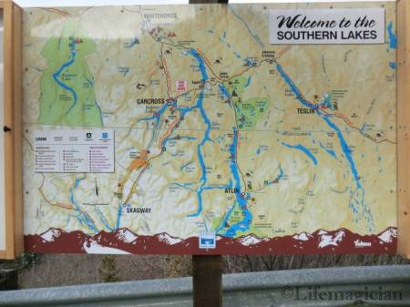
    On Sat morning I left Whitehorse, backtracked along the Alcan to the Klondike Highway and headed for Skagway, via Carcross. Last time I went to Carcross (2004), it was a more hurried trip, and I did not get time to stop for very long at the sights along the way. This time I hoped to have more time, but since there was only one ferry that day, in the afternoon, and not another till Monday, I did not want to take the chance of missing it.

    Still, I cannot bring myself to rush through this wonderful scenery.


    The first turn-out is at Emerald Lake - a magnificent sight. One of the most beautiful lakes in the YT. It is the limestone gravel carved from the surrounding mountains and deposited by glaciers, some 14000 years ago, which gives the lake its bright green colour. What a magnificent spot to build that home overlooking the lake.


    Note the house on the hill, with the green roof.

    Emerald Lake is one of a large system of 'Southern Lakes' formed by glaciers. The Alcan skirts the east side of Teslin Lake - one of the largest in the system - for some 50 miles.


    Only a few miles further on one comes across the smallest desert in the world - Carcross Desert - a real surprise along this road amid the snow peaked mountains and glacial lakes still partly covered with ice.


    A mere 260 hectares, it is the remains of the sandy bottom of a glacial lake, from the last ice age.

    From the desert it is walking distance to the tiny settlement of Carcross.


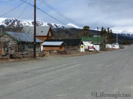
    It was mid morning, and the place looked almost like a ghost town. Not a soul to be seen, and only a couple of visiting cars driving around.


    Since there did not appear to be a visitor centre, to get some more information, I moved on. Little was I to know what lay ahead. Sections of this road were gravel, but that did not detract from the magnificent drive it was.


    Stopped at several scenic points along the Tutshi River and Lake.


    Just before the Canadian / US border is Fraser Rest Area, with its magnificent view of Fraser Lake. I am really glad I read this somewhere, as I would never have known. All I could see was snow.... and information signs which I could not read from a distance, and which I was unable to approach.


    Up until this point the weather had been fine, but that was to end as the road climbed up towards White Pass.


    By now it was snowing.


    Once over the Pass the weather deteriorated rapidly. The road was now quite steep and in places narrow, the snow had turned to rain and visibility was limited. On a fine day, I am sure this would be a spectacular drive, but for me it was best over and done with as quickly as possible. So was the border crossing. No one wanted to get drenched.

    Lifey

  10. #40

    Default Oh, How I wish I Was There!

    I've been busy this week and finally got on the computer this morning to check for your updates. Wow, what interesting and absolutely beautiful are the places you're going through. The next time I drive to Alaska, I'm definitely going to check out this route. Great pictures, particularly of the very large bears you've seen.

    Thanks you so much for these reports. I'm getting the fever to make that Alaska trip again.

    Bob

Similar Threads

  1. NYC to NYC, heading via NC-FL-GA-TN-MI-Canada-MA
    By Rob in forum Planning Summer RoadTrips
    Replies: 1
    Last Post: 05-17-2008, 08:15 PM
  2. Heading Far South-any help?
    By MissErin112 in forum Spring RoadTrips
    Replies: 2
    Last Post: 04-22-2008, 03:52 AM
  3. Heading out, one lap around the USA!
    By RoadTrippers A & R in forum RoadTrip Field Reports
    Replies: 77
    Last Post: 07-22-2007, 11:52 PM
  4. Heading West~
    By Roman Around in forum Planning Summer RoadTrips
    Replies: 2
    Last Post: 06-08-2007, 01:44 AM
  5. Heading East
    By Brianne in forum Share the Gas
    Replies: 0
    Last Post: 09-24-2002, 08:52 PM

Posting Permissions

  • You may not post new threads
  • You may not post replies
  • You may not post attachments
  • You may not edit your posts
  •