I am also planning for a trip like this in the near future. Let's see how well it goes. I will take some notes from here.

I am also planning for a trip like this in the near future. Let's see how well it goes. I will take some notes from here.

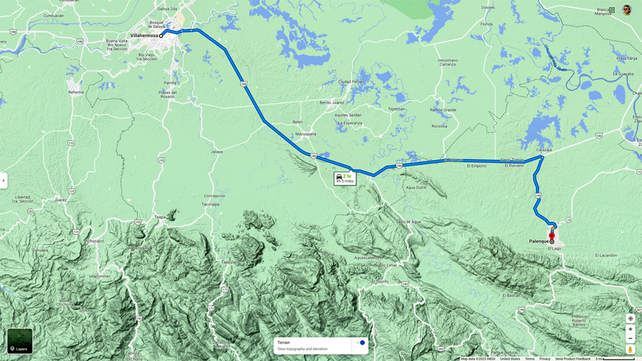
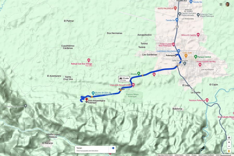
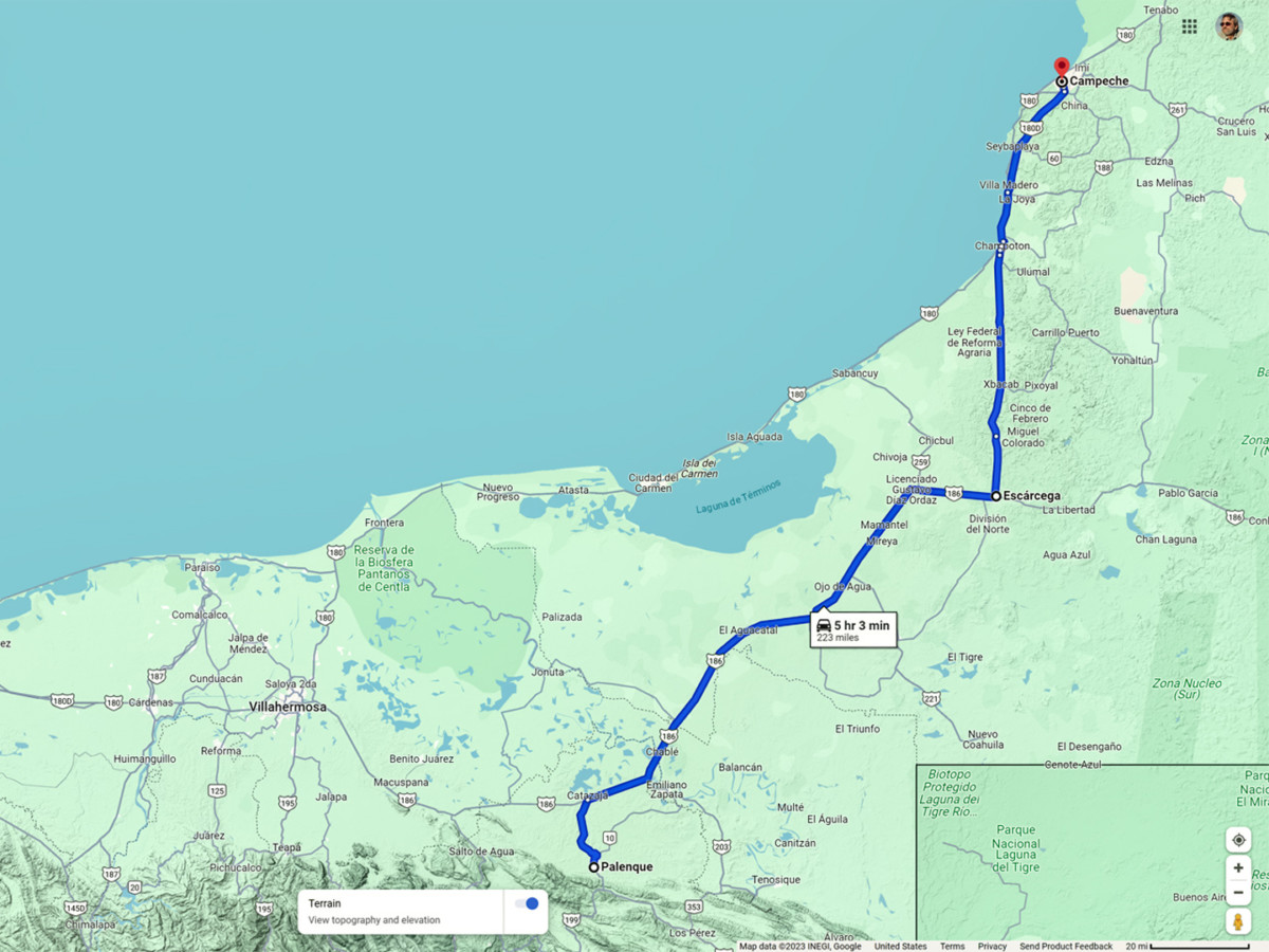
After three long days and more than 1,200 miles of driving, wed made it from Laredo, on the border with Texas, all the way to Villahermosa, in the Mexican State of Tabasco. We stayed the night there, but we didnt stick around long enough to check out the town. Palenque, our first official destination, was just two hours away, and we were anxious to get on the road! We hopped onto MX 186, the toll road, and drove east/southeast toward Catazaja and the intersection with MX 199, a distance of just 75 miles.
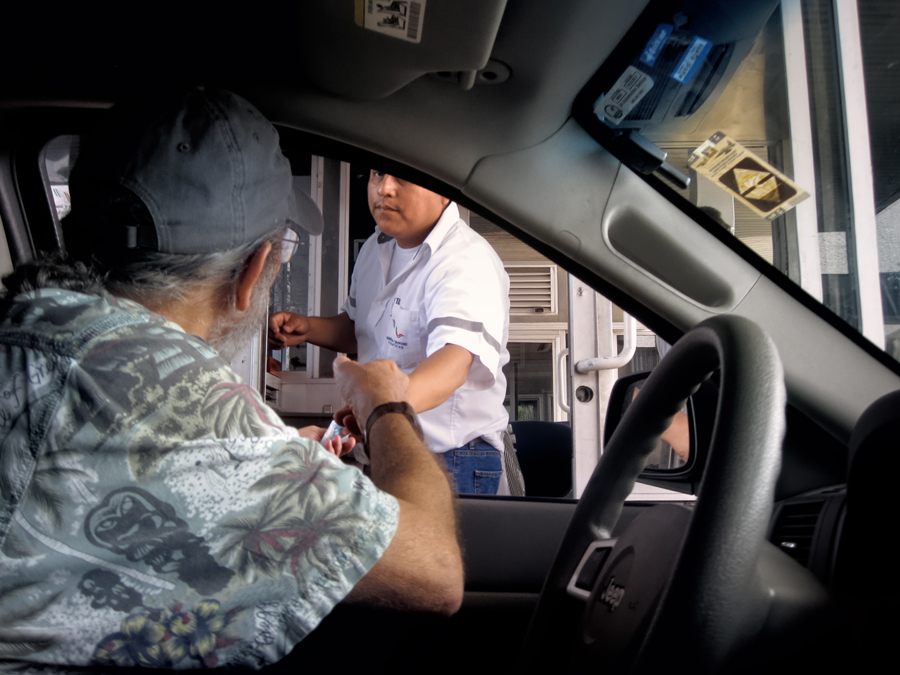
Paying the toll east of Villahermosa
From there, it was another 15 miles south to one of the most spectacular ancient cities in the Americas. Ancient ruins are my passion. This was my first trip to the land of the Maya, so I was looking forward to this day the way a kid looks forward to Christmas.
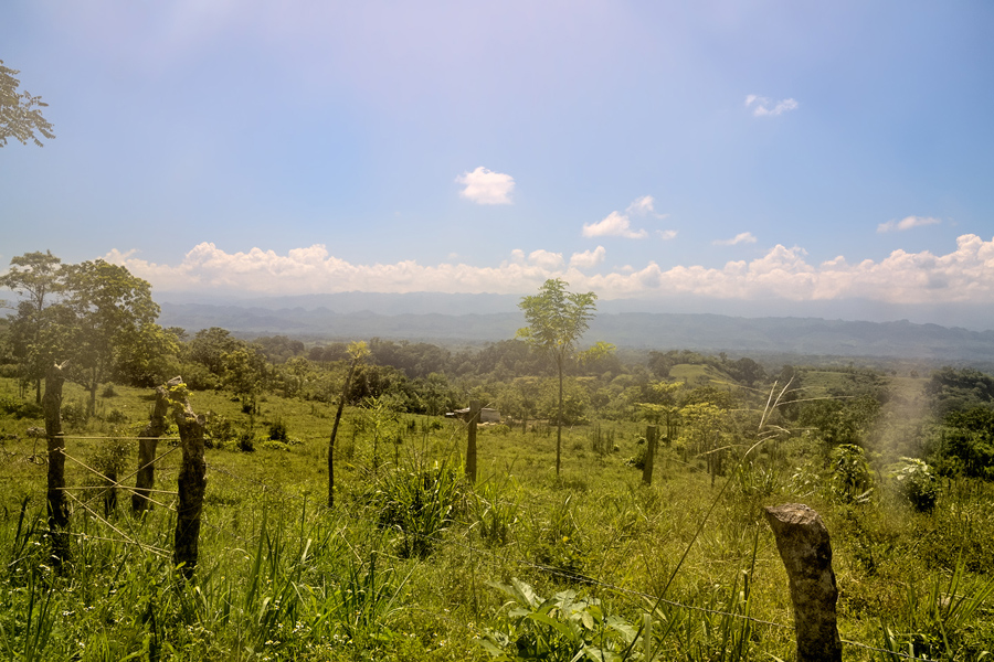
The Normal Route from Villahermosa to Palenque
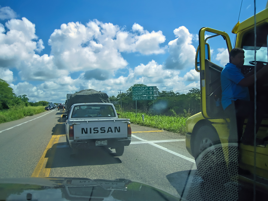
We had smooth sailing the whole way, until just before we reached the road junction. That was where all the traffic came to a halt, a line of buses, trucks, and private cars that stretched out further than I could see. The truckers had all shut off their engines. Many of them had bedded down in the shade underneath their vehicles, and were taking an early morning siesta; some sat together in small groups, playing cards. Vendors were walking up and down the line selling sodas and other refreshments to the stalled drivers, and from the look of things, everyone was settling in for a long wait.
Zapatista Road Block, Stopping all traffic on MX 186
I asked one of the truckers what was going on, and he explained that this was a Bloqueo, a protest mounted by the Zapatistas, a group of indigenous political activists, and they were stopping all traffic on every road leading into the State of Chiapas. They apparently did this sort of thing on a regular basis. This time, they were protesting the proposed construction of a Super Carretera, a modern highway that would run from Palenque to San Cristobal de Las Casas. The existing road was dangerous, and notoriously slow. A new toll road would cut the travel time in half, enhancing commerce, improving safety, and attracting more tourists to the region.
The Zapatistas felt that a road like that would only benefit outside interests, to the detriment of local residents, and that it would degrade the natural environment. To call attention to their position, they parked several 18 wheelers sideways across the highway by one of the toll plazas, and refused to move them, bringing all traffic to a halt in both directions. The Federales showed up first, followed by a squad of soldiers. The opposing factions faced off against each other, the Zapatista commanders exhorting the crowd with bullhorns, and before long the news media arrived, undoubtedly hoping to document a lively head bashing and mass arrests.
That was about the time that Michael and I got there. We walked up closer to the head of the line, to see what we could see: soldiers and police with rifles, campesinos waving signs, and at least one television news crew. I asked someone how long it was likely to last, and was told that it would probably end at sundown. But it could stretch out for two or three days, they said. You never know with these guys.
I wasnt about to spend even one whole day sitting in a traffic jam, no matter how much sympathy I might have for their cause, so that left us with two choices: Option 1: we could make a U-Turn and head back to Villahermosa, then take the coast road north into the Yucatan, saving Palenque for another day, or: Option 2: see if we could find a back road to Palenque that bypassed the Zapatista Road Block.
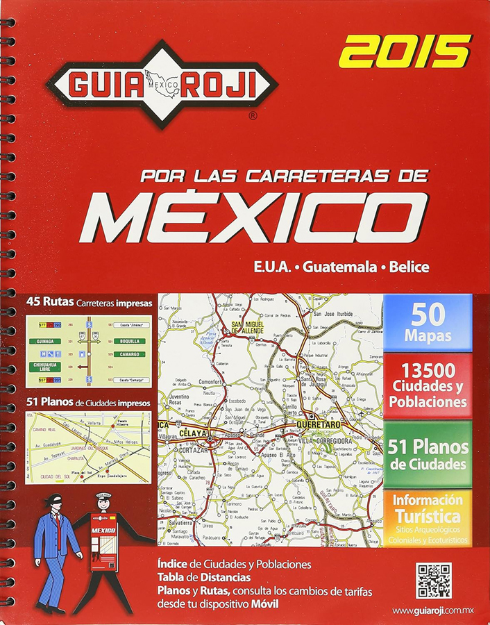
Guia Roji, a Mexican Road Atlas
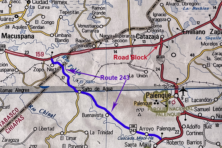
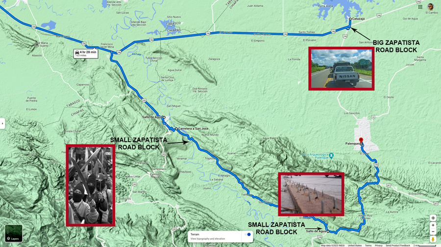
I had a spiral bound copy of the Guia Roji, a Mexican road atlas thats a bit like Rand McNally. I turned to the page with a map of the area around Palenque, located the highway intersection where theyd put up the road block, and then traced backwards along MX 186, looking for an alternate routeand I actually found something! There was a State Highway, #243, that intersected MX 186 about 25 miles back toward Villahermosa.
Route 243, a State Highway, as depicted in the Guia Roji, with the location of the Zapatista Road Block marked
Route 243 crossed the line into Chiapas just before reaching a town called Salto de Agua (Waterfall), about five miles from the main highway. From there, it continued southeast through the countryside, and connected with MX 199 forty miles south of Palenque. It was marked as a secondary road, so it was probably paved, and since wed already decided not to wait where we were, I figured we had little to lose. Itll be an adventure, I said to Michael. As it turned out, truer words were never spoken!
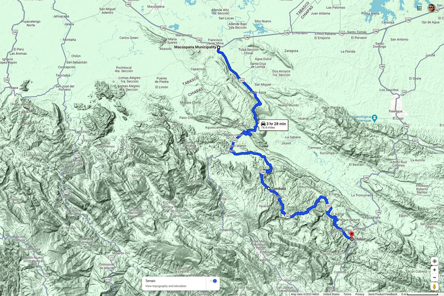
I had no reason not to trust the Guia Roji, but since I had a decent signal on my smart phone, I figured it would be wise to double check that back road using Google Maps. I found State Route 243, but when I tried to match it with what I was seeing in my road atlas, it appeared as though Guia Rojis map artists had smoothed out some serious curves. The road began and ended in the right places, but the countryside in between was something else again!
Route 243 on Google Maps, quite different than the Guia Roji!
The distance to MX 199 was 75 miles, and Palenque was 42 miles further. According to Google, Id need a bit more than 5 hours to drive it. Thats a very slow road, barely averaging 20 mph, with one switchback curve after another!
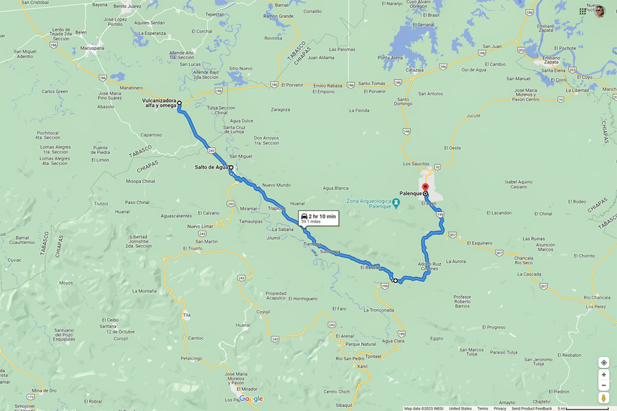
One nice thing about Google Maps is the way it lets you zoom in to view an area in greater detail. When I zoomed on the little town of Salto de Agua, I spotted yet another road, this one even smaller, that seemed to be a shortcut, connecting Route 243 with MX 199 in half the distance, and requiring less than half the time.
A shortcut that we found on Google Maps that was NOT in the Guia Roji Map Atlas
This road didnt appear at all in the Guia Roji atlas. Id been burned by Google Maps enough times to to be cautious: the mystery shortcut might be nothing more than a cart track, or a footpath, in which case Id have to stick with Route 243. Either way, the first step was to drive to Salto de Agua. Once we got there, the locals would know the best way to go.
MX 186 was a major regional highway that carried a ton of traffic; the line of vehicles backed up behind us had grown by almost half a mile, just in the time wed been stopped. Many drivers were turning around and going back the other way, so I made a U-turn, and joined the pack. I assumed that there would be plenty of other drivers with the same idea as me, but when we got to the junction with Route 243, ours was the only vehicle that slowed and made the turn. It was a smaller road than what I expected, so small we almost missed it. Calling this road paved was a serious stretch: half the asphalt was missing altogether, and the rest had potholes big enough to cause damage. We bumped and bounced our way past a sign that read, Welcome to Chiapas. That was encouraging! Nobody was trying to stop the traffic on this roadit wouldnt be worth their time.
We reached Salto de Agua, and almost immediately came to an unmarked fork in the road. This was the point where we were going to need some guidance, so I looked around, and spotted a policeman, standing on the corner. He was staring at us, obviously curious, so I turned around, and drove over beside him.
Good morning, I said cheerfully. Can you tell me which of these roads is the best way to Palenque?
Palenque? he said, looking a bit perplexed. You should go back to the main road. Thats the way to Palenque.
The main road is closed today, I informed him. Nobody is moving past the crossroads.
Ah. The Bloqueo. But even so, thats the only way to Palenque. Youll have to go back the way you came.
My map says that this road goes on to Palenque. I opened up the atlas and showed it to him, explaining about the long way around on Route 243, versus the shortcut Id found on Google Maps. Im wondering if it would be possible to get through on the small road. Its not on my map, but it would be right alongside the river, just north of it.
The policeman studied the lines on the map, tracing them with his finger, looking even more perplexed Yes, he admitted with a shrug. It is possible, but you really dont want to go that way. Its a terrible road! He said something else after that, but I didnt quite catch it, and besides, he had me at terrible road. I drive a Jeep, after all, and I love a challenge!
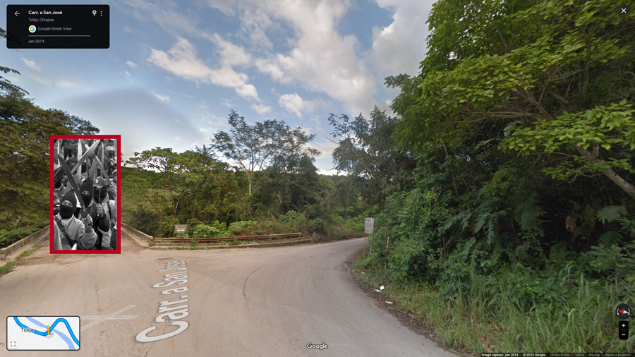
The guy wasnt kidding about the road. The first couple of miles were paved, because we were still in the town, but after that, it went to the dogs, with wheel ruts so deep, it was like driving across a plowed field. According to Google Maps, the road followed a river. We hadnt actually seen it yet, but we were supposed to be crossing it on a bridge at any moment. We rounded a curve, and sure enough, there it was, but there was a gang of guys with machetes who seemed to be waiting for us, and they had a chain stretched across the road, blocking the way.
An unexpected Zapatista Road Block on our unmarked short cut, manned by Mayan men with machetes
More Zapatistas? Mike asked.
If were lucky, I replied. If its anybody else, were in serious trouble. I drove slowly up to the roadblock, and lowered my window.
Good morning, I said. Were driving to Palenque. Will you allow us to pass?
The leader of the group, a young Mayan lad, walked up beside my Jeep, and fixed me with a menacing glare. The road is closed, he said, keeping his hand on the hilt of his machete. By order of the Ejército Zapatista de Liberación Nacional!
Is it closed to everyone? I asked innocently. How about if we pay a toll? How much would the toll be?
He gave me an even more menacing glare. That will cost you everything youve got, he said gruffly, brandishing his machete, while his companions did the same.
I didnt like the sound of that. Not at all, so I gave him a blank look and said, No entiendo. (I dont understand).
No entiende? he repeated back to me. He wasnt quite sure how to respond to that.
How about you take ten Pesos, I said in English, pressing a large, gold-colored coin into his hand. He stared at the coin, worth about 60 cents. It was such a ridiculous offer, he couldnt decide if he should laugh in my face, or chop off my thumbs. The other guys took his uncertainty for acceptance and dropped the chain, so we sped away across the bridge, before they had a chance to reconsider.
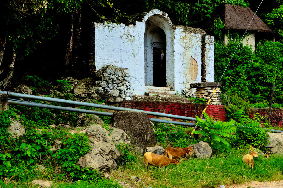
There followed more than two hours of incredibly slow going over what really was a terrible road, but it was beautiful, and driving it was great fun. This was the most rural area wed been through yet, tiny subsistence-level farms, so far off the grid, it was like observing life in a previous century. The only connection with the modern world was the road, which remained terrible for its entire length.
Rural scene along remote back road in Chiapas
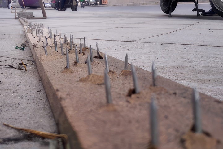
When we finally got to the other end, just before we rejoined the paved highway south of Palenque, we ran into another roadblock! The Zapatistas werent done with us yet. At this road block, they had a long board with nails driven through it from the bottom side, and theyd laid it across the width of the road.
Board with nails, crude but effective way to stop traffic at a road block
We slowed down as we approached, and watched as they pulled their board back to allow a small local shuttle van to pass. Those little vans were the only transportation available to local residents, and they were apparently allowing them through the blockade. I saw that as an opportunity: while the van scooted past the stop point headed west, I shot around them headed east, just barely making it past as they attempted to jam their board full of nails under my tires, loudly yelling at me to stop. Needless to say, I kept going!
We made it to Palenque about half an hour later, found ourselves a room, and headed for the famous Mayan ruins on the outskirts of the town. With all the roads to the outside world sealed off by the Bloqueoeven the smallest roads, as wed discoveredthe only visitors to the archaeological park that day were people who were already there in Palenque before the roadblocks went up, a small fraction of the usual number of visitors. When we pulled into the parking area by the ruins, we attracted a curious crowd, and one of the men asked how wed gotten through.
We took a back road, I told him.
You found a road with no bloqueo?
There was a small bloqueo, I replied. But they let me pass when I paid the toll.
He laughed, but then he quizzed me about that, wanting to know how much Id paid, and on which road, and I realized that he might be some sort of Zapatista organizer, trying to figure out which of their people had failed at his job. I really didnt want to get the guy at the road block into trouble, so I was deliberately evasive, claiming that I was lost out there, and didnt even know which road I was on. He didnt much like that answer, but he didnt press me any further.
Running those roadblocks provided one heck of an adrenaline rush, but, in hindsight, it was more than a little foolish. We were extremely lucky that it didnt end with punctured tires, if not punctured torsos.
The Zapatistas are a serious organization with serious concerns. We were in Chiapas, which is their turf, so I really should have shown more respect. The wise move, under these circumstances, would have been to simply leave the area, and find somewhere else to go until the protest ran its course, and the road opened once again.
Next up: Day 4 (Afternoon): Palenque! My first Mayan City, and it was a Doozy!
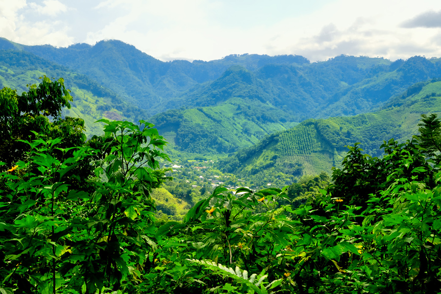
As a photographer, my favorite subject has always been beautiful landscapes, of the sort that you find in our National Parks, but ruined buildings, especially those that are ancient and iconic, run a very close second place. The Mayan cities in the Yucatan had been at the top of my bucket list for decades, but it wasnt until after I retired that I finally had the free time, along with the wherewithal to actually make the long drive south, to see them for myself. Anticipation had been building since we started this road trip, through the course of four days, more than 1,300 miles, and some truly one-of-a-kind adventures. Wed spent the first half of this 4th day bashing through the countryside, evading Zapatista road blocks. Now, at long last, it was time for the good stuff!
Location of Palenque relative to the Yucatan Peninsula
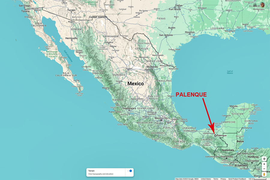
The Yucatan was our nominal goal on this road trip, but Id decided to make Palenque our first stop, mostly because it was the first Mayan city that we came to on our way south from the border. Palenque was one of the southern Mayan kingdoms, at its peak during the Classic Era, more than a thousand years ago. Its located in the State of Chiapas, in an area known as the Lacandon Jungle, which is south of the Yucatan Peninsula. We drove to the town of Palenque, which I assumed was named after the ruined Mayan city. As it turns out, its the other way around. Palenque, the town, is one of the oldest in southern Mexico, founded in 1567, with a current population of more than 130,000 residents. Palenque, the ruin, just five miles away, is the singular tourist attraction in the area, and the only real reason for stopping there.
Palenque is one of the most famous Mayan cities, not because its the biggest or the most elaborate, rather because it was the first to come to the attention of the outside world, as far back as the 17th century. Travelers descriptions of the ruins, illustrated with detailed drawings, inspired much debate among the European intelligentsia, who argued about the origins of the remarkable stone buildings that had been discovered, buried in the steaming jungle. Many scholars assumed that the ruins must have been left by Romans, or Phoenicians, while others saw them as remnants of the lost city of Atlantis! No one thought it possible that the primitive people native to the area could have produced such wonders on their own. Later research proved them all wrong, of course, because the modern day Maya, primitive though they might seem, are the direct descendants of the pyramid builders, and not so very far removed.
Of all the Mayan ruins in Mexico, Palenque is one of the most thoroughly and extensively studied. Todays scholars actually do know a fair bit about the place, and by deciphering the glyphs in the Temple of the Inscriptions, they even know much of the ancient citys history. (If youd like more details, consider checking out my blog: Palenque: Mayan City in the Hills of Chiapas.)
The drive from Villahermosa to Palenque shouldnt have taken more than two hours, which would have put us there mid-morning. Thanks to the Zapatistas, wed been forced into a detour that took us at least four extra hours, so it was already mid-afternoon! That left us just enough time for a brief visit to the archaeological park. First order of business was grabbing a hotel. (We did good! More on that below.) Then it was off to the ruins! There are small vans called combis that shuttle visitors from the town to the park for a reasonable fee, but we had my Jeep, so we simply drove ourselves.
The road to the park is lined by jungle on both sides, and there are several resort hotels along the way; conveniently located, but a good bit more expensive than the lodging in town. We arrived at a ticket booth, where we paid two bucks apiece to enter the Palenque National Park; they made sure to warn us that this fee did NOT include entry to the ruins.
Location of the Palenque Archaeological Park, in relation to the town of Palenque
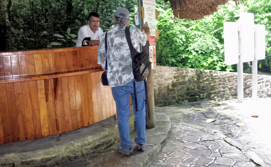
We came to a secondary entrance to the grounds, across the road from a small museum. I attempted to buy our tickets, only to be told that they dont sell them in that spot, that I needed to keep driving, on to the main entrance, a bit further up the road.
Asking directions at the lower entrance, where they do NOT sell tickets!
While walking back to the Jeep, we were accosted by a half dozen guys, loudly offering their services as tour guides. They were overly aggressive, visibly angry with me when I turned them down, and when we got back in the Jeep and drove away, several of them actually chased us down the road, shouting at us to stop! I found out later that these werent authorized guides, they were local hustlers. If we had agreed to hire them, there was a good chance they would have taken our money and disappeared with it!
A word to the wise about tour guides: if you need a guide at Palenque, or at any of Mexicos archaeological parks, its okay to hire someone on site, rather than through an agency, but you should always use the certified guides at the main entrance.
We came to a small parking lot with several empty spaces, but when I attempted to pull in, I was met by a local who made a great show of guiding me into the spot, using elaborate hand signals. He was in charge of this space, he informed us, and for a mere 100 Pesos, he would personally insure that our vehicle would be safe and secure for the duration of our visit. Did that mean it would NOT be safe if we declined to pay him? That was definitely the implication. Feeling a bit like Id just been extorted, I handed over the 100 Pesos (a little over $5.00), then I made a great show of setting my extremely LOUD car alarm before we walked away toward the ticket booth. Entrance to the ruins was another $3.00 apiece, but even when you add all those charges together, I thought it quite reasonable. (Bordering on cheap!) If we had elected to hire a guide, it would have set us back an additional $60 for a two hour tour. Thats still cheap, in the larger scheme of things, but it was more than we wanted to pay, so we decided to skip it; I had a guide book that would tell us most of what we needed to know.
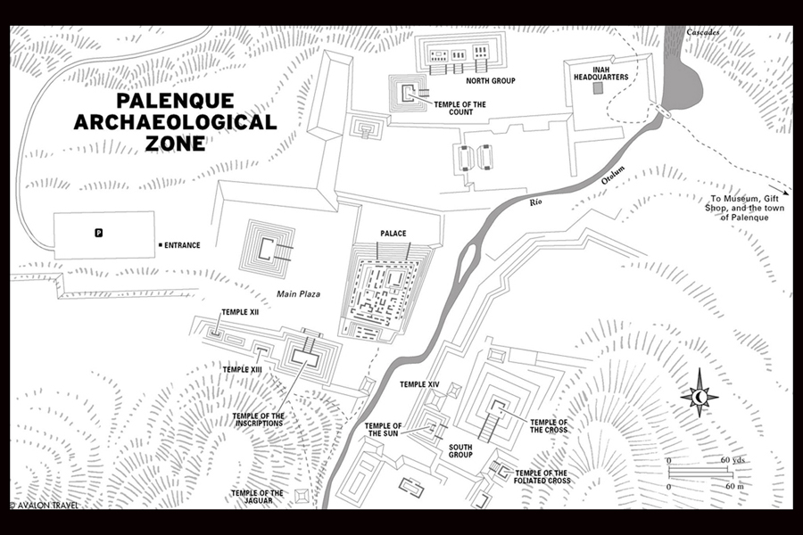
Palenque Archaeological Zone
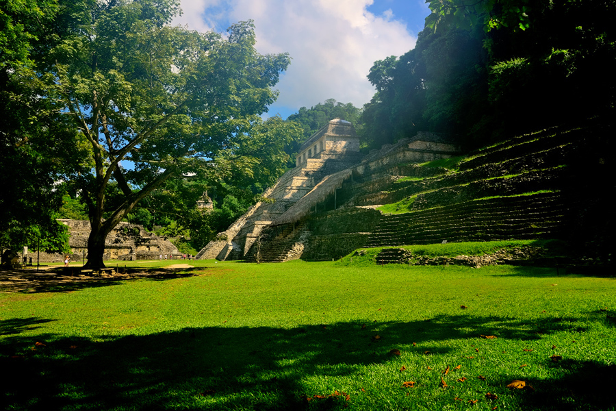
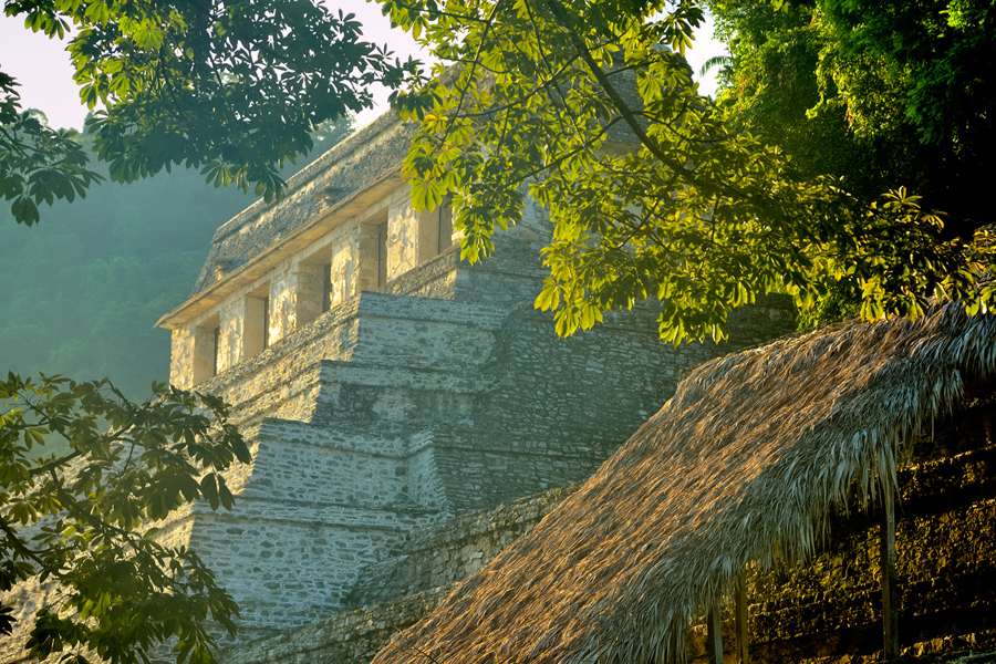
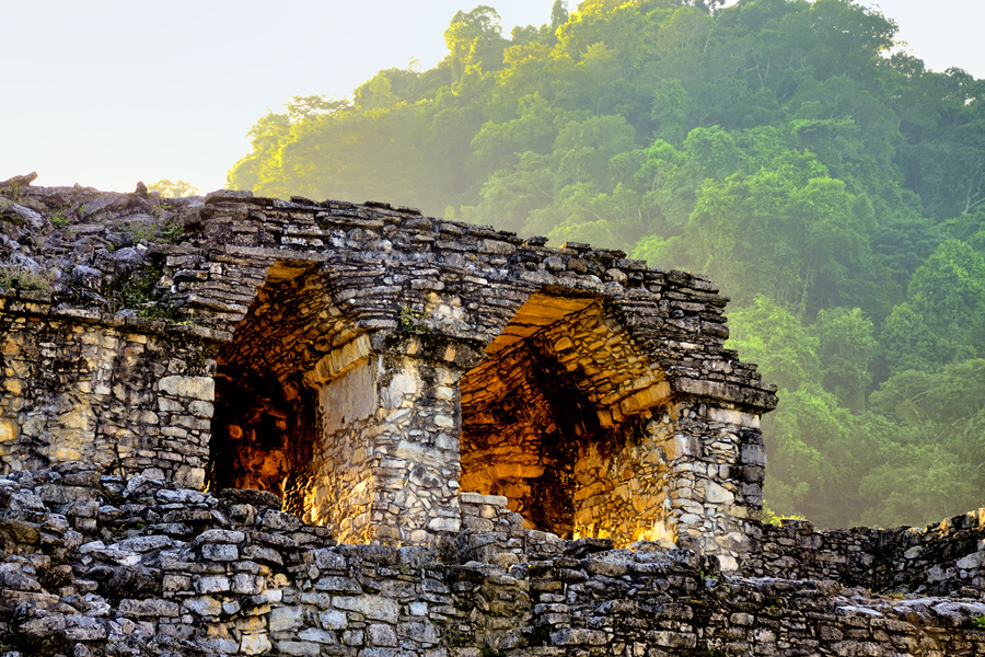
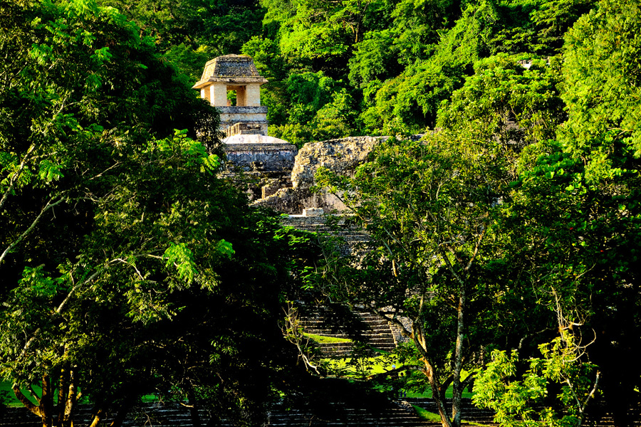
Id studied my little book in advance, at least briefly, and Id read quite a lot about Palenque, everything from illustrated articles in the National Geographic to my old college textbooks about the Maya, so I thought I knew what to expect. We walked up the entrance road, and when we caught our first view of Palenques main plaza, I stopped dead in my tracks, literally struck dumb by that view!
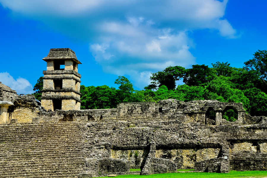
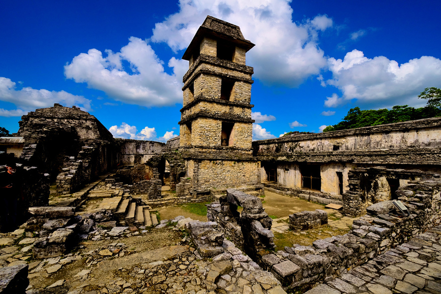
My first view of the ruins: Three pyramids and a Palace!
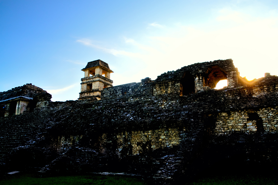
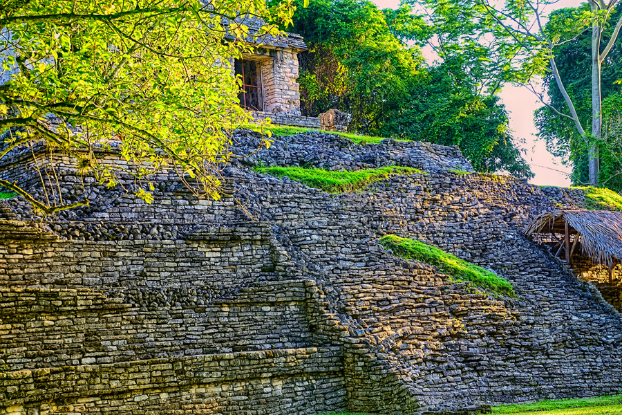
As is so often the case with the worlds ancient wonders, no photograph can possibly prepare you for the extraordinary sight of the real thing, up close and in person. The most important buildings were right there, three pyramids lined up in a row, plus the huge Grand Palace with its four story tower, and so much more! There were crumbling temples crowning the hills in every direction, and the jungle crowded in close on all sides, threatening to swallow it all. Mayan ruins in the jungleit was utterly fantastic! The only thing missing was Indiana Jones in his fedora!
We spent a quite wonderful afternoon exploring the ruins. There were very few other visitors, because the Zapatistas and their road blocks had prevented all the normal traffic from getting through to the town. We took full advantage of the minimal crowd, and I got some great photographs. At the busier Mayan sites, they no longer allow visitors to climb on the pyramids, and the buildings are surrounded by barrier ropes, to prevent you from getting too close. In 2015, when our visit took place, that hadnt happened yet at Palenque. Some stuff was off limits, but we got to climb around on many of the buildings, up the steps, through the courtyards, so we really got to feel the place, the sights and sounds, the musty smells, the rough texture of the stone. I tried to imagine what it must have been like when it was a living city, the buildings stuccoed and painted in bright colors, murals and frescos on the interior walls, and people everywhere, including the priests and royals in their colorful finery. It must have really been something to see!
The park closed promptly at 5:00 PM, and they did a good job of herding everyone out before they locked the gates. We weren't done with our visit--there were sections of the ruins we hadn't even seen yet--but we were planning to come back again first thing in the morning. Our hotel was just minutes away, so we headed back there to relax and regroup.
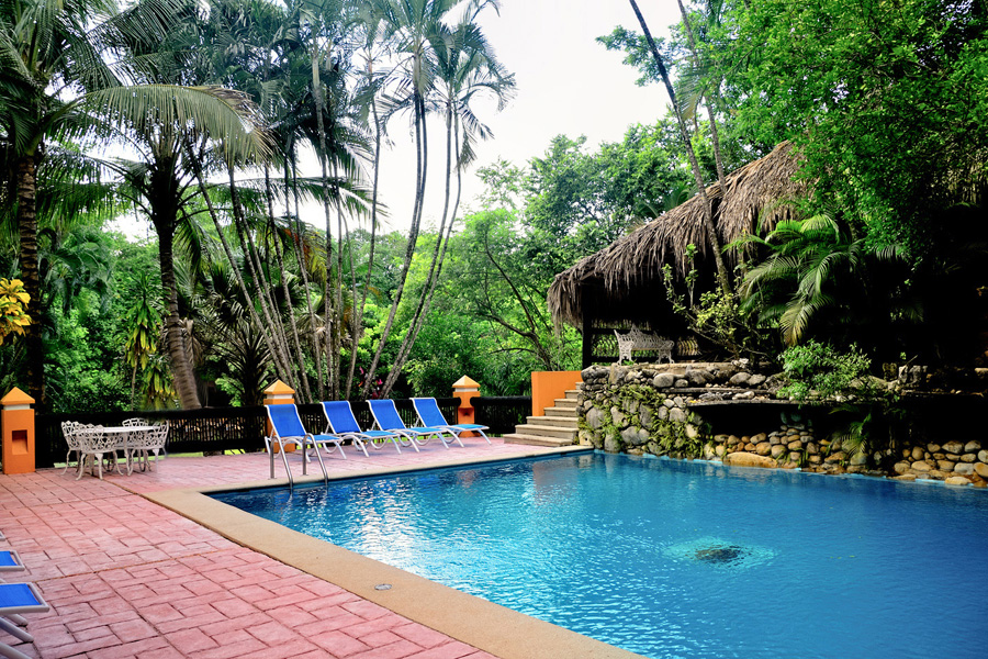
Comfort Inn Palenque/Hotel Maya Tucan
Wed vowed to avoid staying in boring American chain hotels, but we made an exception for the Comfort Inn in Palenque. One look at the pool and gardens and we knew, absolutely, that we were not in Kansas anymore, (or California, or anywhere else north of the border).
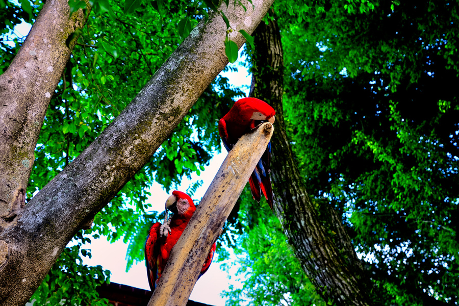
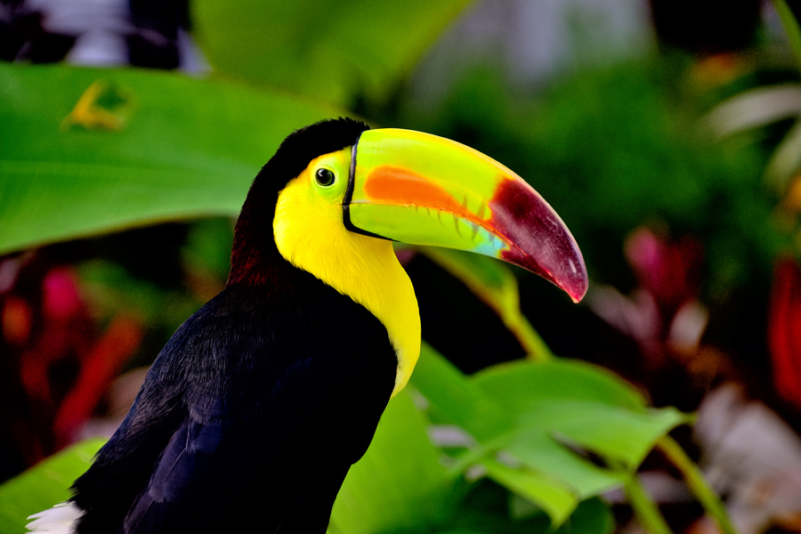
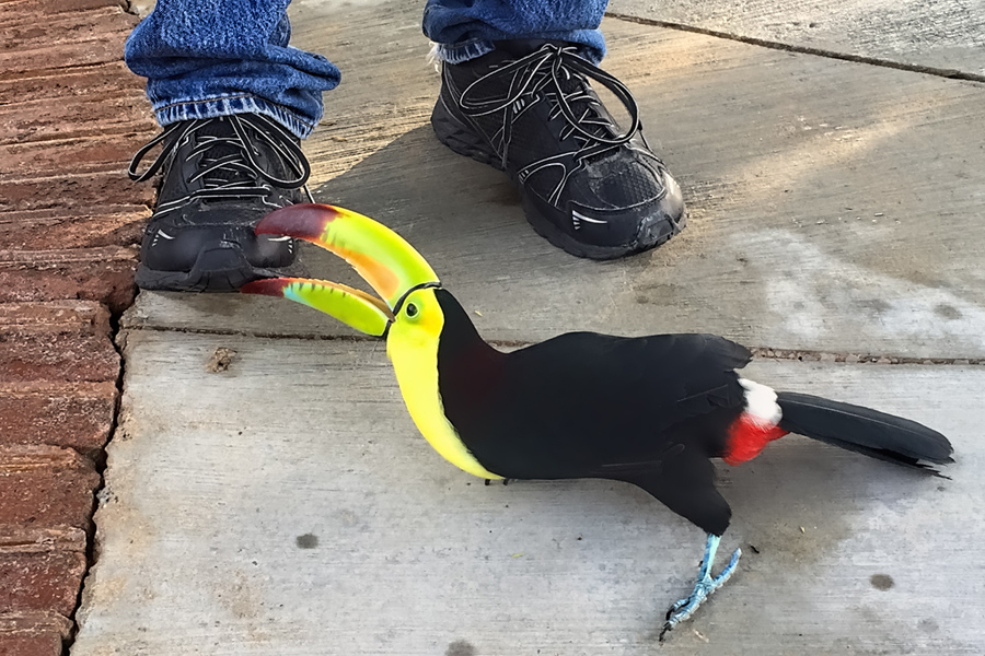
The tropical foliage was one clue, but the real kicker was the tropical birds: parrots, scarlet macaws, and an extremely comical pair of toucans that chased Mike around the pool deck, trying to bite his shoes.
We were there two nights, and I can definitely recommend it. (The property changed names since we were there, and is now called the Hotel Maya Tucan.)
Next up: Day 5 (Morning): Palenque, by the Dawns Early Light!
The next morning, Day 5 of our Road Trip, we were waiting at the entrance to the Archaeological Park a half hour before they opened for the day. We were the only ones there, so they let us through early, and I had the glorious privilege of photographing that wonderful ruin in the golden light of early morning, without a single fellow tourist cluttering my view. We hadnt originally intended to spread our visit across two different days, but in the end, it all worked out quite well!
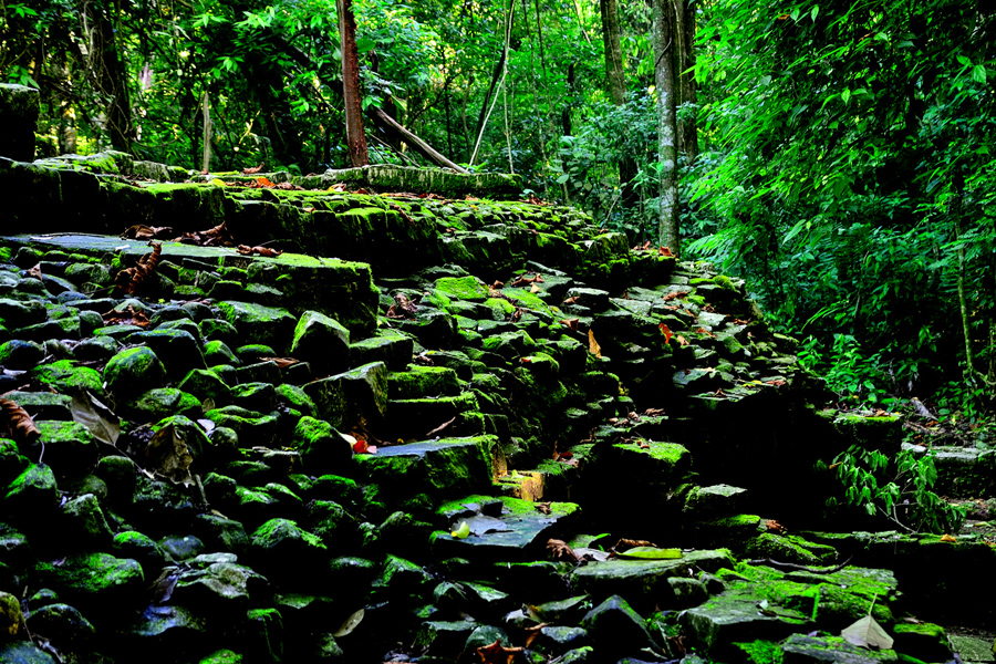
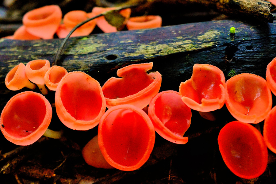
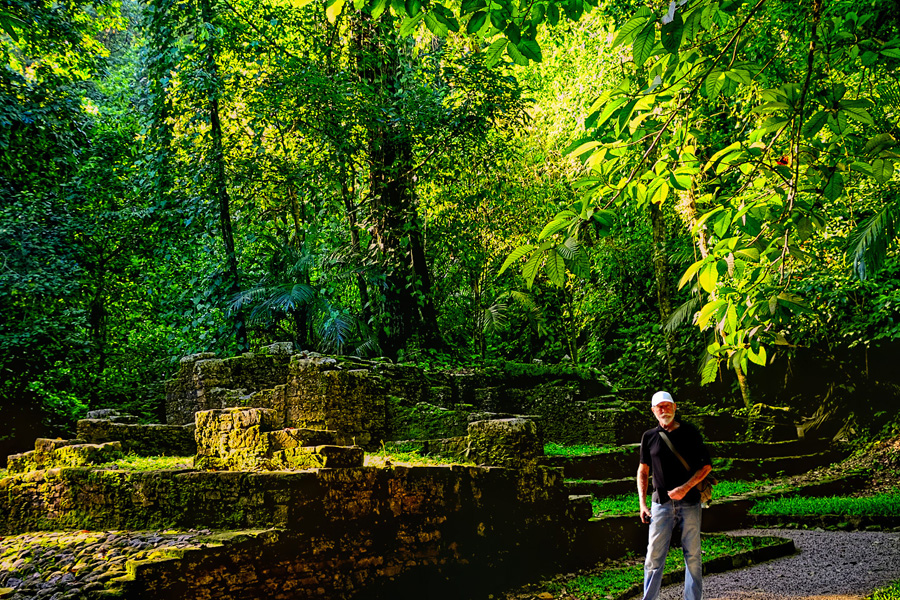
Our first visit to the park, the previous day, was unfortunately rushed, because we got such a late start. Wed checked out whats known as the North Group, a set of smaller temples located apart from the grand structures on the main plaza, but wed postponed the path that led down the mountain from there, into the area called the Arroyo Otulum, the lower section of the ruins. A stone staircase led the way into a steep sided gorge filled with jungle growth, and mossy, overgrown ruins. This was a for real rain forest, perpetually damp, humid, all but stifling within the confines of the ravine. It had been decades since Id hiked in a jungle. This place brought back quite the mixed bag of memories!
Ruins in the Arroyo Otulum, green with moss. The unusual orange fungi was found sprouting from a fallen log
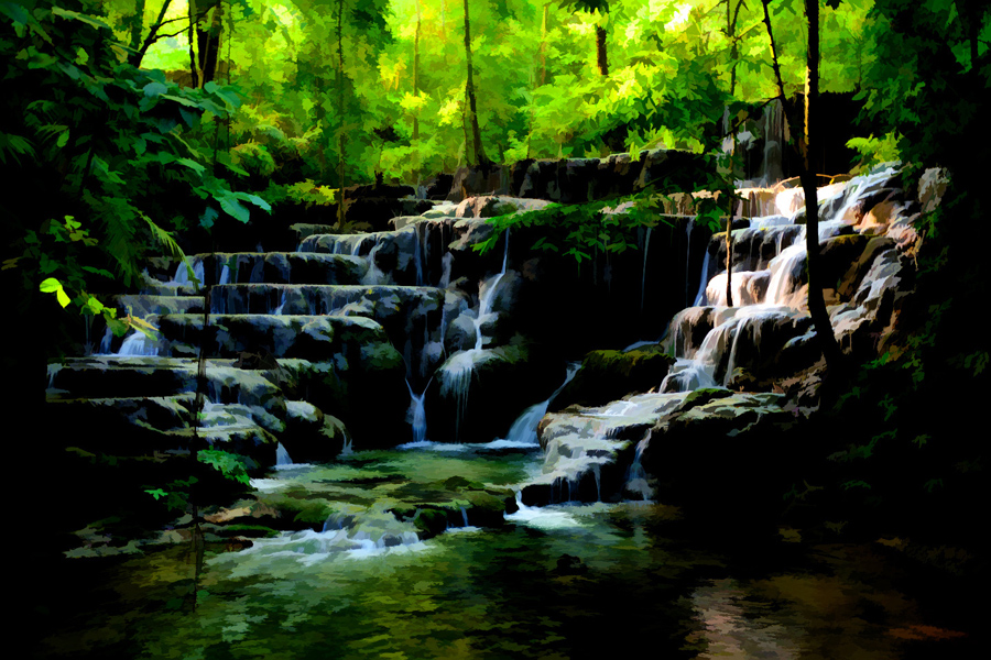
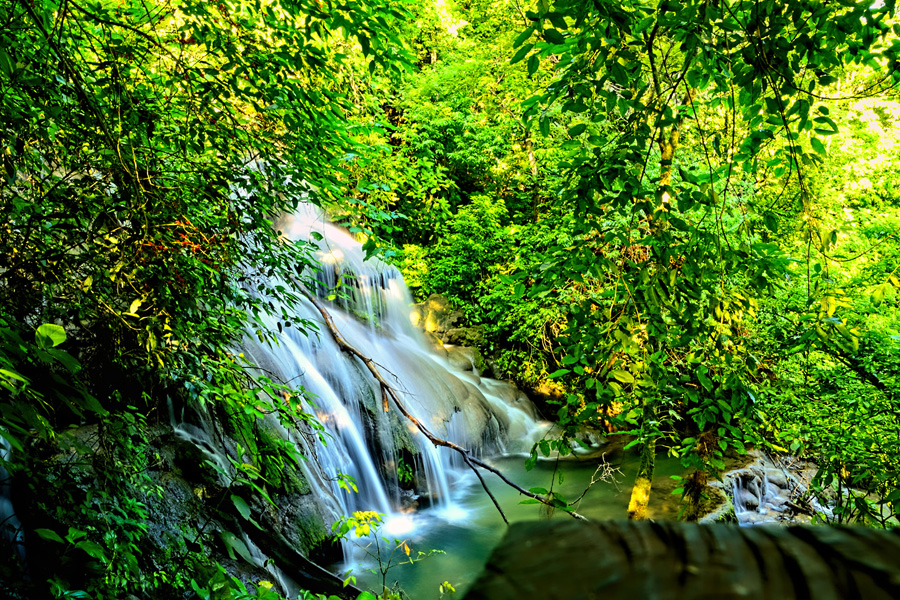
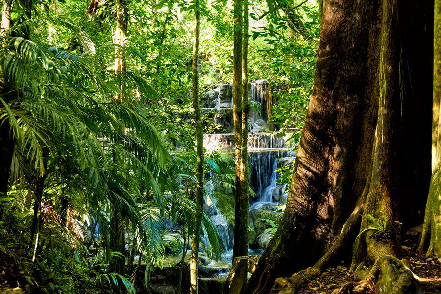
There were several beautiful waterfalls in the Arroyo Otulum, including a wide, multi-tiered cascade known as the Baño de la Reina, the Queens Bath. Was it actually used for that purpose by Palenques nobility? Im not sure if thats ever been established as fact, but it paints a lovely picture.
The Maya loved water, especially flowing water, and Palenque, in its heyday, featured aqueducts, pools, and streams that ran through channels. There was even a flowing stream beneath the palace, engineered to sweep clean the toilets!
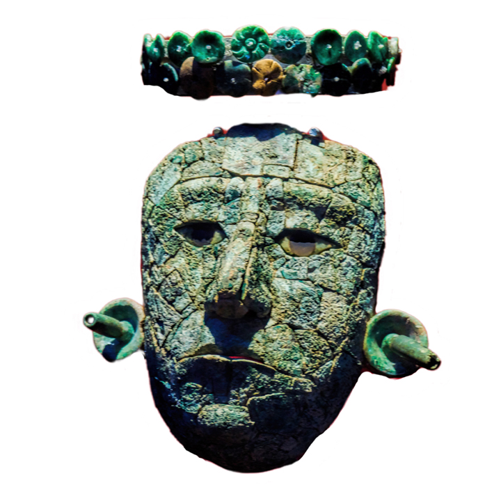
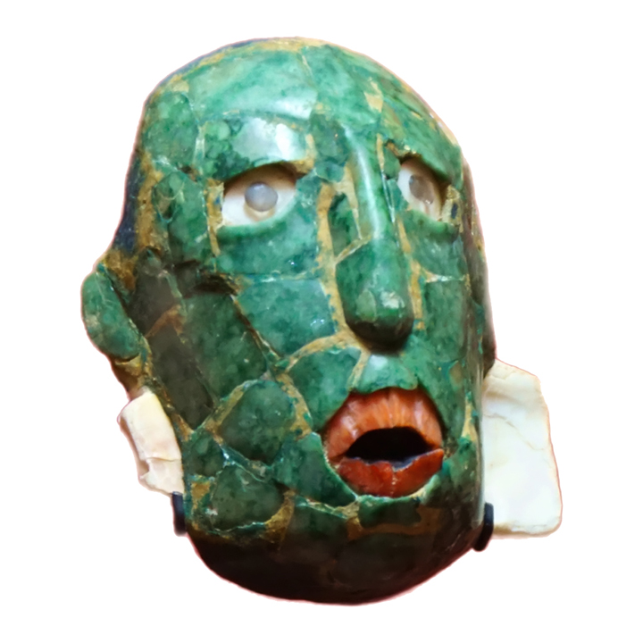
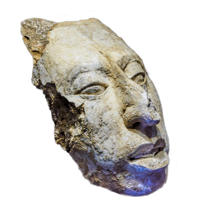
At the bottom of the hill, we emerged back out onto the road, right by that secondary entrance where wed stopped the day before. I was afraid wed run into the phony tour guides again, but they didnt seem to be around this early in the day. We checked out the small museum, which had some very interesting exhibits of precious objects that had been recovered from the ruins, including jade funerary masks and molded stucco heads.
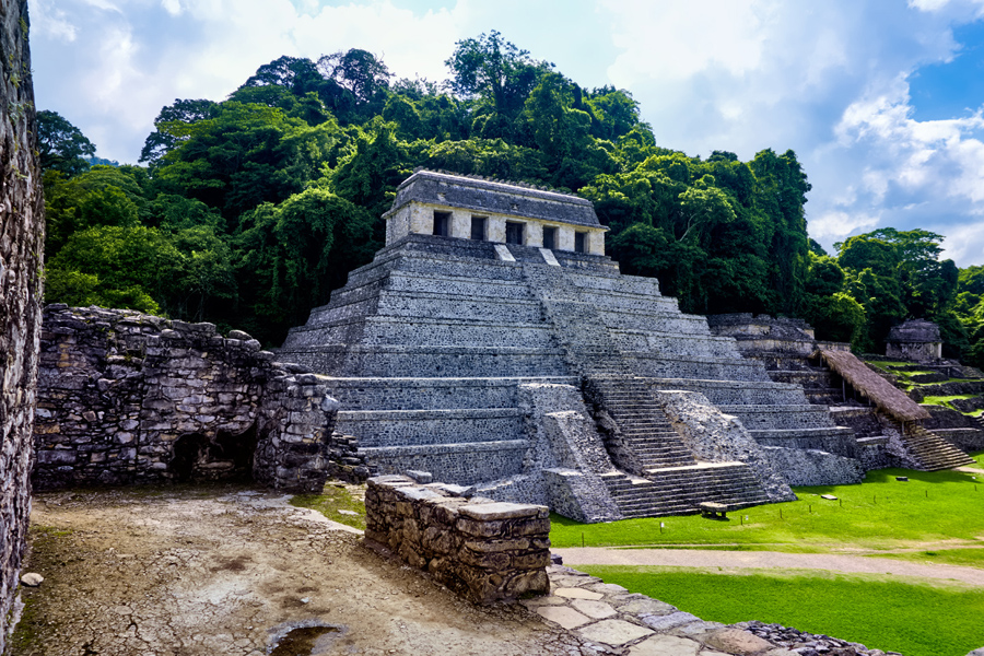
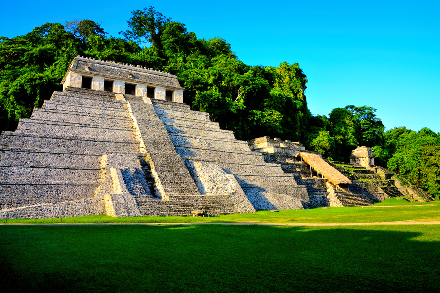
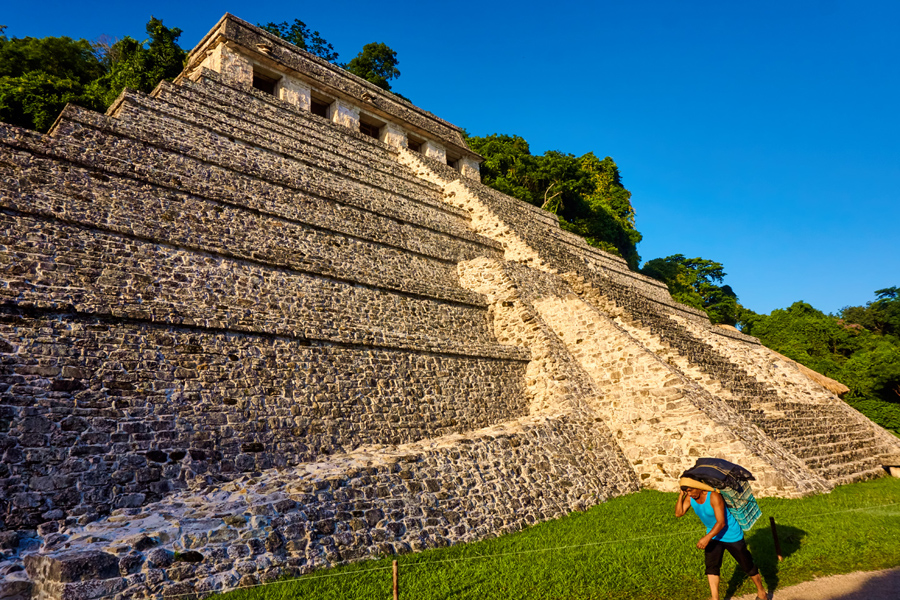
The artistry is extraordinary, adding a human dimension to this ancient city in the jungle. Glyphs on these objects, as well as surviving examples carved into the stucco on the inside walls of the temples tell the story of the great king Pakal and his sons, the dynasty that ruled Palenque at the height of its power. The largest pyramid at the site, the Temple of the Inscriptions, was Pakals final resting place, a massive mausoleum with a hidden burial chamber, in the manner of the Egyptian pharaohs. After leaving the museum, we had to trudge back up the hill to the main section of ruins, and in that climate, it was no easy task!
By the time we finished touring the ruins a second time, I felt wed done justice to Palenque, and I was ready to try something different. Wed been told about a particularly beautiful spot that was a short drive up the highway, so we decided to head out that way, and see for ourselves.
Next up: Day 5 (Afternoon): A BIG waterfall, and More Roadblocks in Chiapas

Holy batwings -- that was some exciting narrative and glad you survived the journey!Originally Posted by Rick Quinn

Amazing photos too!
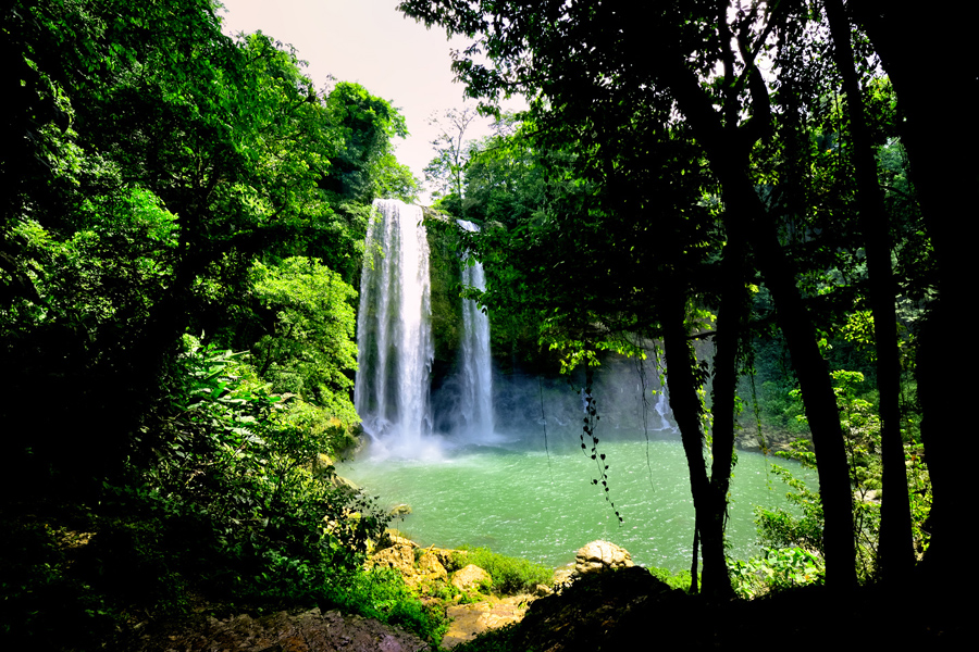
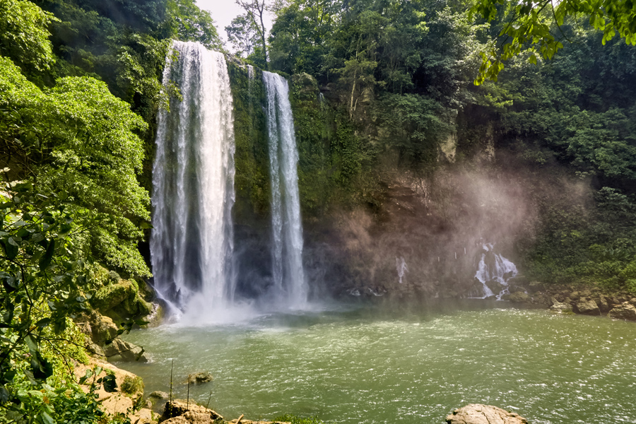
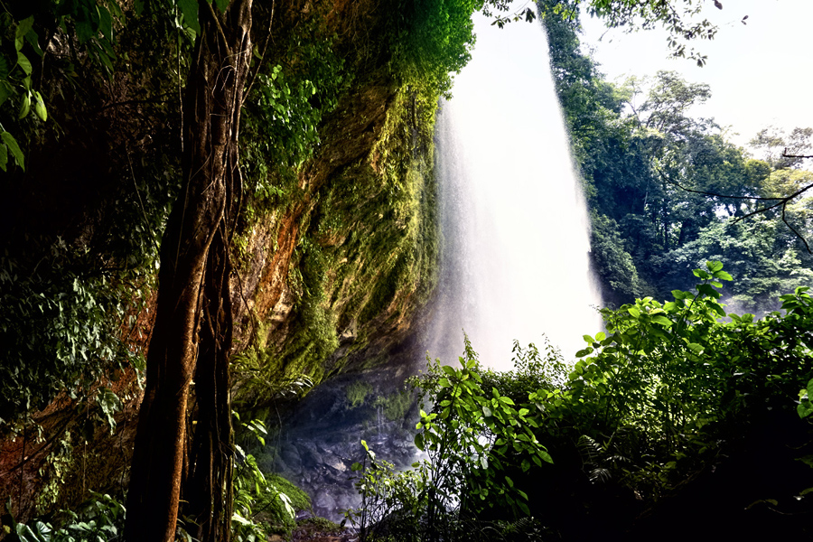
About 12.5 miles west of Palenque, a short detour off the main highway takes you to a parking area and a path that goes downward. Theres a pervasive roar and a fine mist in the air from the elephant in the room, the cascade known as Misol Há, a beautiful waterfall that drops more than a hundred feet straight down into a circular pool of clear, blue water.
Misol Há, a 100 foot waterfall in the Lacandon Jungle of Chiapas
The path leads to a viewing area at the base of the falls, and goes on from there to a slippery ledge carved into the rock behind the thundering cascade. If you dont mind getting wet, you can get VERY close to this waterfall, and if you feel like a swim, the path continues all the way to the edge of the lagoon. This is a truly magnificent spot, and during the brief time Mike and I were there, we actually had it all to ourselves!
It was barely past noon when we finished exploring Misol-Ha. When I studied my map, I saw that San Cristobal de Las Casas, a place I definitely wanted to see, was only 100 miles away. A hundred miles? Heck, even on a slow mountain road, that should only take three hours at the most! Or so I thought. That stretch of highway is heavily used by trucks and buses that are often dangerously overloaded. The road consists of one steep curve after another; those heavy trucks are doing quite well if they hit 10 mph on the upgrades, and 15 mph rolling downhill in compound low. There are no passing lanes, nor is there much point in risking your life to get ahead of the pack, since every vehicle on the road is equally slow. A hundred miles on THAT kind of road takes closer to six hours, and its exhausting!
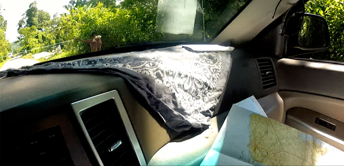
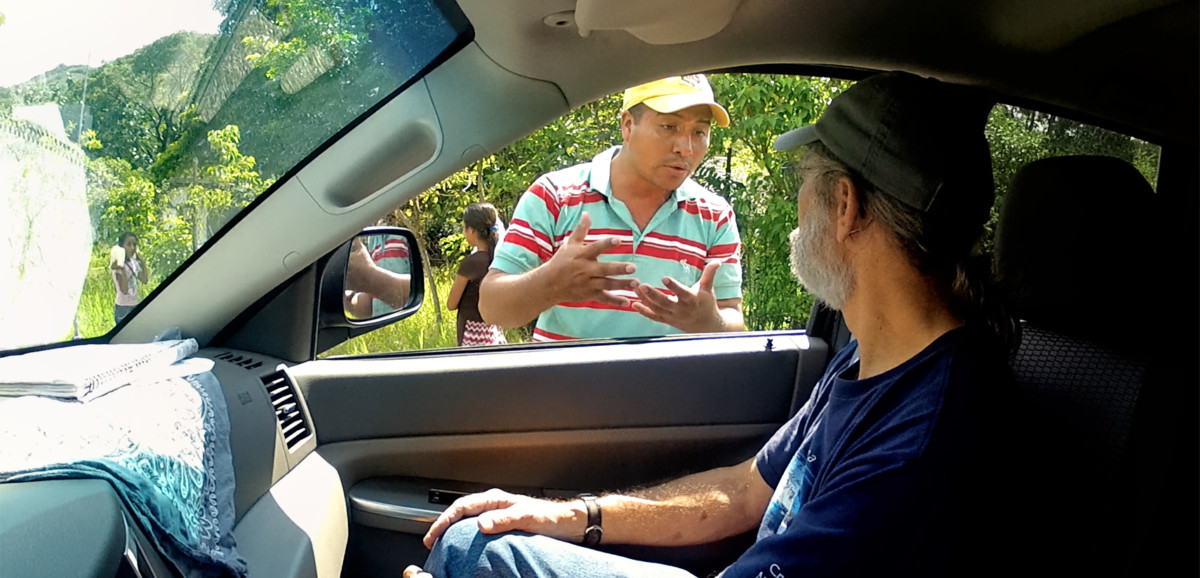
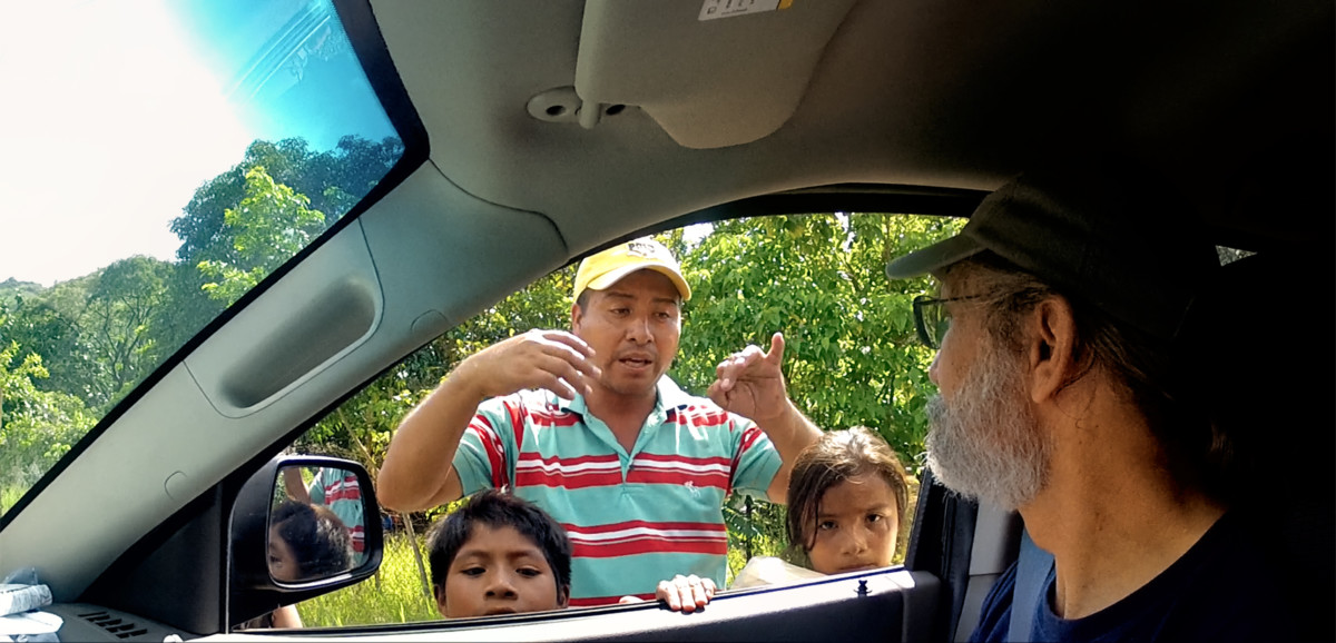
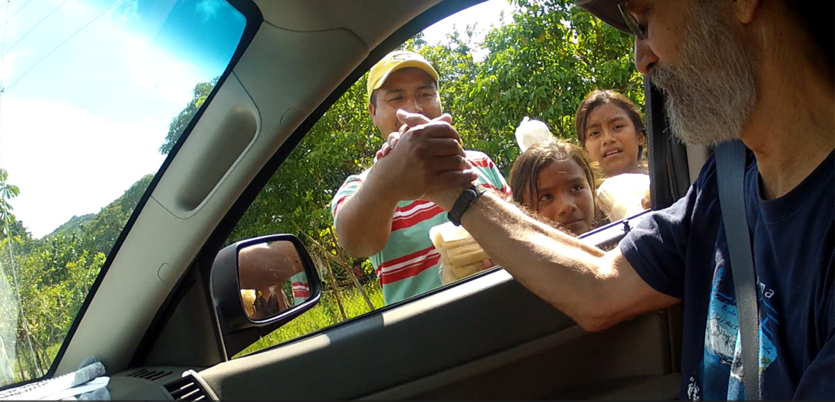
The highway went through the middle of every small town along the way, which meant slowing down even more for speed bump after speed bump, all the while dodging potholes and free ranging chickens and goats. In one tiny community, we slowed for a group of children trying to sell us some sort of fruit, portioned out in plastic bags. We noticed that a young girl standing just ahead of the others was holding a string that shed tied to a tree on the far side of the road. When she saw us approaching, she pulled her string taut, and held up her other hand, which was holding some of the bags of fruit, and shouted for us to stop.
Her string obviously wouldnt have stopped us if wed elected to keep going, but I didnt want to spoil their game, so I told Mike to stop just short of it, and I rolled down my window.
Buenas tardes, I said. Can I help you?
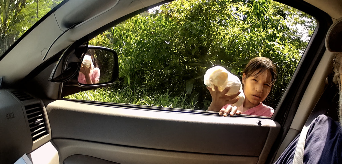
You must buy these guavas, said the girl.
I dont want them, I replied. I dont like guavas.
If you dont buy, you must pay the toll, she said, her face very serious.
"How much is the toll?"
One Hundred Pesos.
Thats ridiculous, I replied. I wont pay it.
She stepped closer, peering through the passenger-side window, taking stock of the cameras and other expensive equipment cluttering the front seat. Five Pesos, and those gafas. Mike was wearing a pair of Ray Bans worth at least a hundred bucks. Clearly, the young lady had taste!
I handed her a ten Peso coin, the same amount Id paid the young Zapatistas the day before. She scowled, but she dropped her string, and we drove on toward Ocosingo, a town near the halfway point between Palenque and San Cristobal. I was beginning to wonder if we would EVER get where we were going, but right about then, all the traffic on the highway came to a halt, stopped dead, all the way through the town. I pulled over to the side of the road, and one of the truck drivers walked over and greeted us. This was another Zapatista Bloqueo, he explained, and this time, they were stopping all traffic headed toguess where? San Cristobal de Las Casas! The trucker chatted with us for quite awhile, and he was definitely passionate about his grievances.
It would seem that support for the Zapatistas and their road blocks is far from universal. A lot of people in the region make their living, in one way or another, from the transportation of goods. Not just the truckers, but the farmers, the shop keepers, ordinary people who have nothing to do with the Zapatistas and their politics. Many other people are dependent on the tourists, and when the roads are blocked to keep them out, everyone loses income. Theres also a lot of mistrust, a widely held belief that the Zapatista leadership is cutting back room deals with the government, and lining their own pockets, at the expense of everyone else. These are complex issues, and they are ongoing: the events in this post took place in 2015, more than eight years ago, and according to current reports on the news media, as well as social media, very little seems to have changed.
We bade goodbye to our trucker friend, then we turned around and drove back to Palenque, where we spent a second night with the toucans at the Comfort Inn.
Our drive from Palenque to Ocosingo and back, with the stop at Misol Há, was some of the prettiest countryside wed seen, so the day wasnt wasted. Still, Id have to admit that I shouldnt have attempted the drive to San Cristobal de Las Casas. In hindsight, that was a rookie move. Id underestimated the difficulty of that stretch of road, so it was just as well that wed been forced to turn around. It actually made a lot more sense logistically to save San Cristobal for later, AFTER our circuit of the Yucatan, so that wed only have to drive that crazy highway ONCE! Meanwhile? The Yucatan, and all its wonders, was waiting for us, just down the road.
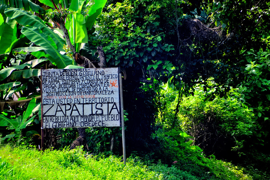
Sign along the highway when you enter the State of Chiapas. Translated, the sign reads:
Northern Zone: Good Government Board:
We strictly prohibit weapons trafficking, planting and consumption of drugs and intoxicating beverages, illegal sale of wood, and the destruction of nature!
Zapata lives, the fight continues
You are in Zapatista Territory!
In rebellion: here, the People rule, and the government obeys
Scenes along the highway in Chiapas
Next up: Day 6: At last, the Yucatan!
Rick I am enjoying your posts in this thread. I have never been through Mexico like this and I am fascinated with your journey. It also reminds me why I will never set foot in that country other than the cruise terminals or resorts! Simply not for me.
"Adventures suck when you are having them" (Neil Peart) but of course they always make the best stories (like yours!). Thanks for sharing.

Yeah quite the adventure!! Although the roadblocks were a real pain at least you got the pay off of a quiet visit to Palenque, which made it even more special!
Great pictures!
Dave
I'm glad y'all are enjoying my recollections. And Dave--that quiet visit to Palenque really was quite special, a memory that I'll sincerely treasure. The recently inaugurated "Tren Maya," once it's fully operational, will be ferrying visitors from Cancun directly to many of the major Mayan sites, including Palenque, making them more accessible than they've ever been. Cancun gets 25 million tourists in an average year, so there are a LOT of potential customers. I daresay many of the "intimate" experiences I'll be describing in this thread will be hard to come by going forward.
Rick
What with all the Zapatista roadblocks, and the ill-fated attempt at driving to San Cristobal de las Casas, it was beginning to feel like we were spinning our wheels. We were already almost a week into our Mexican Road Trip, and, quite frankly, it was past time to come up with a realistic plan for the rest of it. When we started out, I had a general idea of the places I wanted to see, but I stopped short of creating a day-by-day itinerary. I rarely make advance reservations when Im road tripping, because I prefer having the freedom to add destinations, or to skip them, or to change the order of them based on what I see and hear when I get closer to where Im going. Southern Mexico didnt lend itself all that well to that style of travel, because there were simply too many possibilities! And then there was the time factor: Michael, my traveling companion, had a fixed date when he had to be back home in Arizona, which only gave us three more weeks, including the time that would be required to drive back north. Under the circumstances, it made sense to impose some structure on our little expedition.
At the hotel in Palenque, we studied our maps, and a reasonably logical sequence began to take shape: I wanted to see Mayan ruins in the Yucatan. Some of the big ones, like Chichén Itzá and Uxmal, those were a given, but I still hadnt decided about the rest. I figured we could start in Merida, and circle the peninsula clockwise, stopping at as many Mayan sites as possible along the way. After that, back to Chiapas to make one more attempt at driving to San Cristobal de Las Casas (another of my must-see destinations), and finally, back to the border, with a stop in Oaxaca, and a longer stop in San Miguel de Allende, to take in the Day of the Dead celebration. Wed originally hoped to cross into Belize, and possibly Guatemala, to visit ruins in those countries, but considering our time constraints, and the aggravating complexity of multiple border crossings, that was beginning to seem unlikely. Two, maybe three beers later, I had a rough sketch of a plan tucked away in my pocket, and we were ready to hit the sack.
The next morning, Day 6, we checked out of the Comfort Inn, and headed north, destination: Merida, capital of the Yucatan, a mere 333 miles away! The main road going to or from Palenque is MX 199, the same road that the Zapatistas shut down with their bloqueo when we first arrived in the area, two days earlier. This time, there was no sign of any road block, and we merged smoothly onto MX 186, the principal east/west route across the bottom of the Yucatan peninsula. This highway was a main road, but it wasnt an expressway; there was traffic in both directions, and access was not limited, so there were hazards in the right-of-way ranging from slow moving donkey carts to topes, (toe-pays), the bone-jarring speed bumps installed to slow traffic through populated areas.
Day 6: From Palenque to Campeche
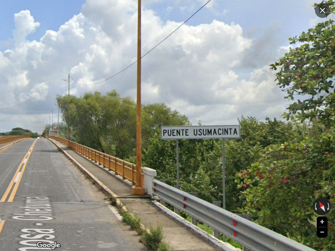
After 20 miles or so the road crossed a river, the Usumacinta, which served as the boundary between the State of Chiapas and the State of Tabasco. I had to smile when I noticed the sign marking the Usumacinta.
Many years ago I wrote a novel that I called Chivor, an adventure yarn set mostly in Colombia. The flawed hero of my story was a treasure hunter named Sam, and in the first scene, I had him sneaking into Mexico from Guatemala, smuggling a jade figurine illegally dug from a ruin. He gets ambushed and shot by bandits while traveling down the Usumacinta River in a canoe. When I wrote that, Id never been anywhere near the Usumacinta River. I chose the location after studying a map, a traditional paper road map, because this was at least fifteen years before Google gave us easy access to all that wonderful satellite imagery. At that time, I had no idea what the area actually looked like. The World Wide Web hadnt been developed yet, so there was no easy way to find out. My descriptions of the terrain as written in my novel were based solely on my imagination, and now, after all those years, I was actually there, close enough, anyway, crossing the Usumacinta on a highway bridge! It wasnt exactly Deja vu, since I knew Id never seen it before, but it was a similar, eerie sensation!
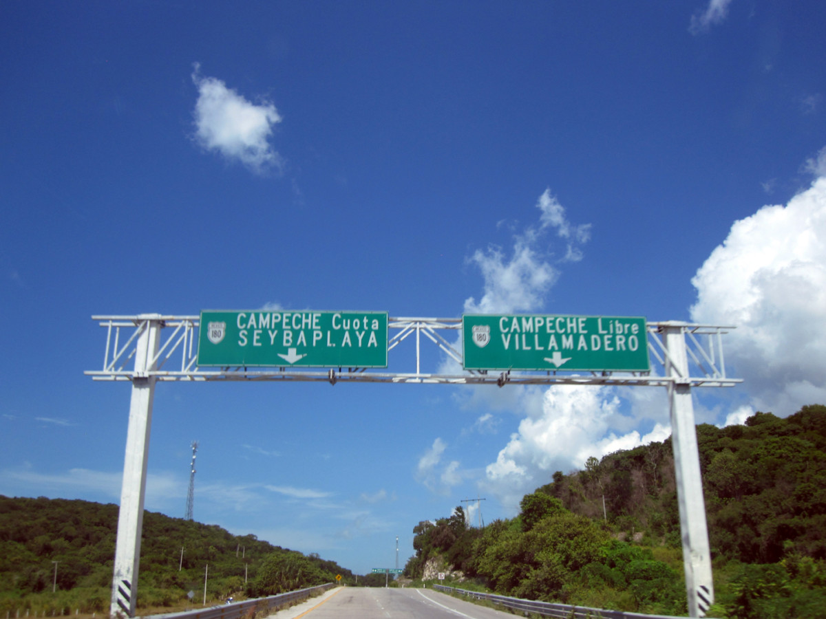
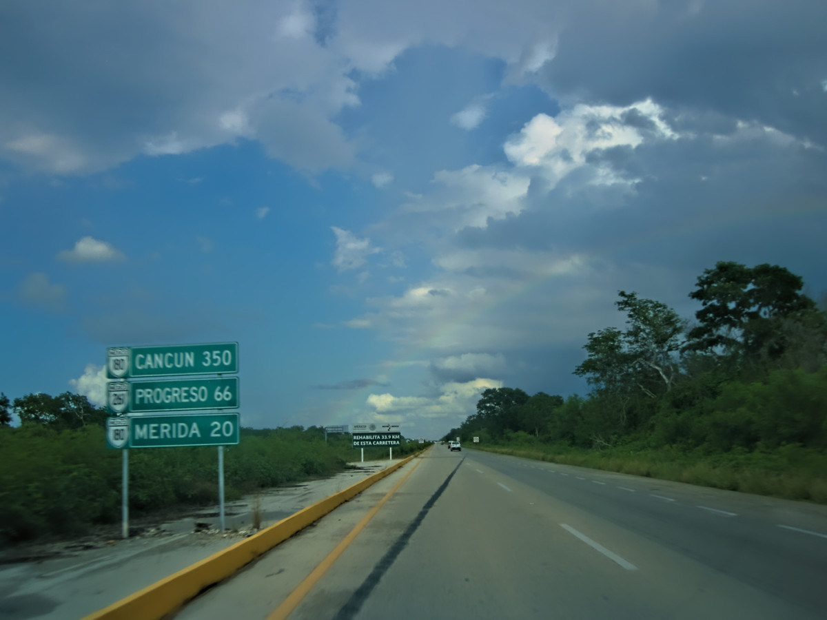
The first leg of our drive this day took us northeast to the town of Escarcega, where we left MX 186, and merged on to MX 180, headed due north to the city of Campeche. We had a choice between the Libre (free) version of the road, which hugged the approaching coastline, passing through a half dozen tiny towns, and the Cuota (Toll Road), which would take us to Campeche more directly. Rule of thumb when driving in Mexico: when given a choice, always take the Toll Road, if only to avoid the damned topes!
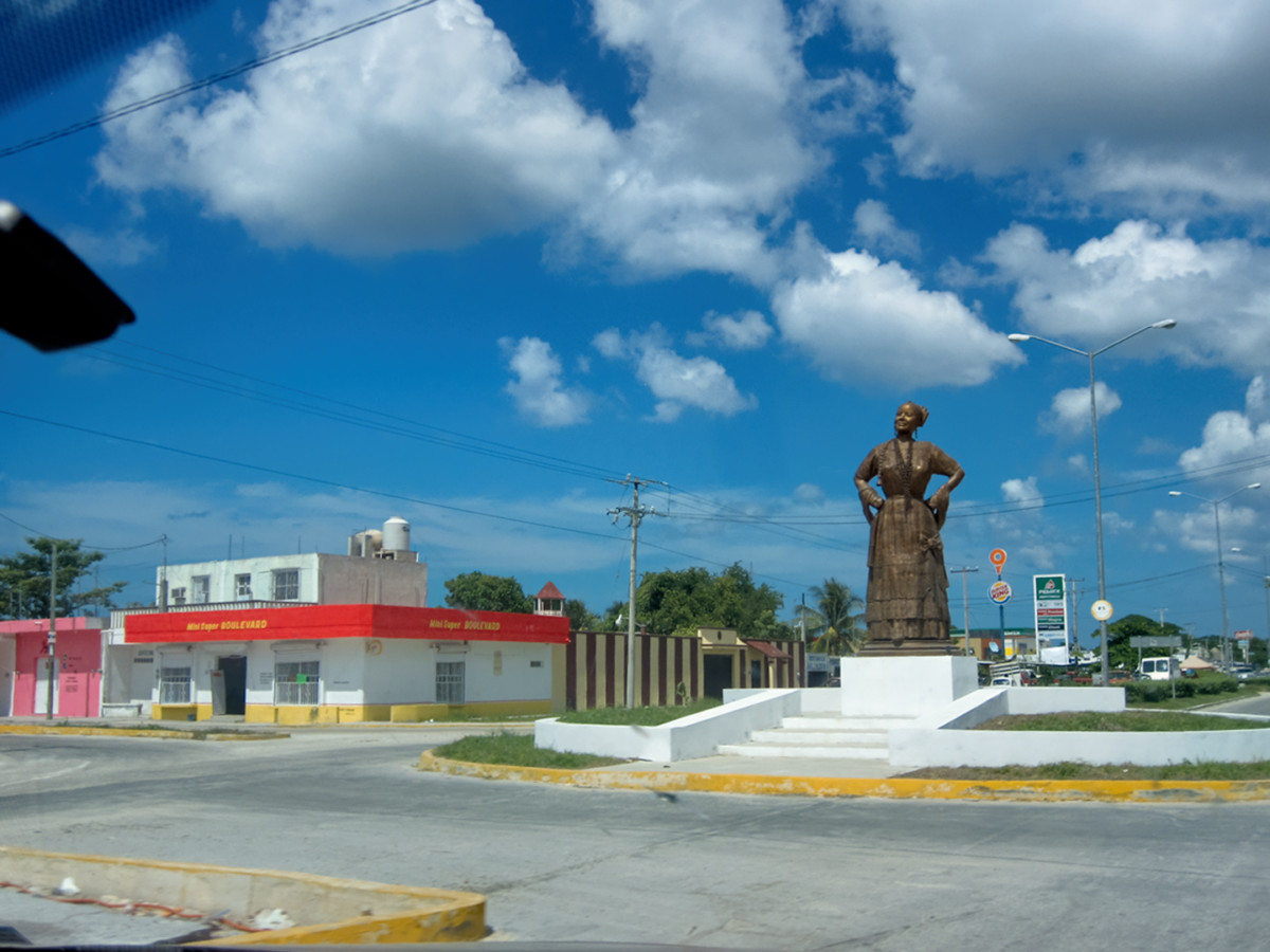
Statue in Escarcega, dedicated to the Women of Campeche
Toll Road, or Free Road? Whenever possible, choose the Cuota, the Toll Road!
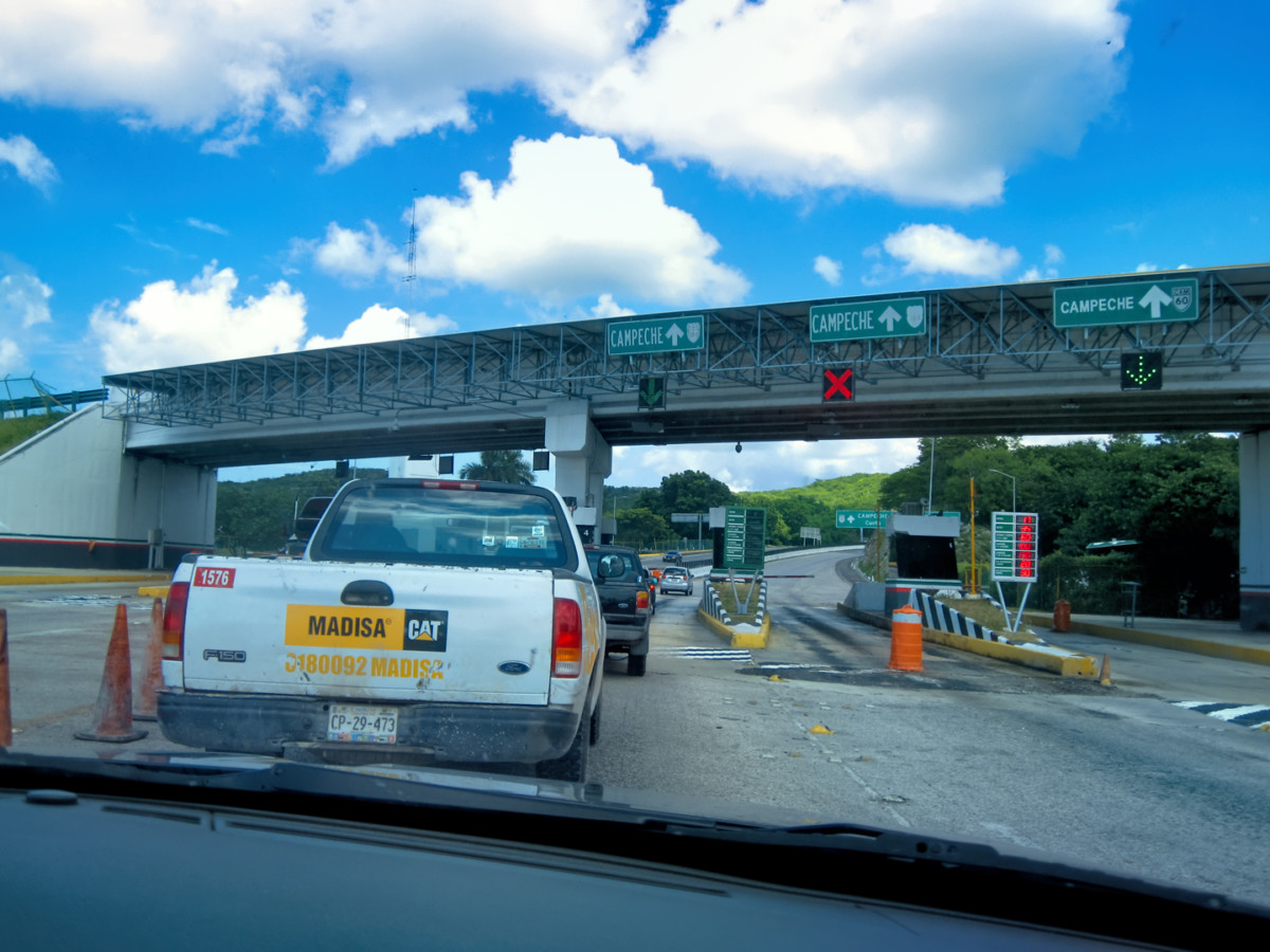
Toll plaza outside Campeche
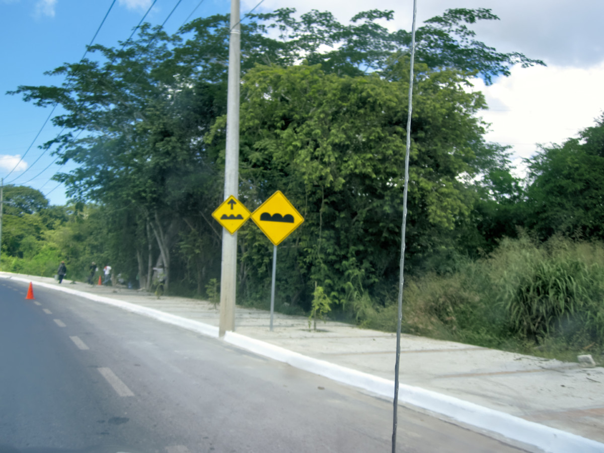
Signs warning of Topes (speed bumps) dead ahead!
The Yucatan peninsula is bordered by the Gulf of Mexico to the west, and the Caribbean Sea to the east. As we entered the city I could smell the ocean, the salty tang of it, and I could feel it in the air, bringing back some really great memories of my youthful adventures on the coast of Colombia (more than 50 years ago).
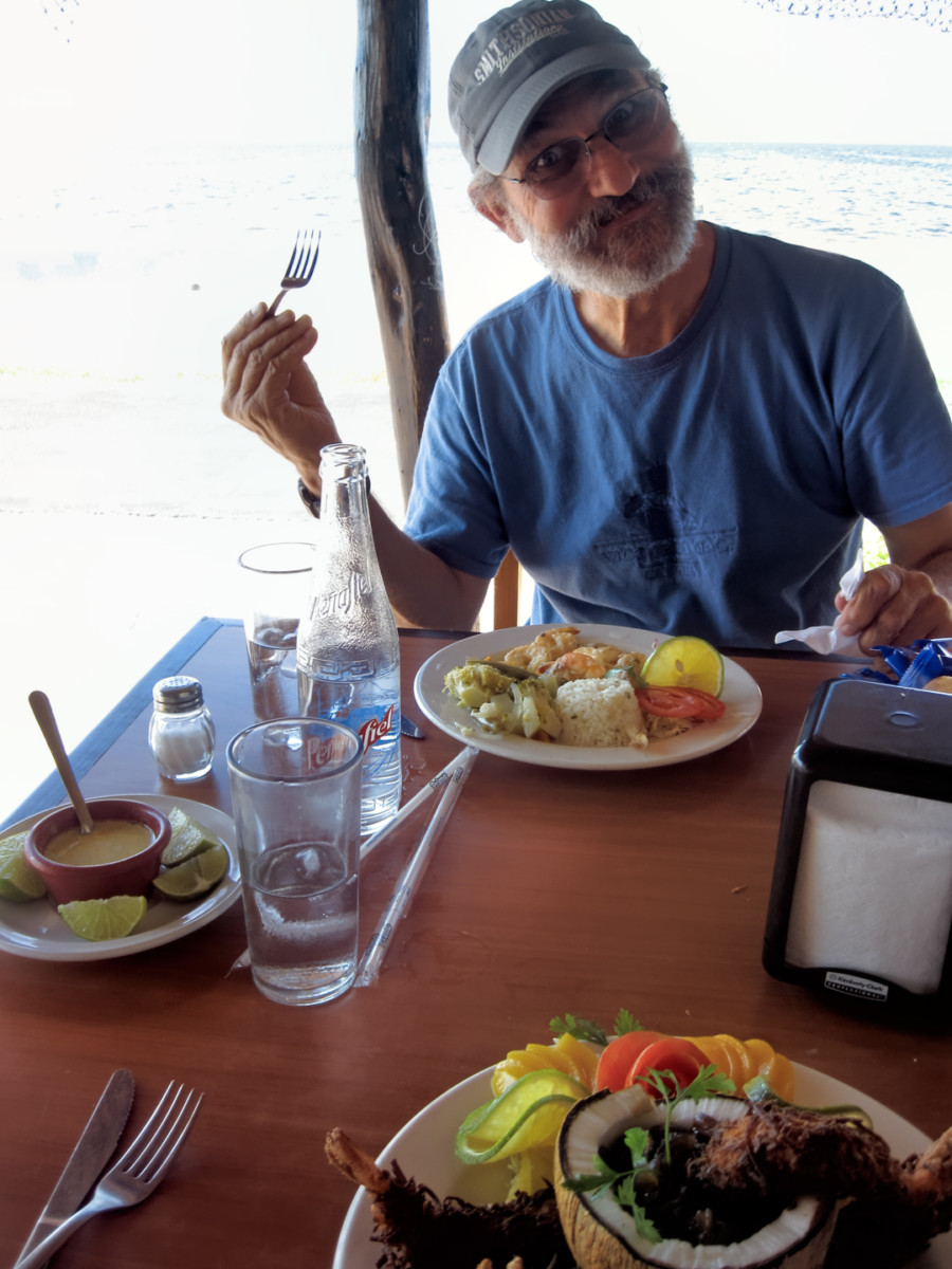
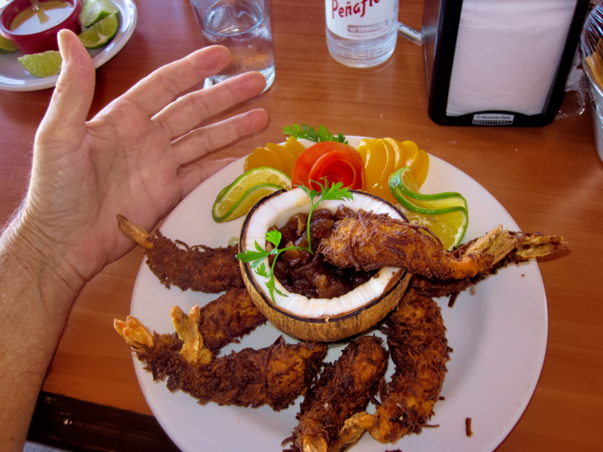
Campeche is one of the oldest cities in Mexico, founded by the Conquistadores in 1540, eighty years before the Pilgrims landed at Plymouth Rock. The historic city center is a UNESCO World Heritage Site, but passing through like we were, we didnt see ANY of that. We had at least two more hours of driving before wed get to Merida, so we decided to save Campeche for another day, when we had more time to explore, and perhaps stay the night. This time, we merely paused for lunch. The local specialty is shrimp, courtesy of one of the largest fleets of shrimp boats in the Gulf of Mexico. An open air seaside restaurant served up some of the best Ive ever eaten!
Now that's what I call coconut shrimp!
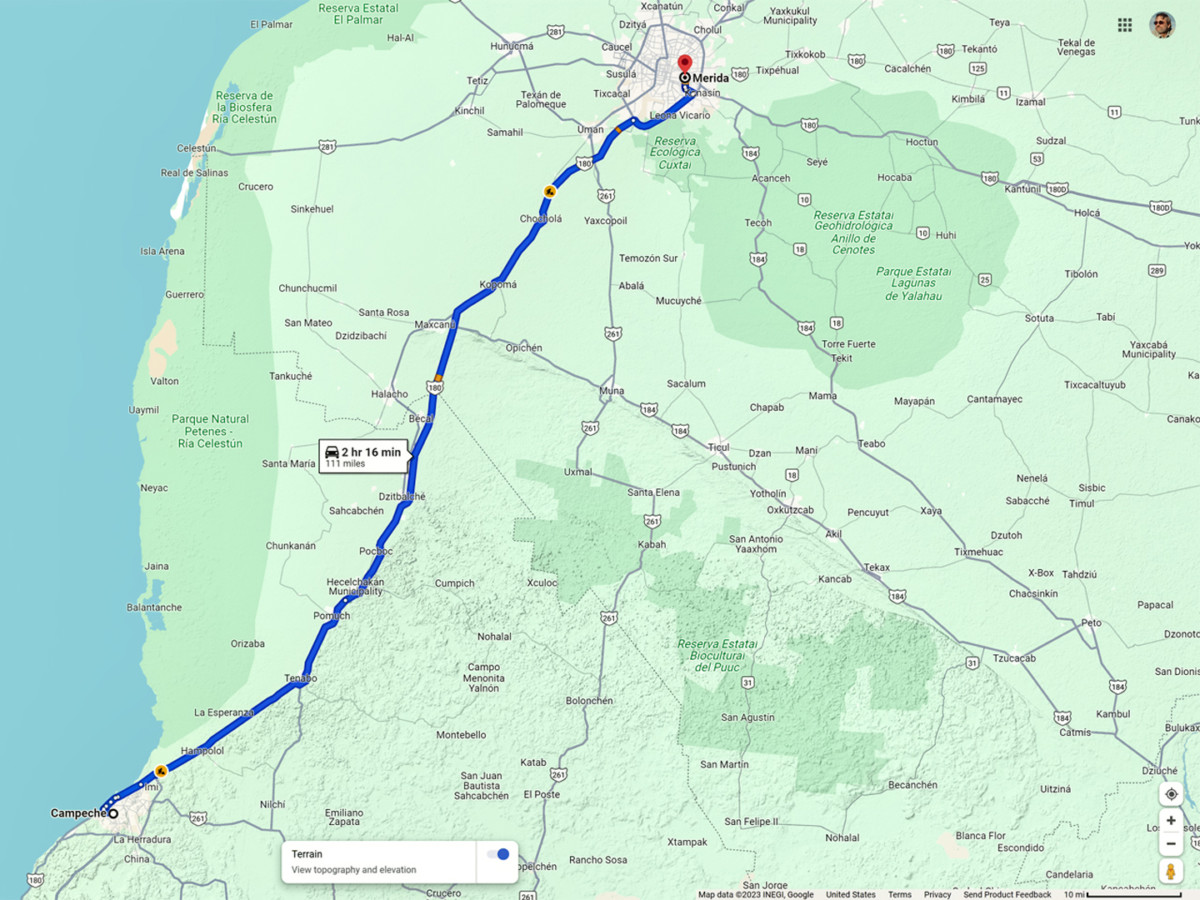
After Campeche, the Highway veered inland. It was a Toll Road, a true expressway, relatively new and in excellent condition, so we made short work of the 111 miles to the big town.
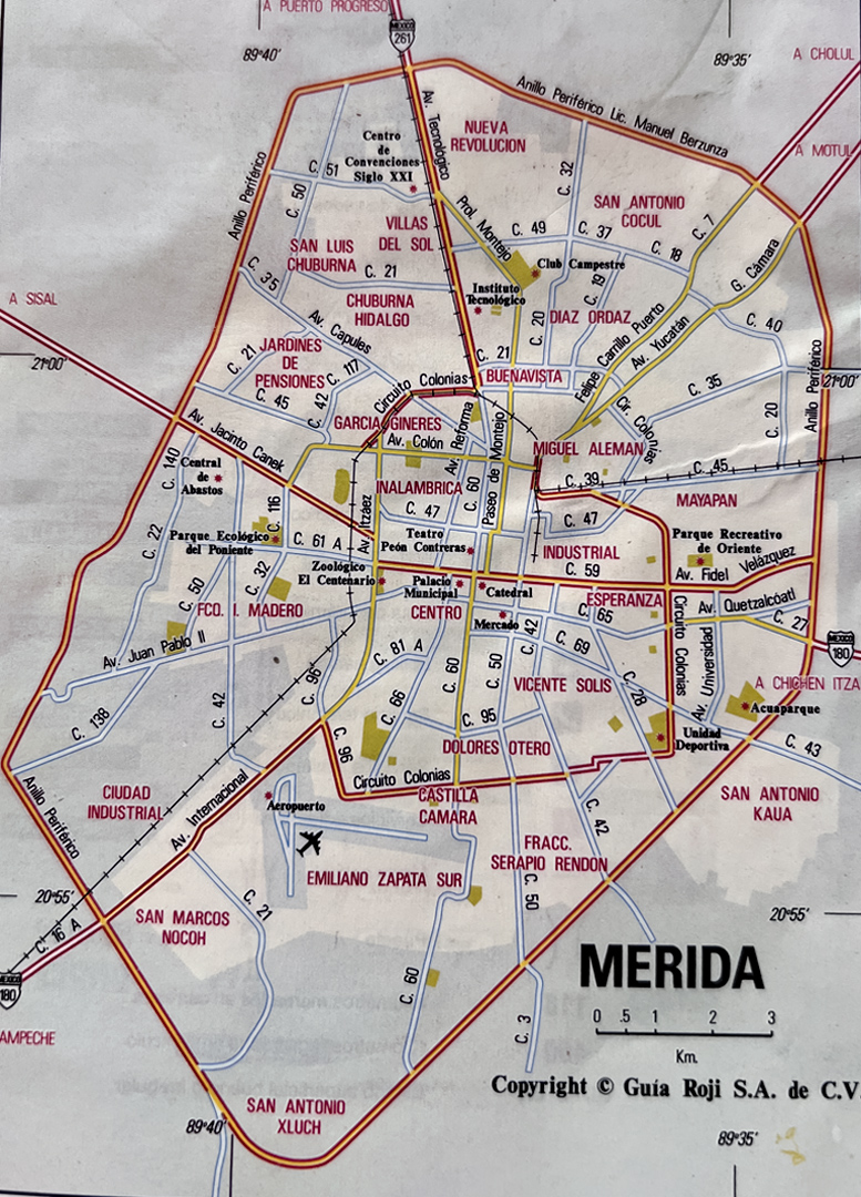
Merida was not only the capital of the State of Yucatan, it was the largest city in southern Mexico, with a population of almost a million. Statistically, Yucatan is the safest of Mexicos states, and Merida is widely considered the safest of all Mexicos cities. Theres a relatively large population of expatriates, Americans and other foreign nationals who reside in Merida on a permanent basis, so I was very curious about it, wondering what it would be like to actually live there.
Route from Campeche to Merida
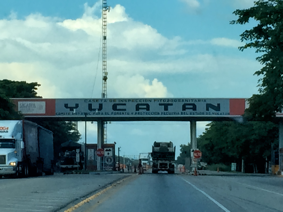
Welcome to the Yucatan!
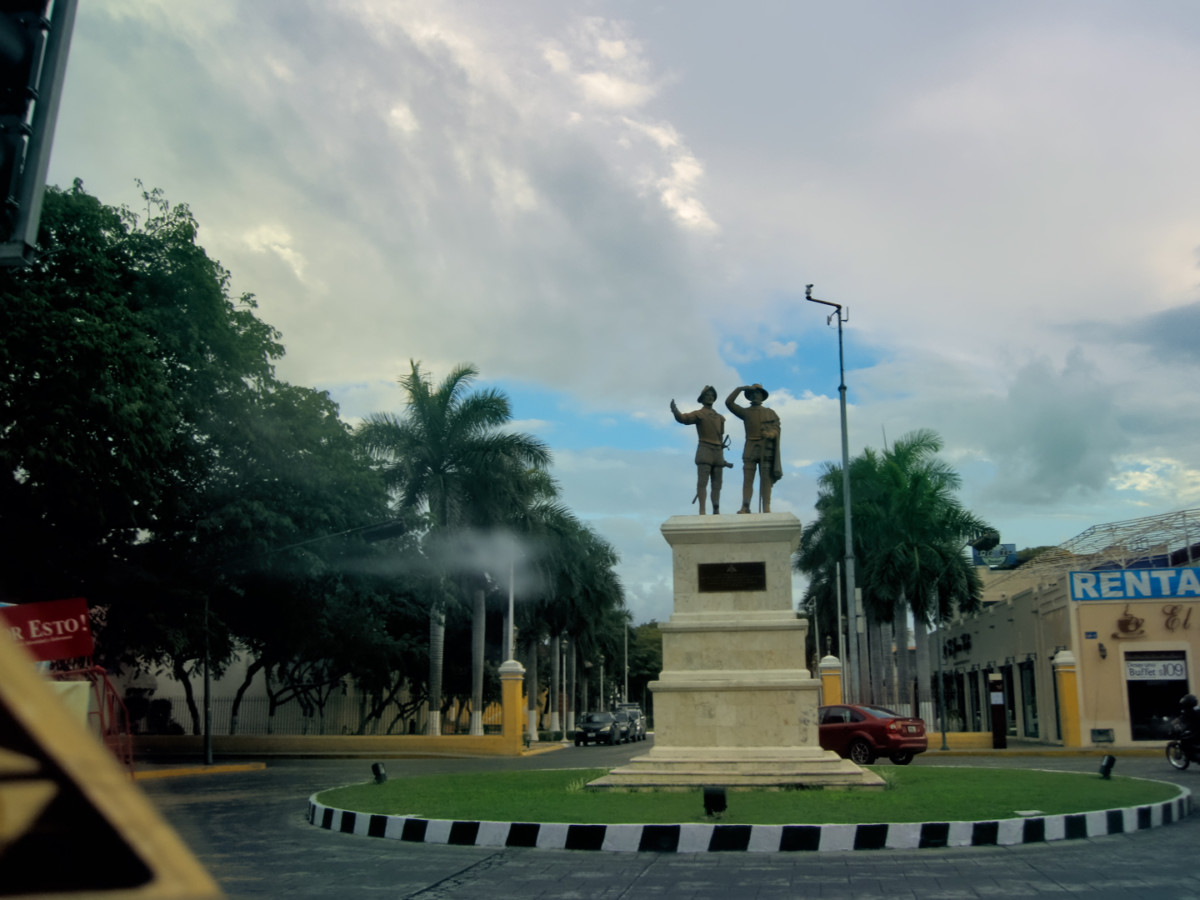
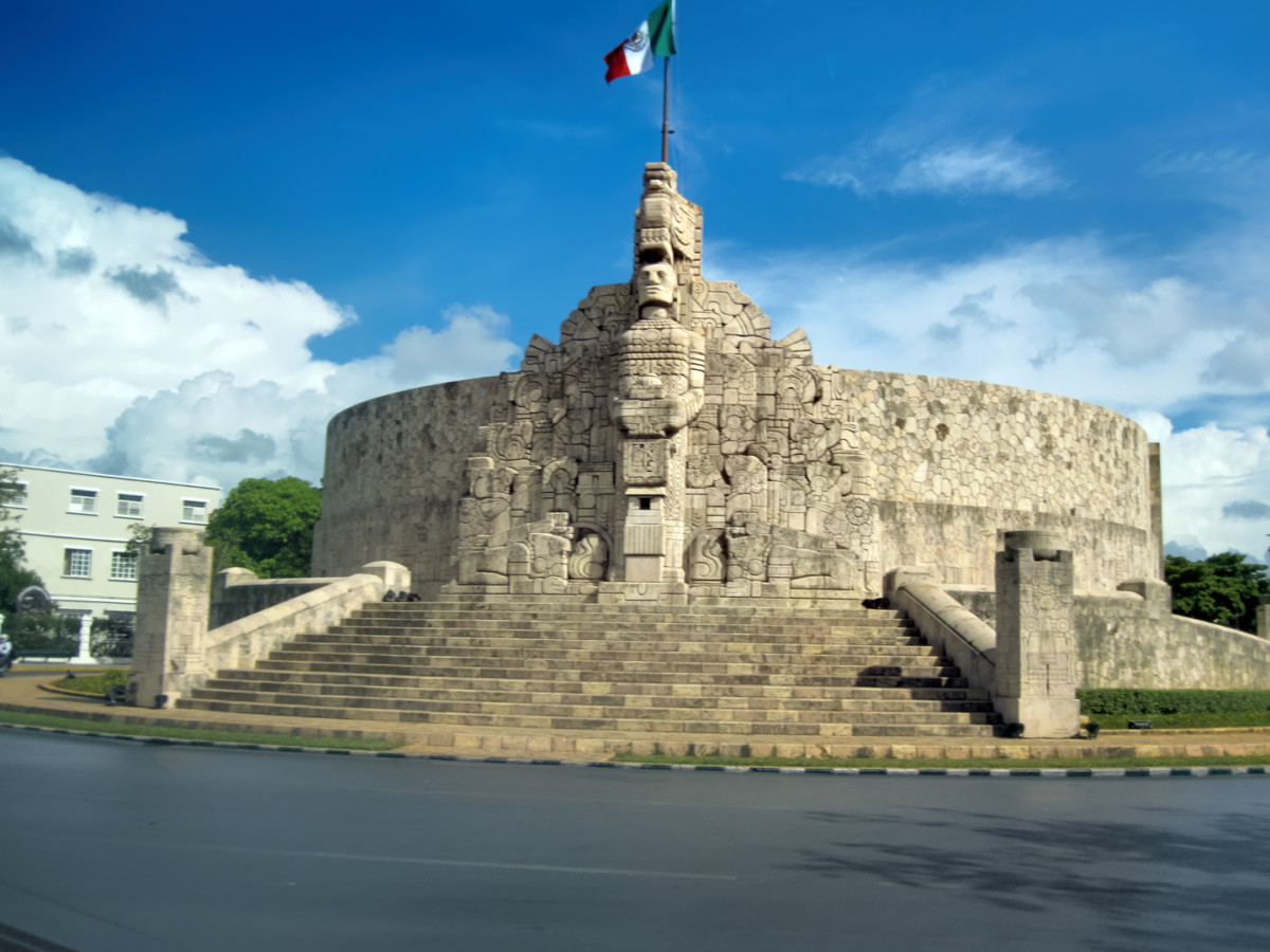
Traffic circle in Merida
Roundabout on the Paseo Montejo in Merida
Tired from the drive, our first order of business was finding lodging, and because we didnt know the city at all, we werent sure where to look. The main drag is the Paseo Montejo, a wide boulevard lined, at least in part, with stately old homes. We followed that toward the city center, until we spotted a likely prospect, the City Express Hotel. We booked a room, and even though the place was perfectly nice, I had immediate regrets. The hotel was a Marriott property, and that left us batting 1.000: every single hotel wed stayed in so far was connected to an American chain, and I was quite certain we could do better than that, if only in price! Sitting in our room, using Google to figure out where to eat dinner, I had a flash of inspiration, and did a quick search on cheap hotel rooms in Merida. The search results included a link to the Mexican version of Expedia, and a quick search on that site helped me find a place that sounded perfect for us: The Dolores Alba Inn, near the old city center, and at $35 per night (in 2015), it was less than half what we were paying at the City Express. We planned to stay in Merida at least one more day, so I used Expedia to book us a room for the following night.
I had never used online booking sites in the past, because I always figured I could get a better deal by walking in off the street and negotiating. The booking sites take a portion of the hotels profit, and they charge a fee to the traveler, so I blindly assumed that the bottom line cost would always be higher. I was also leery about reserving a hotel room sight unseen, not sure if the travelers reviews posted online could really be trusted. But I had an open mind. There was an obvious advantage to the consolidated listings, and the ability to compare prices and amenities, especially in an unfamiliar town. If the cheaper hotel proved to be even half as nice as it sounded in their ad, I just might have to revise my attitude!
Next up: Merida, the White City
 Posting Permissions

 Reply With Quote