Something you don't often see - right now, I-80, US-50, and CA-88 are all CLOSED over the Sierras.


 RoadTrip Guru & Enthusiast
Something you don't often see - right now, I-80, US-50, and CA-88 are all CLOSED over the Sierras.
June 8th. Noon.
Donna

Check out the latest Proof of Gas (PoG) photo in the first post of this thread!

Nice picture Mark, good to see a new winner photo.
The weather looks pretty awful for the rest of the week in the Sierra's with plenty more snow forecast but for now there are Flood warnings issued with a mix if rain and snow melt.
From the weather centre. Flood watch.
And storm warning with up to 7 feet of snow at the higher elevations !The Flood Watch continues for
* A portion of central California, including the following
areas, Kern County Mountains, Mariposa, Madera, and Fresno
County Foothills, Sierra Nevada from Yosemite to Kings Canyon,
Tulare County Foothills, and Tulare County Mountains.
* Through Thursday morning
* Heavy rainfall can be expected over much of the area through
Thursday morning. The combination of rain and rapidly melting
snow over the higher elevations of the Sierra will increase the
threat of potentially serious flooding during the next 24 hours,
especially at elevations below 5,000 feet.
* Rising waters can be expected along many rivers and streams
through Thursday morning with the possibility of substantial
flooding in the foothills in addition to mud slides, rock
slides and debris flows.
...WINTER STORM WARNING REMAINS IN EFFECT UNTIL 10 PM PST
THURSDAY ABOVE 5000 FEET...
* WHAT...Snow levels are now expected to remain above 8000 feet
through Thursday afternoon and will lower to around 5500 feet by
Thursday evening. Total snow accumulations of around 1 foot
above 7000 feet, 3 to 5 feet above 8000 feet with amounts up to
7 feet above 9000 feet. Winds could gust as high as 70 mph
above 9000 feet.
* WHERE...Sierra Nevada from Yosemite to Kings Canyon and Tulare
County Mountains.
* WHEN...Through 10 PM PST Thursday.
* ADDITIONAL DETAILS...Travel could be very difficult to
impossible. The hazardous conditions could impact the morning
or evening commute. Very strong winds could cause extensive
tree damage.
Photo courtesy of the Yosemite Conservancy -- February 13th at 4:20 pm PST
(Wow, not even snowing -- but more on the way!)
Dave.
Last edited by Mark Sedenquist; 02-13-2019 at 05:24 PM. Reason: added a photo
We are getting lots of rain down here in the southern part of the state, too. It's good to see this, though the thoughts of mud-slides along CA-1 are more probable when we get this kind of rain.
Our reservoirs really need the water from the rain. San Vicente Reservoir, among others, was looking pretty sad a few months ago.
Donna
Yeah certainly good for the water table Donna although it looks like the weather is drying out for the weekend, which is good news for me ! ;-)
I better get a prediction in. June 5th at 11am.
Dave.
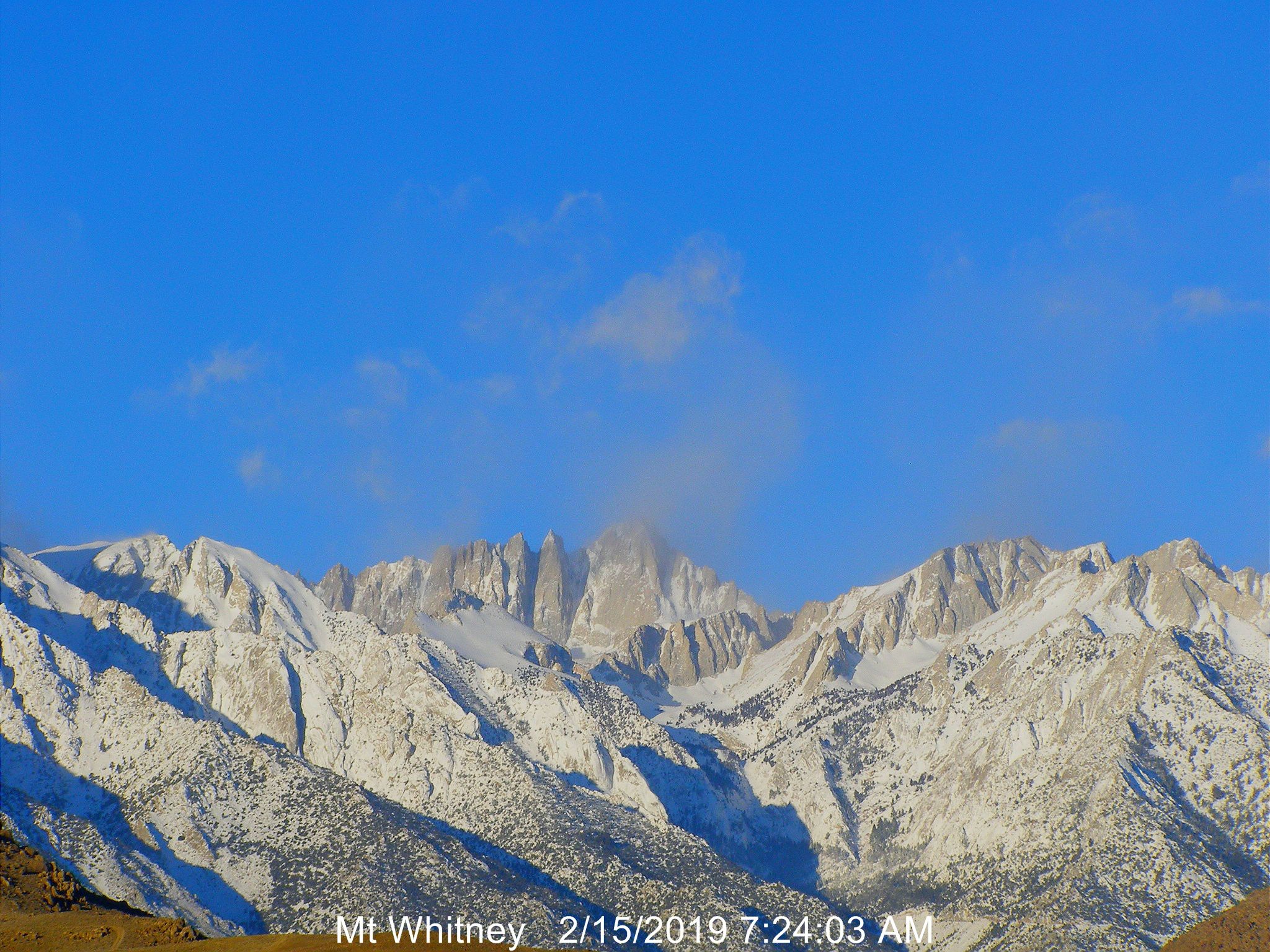
Nice view of Mt. Whitney!
Another winter storm alert is in effect.
At the moment the high Sierra webcam seems to be down, either that or it's completely covered!...A WINTER STORM WARNING REMAINS IN EFFECT UNTIL 4 PM PST
SUNDAY...
* WHAT...Heavy snow. New snow accumulations of 12 to 18 inches,
with up to two feet in the high country. Winds gusting as high
as 65 mph on exposed ridgetops and near the crest.
* WHERE...Sierra Nevada from Yosemite to Kings Canyon and Tulare
County mountains.
* WHEN...Until 4 PM PST Sunday.
* ADDITIONAL DETAILS...Travel could be extremely difficult or
impossible. Strong winds may damage trees. Wind chill readings
as low as 25 below zero could cause frostbite on exposed skin
in as little as 30 minutes.
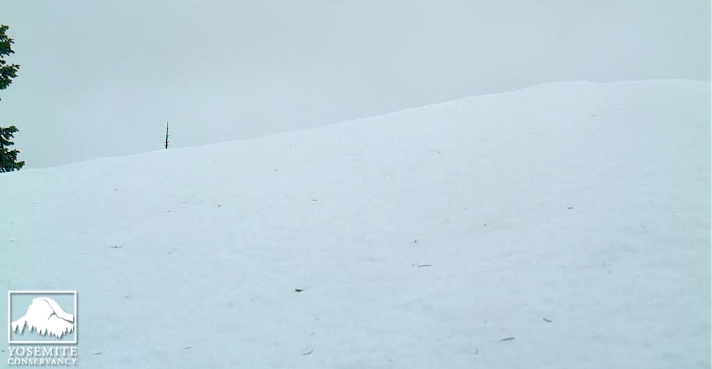
This is, I think, the most snow I've ever seen on this camera!
Photo courtesy of The Yosemite Conservancy -- February 17th at 11:33 am PST
If you squint you can just barely see the tip of the tallest pine on the ridge. The way to find that is too look at the snow-covered bough on the top left-hand side of the image and then trace the rising snow line (left to right) about three feet and that tip is just barely noticeable.
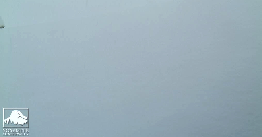
***Update -- just saw another view -- that tip is gone -- this is some deep snow**
Photo courtesy of The Yosemite Conservancy -- February 17th at 11:38 am PST
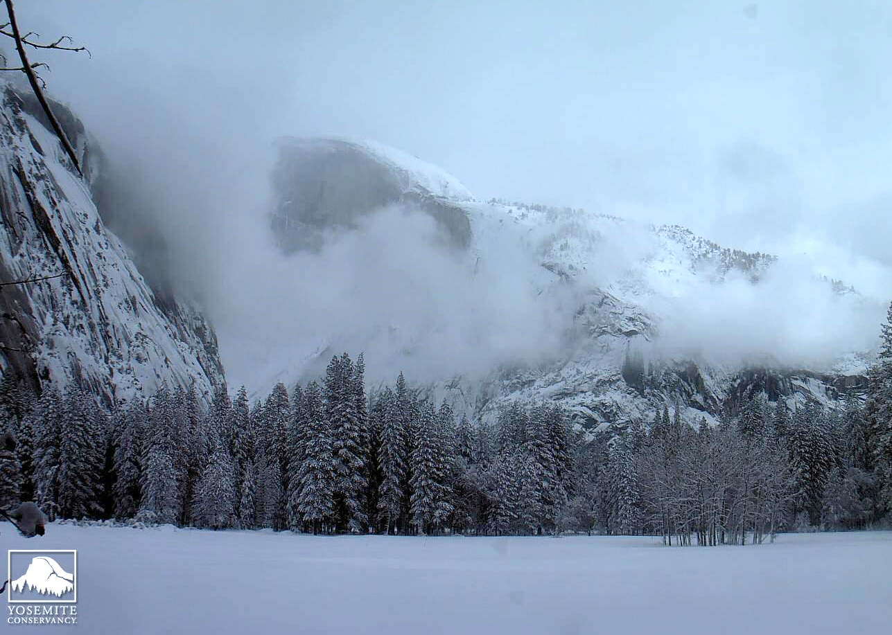
And this might be the most snow I've ever seen in the Ahwanee Meadow, (at least in the recent years).
Mark
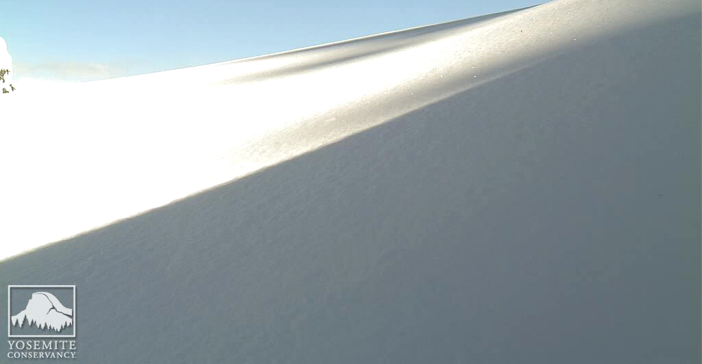
The sun has returned to the High Sierra
Photo courtesy of The Yosemite Conservancy -- February 18th at 12:33 am PST
 Posting Permissions