Page 2 of 5 FirstFirst 12345 LastLast
Results 11 to 20 of 45
  1. #11

    Default Western Arkansas

    Wednesday, September 24
    Start: El Reno, OK
    Finish: Devil's Den State Park, near Wilson, AR

    The El Reno Lake campground was a good deal, however it was a bit too close to I-40. It wasn't too loud, just persistent highway noise. Our first stop was in Oklahoma City at the Oklahoma City Museum and Memorial. We spent time outside at the Memorial. The recent trip report by '2014-The American Swansong' gave a good report of this museum and memorial. (Scroll down about 1/2 way down the page to read Derek's report in this link)

    Before we left town we found gas for $2.89. The east side of town seems to have the best gas prices. Next stop was for ice at one of the roadside vending boxes, unfortunately it was under repair. The repairman told us there were machines in Shawnee, about 30 miles east on I-40. At $2 for 20 lbs of ice it is a great deal. We carry a collapsible cylinder (from Camping World) that will hold the 20 lbs. You can also get 16 lbs in a bag for $2. Next stop - Shawnee.

    Further east in Oklahoma we visited Sequoyah National Wildlife Refuge, just 3 miles south of I-40. The refuge office has minimal displays, but the worker on duty gave us a lot of information. This refuge borders the Arkansas River and has been instrumental in repopulating the area with Bald Eagles.

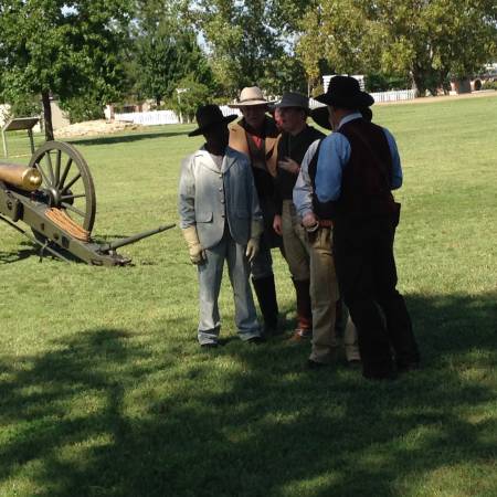
    After lunch we arrived in Fort Smith, AR and the site of Fort Smith National Historic Site. We arrived just as they were ready to fire their big, brass cannon. A ranger, dressed in period uniform, gave a short talk prior to the firing. He explained, while in his character, this cannon was being fired as part of an Independence Day celebration in 1876, the US Centennial. He explained that areas that were sympathetic to the Confederates did not celebrate 4th of July since the end of the Civil War. The commander at the fort had ordered the firing in 1876. To say the least, it was loud.

    Cannon Firing re-enacters


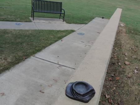
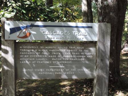
    We continued north on I-49 to just south of Fayetteville to camp at Devil's Den State Park. This area of Arkansas is considered part of the Ozarks. No Fall colors yet, just extensive hillsides of GREEN. My husband had planted a letterbox here in 2009. We got a camp site and hiked out to the box. The evening was cooling off nicely.

    Arkansas state parks are wonderful. Camping, with no hook-ups cost us $9.88. Because one of us was over 62 there was a 25% discount, and that was without being a state resident. The restroom and non-coin showers were one of the cleanest I've seen anywhere. This park had no entrance fee so you could hike on their many trails, and probably make use of the showers.

    Thursday, September 25
    Start: Winslow, AR
    Finish: Buffalo National River, St. Joe, AR

    Quiet night in camp, weren't sure what to expect. We learned there was a large motorcycle rally in Fayetteville with the campground fairly full of bike groups. Luckily no one was up and on the go before we woke up. Enjoyed a hike on the Devil's Den Trail and found several letterboxes.

    Devil's Den State Park


    Rock Art along the trail


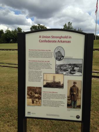
    After showers we headed north on I-49, past Fayetteville. This was the site of the Bikes, Blues and BBQ event being held from Wednesday - Saturday. Later today we heard there were 450,000 bikers in attendance. Throughout the afternoon as we made our way across northern Arkansas it felt like we saw most of them. We drove through Eureka Springs on US 62 after leaving Pea Ridge Nat'l Military Park, on our way to Harrison, AR. Today's Poker Run for the bike event was to Eureka Springs!

    After leaving Harrison we continued south to Buffalo National River, a new NPS site for me. On the way we stopped at Big Springs Restaurant in St. Joe, AR for smashed pennies. The food smelled so good I bought some smoked Pork Loin with their BBQ sauce to reheat at camp - Yum!

    BBQ dinner


    Tyler Center NPS campground, along the Buffalo River


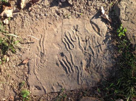
    Fossil Worm burrows - pavers at campsite - Buffalo National River


    Passport Stamps
    Oklahoma City Nat. Memorial - Oklahoma City, OK
    Fort Smith NHS - Fort Smith, AR
    Trail of Tears Nat'l Hist. Trail - Fort Smith NHS, AR
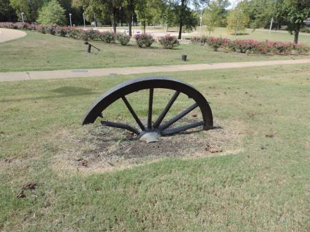
    Pea Ridge Nat'l Military Park - Pea Ridge, AR
    Trail of Tears NHT - Pea a Ridge NMP
    Buffalo National River
    Buffalo National River - First National River

    Bonus
    Sequoyah National Wildlife Refuge
    Fort Smith National Historic Site (pictorial)
    Pea Ridge National Military Park (pictorial)
    Devil's Den State Park

    Bonus

    Letterboxing
    Wednesday - 2
    Thursday - 2

    Wildlife Sighting
    White-tailed Deer

    Turkey vulture
    Common Raven
    Blue Jay
    Pileated Woodpecker
    Hairy Woodpecker
    Canada Goose
    Scissor-tailed Flycatcher
    Blackbirds
    Last edited by Mark Sedenquist; 10-12-2014 at 12:56 PM. Reason: ADDED link to Derek's field report

  2. #12

    Default Central & Eastern Arkansas

    Friday, September 26
    Start & Finish: Tyler Bend Campground, Buffalo National River (NPS)

    Woke to an overcast sky, but a clear forecast. By the end of the day it was reaching 90 degrees. After a yummy breakfast at Ferguson's (and smashed pennies) just a couple of miles from the campground on US 65 in Saint Joe we drove into the quaint town of Gilbert. The Penny Collector app showed there were 3 places there. The first stop was at the Gilbert RV campground. My husband was inside a looong time - the man there owned the machines in the area and had his own machine. Besides the set he bought from the machine the man gave him several more from his private collection. Next stop was the General Store. Today the rent canoes for the River and cabins. In 1903 they were the Post a Office as well as the local store.

    Gilbert General Store

    Back into the park to pick up the Junior Ranger booklet, another program with no age range given. It appears more and more parks are encouraging the over 12 crowd to participate. As I have said before I have always learned something new when completing a program. Don't be afraid to ask- go for it!

    We drove south into Marshall and spent a couple of hours doing laundry and grocery shopping. This put us in place to drive over to another part of the park, Buffalo Point. Pretty drive on curvy back roads. At Buffalo Point there are a number of River views, high from a bluff and down along the river. For campers - this NPS campground had electric and water hookup sites and it takes reservations. There are also showers for all campers. While there I finished my Junior Ranger activities and received my badge.

    We continued a loop back to camp by continuing north on AR 14 to Yellville. Then cut back to US 65 north of the campground on AR 235, another good road will plenty of views and curves. We are a couple of weeks ahead of the Fall colors, a few spots starting to show, I can only imagine how spectacular this area will be then.

    Passed the Big Spring Restaurant in Saint Joe where we got smoked pork loin last night for dinner, and beef brisket for tonight's dinner - excellent. They also have sit down service, but so nice to enjoy the meal at camp with a beer of our choice! Once in the shade the temperature was comfortable.

    Saturday, September 27
    Start: Tyler Bend campground, Buffalo National River
    Finish: Pendleton Bend campground (AC), N of Dumas, AR

    Woke up to fog, but by the time we finished breakfast in camp the sky had cleared. Heading south on US 65 towards Conway & Little Rock. Nice highway, looks like a major thoroughfare through the Ozarks. Cell service has been excellent throughout Arkansas, even on the back roads.

    We spent a couple of hours in downtown Little Rock which had lots to see and do. We wanted to see Peter Toth's Whispering Giant for Arkansas. It is part of their Riverfront Park. While meandering around we found several places with smashed penny machines. The Old State House Museum is free and had exhibits related to bicycles and landscaping. The MacArthur Military Museum is about a mile from downtown, next to the Arkansas Arts Center, which is also free.

    Little Rock - Old State House


    Fountain at Old State House


    Southern Welcome


    Whispering Giant #13 - Little Rock


    Our last stop in town was a visit to Little Rock Central High School National Historic Site. Their exhibit area is small, but tells a powerful story. It reminded me of several facts; it was 3 years after the Supreme Court had ordered schools to be integrated before the nine African-American students entered Central High. And what I had forgotten was that the state of Arkansas passed a state law allowing a governor to close a school, which the governor did after that first year of integration. It took 2 more years before the schools were reopened as integrated. To me it is amazing that so much negative energy and action was expended for something that I believe should never have occurred. The exhibits also tell the story of individuals from other minority groups that worked to correct injustices in our country. This site is well worth a visit.

    Back on the road, heading SE on US 65 through Pine Bluff to Dumas, AR. Here we headed north on US 165 to the Arkansas River to camp at an Army Corp of Engineers campground, Pendleton Bend. Warm and muggy! Hard to identify many birds, they fly into the trees never to be seen again.

    Passport Stamps
    Buffalo National River - First National River
    Little Rock Central High School NHS - Little Rock, AR

    Bonus
    Buffalo National River (pictorial)
    Central High School NHS - Little Rock, AR (pictorial)

    Smashed Pennies
    Ferguson's Country Store & Restaurant, St. Joe -4
    Gilbert RV Campground, Gilbert - 8
    Buffalo Camping & Canoeing, Gilbert - 4
    Pickle Gap Village, Pickle Gap - 1
    Old State House Museum, Little Rock - 3
    MacArthur Military Museum, Little Rock - 4
    Clinton Museum Store, Little Rock -3

    Wildlife Sightings
    White-tailed Deer

    Turkey Vulture
    American Crow
    Common Raven
    Pileated Woodpecker
    Barred Owl (heard)
    Northern Cardinal
    Mourning a Dove
    Northern Mockingbird
    Blackbird
    Great Egret
    Canada Goose
    Pileated Woodpecker
    Downy Woodpecker

  3. #13

    Default Leaving AR, across MS & into Alabama

    Sunday, September 28
    Start: N of Dumas, AR
    Finish: Tishomingo State Park, Tishomingo, MS

    Cooled off nicely for sleeping, lower 60s. Pleasant morning in camp and at Arkansas Post National Memorial. This is another new NPS site for me. A lot of history happened here, but no structures remain, hence a Memorial and not a Site. Many flags have flown in this area; French (2), Spanish, Confederate and American, as well as the original settlers, the Quapaw Indians in the 1400s. Today it is mainly a natural area, a beautiful place to walk around. Alligators are found here, but one today.

    Back to US165 N, then AR 1, both part of the Great American River Road that follows the Mississippi River. At US 49 we turned east to Helena, AR. We were looking for a Southern Buffet for our Sunday lunch, but most restaurants were closed on Sunday. The only place that was open turned out to be a Mexican place down along the levee and a section of town celebrating the Delta Blues. Rio Linda was busy and the food was excellent, as authentic as anything in Tucson.

    Helena, AR


    Crossing the Mississippi at US 49


    After several enjoyable days in Arkansas we entered Mississippi. We picked up US 278 and headed east. This is a 4-lane divided highway with on-off ramps. We stopped in Oxford and toured the Town Square and the author, James Faulkner's home, Rowan Oak. I had spent a bit of time here in the 90s as part of a USDA grant and enjoyed Oxford. On the way into town you pass John Grisham's house, or it was when I was there in the 90s.

    Fauklner's Home -Rowan Oak


    Further east on US 298 we picked up the Natchez Trace, just west of Tupelo. I can't say enough about what delightful 'roadie' experience this is. Not as scenic as the Blue Ridge Parkway or Skyline Drive, both further east, but an enjoyable drive. After stopping at the Parkway Visitor Center, near Tupelo, we continued north on the parkway to Tishomingo State Park for the night. The past couple of nights we have started seeing fireflies at night, a childhood memory growing up in the upper MidWest.

    Monday, September 29
    Start: Tishomingo, MS
    Finish: Florence, AL

    The morning was spent revisiting some NPS sites we had spent time at the Summer of 2013 when the National Park Travelers Club had their annual convention in Corinth, MS at Shiloh National Military Park. The main battlefield of Shiloh is just across the Tennessee border and has a great auto tour that takes you past numerous memorials ( not as many as Gettysburg) with a detailed explanation of the battle. Back in Mississippi in the town of Corinth there is a very nice interpretive center that has excellent displays. I spent a lot of time there last summer completing their Junior Ranger program. As you walk up to the center, imbedded in the walkway are bronzed artifacts from the battlefield. Of all the Civil War sites I have visited I think this does the best of telling the whole story.

    Corinth Civil War Interpretive Center


    Explanation of imbedded items


    As we were on our was to Florence, AL on US 72 we took a detour south to the Coon Dog Cemetery. We had clues for a letterbox and the title was too intriguing to pass up. It turned out to be a bit longer drive than we had intended, but we persevered and were rewarded with a unique experience. It turned out it is a well-known site in these parts.

    Coon Dog Cemetery


    Our final stop of the day was at the University of North Alabama at the Muscle Shoals National Heritage Area. This is an area in the NW corner of Alabama that celebrates their unique culture. We'll be visiting numerous sites over the next several days. The director walked us over to their new office and spent considerable time with us. We finished the day along the Tennessee River at McFarland Park, a public RV park near downtown Florence. Another warm day, mid-80s, hoping for a cool evening.


    Passport Stamps
    Trail of Tears National Historic Trail - Arkansas Post
    Arkansas Post National Memorial - Gillette, AR
    Trail of Tears NHT - Natchez Trace Parkway
    Natchez Trace Patkway - Tupelo, MS
    Natchez Trace Nat'l Scenic Trail - AL, MS, TN
    Shiloh NMP - 150th Anniversary of the Civil War
    Shiloh National Cemetery - Pittsburgh Landing, TN
    Trail of Tears National Historic Trails - Pittsburgh Landing, TN
    Shiloh National Military Park - Shiloh Battlefield, TN
    Shiloh National Military Park - Corinth Contraband Camp
    Siege & Battle of Corinth NHL - Corinth, MS
    Corinth Civil War Interpretive Center - Corinth, MS 38834
    Corinth - 150th Anniversary of the Civil War
    Muscle Shoals National Heritage Area - Florence, AL

    Bonus
    Arkansas Post National Memorial (pictorial)
    Shiloh National Military Park (iconic, presented by NPTC July 2013)

    Letterboxes
    Monday - 2

    Wildlife Sightings
    Turtle
    Eastern Gray Squirrel
    Red Squirrel
    Spiders - too many to count or identify
    Fireflies!

    Great Blue Heron
    Great Egret
    Cattle Egret
    Red-tailed hawk
    Red-headed Woodpecker
    Downy Woodpecker
    Prothonotary Warbler
    Wild Turkey
    Mourning Dove
    Fish Crow
    Cedar waxwing
    Northern Mockingbird
    Eastern Bluebird
    Hummingbird
    Northern Cardinal

  4. #14

    Default Muscle Shoals NHA, Alabama - Day 1

    Tuesday, September 30
    Start & Finish: Florence, AL

    Muscle Shoals National Heritage Area - our plan today was to visit as many of the sites we could today. It was a navigator's nightmare, I ended up re-routing us a couple of times. We definitely saw lots of back roads and new sites. At each site the staff were delightful, thrilled we had stopped by and helpful when needed. I think today was as much about the people of NE Alabama, as their rich heritage.

    Stop #1 - Old State Bank, Decatur, AL
    The town Decatur was a significant site during the Civil War, held by Union forces throughout the war. It is on the banks of the Tennessee River and two major railroad lines. The gentleman who greeted us had a wealth of information about the area and the building. The fireplace mantle pictured below is called a War and Peace mantle - look closely and you will see the uprights are cannons held up on each end by bibles. Also the upstairs was the home of the banker. It is beautifully furnished with period pieces.


    Stop #2 - Wheeler National Wildlife Refuge, Decatur, AL
    Nice stop with lots of natural scenery. The big season of migrating cranes, geese and ducks are a month or so off. Inside the visitor center there were good displays of the birds that use the refuge. As we keep trying to get better at identifying birds these displays are helpful.


    Stop #3 - Mooresville, AL at JaVa Coffee
    A beautiful, small intact town settled in 1818, a small Williamsburg without any commercialization. The passport stamp for the heritage area is at a coffee place in the village. What a surprise, Jack the owner was raised in Tucson. We enjoyed a hot beverage, slice of Apple pie and sharing stories. Along with selling drinks he has an eclectic selection of art and collectibles, including beautiful photos of western landscape. What a pleasant surprise!


    Stop #4 - Belle Chèvre Artisan Cheese, Elkmont, AL
    Fun stop at the factory and store. A tour was being conducted when we stopped. We were able to get the stamp and look around on our own. The building had been a cotton warehouse, we found the front of the building very interesting, lots of architectural history.


    Stop #5 Red Bay Museum, Red Bay, AL
    This was a very well done small town museum. A number of years ago the town asked someone to write their history, in the process they realized they had a lot of the artifacts that told their story. They were collected and became this museum. They did a great job of creating displays with a common theme. Upstairs they have an extensive collection relating to Tammy Wynette, a country singer, she was born nearby. Her glittery gowns, with the lighting and my camera did not do justice to the 'flash' of her dresses.


    Tammy Wynette's gowns


    Stop #6 Rock Bridge Canyon, Hodges, AL
    Not much to do here, but would love to come back and camp and hike. The mid 80s with humidity higher than we like kept us in the front office. From the pictures this natural areas looks spectacular. It is marketed as an Equestrian Park, but trails also open to hikers.


    Stop #7 Alabama Music Hall of Fame, Tuscumbia, AL
    This was an end of day, quick stop. The stars embedded in the front hall included many greats; EmmyLou Harris, Percy Sledge, The Temptations, Alabama (of course) and Nat King Cole, to name a few.

    Stop # 8 Alabama Chanin, Florence, AL
    Another end of the day stop, which was probably a good thing. They make beautiful hand-sewn women's clothing. Lots to admire, but not in my budget. The display area was beautifully arranged. Sorry I didn't get pictures. They serve lunch from 11-3.

    Back into town for fresh, local beer while enjoying a tasty Calzone at The Pie Factory in downtown Florence. After eating we walked the several blocks of the thriving downtown, always nice to see.

    A few more Muscle Shoal NHA sites tomorrow and then continuing east to new NPS sites for me.


    Passport Stamps
    Muscle Shoals NHA
    Old State Bank
    Wheeler Wildlife Refuge
    Belle Chèvre
    Red Bay Museum
    Rock Bridge Canyon
    Alabama Music Hall of Fame
    Alabama Chanin


    Wildlife Sightings

    Great Egret
    Great Blue Heron
    Northern Cardinal
    Northern Mockingbird
    Feral Dove
    American Robin
    American Crow
    Swallow
    Eastern Bluebird

  5. #15

    Default Muscle Shoals and beyond

    Wednesday, October 1
    Start: Florence, AL
    Finish: DeSoto State Park, AL - near Fort Payne, AL

    Another fairly quiet night along the Tennessee River, a few trains through the night. The quest continues. . .
    Stop #1 - Ivy Green, Home of Helen Keller, Tuscumbia, AL
    Beautiful, simple birthplace and childhood home of Helen Keller. What a remarkable woman, first deaf & blind person to graduate from college, and so much more. The founds are beautifully landscaped and maintained. Tour guides provide tours throughout the day.


    Stop #2 - W.C. Handy Home, Florence, AL
    Born in 1873 in this cabin, Handy is known as the Father of the Blues. Besides maintaining his birthplace the area holds the WC Handy Music Festival each year.


    Sculpture outside WC Handy Home


    Current resident at WC Handy Home


    Stop #3 - Pond Spring, Home of General Joe Wheeler, Wheeler, AL
    This was the oddest stop of all of the sites. A brown sign off the highway gave the turn off the highway onto a gravel road, and then no other signs. We saw a large home, and a few cars up a long, shaded driveway. Not until you walked up on the front porch and saw a sign about tours did you think you were in the right place. We asked about a sign and were told they were waiting on a big donation. Gen. Wheeler was a Confederate general, who later served in the US Congress and was a major supporter of reunification between the North and South. All of the furnishings are original to the house. Even though there was a tour in progress a young lady took us to,the gift shop effort the passport stamp.

    Stop #4 Oakville Indian Mounds, Oakville, AL.
    This was a great final stop on our quest to visit all of the Muscle Shoal NHA sites with passport stamps. The site is owned by the local school district: it preserves the Cherokee heritage. The building is a museum built as a Council House. Anna, the staff person, was delighted with our visit, even took our picture holding our stamp books on front of their statue of Sequoyah. The collection of arrowheads is impressive. There are two mounds on site, one in the process of being reconstructed.
    Inside the museum


    Burial Mound


    Entrance with Clan names


    So, we did it - got all of the passport stamps for this National Heritage Area. Not sure why this area intrigued us enough to spend the extra time in the area, but we enjoyed all that we saw and everyone we met.

    Heading East to Little River Canyon National Preserve, near Fort Payne, AL. This is a new park site for me, and a beautiful natural area. The visitor center is located at the edge of the preserve and is managed by Jacksonville State University. Their are no exhibits, but their 19 minute film does an excellent job of interpreting the area. We drove along the Scenic Drive for some great views.

    Little River Canyon NP


    Little River Falls


    The day ended at a very nice state park nearby, DeSoto State Park. Beautiful campsites and great evening weather. The air seems a bit drier, and cooler.

    Passport Stamps
    Muscle Shoals NHA
    Helen Keller Birthplace
    WC Handy Home
    Pond Spring
    Oakville Indian Mound
    Little River Canyon National Preserve - Fort Payne, AL
    Trail of Tears National Historic Trail - Fort Payne, AL

    Smashed Pennies
    DeSoto State Park - Fort Payne, AL

    Wildlife Sightings
    White-tailed Deer
    Eastern Gray Squirrel
    Bat

    Great Blue Heron
    Great Egret
    Northern Cardinal
    Canada Goose
    House Sparrow
    Warbler

  6. #16

    Default Alabama into Tennessee

    Thursday October 2
    Start: Fort Payne, AL
    Finish: Kingston, TN

    Excellent sleeping weather up on the ridge in DeSoto State Park. This is a state park that has a lodge and restaurant, we find the MidWest & SouthEast state parks to have great food at very reasonable prices. We enjoyed an excellent breakfast, along with a perfectly cooked omelet I enjoyed a bowl of grits. The drive off the ridge, down into the valley was a pretty drive on narrow, curvy roads.

    Our first stop was Russell Cave National Monument, way up in the corner of NE Alabama. This is a site that dates back to human habitation 10,000 years BCE. Currently you can walk open to the large shelter, but not into the cave due to the white-nosed syndrome which is devastating the bat population throughout the US, mainly the East and MidWest, to date. Anyone who has visited a cave, anywhere in the US has been educated about this issue. Basically it disturbs their hibernation cycle, causing them to 'wake' up too soon when enough of their food source is not available. This site was a new national park for me, eight more to go to finish visitng all the NPS sites in the Lower 48!

    Map 101 - a line on a paper or app map does not always equal a real road. As we left Russell Cave both maps showed a line heading north into Tennessee. The county road leaving Alabama was paved and numbered. As we entered the town of Orme, TN there was a handmade metal sign with the number 156 and an arrow pointing to the right. The other roads at that intersection were all paved, the one following the arrow was uphill and gravel. Off we went, up, up and more up until we reached a crest and then down. Luckily we met no one coming the opposite way because most of it was single lane. After about 10 miles we reached pavement and civilization. Never a dull moment! Shortly after we picked up I-24 heading into Chattanooga we were stopped dead on the road due to a traffic accident miles ahead. Crossing on the gravel road was looking better all of the time!

    In Chattanooga we visited Audubon Acres, just off I-75 for a Trail of Tears NHT stamp. This is a nice site, with hiking trails and picnic areas. While there we watched a Black-capped Chickadee explore the feeder.

    Audubon Acres


    After a picnic lunch there we headed north on TN 58 to the Cherokee Removal Site, just east of Dayton. This is a site we have tried to visit previously, but their hours are limited. Today they were open. After getting the passport stamp and visiting with the staff inside we explored the monuments and displays outside. Actually, the outside displays give the full interpretation of the site. This was the site where the Cherokees were ferried westward across the Tennessee River during their removal to the West in the 1800s.


    Map of Trail of Tears routes


    We ended the day at my sister's house, further up the River. We'll be there over the weekend, back on the road Sunday.

    Passport Stamps
    Russell Cave National Monument - Bridgeport, AL
    Trail of Tears National Historic Trail
    - Tennessee
    Chattanooga, TN
    Meigs County, TN

    Wildlife Sightings
    White-tailed Deer
    Eastern Gray Squirrel

    American Crow
    Turkey Vulture
    Black-capped Chickadee
    Ruby-throated Hummingbird
    Rock Pigeon

  7. #17

    Default Great Smoky Mountain National Park

    Friday - Saturday, October 3-4
    Start & Finish: Kingston, TN

    On Saturday we drove to Fall Creek Falls State Park, near Pikeville, Tn. This another beautiful state park with well-developed facilities. The park is large and spread out. We did a hike from the Nature Center which required crossing a suspension bridge. A sign gave notice that only 6 people were to be on the bridge at a time. As this was the first cool day of Fall we had to wait a bit before we were able to cross, once on the bridge the swinging motion was substantial.

    Suspension bridge crossing


    Further in the park there was an overlook to the tallest of the falls, Fall Creek. Lighting wasn't the best for a great picture. Before leaving the park we enjoyed a Southern-style buffet at their restaurant overlooking the lake.

    Fall Creek Falls


    Sunday, October 5
    Start: Kingston, TN
    Finish: Elkmont campground, Great Smoky Mountains NP, near Townsend, TN

    After stopping in. Maryville, TN for groceries we stopped in Townsend, TN at the visitor center for passport stamps, tokens and park information, and a couple of letterboxes before entering Great Smoky Mountains National Park. Even though the leaves have not turned colors and it was mid-Sunday afternoon the park was very busy. The out-of-state license plates were abundant. We set up camp at Elkmont, a first time camping here. The campground is very well organized, even providing large areas that are generator-free, a treat for us.

    We drove to the Sugarlands Visitor Center, near Gatlinburg. After getting several passport stamps and spending time in their museum we drove into. Gatlinburg to another visitor center on the western edge of town. What a throng of people along the streets of Gatlinburg, glad we weren't looking for a parking spot. It looks like Fall Break for schools must be starting as we are seeing more families than we have on our trip. Back at camp we enjoyed dinner and a campfire.

    Monday, October 6
    Start & Finish: Elkmont Campground

    I have decided a quiet morning in camp means waking up at 8:30, which we did this morning. We eventually made our way out of camp and drove south to Tremont and then to Cade's Cove. Traffic was less than on Sunday, but still busy. Once on the eleven mile scenic loop around historic Cade's Cove it was very slow going, maybe 10 mph. Clouds were moving in, as predicted, and soon opened up with rain, lightning and thunder. We made our way back to camp to enjoy a quiet afternoon of reading and napping. The rain had let up, but more was predicted.

    Flowers along the trail


    We drove into Gatlinburg for dinner at Great Smoky Brewhouse, excellent beer and a tasty dinner. Town was busy, but not as crowded as it was on Sunday afternoon.

    Passport Stamps
    Great Smoky Mountains NP
    -Townsend, TN
    -Sugarlands
    -Tremont, TN
    Cade's Cove, TN
    Elkmont, TN
    Clingmans Dome
    Oconaluftee, NC
    Appalachian National Scenic Trail - Maine to Georgia
    Trail of Tears National Historic Trail
    Tennessee
    North Carolina
    Blue Ridge Parkway - NC-VA

    Tokens
    Great Smoky Mountains NP - 6

    Letterboxes
    Saturday - 3
    Sunday - 8
    Monday - 2

    Wildlife sightings
    Eastern gray squirrel
    Eastern Chipmunk

    Wild Turkey
    American Crow
    Turkey Vulture
    Mourning Dove
    Black-capped Chickadee
    Northern Mockingbird

  8. #18

    Default Blue Ridge Parkway

    Tuesday, October 7
    Start: Elkmont campground, Great Smoky Mountain NP
    Finish: Davidson River campground (USFS), Brevard, NC

    Rained most of the night, slept (or tried to) with a persistent 'tip tap' on the roof. Cleared enough in the AM to fix breakfast in camp. Drove east through Great Smoky Mountains NP on US 441. No bear jams as we drove through the park. Drove up to Clingman's Dome even though the cloud cover was significant. I think only once out of the 5 times I have been there has it been clear.


    View at Clingman's Dome (or not)

    We arrived in Cherokee, NC by 11AM. We noticed quite a bit of activity in the area which we later learned were people getting ready for the Cherokee Indian Fair and their parade. We got through town before the main road was closed for the parade.

    Two passport stamps had always eluded my husband, both on the east side of Great Smoky Mtns NP. We decided to go to both sites; Deep Creek and Cataloochee. Getting to Deep Creek, through Bryson City (S US 19) was easy and pretty. Bryson City has a lot to offer tourists, lots of restaurants, shops and the Smoky Mountain Railroad. It seemed to be a little less 'touristy' than Pigeon Forge, Gatlinburg or Cherokee. The drive into Deep Creek was pretty, and we found a back, gravel road out of the area that took us back to US 19 heading north.

    Getting to Cataloochee was another story! After driving through Maggie Valley (US 19) you turn east on US 276 (a nice four-lane, divided road), almost to I-40. The 10 miles down into the valley starts out paved, a 2 lane road, then it becomes gravel, a 1 lane road and finally back to paved road. Once in the valley there are old buildings to view and elk in the meadows. To get the passport stamp you need to find a park service volunteer that is part of the Elk Bugle Corp. After driving through the valley we spotted a volunteer and followed him to their cabin/office to get the passport stamp.


    Elk in Cataloochie Valley

    We drove back out of Cataloochee, then Maggie Valley up to the Blue Ridge Parkway. We have driven the entire length of this parkway, a very favorite drive of ours. It is more scenic than the Natchez Trace Parkway, and longer. The weather had not cleared up and at times we were driving through 'pea soup'. We stopped at Waterknob Rock, it was windy, cold and totally socked in. A little further down the road we drove off the parkway on Wagon Gap Road (US 276 East) down to Davidson River campground. This campground is adjacent to an active Job Corp site that was a CCC camp. There are over 200 campsites, including a generator-free section which we were assigned. Showers are also available at this site. We enjoyed a nice evening before retiring with a clear sky overhead.

    Wednesday, October 8
    Start: Davidson River campground (USFS), Brevard, NC
    Finish: Carolina Hemlocks campground USFS), Micaville, NC

    Somewhere during the night the skies opened up and poured, at times. So another night of 'tip tap', irregular rain drops on the roof of the van from the trees above. The skies were clear in the AM. Before heading back up to the Blue Ridge Parkway we had several other places to explore.

    Heading back up Wagon Road we first stopped at the Pisgah National Forest visitor center, within a mile of the campground. While there I heard a volunteer tell a visitor that to drive from their site to Cherokee, NC it would take 2 hours. Hmmm, we left Cherokee at noon the day before and made it to the campground at 6PM, definitely not the direct route for us, as usual. From there we continued back towards the Blue Ridge Parkway to the Forest Discovery Center. This is only 4 miles off the parkway and definitely worth a visit. There is an entry fee (free with Golden Age pass). George Vanderbilt (of Biltmore fame) established the first forestry school in America on his private land. Excellent exhibits and great activities for kids. There are trails, a gift shop and cafe on site.


    Forest Discovery Center

    Back, heading east, again on the Wagon Gap Road we re-traced our steps. Along the way we stopped at 2 natural areas along the road, Sliding Rock and Looking Glass Falls.


    Looking Glass Falls


    My goal for today was to visit the Carl Sandburg Home National Historic Site in Flat Rock, NC. We had been there in 1995, but it was pouring rain that day. We arrived at noon and had a picnic lunch in the parking area. The walk to the house and visitor center is 0.3 mile uphill. The day was warming up, but the trail is nicely shaded. I picked up the Junior Ranger booklet and was able to complete it during my visit. Carl Sandburg was a poet, journalist, biographer (of Lincoln) who completed 1/3 of his literary accomplishments while living at this site, Connemara. His wife, Lillian,was well-known for her expertise in raising and breeding goats. On the site is a goat herd that you can pet and observe. The site is beautiful and well worth a visit.


    Carl Sandburg Home NHS

    We worked our way back to the Blue Ridge Parkway, just south of Asheville. We stopped at the main visitor center, the Folk Art Center and Craggy Mountain. The sky was clear and the views spectacular. This roadway was built in the 1930s as part of a public works project during the Depression. The hills were beginning to show some autumn color.


    Views from Craggy Mountain

    We ended the day at another Pisgah National Forest camp, on NC 80, west of the parkway, called Carolina Hemlock campground. The hemlocks on the east coast have been destroyed by a small pest, this area was aggressive in treating the trees and have saved them. The campground was along a beautiful creek, Clear Creek which provided great background noise. Another beautiful Fall evening in camp.


    Carolina Hemlock campground.

    Passport Stamps
    Great Smoky Mountains NP
    -Deep Creek, NC
    -Catalochee, NC

    Blue Ridge Parkway
    -Waterknob Rock, NC
    -Visitor Center (Asheville)
    NC-VA
    Graveyard Fields
    Folk Art Center
    Craggy Gardens

    Carl Sandburg Home NHS - Flat Rock, NC

    Blue Ridge Nat'l Heritage Area - Asheville, NC

    Bonus
    Pisgah National Forest (pictorial)
    Cradle of Forestry in America - Pisgah Nat'l Forest

    Wildlife Sightings
    Eastern Grey Squirrel

    Wild Turkey
    American Crow
    Last edited by Mark Sedenquist; 10-12-2014 at 12:40 PM. Reason: fixed links so the photos display on the page

  9. #19

    Default Blue Ridge Parkway - Part 2

    Thursday, October 9
    Start: Carolina Hemlock campground (USFS), near Micaville, NC
    Finish: Rocky Knob campground (NPS), mp 170 in VA on Blue Ridge Parkway

    Great morning in camp, including a very nice non- fee shower! Back up to the BRP, continuing south. Today would be a full day on the parkway. We stopped at the Museum of North Carolina Minerals which has excellent displays. As we got closer to Linville Falls the Fall colors were in full color and the crowds were out and about. Along the way I picked up the Junior Ranger booklet for the Blue Ridge Parkway (BRP). I like the way they have it organized, it is actually a pocket folder with activities to complete. Ten of the visitor centers along the parkway have separate activity sheets. By completing the folder and one sheet you get the standard badge. If you complete four sheets you get a patch, and all ten will earn you an attractive metal badge.

    Just past the Moses H. Cone home, Flat Top Manor, we drove off the parkway into Blowing Rock, NC for gas and lunch. This is a very upscale and crowded town. One restaurant even had parking spaces with a white board at each space which had names and reserved times for that day. We enjoyed a very tasty lunch at Blowing Rock Ale House and Brewery.

    Back on the parkway we stopped for a nice hike to some cascades. It was a signed Nature Trail which helped us to identify some of the trees we've been seeing out East. The weather today was 'Fall Perfect'.

    E.B. Jeffries Cascade Trail Sign


    A favorite stop along the parkway is the Blue Ridge Music Center at mp 213. As we walked up two gentlemen were playing bluegrass on the porch. The exhibits in this center interpret the roots of American music. While there I had completed enough of the Junior Ranger program to earn the standard badge. The ranger was very excited to have an adult participating.

    Blue Ridge Music Center
    Music on the porch


    Which music delivery system did you first use?


    Junior (Senior) Ranger pledge


    We ended the day at Rocky Knob campground. A bare-bones NPS campground along the parkway. On a previous trip this is where we first heard the Barred Owl. To be honest it scared us out of a deep sleep. Hopefully we will hear again tonight, we are better prepared, knowing what it is.


    Friday, October 10
    Start: Rocky Knob campground, VA
    Finish: Bluestone State Park, near Hinton, WV

    No Barred Owls heard. It only rained when we arrived and cleared up during the night, even saw the full moon. We drove back south on the parkway to a very favorite place, Mabry Mill. Besides having a nicely restored and working pioneer village there is also an excellent restaurant. Their cornmeal pancakes are the best. Everything is good there, and so on the weekends be prepared for a wait. Once done eating we walked out through the village, the fall colors only added to the beauty.

    Mabry Mill


    No rain, however, for a lot of the drive to the end of the parkway we were looking down on the clouds in the valleys below. And we were driving through the clouds from time to time. At times it was erie, but pretty as well. Along the way we stopped at the various visitor centers to see the exhibits and get the passport stamps. We finished the parkway at its northern terminus, just where Skyline Drive begins through Shenandoah National Park. We have done that drive as well, but not this time. We picked up I-64 west towards West Virginia. It is always a shock to leave the Blue Ridge Parkway and get back on highways.

    After crossing the state line we stopped in Sulphur White Springs for a tasty dinner at the Mason Jar restaurant. We continued towards Beckley, but turned off before getting there to reach Bluestone State Park. By this time is was getting dark and the road to and into the state park was narrow and poorly marked in places, plus the rain was starting to get serious. Luckily we got a camping spot without trees over us!

    Finances: at the end of 4 weeks of travel our weekly cost has averaged to be $527.

    Passport Stamps
    Blue Ridge Parkway
    Museum of NN Minerals
    Overmountain Victory Trail
    Linville Falls
    Linn Cove Viaduct
    Cone Memorial Park
    Blue Ridge Music Center
    - Mabry Mill
    Peaks of Otter
    James River
    Humpback Rocks
    Virginia's Explore Park - Blue Ridge Parkway
    Appalachian National Scenic Trail - Maine to Georgia

    Smashed Pennies
    Mabry Mill

    Wildlife Sightings
    Chipmunk
    Tree Frog (heard)
    Cottontail Rabbit
    Glow worm
    White-tailed Deer

    Turkey Vulture
    American Crow
    American Robin
    House Sparrow
    Northern Mockingbird
    Mourning Dove
    Last edited by Mark Sedenquist; 10-16-2014 at 05:38 PM.

  10. #20

    Default West Virginia & Kentucky

    Saturday, October 11
    Start: Bluestone State Park, WV
    Finish: Grayson Lake State Park, S of Grayson, KY

    Glad there were no trees overhead as it rained off and on through the night. Luckily it was a light, gentle rain which does not disturb our sleep. Today the goal was for me to visit the three NPS sites in West Virginia that I had not been to before. The first one, Bluestone National Scenic River which ran up against the state park in which we camped. There are no facilities, it is included with the larger, and better known New River Gorge National River (NRGNR). We drove back north from the state park to the Sandstone Visitor Center for NRGNR they had the passport stamps for there and Bluestone NSR. We watched the park film and I picked up the Junior Ranger booklet for NRGNR.

    Sandstone entrance at visitor center


    From there we continued north to the historic district of Thurmond, which is part of NRGNR. To get there off of US 19 it is a narrow, at times single lane & bridges, road then crossing the New River on single lane metal grid bridge. Once there the train depot is the visitor center and AMTRAK station. Three days a week the AMTRAK Cardinal, New York to Chicago, passes through. By request it stops to pick up or drop off passengers.

    Thurmond Train Depot


    Falls along Road to Thurmond


    Within this area of the country is the National Coal Heritage Area with sites separate from the National Rivers. A small town off of US 19 and after we left Thurmond is Whipple. A passport stamp for this heritage area is at the Whipple Country Store. It was a mine company store that is open for tours. The woman at the gift shop today was very welcoming and pleased we had stopped by for the passport stamp.

    Whipple Company Store


    We continued north on US 19 through Fayetteville to the Canyon Rim visitor center, which overlooks the New River gorge and the famous arch bridge. The River and bridge were totally socked in with fog today. A display inside explained that until the bridge opened in 1977 it took 45 minutes to cross the gorge, today it takes 45 seconds! While there I received the Junior Ranger badge and an attractive patch.

    Fall Colors


    The final site to visit today was Gauley River National Recreation Area, further north on US19. This is another site without facilities so the passport stamp is at the Canyon Rim visitor center. Not far up the road we turned onto West 129 to enter the recreation area. We drove down to a river access area to get closer to the Gauley River. Even though it was overcast and in the mid-50s the parking lot was quite full. As we drove the back roads to Charleston we passed a number of raft company busses full of people. I hope they provided wet suits!

    Gauley River


    Kanahwa River Falls along US 60


    Once outside of Charleston we picked up I-64 west to the Kentucky border. All through West Virginia and about 10 miles past Charleston there was no Verizon service, not even enough for text messages. Past Charleston and into Kentucky there was 4G service.

    We ended the day south of I-64 at Grayson Lake State Park. Another campsite without trees overhead!

    As of today I have 5 NPS sites to complete visiting all of the sites in the Lower 48. All 5 are west of the Mississippi River, stay tuned.

    Sunday, October 12
    Start: Grayson Lake SP, KY
    Finish: Laurel Branch (AC), McDaniels, KY

    Another rain-free night! A new area for us was our goal today, Red River Gorge Geological Area, south of where we camped. We worked our way to south to Kentucky's Mountain Parkway. Initially it was 2 lane with controlled access, it eventually became a 4-lane freeway. This was an unplanned visit so we didn't have detailed information. With limited cell service I could only get basic information. We made our way to Slade, KY to a Rest Area just north of the Natural Bridge State Resort Park. While looking at a big map of the area an attendant handed us a detailed brochure. With that in hand we began our drive through this beautiful area. The geological area road was about 20 miles, we did not do the Scenic By-Way portion, which would have been 46 miles.

    We entered from the west end and immediately came upon the one-lane Nada Tunnel.

    Red River Gorge Geological Area
    West Entrance


    About halfway around is an excellent visitor center, Gladie Learning Center, which is open daily 9 - 5:30. Very nice displays and several movies about the area. We watched the main film, 8 minutes long about the geological area. While there we walked down to view the cabin and walk through the barn which was full of original tools and implements used in the area.

    Gladie Learning Center

    Dulcimer & music books for you to play


    Pioneer Cabin


    Pioneer still


    As we drove on through we stopped at a few overlooks and fixed lunch. There was a bright orb overhead that looked familiar. It wasn't until early afternoon that we were able to see the Sun for the first time in days, probably since last Tuesday or Wednesday.

    Overlook views


    We continued around Lexington and picked up the Bluegrass Parkway heading west. We then headed south on US 31 E at Bardstown for Abraham Lincoln Birthplace National Historical Park. Before getting to the main site, S of Hodgenville, you pass part of the site at Knob Creek. This is where Lincoln's family moved to when he was two years old and stayed until he was seven. It is not as developed as the main site, but rangers were on site today and told us several improvements are in the works. The cabin here is from the same era as when Lincoln lived here, it was a neighbor's cabin.

    Knob Creek, KY - part of A. Lincoln Birthplace NHP


    From there we continued to the main site which is a bit unusual. Within a large stone building there is a replica of the cabin in which Lincoln was born.

    Lincoln Timeline


    We made our way to an Army Corp of Engineers campsite near McDaniels, KY. To get there we used another KY parkway, Western KY Parkway, a great road system throughout the state. Another night of rain predicted, but nice enough in the evening to sit outside before retiring for the night.

    Monday, October 13
    Start: McDaniels, KY
    Finish: Albion, IL

    Our first night of thunder and lightning with rain, but we stayed high and dry in the van. With electricity and a hot pot we had our hot AM beverage and breakfast before we crossed the Ohio River and entered Indiana. We stopped at Lincoln Boyhood NMEM IN Lincoln City, IN. This is another site that does not have the actual buildings that Lincoln lived in, but replicas on the property. The short film in the visitor center was excellent and provided great background material on the influences in his younger years that probably developed his adult beliefs.

    From here we headed to SE Illinois to visit relatives for several days. A big storm is predicted for tonight so we are glad to be off the road for a few days.

    Passport Stamps
    New River Gorge National River
    Sandstone VC
    Grandview, WV
    Glen Jean, WV
    Thurmond, WV
    Canyon Rim VC
    Bluestone National Scenic River - West Virginia
    Gauley River National Recreation Area - West Virginia
    National Coal Heritage Area
    Thurmond Train Depot, WV
    Whipple Company Store
    Fayette Station Road, WV
    Abraham Lincoln Birthplace
    -Boyhood Home Unit
    -Hodgenville, KY
    Lincoln Boyhood Home National Memorial- Lincoln City, IN

    Bonus
    Daniel Boone National Forest
    -Red River Gorge
    -Sheltowee Trace

    Letterboxes
    Sunday - 2
    Monday - 2

    Wildlife Sightings
    Woodchuck
    Eastern Gray Squirrel
    Eastern Fox Squirrel
    White-tailed Deer

    Wild Turkey
    Turkey Vulture
    Great Blue Heron
    American Crow
    Canada Goose
    Northern Mockingbird
    Killdeer
    Last edited by Mark Sedenquist; 10-16-2014 at 08:14 PM. Reason: fixed a typo

Similar Threads

  1. 2 week West Coast Loop & 2 week East Coast Loop
    By SJ14 in forum Planning Summer RoadTrips
    Replies: 9
    Last Post: 03-02-2014, 10:05 AM
  2. Initial planning - Western loop trip for May 2014
    By crose in forum Planning Summer RoadTrips
    Replies: 6
    Last Post: 09-05-2013, 11:14 AM
  3. Planning: RT08 (Fall 2014) - The Upper Midwest
    By Kinless in forum Fall & Winter RoadTrips
    Replies: 12
    Last Post: 08-15-2013, 03:20 PM
  4. the great oakland loop-dee-loop
    By mmcginn in forum Planning Summer RoadTrips
    Replies: 9
    Last Post: 07-30-2009, 02:42 PM
  5. New England In The Fall
    By Roundwood in forum Fall & Winter RoadTrips
    Replies: 8
    Last Post: 10-17-2005, 08:10 PM

Tags for this Thread

Posting Permissions

  • You may not post new threads
  • You may not post replies
  • You may not post attachments
  • You may not edit your posts
  •