 The 101 free maps listed below were hand-built by Tom Herbertson, based on the driving directions provided by Pete KJ in his book Base Camp Denver: 101 Hikes in Colorado's Front Range published by Imbrifex Books in April 2019. All of the maps start in downtown Denver at the Denver Tourist Information office located at 1575 California Street and provide the best driving routes to each of the 101 trailheads described by the author in the book.
 SPECIAL NOTE: When these maps were created, some of the roads were subject to snow and seasonal closures and so some of the routes might not always follow the directions in the book to the trailheads, because the underlying Google database prevents us from creating maps on roads with construction or seasonal closures. But the route shown on the maps is as close to the author's instructions as we could get them.
You can use these maps as is, or add your own additional points of interest by registering for a free account on RoadTripAmerica.com. If you don't already have an account, you can register here. The account is free and allows you to customize, save, and share maps. Please read the instructions below this list for more info on how to use, customize, save, and share your maps.
Scenic Drives to Hikes in the Fort Collins Area
001 Pawnee Buttes
002 Soapstone Prairie's Towhee Loop
003 Coyote Ridge
004 Horsetooth Rock
005 Arthur's Rock & Westridge
006 Greyrock Mountain
007 Mount Margaret
008 Emmaline Lake
009 Big South
010 Trap Park
011 Twin Crater Lakes
012 Blue Lake of Poudre Valley
013 Diamond Peaks
014 American Lakes
Scenic Drives to Hikes in the Loveland & Longmont Area
015 Bitterbrush & Nighthawk
016 Crosier Mountain
017 Signal Mountain
018 Gem Lake
019 Ypsilon Lake
020 Ute Trail
021 Black Lake
022 Flattop Mountain
023 Lily Mountain
024 Estes Cone
025 Chasm Lake
026 Wild Basin
027 Finch Lake
028 Meadow Mountain
Scenic Drives to Hikes in the Boulder Area
029 Walden Ponds
030 Eagle Trail to Mesa Reservoir
031 Mount Sanitas
032 The Flatirons
033 Canyon Loop
034 South Boulder Peak
035 Meyers Homestead
036 Rattlesnake Gulch
037 Wapiti Trail & Ponderosa Loop
038 Ceran St. Vrain & Miller Rock
039 Blue Lake of Indian Peaks
040 Pawnee Pass
041 Rainbow Lakes
042 Red Dot/Yellow Dot
043 South Arapaho Peak
044 Rogers Pass
Scenic Drives to Hikes in the greater Denver Area
045 Barr Lake
046 Lone Tree Bluffs
047 Black Bear Trail & Frazer Meadow
048 Mount Galbraith
049 Beaver Brook
050 Green Mountain
051 Morrison Slide
052 Mount Falcon
053 Plymouth Mountain
054 Carpenter Peak
055 Evergreen Mountains & The Three Sisters
056 Maxwell Falls
057 Chief Mountain
Scenic Drives to Hikes in the Idaho Springs and Georgetown Area
058 Chicago Lakes
059 James Peak from Saint Mary's
060 Berthoud Pass West
061 High Lonesome
062 Mount Bierstadt
063 Square Top Lakes
064 Grays Peak
065 Woods Mountain
066 Herman Lake
067 Mount Sniktau
Scenic Drives to Hikes in Summit County
068 Upper Cataract Lake
069 Ute Peak
070 Willow Lakes
071 Buffalo Mountain
072 Wheeler & Lost Lakes
073 Mount Victoria
074 McGullough Gulch
075 Quandry Peak
076 Argentine Pass
Scenic Drives to Hikes in in the Conifer and Bailey Area
077 Eagle's View Loop
078 Colorado Trail from South Platte
079 Little Scraggy
080 Pine Valley & Strawberry Jack
081 Staunton's Elk Falls
082 Pegmatite Points
083 Abyss
084 Gibson Lake
085 West Jefferson
086 French Pass
087 Bison Pass
Scenic Drives to Hikes South of Denver
088 Castlewood Canyon
089 Devil's Head Lookout
090 Spruce Mountain
091 Mount Herman
092 Red Rock Canyon
093 Barr Trail
094 Stanley Rim
095 Mount Rosa
096 Gray Back Peak
097 The Crags
098 Mueller's Rock Pond
099 Dome Rock
100 Pancake Rocks
101 Oil Creek Tunnel
Please note that each map includes the described route from the book and 3-4 of the RTA attractions found along it. You can add additional attractions from the book or points of interest of your own choosing to the maps.
After registering, you will be able to customize any and all of the 101 maps listed above by navigating to "Advanced Maps" (in the navigation bar at the top of every page) or by clicking here.
On the left hand column of the "Advanced Maps" page you will see some tables labeled as follows:
My Maps
My Custom Places
My Routes
My Drawn Routes
RTA Map Library -- this is where you will find the list of maps that correspond to the routes in the book.
All the routes described in 101 Hikes in Colorado's Front Range are labeled like this: West BCD-##-Hike Name (where ## represents the hike number associated with that map). So, the first one you will see in that list is called "West-BCD-01-Denver to Pawnee Buttes Trailhead." The easiest way to see all 101 routes is to use the bcd in the keyword search box.
If you click on the blue line under the number next to the word "West" it will open the link to the route.
Some key elements to note:
1. If you click on the blue flag labeled "1" you will find a description of the route and details about long it takes to drive this route.
2. The icons that have little colored flags are RoadTrip Attractions published by RoadTrip American contributing writers. They are not specifically related to Pete KJ's hiking guide, just a quick means of getting to the trailhead.
You can save this RTA Library map into your personal collection of maps. Here are some general instructions about how to do that:
To modify a RTA Library Map and Save it as one of your Personal Maps:
Click on the number link. At this point, you can add your personal Custom Places and then save whatever is on your screen as a map. Just click the Save Map button. The maps name will now appear in the My Maps box in the left-hand column.
To create a new map based on the original RTA Library Map + some new places that you'd like to add, you will be using the RTA Custom Maps "Waypoints" system. The Waypoints system is explained in greater detail on the Advanced Maps page -- look for MAP INSTRUCTIONS.
Once you have added any new Custom Places, you would save the new map that you just created. Note: The resulting blue line route might not follow the exact route of the RTA Library Maps because there is a limitation on the number of waypoints available (23 waypoints plus the beginning and ending locations) but you can use the RTA flags and your new Custom Places markers as those waypoints and choose your new starting and ending locations. The resulting map will be very similar to the original RTA Library Map. (For more information about using the "Waypoint" system, see post #1 in this thread.)
And if you need help with any of this, please get in touch with us via email to map.center.support@roadtripamerica.com. You can also join the map discussion on the Trip Advice Planning Forum.
-------------------------------------------------------------------------------------------------
Here are some book reviews of this new book:
--------------------------------------------------------------------------
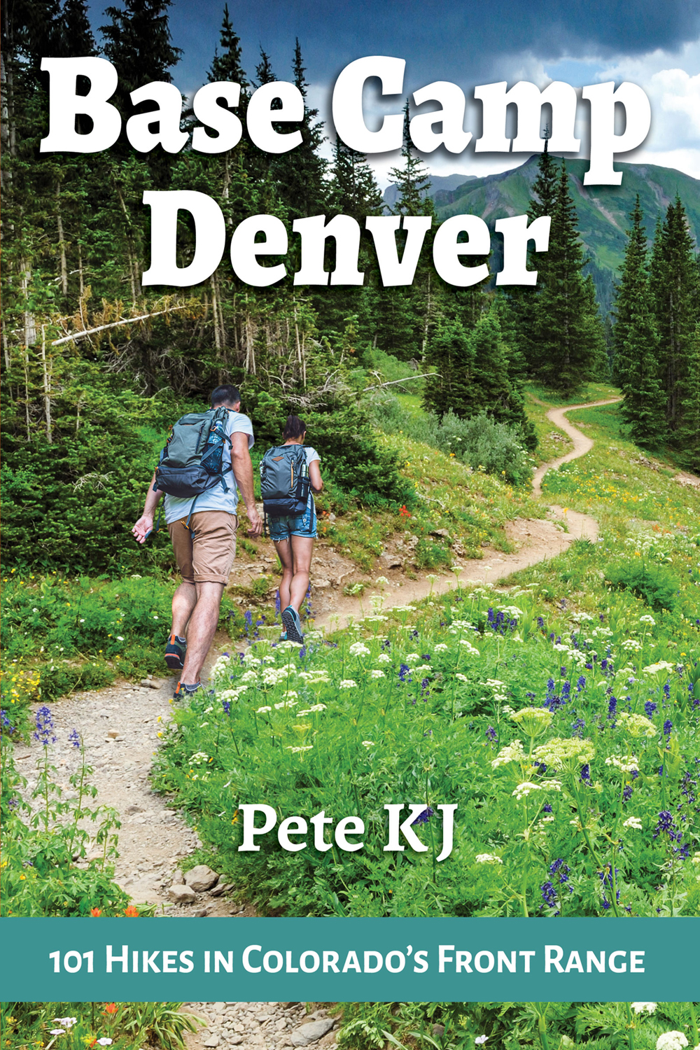
Buy
Base Camp Denver:
101 Hikes in Colorado's Front Range
from these fine retailers!
Amazon.com
Barnes & Noble
Books A Million
Indie Bound
Apple Books (e-book)