
Getting
Out There: |
Directory of all "Getting Out There" Articles> |
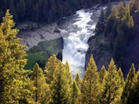
Summer Picnic on the Mesa Falls Scenic Byway
by Dennis Weaver
|
My brother rolled in. He and his wife were just completing an 11,000 mile road trip in five weeks. They live in Fairbanks, Alaska, and had flown into Boise, Idaho where they had rented a car-with unlimited mileage, of course. They had driven across the Southwest, through Florida, down to Key West, and then back and up the Appalachian Trail. Now they were headed back to Boise and had stopped off to see us in eastern Idaho.
Being insatiable, he said, "Show us what you've got. Let's do a day trip and a picnic."
We counted heads: Robert and Roberta--our intrepid guests from Alaska-Merri Ann, my wife, those of my kids who wanted to go, and a couple little granddaughters. It was going to take two vehicles.
"Not to worry," said Robert. "We'll take the rental."
His rental agreement included unlimited mileage but in the fine print, it specified, "No dirt roads." That's a serious limitation in eastern Idaho where graveled roads stretch everywhere. We pored over a map, not used to being limited to the pavement, and chose Island Park in the eastern corner of Idaho and just outside West Yellowstone. We assembled our picnic lunch and headed out.
Ashton, Idaho, is the last stop before Island Park. It's not much more than a spot in the road, a pretty little town with history. It used to be on the stage route and then early rail route going into Yellowstone Park. In the 1800s, tourists passed through on their way to see the brand new national park. You can still see the old railroad bed with rails and ties removed lining along the Henry's Fork of the Snake River. In the higher country, the old rail bed is now a hiking and bike trail, cutting spectacularly across canyon walls and drilling through long dark tunnels in the mountains. Maybe more importantly, Ashton has the last real grocery store-about half the size you're used to-and gas at flatlander prices.
Just past the grocery store there is a sign that
says, "Mesa Falls Scenic Byway". We turned right
up the old main street. It's not much different than most
main streets in small towns across America, except this one
boasts dog sled races in the winter. Out of town, the landscape
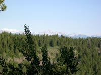
turned to rolling fields of potato and grain, verdantly green
with spring. The Teton Mountains, seen from this -- the west
side -- instead of the more familiar Jackson Hole view, formed
a magnificent white and steely blue backdrop. We wondered
how many people would be climbing these peaks on such a beautiful
spring day. We thought of the search and rescue operations
that seemed to occur regularly and the occasion death that
made the local papers.
[Continued
on Page
2]
More "Getting Out There" Articles>
|
|
Privacy Policy |
Copyright 1996 - 2025, RoadTrip America® - All Rights Reserved |
Contact RTA |